|
Olomane River
The Olomane River (french: RiviГЁre Olomane) is a river in the CГґte-Nord region of Quebec, Canada. Location The Olomane basin covers . It lies between the basins of the Washicoutai River to the west and the Coacoachou River to the east. It includes part of the unorganized territory of Petit-MГ©catina, Quebec and part of the municipality of CГґte-Nord-du-Golfe-du-Saint-Laurent. The proposed River Natashquan Biodiversity Reserve would be partially within the watershed. The river is more than long, flowing to the west of the Г‰tamamiou River. It rises in a swampy area, first flows northwest, then makes an abrupt turn and flows south to the Gulf of Saint Lawrence. The mouth of the Olomane River is in the municipality of CГґte-Nord-du-Golfe-du-Saint-Laurent in Le Golfe-du-Saint-Laurent Regional County Municipality. The Innu settlement of La Romaine is on the west shore of the bay at the mouth of the river. Description According to the ''Dictionnaire des riviГЁres et lacs de la ... [...More Info...] [...Related Items...] OR: [Wikipedia] [Google] [Baidu] |
CГґte-Nord
CГґte-Nord (, ; ; land area ) is the second-largest administrative region by land area in Quebec, Canada, after Nord-du-QuГ©bec. It covers much of the northern shore of the Saint Lawrence River estuary and the Gulf of Saint Lawrence past Tadoussac. While most of the region is in the same time zone as the rest of Quebec, the far eastern portion east of the 63rd meridian, excluding the Minganie Regional County Municipality, is officially in the Atlantic Time Zone and does not observe daylight saving time. Population At the 2016 Canadian Census, the population amounted to 92,518, approximately 1.1% of the province's population, spread across 33 municipalities, various Indian reserves and a Naskapi reserved land. The towns of Baie-Comeau and Sept-ГЋles, Quebec, Sept-ГЋles combined amount to a little more than half of the population of the region. Geography and economy CГґte-Nord was created as an administrative region in 1966. Important landmarks of CГґte-Nord include Anticost ... [...More Info...] [...Related Items...] OR: [Wikipedia] [Google] [Baidu] |
Natashquan (reserve)
Nutashkuan ( INAC) or Natashquan (CGNDB) (sometimes Natashquan 1) is a First Nations reserve in the Canadian province of Quebec, belonging to the PremiГЁre Nation des Innus de Nutashkuan band. The reserve is located on the north shore of the Gulf of St. Lawrence at the mouth of the Natashquan River, east of Sept-ГЋles and has been accessible by Route 138 since 1996. The reserve should not be confused with the adjacent but distinct township of Natashquan just to the north and east. The community is serviced by a nursing station, community radio station, municipal water and sewer system, fire station, and an aboriginal police force. The site was mapped in 1684 by Louis Jolliet who called it ''NoutascoГјan''. It was subsequently spelled as ''Nontascouanne'' (1734), ''Natasquan'' (1831), ''Nataskwan'' (1844), ''Natashkwan'' (1846), ''Natosquan'' (1857), ''Nataskouan'' (1858), and taking its current form, Natashquan, circa 1895. This name, spelled Nutahkuant or Nutashkuan in ... [...More Info...] [...Related Items...] OR: [Wikipedia] [Google] [Baidu] |
Havre-Saint-Pierre
Havre-Saint-Pierre is a town on Pointe-aux-Esquimaux, which is on the Quebec north shore (CГґte-Nord) of the Saint Lawrence River in Canada. Located along Route 138 some east of Sept-ГЋles, it is the largest town and seat of the Minganie RCM, and home to many government, municipal, and regional services. Historically, the town's first inhabitants came from the Magdalen Islands in the nineteenth century. As a result, the people of the town speak a dialect much more closely related to Acadian French than to Quebec French. Other important geological features near the town include the Romaine River to the north and west, les Chutes Manitou, on the Manitou River to the west, l'Ile du Havre, less than a kilometre offshore from the town, and Anticosti Island, which on clear days can be seen to the south of the town. History In 1857, a group of Acadian families from the Magdalen Islands, who had been deported from Savannah (Georgia, USA), settled on Eskimo Point (''Pointe aux Esqui ... [...More Info...] [...Related Items...] OR: [Wikipedia] [Google] [Baidu] |
Romaine River
The Romaine River is a river in the CГґte-Nord region of the Canadian province of Quebec. It is long. It is not to be confused with the Olomane River that is to the east and had the same name for a long time. It flows south into the Gulf of Saint Lawrence. Location The Romaine River is about long, none of which is in Labrador since the east bank of the river forms the border between Quebec and Labrador. The river has a Strahler number of 7. It has its source on the boundary between the Atlantic and Saint Lawrence watersheds, and flows first through a series of lakes, including Long, Marc, BrГ»lГ© (Burnt), Lavoie, Anderson, and Lozeau. This portion of the river to just past the confluence with Uauahkue Patauan Creek forms the boundary between Quebec and Labrador. Then it flows in a mostly southerly direction until a dozen miles from the coast where it takes a sharp turn to the west, flowing through a series of swampy waterlogged small lakes. The Romaine River drains into the J ... [...More Info...] [...Related Items...] OR: [Wikipedia] [Google] [Baidu] |
Jacques-Nicolas Bellin
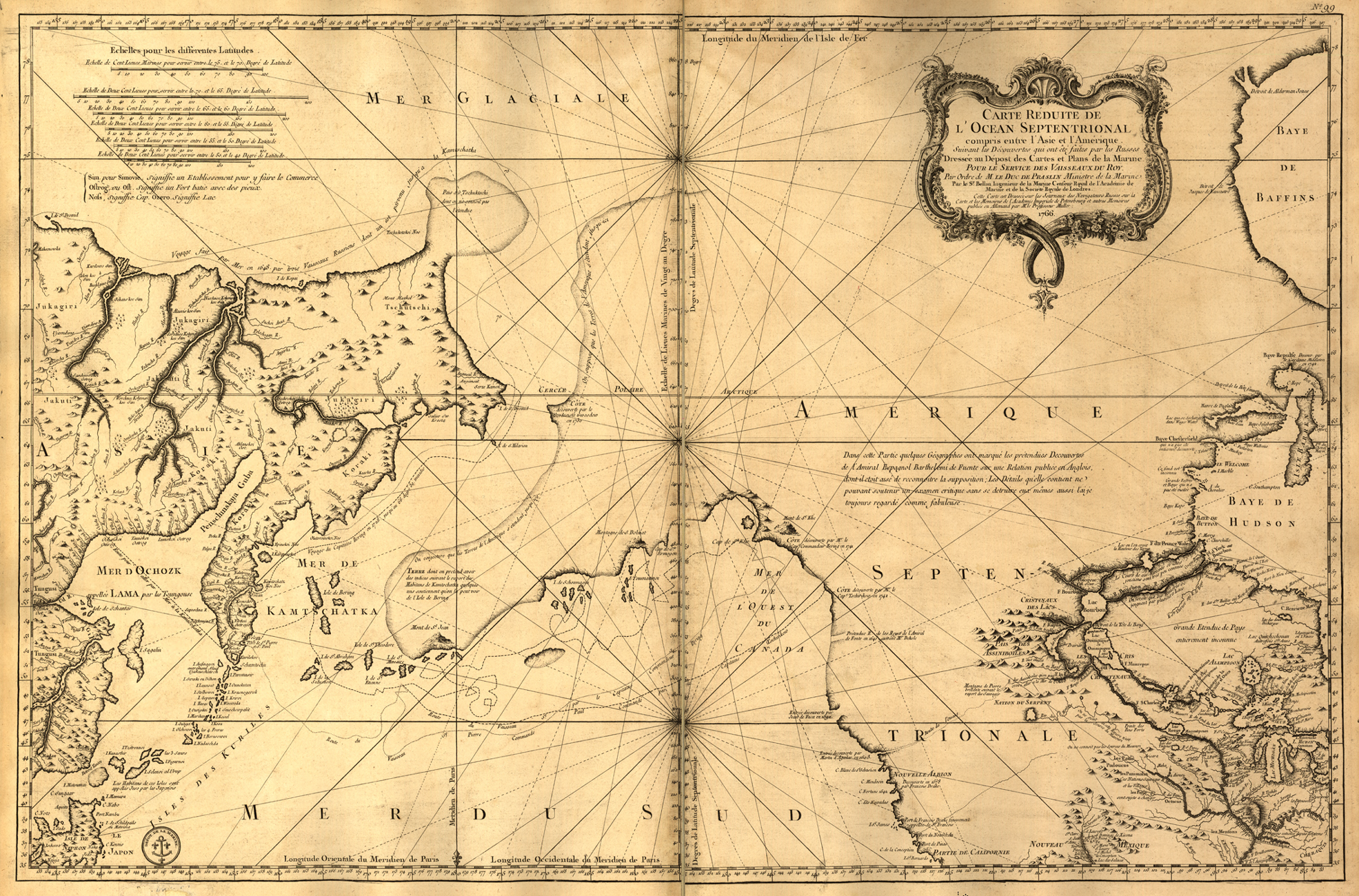
Jacques Nicolas Bellin (1703 – 21 March 1772) was a French hydrographer, geographer, and member of the French intellectual group called the philosophes. Bellin was born in Paris. He was hydrographer of France's hydrographic office, member of the ''Académie de Marine'' and of the Royal Society of London. Over a 50-year career, he produced many maps of particular interest to the ''Ministère de la Marine''. His maps of Canada and of French territories in North America (New France, Acadia, Louisiana) are particularly valuable. He died at Versailles. First ''Ingenieur de la Marine'' In 1721, at age 18, he was appointed hydrographer (chief cartographer) to the French Navy. In August 1741, he became the first ''Ingénieur de la Marine of the Dépot des cartes et plans de la Marine'' (the French Hydrographical Office) and was named Official Hydrographer of the French King. Prodigious work, high standard of excellence During his reign the Depot published a prodigious number of cha ... [...More Info...] [...Related Items...] OR: [Wikipedia] [Google] [Baidu] |
Jean-Baptiste-Louis Franquelin
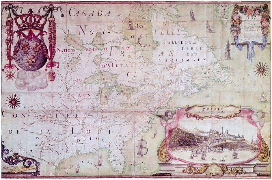
Jean-Baptiste-Louis Franquelin (1650-c.1712) was a French trader who was appointed in the early 1670s as the first cartographer in '' Nouvelle France'' (Canada) by the colony's governor. He was appointed in 1688 as royal hydrographer by Louis XIV. Franquelin was born in the commune of Pallauau-sur-Indre in central France. He migrated to New France in 1671 where he was soon appointed as the colony's cartographer. He documented a decade of Louis Jolliet and RenГ©-Robert Cavelier de La Salle's explorations in North America. He also completed other projects for the Crown and served the king's military engineer. After returning to France in 1692, he never lived in Canada again. Biography Born at Saint-Michel de Villebernin, he grew up in the village in the small commune of Palluau-sur-Indre in central France. Having developed drawing and mapmaking skills, Franquelin migrated in 1671 from Indre department to ''Nouvelle France'' (Quebec) to work as a trader. New France Governor L ... [...More Info...] [...Related Items...] OR: [Wikipedia] [Google] [Baidu] |
Innu Language
Innu-aimun or Montagnais is an Algonquian language spoken by over 10,000 Innu in Labrador and Quebec in Eastern Canada. It is a member of the Cree–Montagnais–Naskapi dialect continuum and is spoken in various dialects depending on the community. Literature Since the 1980s, Innu-aimun has had considerable exposure in the popular culture of Canada and France due to the success of the rock music band Kashtin and the later solo careers of its founders Claude McKenzie and Florent Vollant. Widely heard hit songs with Innu-language lyrics have included "" ("Girl"), "" ("My Childhood"), "" ("Story") and in particular "" ("Take care of yourself"), which appeared on soundtrack compilations for the television series '' Due South'' and the documentary ''Music for The Native Americans''. The lyrics of Akua Tuta are featured on over 50 websites, making this one of the most broadly accessible pieces of text written in any native North American language. Florent Vollant has also rendered ... [...More Info...] [...Related Items...] OR: [Wikipedia] [Google] [Baidu] |
Hudson's Bay Company
The Hudson's Bay Company (HBC; french: Compagnie de la Baie d'Hudson) is a Canadian retail business group. A fur trading business for much of its existence, HBC now owns and operates retail stores in Canada. The company's namesake business division is Hudson's Bay, commonly referred to as The Bay ( in French). After incorporation by English royal charter in 1670, the company functioned as the ''de facto'' government in parts of North America for nearly 200 years until the HBC sold the land it owned (the entire Hudson Bay drainage basin, known as Rupert's Land) to Canada in 1869 as part of the Deed of Surrender, authorized by the Rupert's Land Act 1868. At its peak, the company controlled the fur trade throughout much of the English- and later British-controlled North America. By the mid-19th century, the company evolved into a mercantile business selling a wide variety of products from furs to fine homeware in a small number of sales shops (as opposed to trading posts) acros ... [...More Info...] [...Related Items...] OR: [Wikipedia] [Google] [Baidu] |
La Romaine, Quebec
La Romaine, also known as Unamenshipit in Innu-aimun, is an Innu First Nations reserve in the CГґte-Nord region of Quebec, Canada, at the mouth of the Olomane River on the Gulf of Saint Lawrence. It belongs to the Innu band of Unamen Shipu. Being an enclave within the Municipality of CГґte-Nord-du-Golfe-du-Saint-Laurent, it is geographically within Le Golfe-du-Saint-Laurent Regional County Municipality but administratively not part of it. Directly adjacent to the reserve is the community of La Romaine consisting of a small French-speaking population. La Romaine is only accessible by boat or via the La Romaine Airport. It is serviced by a nursing station, community radio station, arena, community and recreation centre, municipal water and sewer system, fire station, and an aboriginal police force. The name ''La Romaine'' is the French adaptation of the word ''Ulaman''. Before its spelling was standardized, the place has also been called in times past: Fort Romaine, Olomanshibu, ... [...More Info...] [...Related Items...] OR: [Wikipedia] [Google] [Baidu] |
Le Golfe-du-Saint-Laurent Regional County Municipality
Le Golfe-du-Saint-Laurent is a regional county municipality in the Côte-Nord region of far-eastern Quebec, Canada. It includes all communities along the Gulf of Saint Lawrence between the Natashquan River and the Newfoundland and Labrador border. It has an area of according to Quebec's ''Ministère des Affaires municipales, des Régions et de l'Occupation du territoire'' (which includes coastal, lake, and river water territory and also disputed land within Labrador), or a land area of according to Statistics Canada. The population from the Canada 2011 Census was 5126. Le Golfe-du-Saint-Laurent and the neighbouring Minganie Regional County Municipality are grouped into the single census division of Minganie–Le Golfe-du-Saint-Laurent (known as Minganie–Basse-Côte-Nord before 2010). The combined population at the Canada 2011 Census was 11,708. Le Golfe-du-Saint-Laurent Regional County Municipality was created in July 2010, replacing Basse-Côte-Nord, which was a territ ... [...More Info...] [...Related Items...] OR: [Wikipedia] [Google] [Baidu] |
Innu
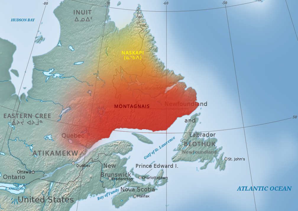
The Innu / Ilnu ("man", "person") or Innut / Innuat / Ilnuatsh ("people"), formerly called Montagnais from the French colonial period ( French for "mountain people", English pronunciation: ), are the Indigenous inhabitants of territory in the northeastern portion of the present-day province of Labrador and some portions of Quebec. They refer to their traditional homeland as ''Nitassinan'' ("Our Land", ᓂᑕᔅᓯᓇᓐ) or ''Innu-assi'' ("Innu Land"). The Innu are divided into several bands, with the Montagnais being the southernmost group and the Naskapi being the northernmost. Their ancestors were known to have lived on these lands as hunter-gatherers for several thousand years. To support their seasonal hunting migrations, they created portable tents made of animal skins. Their subsistence activities were historically centred on hunting and trapping caribou, moose, deer, and small game. Their language, Ilnu-Aimun or Innu-Aimun (popularly known since the French colonia ... [...More Info...] [...Related Items...] OR: [Wikipedia] [Google] [Baidu] |
Г‰tamamiou River
The Г‰tamamiou River (french: RiviГЁre Г‰tamamiou) is a river in the CГґte-Nord region of Quebec, Canada. Location The river runs through the Basse-CГґte-Nord between the Olomane and Little Mecatina rivers. It has a very irregular course of . Upstream from Lake Manet, about from its mouth, the river divides into two sections which meet again at Foucher Lake, further down. The river again divides into two channels before reaching the gulf, which one arm enters downstream from the hamlet of Г‰tamamiou and the other arm enters in BussiГЁre Bay. There is an impressive rapids near the mouth, but above this the river is calm. The mouth of the river is in the municipality of CГґte-Nord-du-Golfe-du-Saint-Laurent in Le Golfe-du-Saint-Laurent Regional County Municipality. The river mouth is about west of La TabatiГЁre and east of Natashquan. The Ouapitagone Archipelago is just south of the river mouth. Name In the Innu language the word "aitumamiu" means "splitting in two" or "l ... [...More Info...] [...Related Items...] OR: [Wikipedia] [Google] [Baidu] |


