|
Havre-Saint-Pierre
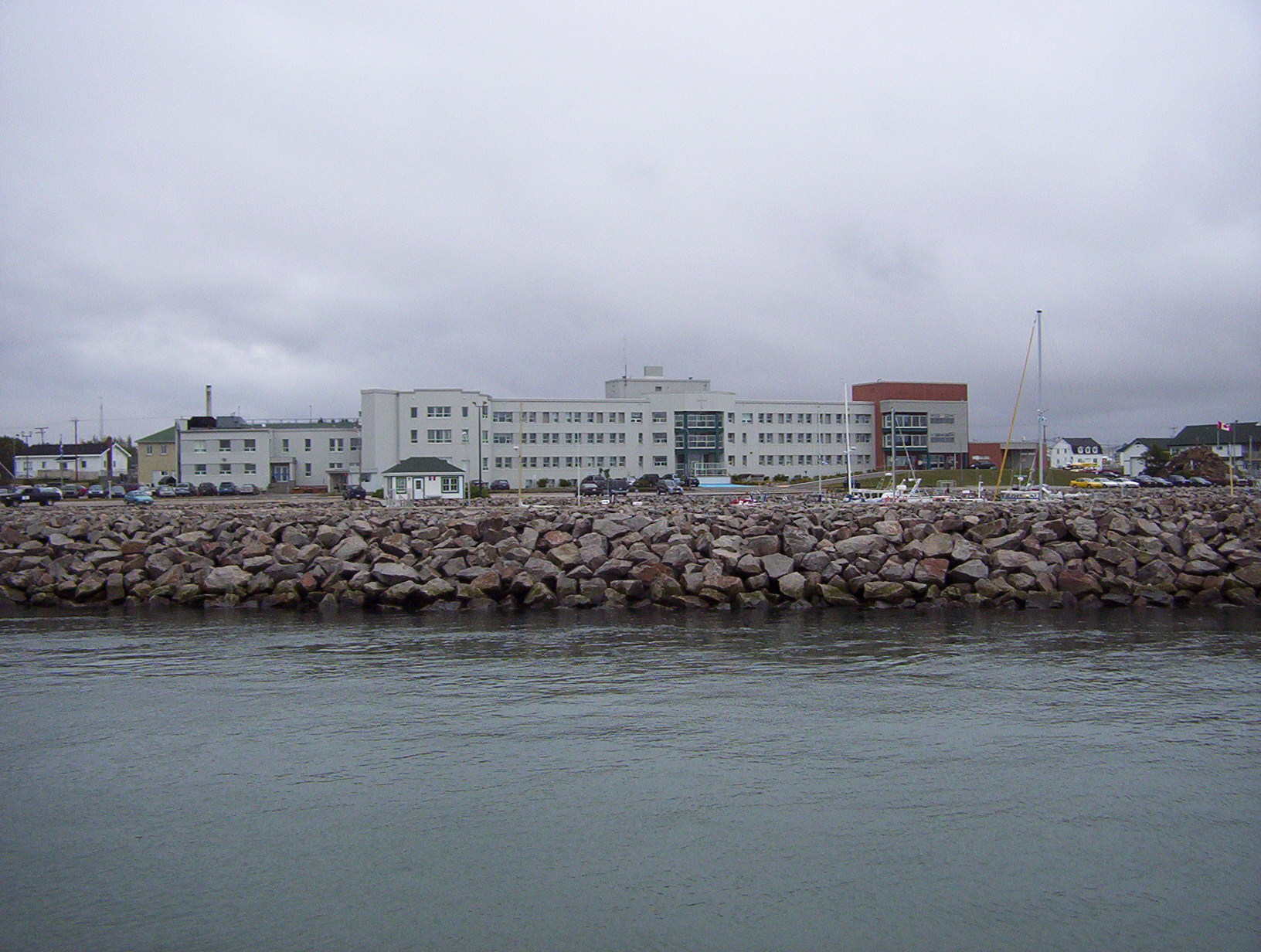
Havre-Saint-Pierre is a town on Pointe-aux-Esquimaux, which is on the Quebec north shore (Côte-Nord) of the Saint Lawrence River in Canada. Located along Route 138 some east of Sept-Îles, it is the largest town and seat of the Minganie RCM, and home to many government, municipal, and regional services. Historically, the town's first inhabitants came from the Magdalen Islands in the nineteenth century. As a result, the people of the town speak a dialect much more closely related to Acadian French than to Quebec French. Other important geological features near the town include the Romaine River to the north and west, les Chutes Manitou, on the Manitou River to the west, l'Ile du Havre, less than a kilometre offshore from the town, and Anticosti Island, which on clear days can be seen to the south of the town. History In 1857, a group of Acadian families from the Magdalen Islands, who had been deported from Savannah (Georgia, USA), settled on Eskimo Point (''Pointe aux Esqui ... [...More Info...] [...Related Items...] OR: [Wikipedia] [Google] [Baidu] |
Minganie Regional County Municipality
Minganie is a regional county municipality in the Côte-Nord region of Quebec, Canada. It includes Anticosti Island. Its seat is Havre-Saint-Pierre, Quebec, Havre-Saint-Pierre. It has an area of according to Quebec's ''Ministère des Affaires municipales, des Régions et de l'Occupation du territoire'' (which includes coastal, lake, and river water territory and also Labrador boundary dispute, disputed land within Labrador), or a land area of according to Statistics Canada. The population from the Canada 2011 Census was 6,582 and in 2016 Canadian Census, 2016 it was 11,323. The majority live in Havre-Saint-Pierre. Minganie and the neighbouring Le Golfe-du-Saint-Laurent Regional County Municipality are grouped into the single Census divisions of Canada, census division of Minganie—Le Golfe-du-Saint-Laurent (known as Minganie–Basse-Côte-Nord before 2010). The combined population at the Canada 2011 Census was 11,708. Until 2002, Minganie RCM encompassed the entire lower n ... [...More Info...] [...Related Items...] OR: [Wikipedia] [Google] [Baidu] |
Quebec Route 138
Route 138 is a major highway in the Canadian province of Quebec, following the entire north shore of the Saint Lawrence River past Montreal to the temporary eastern terminus in Kegashka on the Gulf of Saint Lawrence. The western terminus is in Elgin, at the border with New York State south-west of Montreal (connecting with New York State Route 30 at the Trout River Border Crossing). Part of this highway is known as the '' Chemin du Roy'', or King's Highway, which is one of the oldest highways in Canada. It passes through the Montérégie, Lanaudière, Mauricie, Capitale-Nationale and Côte-Nord regions of Quebec. In Montreal, Highway 138 runs via Sherbrooke Street, crosses the Pierre Le Gardeur Bridge to Charlemagne and remains a four-lane road until exiting Repentigny. This highway takes a more scenic route than the more direct Autoroute 40 between Montreal and Quebec City. It crosses the Saguenay River via a ferry which travels between Baie-Sainte-Catherine and Tadoussac ... [...More Info...] [...Related Items...] OR: [Wikipedia] [Google] [Baidu] |
Duplessis (provincial Electoral District)
Duplessis is a provincial electoral district in the Côte-Nord region of Quebec, Canada, that elects members to the National Assembly of Quebec. It notably includes the municipalities of Sept-Îles, Port-Cartier, Havre-Saint-Pierre, Fermont and the community of Maliotenam. It also includes a single municipality from the Nord-du-Québec region: the Naskapi village municipality of Kawawachikamach (not to be confused with the Naskapi reserved land of the same name, which Duplessis also includes, but is in Côte-Nord). It was created for the 1960 election from parts of the Saguenay provincial electoral district. In the change from the 2001 to the 2011 electoral map, it gained the unorganized territories of Caniapiscau and Lac-Juillet from Ungava electoral district. The riding was named after former Quebec Premier Maurice Duplessis who led the province from 1936 to 1939 and from 1944 to 1959 as leader of the Union Nationale. Members of the Legislative Assembly / National As ... [...More Info...] [...Related Items...] OR: [Wikipedia] [Google] [Baidu] |
List Of G Postal Codes Of Canada
__NOTOC__ This is a list of postal codes in Canada where the first letter is G. Postal codes beginning with G are located within the Canadian province of Quebec. Only the first three characters are listed, corresponding to the Forward Sortation Area. Canada Post provides a free postal code look-up tool on its website, via its mobile apps for such smartphones as the iPhone and BlackBerry, and sells hard-copy directories and CD-ROMs. Many vendors also sell validation tools, which allow customers to properly match addresses and postal codes. Hard-copy directories can also be consulted in all post offices, and some libraries. Eastern Quebec Image:Regions administratives du Quebec.png, 350px, The seventeen administrative regions of Quebec. poly 213 415 206 223 305 215 304 232 246 230 255 266 251 283 263 289 280 302 291 307 307 315 308 294 318 301 333 299 429 281 432 292 403 311 388 ... - 139 FSAs Urban Rural References {{Canadian postal codes Communications in Quebec ... [...More Info...] [...Related Items...] OR: [Wikipedia] [Google] [Baidu] |
Romaine River
The Romaine River is a river in the Côte-Nord region of the Canadian province of Quebec. It is long. It is not to be confused with the Olomane River that is to the east and had the same name for a long time. It flows south into the Gulf of Saint Lawrence. Location The Romaine River is about long, none of which is in Labrador since the east bank of the river forms the border between Quebec and Labrador. The river has a Strahler number of 7. It has its source on the boundary between the Atlantic and Saint Lawrence watersheds, and flows first through a series of lakes, including Long, Marc, Brûlé (Burnt), Lavoie, Anderson, and Lozeau. This portion of the river to just past the confluence with Uauahkue Patauan Creek forms the boundary between Quebec and Labrador. Then it flows in a mostly southerly direction until a dozen miles from the coast where it takes a sharp turn to the west, flowing through a series of swampy waterlogged small lakes. The Romaine River drains into the J ... [...More Info...] [...Related Items...] OR: [Wikipedia] [Google] [Baidu] |
Côte-Nord
Côte-Nord (, ; ; land area ) is the second-largest administrative region by land area in Quebec, Canada, after Nord-du-Québec. It covers much of the northern shore of the Saint Lawrence River estuary and the Gulf of Saint Lawrence past Tadoussac. While most of the region is in the same time zone as the rest of Quebec, the far eastern portion east of the 63rd meridian, excluding the Minganie Regional County Municipality, is officially in the Atlantic Time Zone and does not observe daylight saving time. Population At the 2016 Canadian Census, the population amounted to 92,518, approximately 1.1% of the province's population, spread across 33 municipalities, various Indian reserves and a Naskapi reserved land. The towns of Baie-Comeau and Sept-Îles, Quebec, Sept-Îles combined amount to a little more than half of the population of the region. Geography and economy Côte-Nord was created as an administrative region in 1966. Important landmarks of Côte-Nord include Anticost ... [...More Info...] [...Related Items...] OR: [Wikipedia] [Google] [Baidu] |
Manicouagan (electoral District)
Manicouagan is a federal electoral district in Quebec, Canada, that has been represented in the House of Commons of Canada since 1968. The riding was created in 1966 from parts of Charlevoix and Saguenay ridings. The neighbouring ridings are Abitibi—Baie-James—Nunavik—Eeyou, Chicoutimi—Le Fjord, Montmorency—Charlevoix—Haute-Côte-Nord, Haute-Gaspésie—La Mitis—Matane—Matapédia, Gaspésie—Îles-de-la-Madeleine and Labrador. This riding gained territory from Montmorency—Charlevoix—Haute-Côte-Nord during the 2012 electoral redistribution. Demographics :''According to the Canada 2016 Census'' * Languages: (2016) 85.5% French, 8.7% Innu, 4.5% English, 0.6% Naskapi, 0.1% Spanish, 0.1% Arabic, 0.1% Italian, 0.1% Portuguese Members of Parliament This riding has elected the following Members of Parliament: Election results ... [...More Info...] [...Related Items...] OR: [Wikipedia] [Google] [Baidu] |
Area Codes 418 And 581
Area codes 418, 581, and 367 are telephone area codes in the North American Numbering Plan (NANP) for the eastern portion of the Canadian province of Quebec. Area code 418 was originally assigned to the numbering plan area, but all three area codes now form an overlay plan for this territory. Cities in the numbering plan area include Quebec City, Saguenay, Quebec, Saguenay, Lévis, Quebec, Lévis, Rimouski, Saint-Georges, Quebec, Saint-Georges, Alma, Quebec, Alma, Thetford Mines, Sept-Îles, Quebec, Sept-Îles, Baie-Comeau and Rivière-du-Loup. Also served are the Gaspé Peninsula, Côte-Nord, southeastern Mauricie, and the tiny hamlet of Estcourt Station, Maine, Estcourt Station, in the U.S. state of Maine. History Ontario and Quebec were the only provinces that received assignments of multiple area codes by the American Telephone and Telegraph Company (AT&T) when the original North American area codes were created in 1947. The eastern part of Quebec received area code 418, while ... [...More Info...] [...Related Items...] OR: [Wikipedia] [Google] [Baidu] |
Anticosti Island
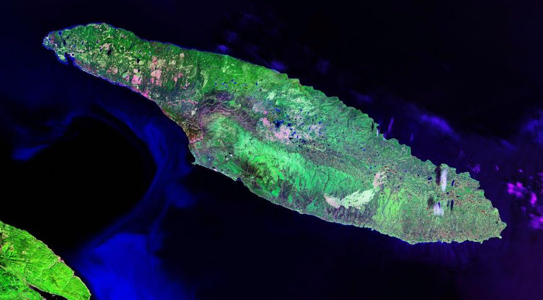
; moe, Notiskuan; mic, Natigostec , sobriquet = , image_name = RiviereHuileAnticosti.jpg , image_caption = Salmon fisherman on Rivière à l'Huile , image_map = , map_alt = , map_size = , map_caption = , pushpin_map = Canada Quebec , pushpin_label = , pushpin_label_position = , pushpin_map_alt = , pushpin_relief = , pushpin_map_caption = , coordinates = , etymology = , location = Gulf of Saint Lawrence , grid_reference = , archipelago = , waterbody = , total_islands = , major_islands = , area_km2 = 7,953 ... [...More Info...] [...Related Items...] OR: [Wikipedia] [Google] [Baidu] |
Quebec French
Quebec French (french: français québécois ), also known as Québécois French, is the predominant variety of the French language spoken in Canada. It is the dominant language of the province of Quebec, used in everyday communication, in education, the media, and government. Canadian French is a common umbrella term to describe all varieties of French used in Canada, including Quebec French. Formerly it was used to refer solely to Quebec French and the closely related dialects spoken in Ontario and Western Canada, in contrast with Acadian French, which is spoken in some areas of eastern Quebec (Gaspé Peninsula), New Brunswick, and in other parts of Atlantic Canada, and Métis French, which is found generally across the Prairie provinces. The term is commonly used to refer to Quebec working class French (when considered a basilect), characterized by certain features often perceived as phased out, "old world" or "incorrect" in standardized French. ''Joual'', in particular, ex ... [...More Info...] [...Related Items...] OR: [Wikipedia] [Google] [Baidu] |


