|
Old Street (London)
Old Street is a street in inner north-east Central London that runs west to east from Goswell Road in Clerkenwell, in the London Borough of Islington, via St Luke's and Old Street Roundabout, to the crossroads where it meets Shoreditch High Street (south), Kingsland Road (north) and Hackney Road (east) in Shoreditch in the London Borough of Hackney. It has London Underground station Old Street on the Northern line which has other platforms for National Rail's Northern City Line. Its west half is inside London's Congestion Charging Zone; a short part of its eastern half is the inner ring marking its limit. History Old Street was recorded as ''Ealdestrate'' in about 1200, and ''le Oldestrete'' in 1373. As befits its name there are some suggestions that the road is of ancient origin. It lies on the route of an old Roman or possibly pre-Roman track connecting Silchester and Colchester, skirting round the walls of Londinium, today the areas known as the City of London. Th ... [...More Info...] [...Related Items...] OR: [Wikipedia] [Google] [Baidu] |
Old Street
Old Street is a street in inner north-east Central London that runs west to east from Goswell Road in Clerkenwell, in the London Borough of Islington, via St Luke's and Old Street Roundabout, to the crossroads where it meets Shoreditch High Street (south), Kingsland Road (north) and Hackney Road (east) in Shoreditch in the London Borough of Hackney. It has London Underground station Old Street on the Northern line which has other platforms for National Rail's Northern City Line. Its west half is inside London's Congestion Charging Zone; a short part of its eastern half is the inner ring marking its limit. History Old Street was recorded as ''Ealdestrate'' in about 1200, and ''le Oldestrete'' in 1373. As befits its name there are some suggestions that the road is of ancient origin. It lies on the route of an old Roman or possibly pre-Roman track connecting Silchester and Colchester, skirting round the walls of Londinium, today the areas known as the City of London. T ... [...More Info...] [...Related Items...] OR: [Wikipedia] [Google] [Baidu] |
National Rail
National Rail (NR) is the trading name licensed for use by the Rail Delivery Group, an unincorporated association whose membership consists of the passenger train operating companies (TOCs) of England, Scotland, and Wales. The TOCs run the passenger services previously provided by the British Railways Board, from 1965 using the brand name British Rail. Northern Ireland, which is bordered by the Republic of Ireland, has a different system. National Rail services share a ticketing structure and inter-availability that generally do not extend to services which were not part of British Rail. National Rail and Network Rail ''National'' Rail should not be confused with ''Network'' Rail. National Rail is a brand used to promote passenger railway services, and providing some harmonisation for passengers in ticketing, while Network Rail is the organisation which owns and manages most of the fixed assets of the railway network, including tracks, stations and signals. The two gener ... [...More Info...] [...Related Items...] OR: [Wikipedia] [Google] [Baidu] |
Hoxton Square
Hoxton Square is a public garden square in the Hoxton area of Shoreditch in the London Borough of Hackney. Laid out in 1683, it is thought to be one of the oldest in London. Since the 1990s it has been at the heart of the Hoxton national (digital and design) arts and media hub, as well as hosting entertainment, with globally eclectic musicians, actors and dancers. Most of the square's buildings, quite tall for the Victorian age, diverge in use, with many floors converted to bars, restaurants and offices and at least one live music club of note. One of the square's 18th-century residents, John Newton, composed the popular hymn "Amazing Grace". History Hoxton Square was laid out by Samuel Blewitt and Robert Hackshaw, who leased the land from the Austen family in 1683. Hoxton and Charles Squares, while upper-middle class, housed many non-conformists (with Anglicanism). From 1699 to 1729 an academy, offering a wide curriculum and also allowing "free enquiry" by its students, st ... [...More Info...] [...Related Items...] OR: [Wikipedia] [Google] [Baidu] |
London Congestion Charge
The London congestion charge is a fee charged on most cars and motor vehicles being driven within the Congestion Charge Zone (CCZ) in Central London between 7:00 am and 6:00 pm Monday to Friday, and between 12:00 noon and 6:00 pm Saturday and Sunday. Inspired by Singapore's Electronic Road Pricing (ERP) system after London officials had travelled to the country, the charge was first introduced on 17 February 2003. The London charge zone is one of the largest congestion charge zones in the world, despite the removal of the Western Extension which operated between February 2007 and January 2011. The charge not only helps to reduce high traffic flow in the city streets, but also reduces air and noise pollution in the central London area and raises investment funds for London's transport system. The standard charge is £15, every day from 7:00 am to 6:00 pm, for each non-exempt vehicle driven within the zone, with a penalty of between £65 and £195 levied for non-payment. The ... [...More Info...] [...Related Items...] OR: [Wikipedia] [Google] [Baidu] |
London Inner Ring Road
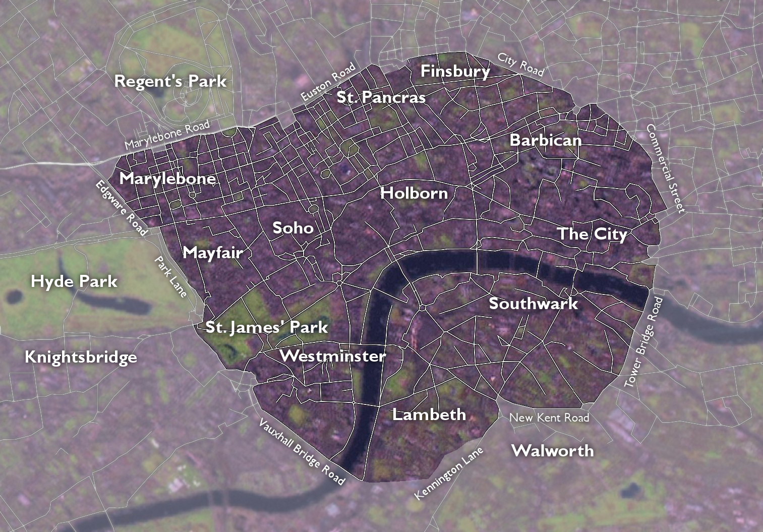
The London Inner Ring Road, or Ring Road as signposted, is a route with an average diameter of formed from a number of major roads that encircle Central London. The ring road forms the boundary of the London congestion charge zone, although the ring road itself is not part of the zone. Starting at the northernmost point and moving clockwise, the roads defining the boundary are Pentonville Road, City Road, Old Street, Great Eastern Street, Commercial Street, Mansell Street, Tower Bridge, Tower Bridge Road, New Kent Road, the Elephant & Castle, Kennington Lane, the roads that constitute the Vauxhall Cross one-way system and Vauxhall Bridge, Vauxhall Bridge Road, the roads that constitute the Victoria one-way system, Grosvenor Place, Park Lane, Edgware Road, Old Marylebone Road, Marylebone Road and Euston Road. The route is described as the ''"Inner"'' Ring Road because there are two further sets of roads that have been described as London ring roads. The North and South Circ ... [...More Info...] [...Related Items...] OR: [Wikipedia] [Google] [Baidu] |
Metropolitan Borough Of Shoreditch
The Metropolitan Borough of Shoreditch was a Metropolitan boroughs of the County of London, Metropolitan borough of the County of London between 1899 and 1965, when it was merged with the Metropolitan Borough of Stoke Newington and the Metropolitan Borough of Hackney to form the London Borough of Hackney. The borough was made up of three main districts: Shoreditch, Hoxton and Haggerston. An individual coat of arms was never granted to the metropolitan borough council; they adopted the arms of the second lord of the manor of Shoreditch, John de Northampton. Boundaries The borough comprised the area of the ancient parish of Shoreditch (parish), Shoreditch (St Leonard's) plus part of the ancient liberty of Norton Folgate to the south The parish vestry had taken on local administration from the 17th century onwards. Civic buildings The civic buildings of the borough included the Shoreditch Town Hall, Town Hall (originally the Vestry Hall) in Old Street with the Magistrates Court (der ... [...More Info...] [...Related Items...] OR: [Wikipedia] [Google] [Baidu] |
St Leonard's, Shoreditch
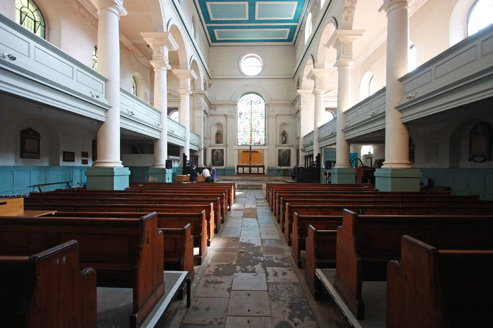
St Leonard's, Shoreditch, is the ancient parish church of Shoreditch, often known simply as Shoreditch Church. It is located at the intersection of Shoreditch High Street with Hackney Road, within the London Borough of Hackney in East London. The current building dates from about 1740 and is Grade I listed. The church is mentioned in the line ""When I grow rich", say the bells of Shoreditch" from the nursery rhyme ''Oranges and Lemons''.The Centre of Attention at Shoreditch Church'' accessed 06/01/08 The beneath the church is the final resting place of many actors from the |
Shoreditch Town Hall
Shoreditch Town Hall is a municipal building in Shoreditch, London. It is a Grade II listed building. History In the mid-20th century, the vestry board decided to procure a vestry hall for the Parish of St. Leonard's; the site they selected had been occupied by some old almshouses known as "Fuller's Hospital". The foundation stone for the new building was laid by the Chairman of the Metropolitan Board of Works, John Thwaites, in 1865. The new building, the eastern section of the current complex, was designed by Caesar Augustus Long in the Italianate style, built by John Perry of Stratford and completed in 1866. The design involved a symmetrical main frontage with five bays facing onto Old Street; the central section featured a tetrastyle porch with Ionic order columns on the ground floor; there were windows interspersed with Corinthian order columns and pilasters on the first floor and a large pediment above. At the time it was described as "the grandest vestry hall in London ... [...More Info...] [...Related Items...] OR: [Wikipedia] [Google] [Baidu] |
York
York is a cathedral city with Roman origins, sited at the confluence of the rivers Ouse and Foss in North Yorkshire, England. It is the historic county town of Yorkshire. The city has many historic buildings and other structures, such as a minster, castle, and city walls. It is the largest settlement and the administrative centre of the wider City of York district. The city was founded under the name of Eboracum in 71 AD. It then became the capital of the Roman province of Britannia Inferior, and later of the kingdoms of Deira, Northumbria, and Scandinavian York. In the Middle Ages, it became the northern England ecclesiastical province's centre, and grew as a wool-trading centre. In the 19th century, it became a major railway network hub and confectionery manufacturing centre. During the Second World War, part of the Baedeker Blitz bombed the city; it was less affected by the war than other northern cities, with several historic buildings being gutted and restore ... [...More Info...] [...Related Items...] OR: [Wikipedia] [Google] [Baidu] |
City Of London
The City of London is a city, ceremonial county and local government district that contains the historic centre and constitutes, alongside Canary Wharf, the primary central business district (CBD) of London. It constituted most of London from its settlement by the Romans in the 1st century AD to the Middle Ages, but the modern area named London has since grown far beyond the City of London boundary. The City is now only a small part of the metropolis of Greater London, though it remains a notable part of central London. Administratively, the City of London is not one of the London boroughs, a status reserved for the other 32 districts (including Greater London's only other city, the City of Westminster). It is also a separate ceremonial county, being an enclave surrounded by Greater London, and is the smallest ceremonial county in the United Kingdom. The City of London is widely referred to simply as the City (differentiated from the phrase "the city of London" by ca ... [...More Info...] [...Related Items...] OR: [Wikipedia] [Google] [Baidu] |
Londinium
Londinium, also known as Roman London, was the capital of Roman Britain during most of the period of Roman rule. It was originally a settlement established on the current site of the City of London around AD 47–50. It sat at a key crossing point over the River Thames which turned the city into a road nexus and major port, serving as a major commercial centre in Roman Britain until its abandonment during the 5th century. Following the foundation of the town in the mid-1st century, early Londinium occupied the relatively small area of , roughly half the area of the modern City of London and equivalent to the size of present-day Hyde Park. In the year 60 or 61, the rebellion of the Iceni under Boudica compelled the Roman forces to abandon the settlement, which was then razed. Following the defeat of Boudica by the Roman governor Gaius Suetonius Paulinus a military installation was established and the city was rebuilt. It had probably largely recovered within about a de ... [...More Info...] [...Related Items...] OR: [Wikipedia] [Google] [Baidu] |
Camulodunum
Camulodunum (; la, ), the Ancient Roman name for what is now Colchester in Essex, was an important castrum and city in Roman Britain, and the first capital of the province. A temporary "strapline" in the 1960s identifying it as the "oldest recorded town in Britain" has become popular with residents and is still used on heritage roadsigns on trunk road approaches.McWhirr, Alan (1988) Roman Crafts and Industries. Published by Shire Publications LTD. () Originally the site of the Brythonic-Celtic oppidum of Camulodunon (meaning "stronghold of Camulos"), capital of the Trinovantes and later the Catuvellauni tribes, it was first mentioned by name on coinage minted by the chieftain Tasciovanus some time between 20 and 10 BC. The Roman town began life as a Roman legionary base constructed in the AD 40s on the site of the Brythonic-Celtic fortress following its conquest by the Emperor Claudius. After the early town was destroyed during the Iceni rebellion in AD 60/61, it was rebuilt, ... [...More Info...] [...Related Items...] OR: [Wikipedia] [Google] [Baidu] |


