|
Old San Antonio Road
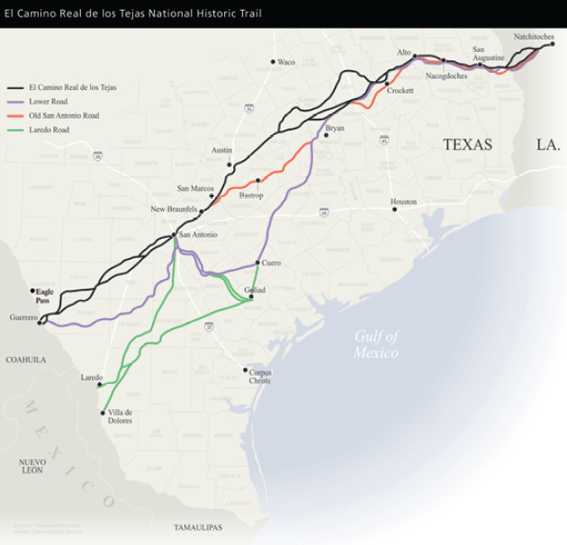
The Old San Antonio Road was a historic roadway located in the U.S. states of Texas and Louisiana. Parts of it were based on traditional Native American trails. Its Texas terminus was about southeast of Eagle Pass at the Rio Grande in Maverick County, and its northern terminus was at Natchitoches, Louisiana. The road continued from Texas through Monclova to Mexico City. The Old San Antonio Road is considered a part of El Camino Real de los Tejas National Historic Trail. Route Louisiana Highway 6 mostly runs alongside the Old San Antonio Road for the entirety of its route through that state from Natchitoches to west of Many. State Highway 21 follows the old road to Midway, Texas, then State Highway OSR (for Old San Antonio Road) follows it around Bryan and College Station, and back to Highway 21 to the eastern outskirts of San Marcos. South of San Marcos, the road follows the Old Bastrop Road until it intersects with I-35. The road leaves the Interstate at New Braun ... [...More Info...] [...Related Items...] OR: [Wikipedia] [Google] [Baidu] |
El Camino Real De Los Tejas National Historic Trail
The El Camino Real de los Tejas National Historic Trail is a national historic trail covering the U.S. section of ''El Camino Real de Los Tejas'', a thoroughfare from the 18th-century Spanish colonial era in Spanish Texas, instrumental in the settlement, development, and history of Texas. The National Park Service designated El Camino Real de los Tejas National Historic Trail as a unit in the National Trails System in 2004. The modern highways Texas 21 (along with Texas OSR) and Louisiana 6 roughly follow the original route of the trail. History Alonso de León, Spanish governor of Coahuila, established the corridor for what became El Camino Real de los Tejas in multiple expeditions to East Texas between 1686 and 1690 to find and destroy a French fort near Lavaca Bay, established by René-Robert Cavelier, Sieur de La Salle on what de León considered to be Spanish lands. The route was refined in 1691-1692 by Domingo Terán de los Ríos, the first governor of Spanish Texas, ... [...More Info...] [...Related Items...] OR: [Wikipedia] [Google] [Baidu] |
College Station, Texas
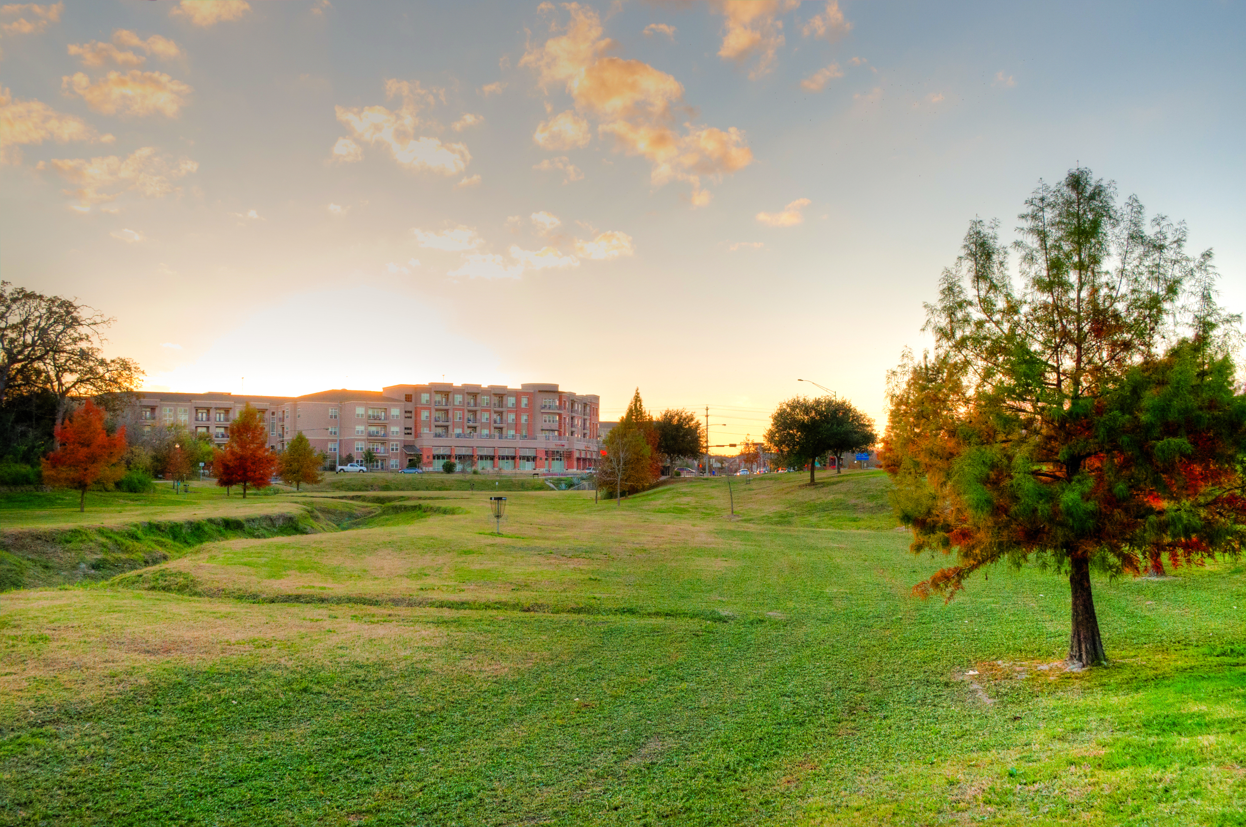
College Station is a city in Brazos County, Texas, situated in East-Central Texas in the heart of the Brazos Valley, towards the eastern edge of the region known as the Texas Triangle. It is northwest of Houston and east-northeast of Austin. As of the 2020 census, College Station had a population of 120,511. College Station and Bryan make up the Bryan-College Station metropolitan area, the 13th-largest metropolitan area in Texas with 273,101 people as of 2019. College Station is home to the main campus of Texas A&M University, the flagship institution of the Texas A&M University System. The city owes its name and existence to the university's location along a railroad. Texas A&M's triple designation as a Land-, Sea-, and Space-Grant institution reflects the broad scope of the research endeavors it brings to the city, with ongoing projects funded by agencies such as NASA, the National Institutes of Health, the National Science Foundation, and the Office of Naval Research. ... [...More Info...] [...Related Items...] OR: [Wikipedia] [Google] [Baidu] |
East Texas
East Texas is a broadly defined cultural, geographic, and ecological region in the eastern part of the U.S. state of Texas that comprises most of 41 counties. It is primarily divided into Northeast and Southeast Texas. Most of the region consists of the Piney Woods ecoregion. East Texas can sometimes be defined only as the Piney Woods. At the fringes, towards Central Texas, the forests expand outward toward sparser trees and eventually into open plains. According to the ''Handbook of Texas'', the East Texas area "may be separated from the rest of Texas roughly by a line extending from the Red River in north-central Lamar County southwestward to east-central Limestone County and then southeastward towards eastern Galveston Bay". Most sources separate the Gulf Coast area into a separate region. Another popular, somewhat simpler, definition defines East Texas as the region between the Trinity River, north and east of Houston (or sometimes Interstate 45, when defining generou ... [...More Info...] [...Related Items...] OR: [Wikipedia] [Google] [Baidu] |
American Bison
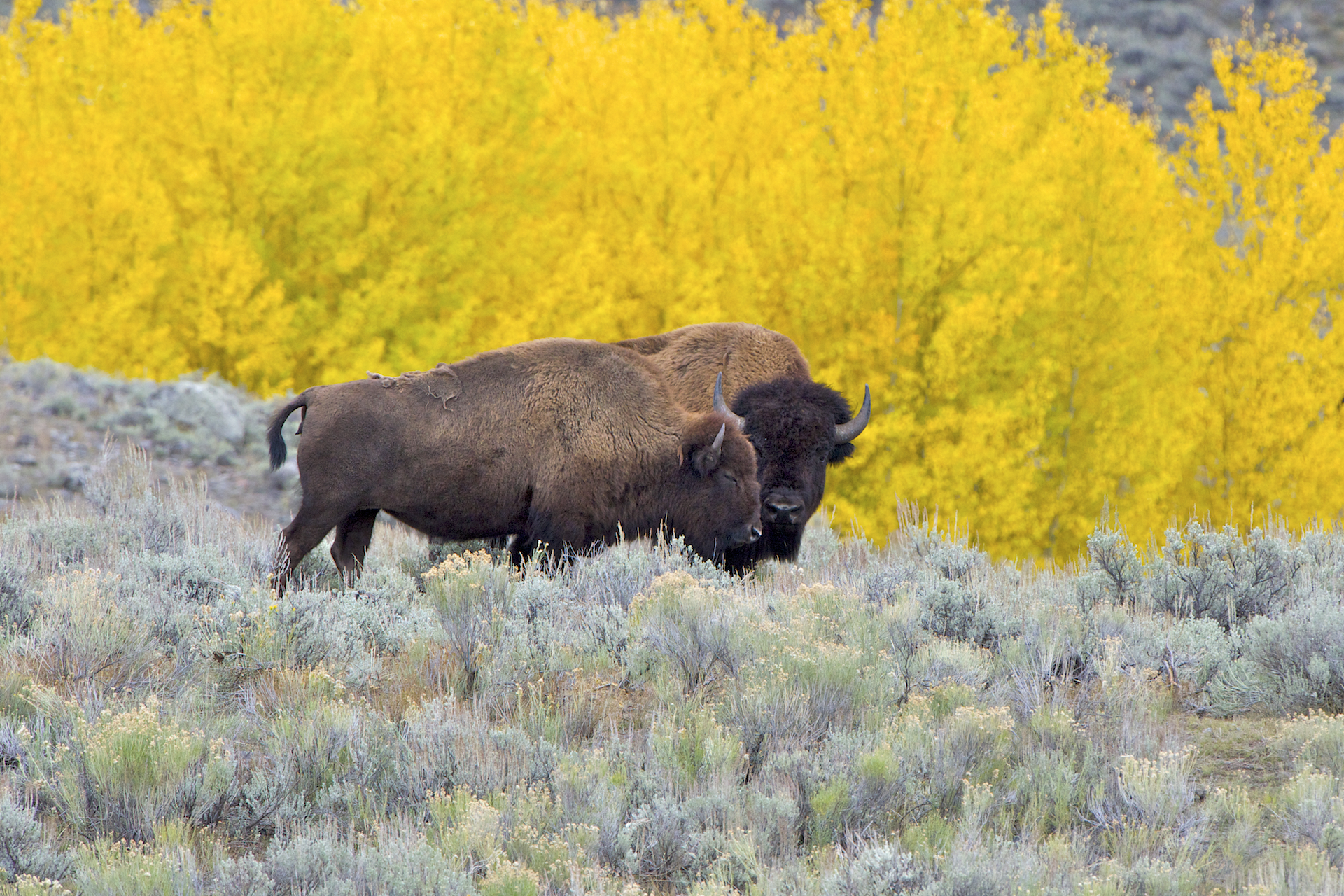
The American bison (''Bison bison'') is a species of bison native to North America. Sometimes colloquially referred to as American buffalo or simply buffalo (a different clade of bovine), it is one of two extant species of bison, alongside the European bison. Its historical range, by 9000 BC, is described as the great bison belt, a tract of rich grassland that ran from Alaska to the Gulf of Mexico, east to the Atlantic Seaboard (nearly to the Atlantic tidewater in some areas) as far north as New York, south to Georgia and, according to some sources, further south to Florida, with sightings in North Carolina near Buffalo Ford on the Catawba River as late as 1750. Once roaming in vast herds, the species nearly became extinct by a combination of commercial hunting and slaughter in the 19th century and introduction of bovine diseases from domestic cattle. With a population in excess of 60 million in the late 18th century, the species was culled down to just 541 animals by 1889. ... [...More Info...] [...Related Items...] OR: [Wikipedia] [Google] [Baidu] |
Indigenous Peoples Of The Americas
The Indigenous peoples of the Americas are the inhabitants of the Americas before the arrival of the European settlers in the 15th century, and the ethnic groups who now identify themselves with those peoples. Many Indigenous peoples of the Americas were traditionally hunter-gatherers and many, especially in the Amazon basin, still are, but many groups practiced aquaculture and agriculture. While some societies depended heavily on agriculture, others practiced a mix of farming, hunting, and gathering. In some regions, the Indigenous peoples created monumental architecture, large-scale organized cities, city-states, chiefdoms, states, kingdoms, republics, confederacies, and empires. Some had varying degrees of knowledge of engineering, architecture, mathematics, astronomy, writing, physics, medicine, planting and irrigation, geology, mining, metallurgy, sculpture, and gold smithing. Many parts of the Americas are still populated by Indigenous peoples; some countries have ... [...More Info...] [...Related Items...] OR: [Wikipedia] [Google] [Baidu] |
Alonso De León
Alonso de León "El Mozo" (c. 1639–1691) was explorer and governor, who led several expeditions into the area that is now northeastern Mexico and southern Texas. Early life Alonso de León González was born in 1639, in the settlement of Cadereyta, Nuevo León in New Spain. He was the third son of General Alonso De León, a celebrated chronicler, historian and conquistador of the frontier of Nuevo León, and Josefa González.Chipman and Joseph (1999), p. 24. To distinguish him from his father, who was also a prominent leader in the colony, sometimes the phrase, ''El Mozo,'' would later be appended to his name (or its English equivalent, "the younger"). De León trained in Spain for a naval career and joined the Spanish navy in 1657. By 1660 he had returned to Nuevo León. He was frequently appointed to lead exploratory parties, and he became an entrepreneur, most notably in salt mining. De León married Agustina Cantú and had six children with her. Expeditions In 1684, ... [...More Info...] [...Related Items...] OR: [Wikipedia] [Google] [Baidu] |
Spain
, image_flag = Bandera de España.svg , image_coat = Escudo de España (mazonado).svg , national_motto = ''Plus ultra'' (Latin)(English: "Further Beyond") , national_anthem = (English: "Royal March") , image_map = , map_caption = , image_map2 = , capital = Madrid , coordinates = , largest_city = Madrid , languages_type = Official language , languages = Spanish language, Spanish , ethnic_groups = , ethnic_groups_year = , ethnic_groups_ref = , religion = , religion_ref = , religion_year = 2020 , demonym = , government_type = Unitary state, Unitary Parliamentary system, parliamentary constitutional monarchy , leader_title1 = Monarchy of Spain, Monarch , leader_name1 = Felipe VI , leader_title2 = Prime Minister of Spain ... [...More Info...] [...Related Items...] OR: [Wikipedia] [Google] [Baidu] |
Catarina, Texas
Catarina is a census-designated place (CDP) in Dimmit County, Texas, United States. The population was 118 at the 2010 census. The community has no U.S. Post Office. Geography Catarina is located at (28.347567, -99.614690). According to the United States Census Bureau, the CDP has a total area of , all of it land. Demographics As of the census of 2000, there were 135 people, 46 households, and 40 families residing in the CDP. The population density was 35.7 people per square mile (13.8/km2). There were 77 housing units at an average density of 20.4/sq mi (7.9/km2). The racial makeup of the CDP was 80.74% White, 19.26% from other races. Hispanic or Latino of any race were 79.26% of the population. There were 46 households, out of which 30.4% had children under the age of 18 living with them, 71.7% were married couples living together, 17.4% had a female householder with no husband present, and 10.9% were non-families. 8.7% of all households were made up of individuals, a ... [...More Info...] [...Related Items...] OR: [Wikipedia] [Google] [Baidu] |
Farm To Market Road 133
A farm (also called an agricultural holding) is an area of land that is devoted primarily to agricultural processes with the primary objective of producing food and other crops; it is the basic facility in food production. The name is used for specialized units such as arable farms, vegetable farms, fruit farms, dairy, pig and poultry farms, and land used for the production of natural fiber, biofuel and other commodities. It includes ranches, feedlots, orchards, plantations and estates, smallholdings and hobby farms, and includes the farmhouse and agricultural buildings as well as the land. In modern times the term has been extended so as to include such industrial operations as wind farms and fish farms, both of which can operate on land or sea. There are about 570 million farms in the world, most of which are small and family-operated. Small farms with a land area of fewer than 2 hectares operate about 1% of the world's agricultural land, and family farms comprise about 75 ... [...More Info...] [...Related Items...] OR: [Wikipedia] [Google] [Baidu] |
Cotulla, Texas
Cotulla ( ) is a city in and the county seat of La Salle County, Texas, United States. Its population was 3,718 as of the 2020 census. History Immigrant Joseph Cotulla, who was reared in Silesia, then a part of Prussia, migrated to the United States in the 1850s. He joined the Union Army in Brownsville, Texas. He lived in Atascosa County, but arrived in La Salle County in 1868 to establish what became a large ranching operation. After learning that the International-Great Northern Railroad intended to lay tracks in La Salle County, he worked to establish the town that bears his name. In 1881, Cotulla donated 120 acres of his land to the railroad, and in 1882, a depot was constructed there. In 1883, the town was granted a post office. The same year, Cotulla became the county seat by special election. Joseph Cotulla's great-grandson, William Lawrence Cotulla (born around 1936), a former storekeeper in Cotulla, is a rancher in La Salle, Dimmit, and Webb Counties. In a 2013 i ... [...More Info...] [...Related Items...] OR: [Wikipedia] [Google] [Baidu] |
Texas State Highway 97
State Highway 97 (SH 97) is a state highway running from Cotulla to Waelder in the U.S. state of Texas. History SH 97 was designated on July 18, 1924, as a route from Pleasanton to Jourdanton. On September 19, 1928, SH 97 extended south to Rio Grande City via Hebbronville and Tilden; this extension was cancelled on June 25, 1929, and SH 97 was instead extended to Fowlerton; On November 30, 1932, a second section of SH 97 was added from Rio Grande City to Hebbronville, with the possibility of these sections being connected in the future. On February 12, 1934, the northern section extended along a new route to Floresville. (causing the cancellation of SH 168 south of there). On March 13, 1934, the northern section extended to Stockdale, replacing SH 168. The southern stretch from Hebbronville to Rio Grande City and the section from Pleasanton to Floresville were cancelled on July 15, 1935. The section from Pleasanton to Floresville was restored on September 22, 1936. ... [...More Info...] [...Related Items...] OR: [Wikipedia] [Google] [Baidu] |
San Antonio, Texas
("Cradle of Freedom") , image_map = , mapsize = 220px , map_caption = Interactive map of San Antonio , subdivision_type = Country , subdivision_name = United States , subdivision_type1= State , subdivision_name1 = Texas , subdivision_type2 = Counties , subdivision_name2 = Bexar, Comal, Medina , established_title = Foundation , established_date = May 1, 1718 , established_title1 = Incorporated , established_date1 = June 5, 1837 , named_for = Saint Anthony of Padua , government_type = Council-Manager , governing_body = San Antonio City Council , leader_title = Mayor , leader_name = Ron Nirenberg ( I) , leader_title2 = City Manager , leader_name2 = Erik Walsh , leader_title3 = City Council , leader_name3 = , unit_pref = Imperial , area_total_sq_mi = 504.64 , area_total_km2 = 1307.00 , area_land_sq_mi = 498.85 , area_land_km2 = 1292.02 , area_water_sq_mi = 5.79 , area_water_km2 ... [...More Info...] [...Related Items...] OR: [Wikipedia] [Google] [Baidu] |


.jpg)

_2007.jpg)

