|
Ochanthuruth
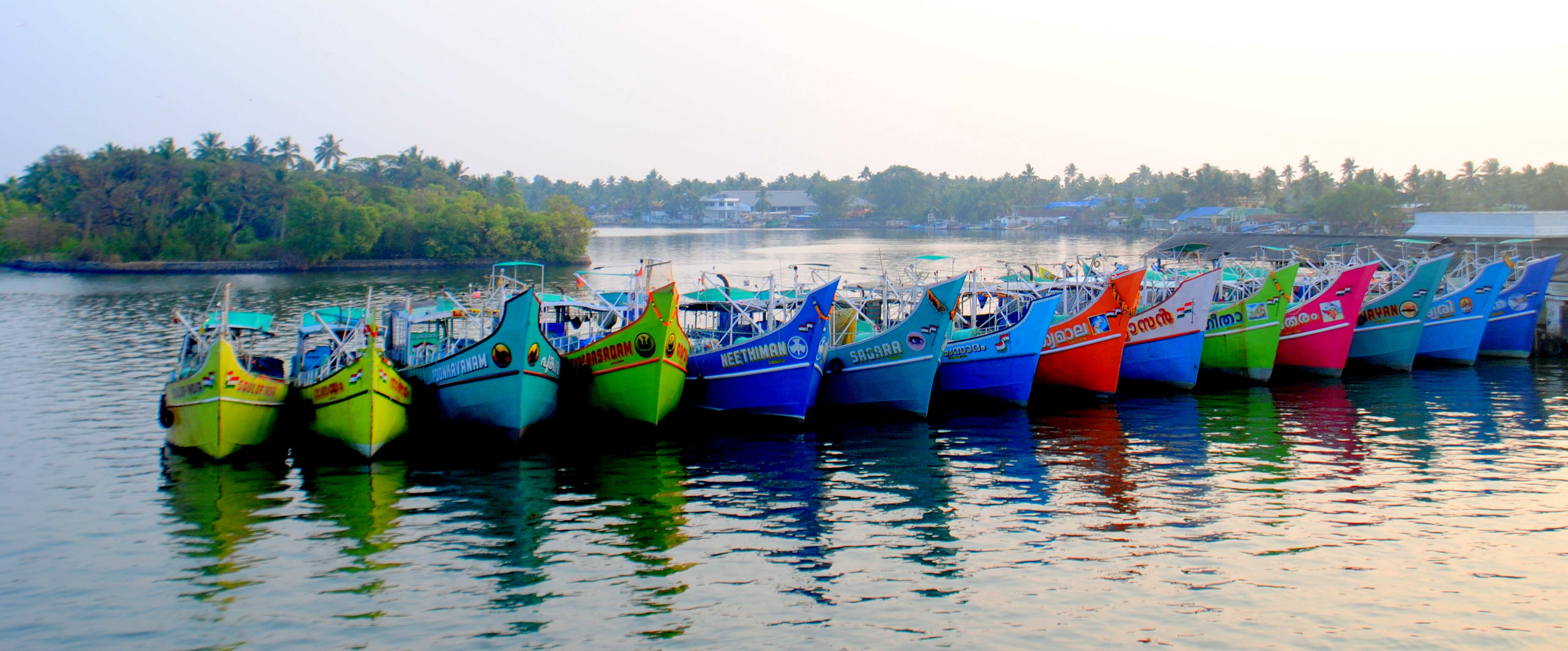
Ochanthuruth is one of the villages in Vypin, an island in Ernakulam district, Kerala, India. It is on the southern part of Vypin. Geography It is located at Vypin Island of Ernakulam District. Location Ochanthuruth is 3 miles (5 km) north of Kochi. Getting there The commissioning of the Goshree bridges in 2004 has greatly improved the connectivity to Vypin island from the mainland. Regular ferry and boat services are also available between Vypin and Fort Kochi. Tourism The lighthouse at Puthuvype attracts a number of tourists. The lighthouse is open to tourists on all days from 3 pm to 5 pm. The famous Cherai Beach and Pallipuram Fort are near Ochanthuruth. Churches * Cruz Milagres Church (Kurisingal Church) *Church of Our Lady of Perpetual Help (Vadakke Palli) Notable People *Joseph Attipetty, Archbishop of Verapoly *Eliswa Vakayil Eliswa Vakayil (Eliswa of the Blessed Virgin Mary in religion) is the foundress of the first indigenous Carmelite congregation fo ... [...More Info...] [...Related Items...] OR: [Wikipedia] [Google] [Baidu] |
Joseph Attipetty
Joseph Attipetty (June 25, 1894 - January 21, 1970) was the first native bishop of the Roman Catholic Archdiocese of Verapoly. Early life and education Joseph Attipetty was born on June 25, 1894, as the second of five children of Matthew and Rosa, at Ochanthuruth in the parish of Cruz Milagris, then in Cochin State, now Ernakulam, Kerala, India. His father was a seminarian, but realizing that his vocation was not priesthood, he dropped from seminary and later married Rosa. Attipetty was fondly called "Kochu Jusei" (കൊച്ചുജ്യൂസെ). He did his primary education at St. Mary's School, Ochanthuruthu and then at St. Albert's High School, Ernakulam. He was sent to St. Joseph's college in Trichy, run by the Jesuit fathers for pursuing his bachelor's degree. His association and close contact with the Jesuit clergy was instrumental in shaping his future. Vocation After completing his B.A degree, Attipetty returned to his native region. As his desire to become a pr ... [...More Info...] [...Related Items...] OR: [Wikipedia] [Google] [Baidu] |
Eliswa Vakayil
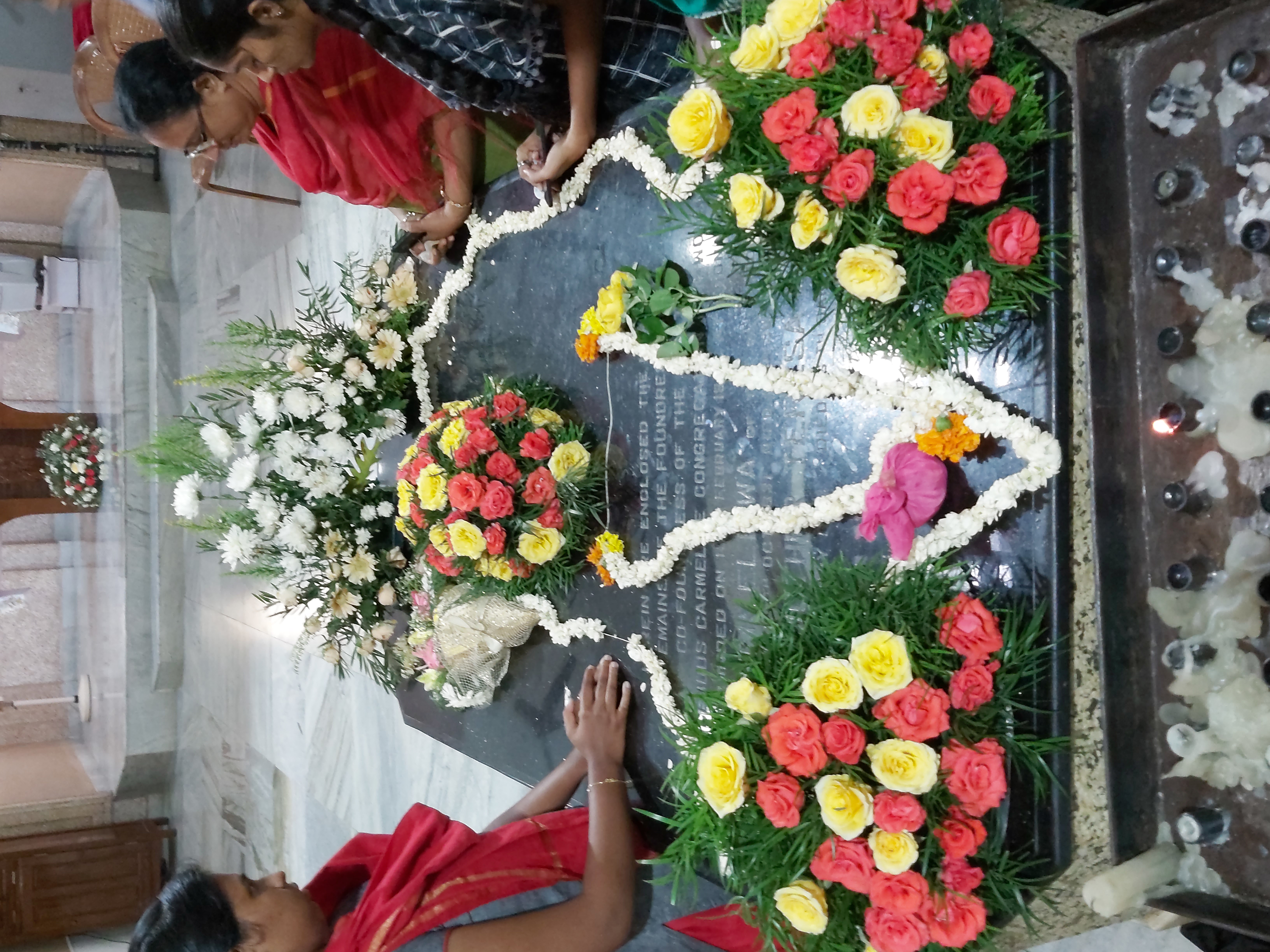
Eliswa Vakayil (Eliswa of the Blessed Virgin Mary in religion) is the foundress of the first indigenous Carmelite congregation for women in India. She was the first religious sister from Kerala, the southern most state of India; she established the first convent school, boarding house and orphanage for girls in Kerala. Early life She was born as the first of eight children of Thomman and Thanda, in the noble family of Vyppissery in the Cruz Milagres parish of Ochanthuruth. From her childhood itself Eliswa showed a keen interest in prayer and sacrifices. Her devotion to Jesus in the Eucharist and the Blessed Virgin Mary was astounding. Little Eliswa was exceptionally compassionate to the poor and the under privileged. According to her parents' wishes, Eliswa married Vatharu Vakayil in 1847. A girl child was born to them on April 21, 1850, and she was named Anna. After one and a half years since Anna's birth, Vatharu suddenly fell ill and died. Even though Eliswa was suggested for ... [...More Info...] [...Related Items...] OR: [Wikipedia] [Google] [Baidu] |
Vypin
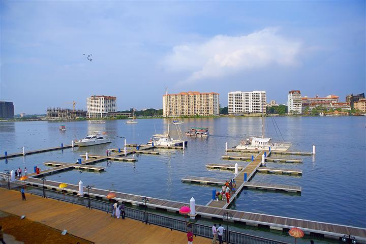
Vypin (Malayalam: വൈപ്പിന്, Cochin Portuguese: Isla Santa) is one of the group of islands that form part of the city of Kochi (Cochin), in the Indian state of Kerala. Vypin forms a barrier island which lies between the Arabian Sea in the west and the Cochin backwaters formed by the various distributaries of Periyar river, in the east. The northernmost end of the island lies on the estuary of the Periyar river in Muziris (Kodungallur), and the southernmost end in the mouth of the Cochin Backwaters in Kalamukku near Fort Vypin. The island is about long and is connected to mainland Kochi by a series of bridges known as the Goshree bridges, which start at Kalamukku in Vypin, touch other two islands and then finish at Marine Drive covering a total distance of around . Vypin is 58th most densely populated islands in the world. Njarakkal is one of the most densely populated locations within Vypin. Development At far the northern tip of Vypin, is home to the Mun ... [...More Info...] [...Related Items...] OR: [Wikipedia] [Google] [Baidu] |
Köppen Climate Classification
The Köppen climate classification is one of the most widely used climate classification systems. It was first published by German-Russian climatologist Wladimir Köppen (1846–1940) in 1884, with several later modifications by Köppen, notably in 1918 and 1936. Later, the climatologist Rudolf Geiger (1894–1981) introduced some changes to the classification system, which is thus sometimes called the Köppen–Geiger climate classification system. The Köppen climate classification divides climates into five main climate groups, with each group being divided based on seasonal precipitation and temperature patterns. The five main groups are ''A'' (tropical), ''B'' (arid), ''C'' (temperate), ''D'' (continental), and ''E'' (polar). Each group and subgroup is represented by a letter. All climates are assigned a main group (the first letter). All climates except for those in the ''E'' group are assigned a seasonal precipitation subgroup (the second letter). For example, ''Af'' indi ... [...More Info...] [...Related Items...] OR: [Wikipedia] [Google] [Baidu] |
Cruz Milagres Church
Cruz is a surname of Iberian Peninsula, Iberian origin, first found in Castile (historical region), Castile, Spain, but later spread throughout the territories of the former Spanish Empire, Spanish and Portuguese Empires. In Spanish and Portuguese, the word means "cross", either the Christian cross or the figure of transecting lines or ways. For example, in the Philippines, the adopted Tagalog language, Tagalog word is rendered to "krus" in plain usage, but the Spanish spelling survives as a surname. The word "Cruz" (Spanish for "Cross"), as well as "Vera Cruz" ("True Cross") and "Santa Cruz" ("Holy Cross") are used as surnames and toponyms. Its origin as a surname particularly flourished after the Alhambra Decree of 1492 and the increasing activities of the Spanish Inquisition, when New Christian families with Crypto-Judaism, Crypto-Jewish, Morisco, Moorish, and/or mixed religious heritage converted to the state-enforced religion of Catholic Church, Catholicism and subsequently ... [...More Info...] [...Related Items...] OR: [Wikipedia] [Google] [Baidu] |
Pallipuram Fort
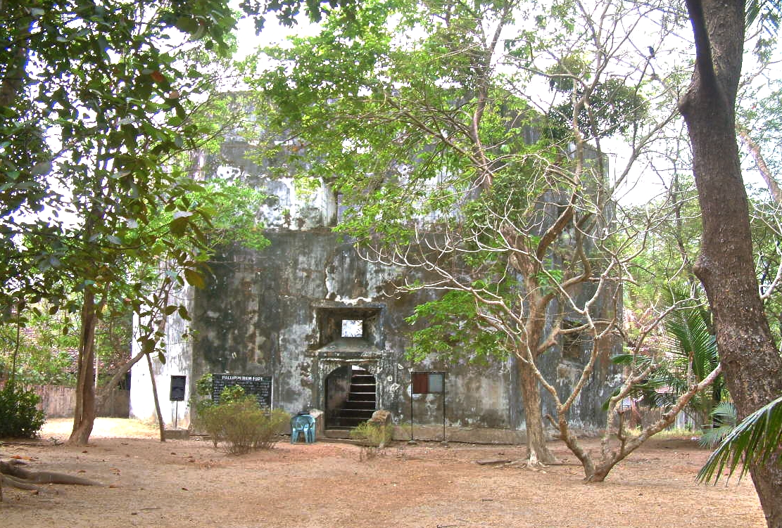
Pallippuram Fort or (Paleport Castelo em Cima) is a fort in Pallippuram, Vyppin, Ernakulam district of Kerala, south India. It was built by Portuguese sailors on 27 September, 1503 using just timber wood, and later renovated in 1505 by replacing timber structure with stone. It is the oldest existing European fort in India. The Dutch captured the fort in 1663 and sold it to the Kingdom of Travancore The Kingdom of Travancore ( /ˈtrævənkɔːr/), also known as the Kingdom of Thiruvithamkoor, was an Indian kingdom from c. 1729 until 1949. It was ruled by the Travancore Royal Family from Padmanabhapuram, and later Thiruvananthapuram. At ... in 1789. The fort is situated in the northern extremity of Vypeen island and is hexagonal in shape, a form popularly known as ''ayikkotta'' or ''alikotta''. Structure Hexagonal in shape, the lowest internal floor of the fort is raised to a height of . The gate and the door posts, and the lintels are finely dressed and arched while u ... [...More Info...] [...Related Items...] OR: [Wikipedia] [Google] [Baidu] |
Cherai Beach
Cherai Beach is a beach located in Cherai in the northern side of Vypin Island, a suburb of the city Kochi in the state of Kerala, India. One of the most visited beaches in the state, it is situated at around 25 km (15 mi) from downtown Kochi and 20 km (12 mi) from Cochin International Airport. Tourism The beach is around 10 km long and is ideal for swimming as the tide is mostly low and the waves are gentle. It is known for frequent dolphin sightings. It is one of the few places where the backwaters and the sea can be seen in a single frame. Cherai Beach offers the less busier and cleaner option accessible to Kochi and always attract the tourists from around and other states as well. Images of Cherai beach Satellite image of the beach Image:Cherai 3.jpg, View of Cherai Beach Image:Cherai Lagoon2.jpg, View of Cherai Lagoon Image:Walk Way Cherai.JPG, One of the walkways near the beach Image:Paraglider at Cherai Beach Kerala 1.jpg, Paragliding Paragliding is ... [...More Info...] [...Related Items...] OR: [Wikipedia] [Google] [Baidu] |
Puthuvype
Puthuvype (Puthu vype - New Vypin) is an upcoming major Industrial area in Kochi in the Indian state of Kerala. It is situated 5 km west of High Court Junction. Demographics As per Government of India Census 2011 Puthuvype has a population of nearly 23,717 people. Males constitute 48.88% of the population and females 51.12% Location and Surroundings Puthuvype is a part of Vypin Island. It borders Vembanad Lake to the East, Arabian Sea to the West and South and Njarakkal to the North. The main thoroughfares in the area are Vypin-Munambam Road and LNG Terminal Road. It is one of the important place in Vypin Island. Puthuvype is well known for Puthuvype Light house beach. Industries Industries located to Puthuvypeen is mainly related to natural regasification project and petroleum projects. * LNG Terminal The Kochi LNG Terminal of Petronet LNG Ltd is the first LNG terminal in southern India and the fourth LNG terminal of country. The Project is a Greenfield LNG Re- ... [...More Info...] [...Related Items...] OR: [Wikipedia] [Google] [Baidu] |
Fort Kochi
Fort Kochi, Fort Cochin in English, Cochim de Baixo ("Lower Kochi") in Cochin Portuguese creole, is a neighbourhood of Cochin (Kochi) city in Kerala, India. Fort Kochi takes its name from the Fort Manuel of Cochin, the first European fort on Indian soil, controlled by the Portuguese East Indies. This is part of a handful of water-bound islands and islets toward the south-west of the mainland Kochi, and collectively known as ''Old Cochin'' or ''West Cochin''. Adjacent to this is the locality of Mattancherry. In 1967, these three municipalities along with a few adjoining areas, were amalgamated to form the Kochi Municipal Corporation. Scientific theory In the BC period, the region that is today known as Kerala was covered by mangrove woods. Turf and sand banks were created with the rise in sea-level which formed the shape of the coastal area as we see it today. The name ''Cochin'' implies "co-chin", meaning "like-China". It looked like China when the Chinese came to the reg ... [...More Info...] [...Related Items...] OR: [Wikipedia] [Google] [Baidu] |
Goshree Bridges
Goshree bridges is a system of bridges that link the mainland side of the city of Kochi (India), Kochi to the islands lying to the north of the backwaters. It provides the vital road connectivity to the islands of Bolgatty Island, Bolgatty and Vallarpadam and also links the western island of Vypin to the mainland. The bridges start from the northern end of Marine Drive, Kochi, Marine Drive between Kerala High Court, High Court and Pachalam. The bridges are constructed by the Goshree Islands Development Authority (GIDA), constituted by the Government of Kerala. The construction was funded by the sale proceeds of reclaimed land adjacent to the bridge. The foundation stone was laid on 29 December 2000. The first segment between Ernakulam and Bolgatty was opened on 29 December 2003. The segment between Bolgatty and Vallarpadam was opened on 10 February 2004. The last segment was completed on 17 March 2004 and the entire bridge is formally opened on 5 June. The bridge is the only me ... [...More Info...] [...Related Items...] OR: [Wikipedia] [Google] [Baidu] |
Ernakulam
Ernakulam () is the Central Business District of the city of Kochi in Kerala, India and has lent its name to the Ernakulam district. Many major establishments, including the Kerala High Court, the office of the Kochi Municipal Corporation and the Cochin Shipyard are situated here. History Classical history The region can claim to have played a significant part in fostering the trade relations between Kerala and the outside world in the ancient and medieval period. The early political history of Ernakulam is interlinked with that of the Chera Dynasty of the Sangam age, who ruled over vast portions of Kerala and Tamil Nadu. After the Cheras, the place was later ruled by the Kingdom of Cochin (Perumpadapu Swaroopam). Princely State of Cochin Although under British suzerainty (specifically the East India Company) since the Anglo-Dutch Treaty of 1814, Rama Varma XII of the Kingdom of Cochin moved his capital from Mattancherry to Tripunithura in about 1840. Fort Cochin Munic ... [...More Info...] [...Related Items...] OR: [Wikipedia] [Google] [Baidu] |
States And Territories Of India
India is a federal union comprising 28 states and 8 union territories, with a total of 36 entities. The states and union territories are further subdivided into districts and smaller administrative divisions. History Pre-independence The Indian subcontinent has been ruled by many different ethnic groups throughout its history, each instituting their own policies of administrative division in the region. The British Raj mostly retained the administrative structure of the preceding Mughal Empire. India was divided into provinces (also called Presidencies), directly governed by the British, and princely states, which were nominally controlled by a local prince or raja loyal to the British Empire, which held ''de facto'' sovereignty ( suzerainty) over the princely states. 1947–1950 Between 1947 and 1950 the territories of the princely states were politically integrated into the Indian union. Most were merged into existing provinces; others were organised into ... [...More Info...] [...Related Items...] OR: [Wikipedia] [Google] [Baidu] |


