|
Otélé
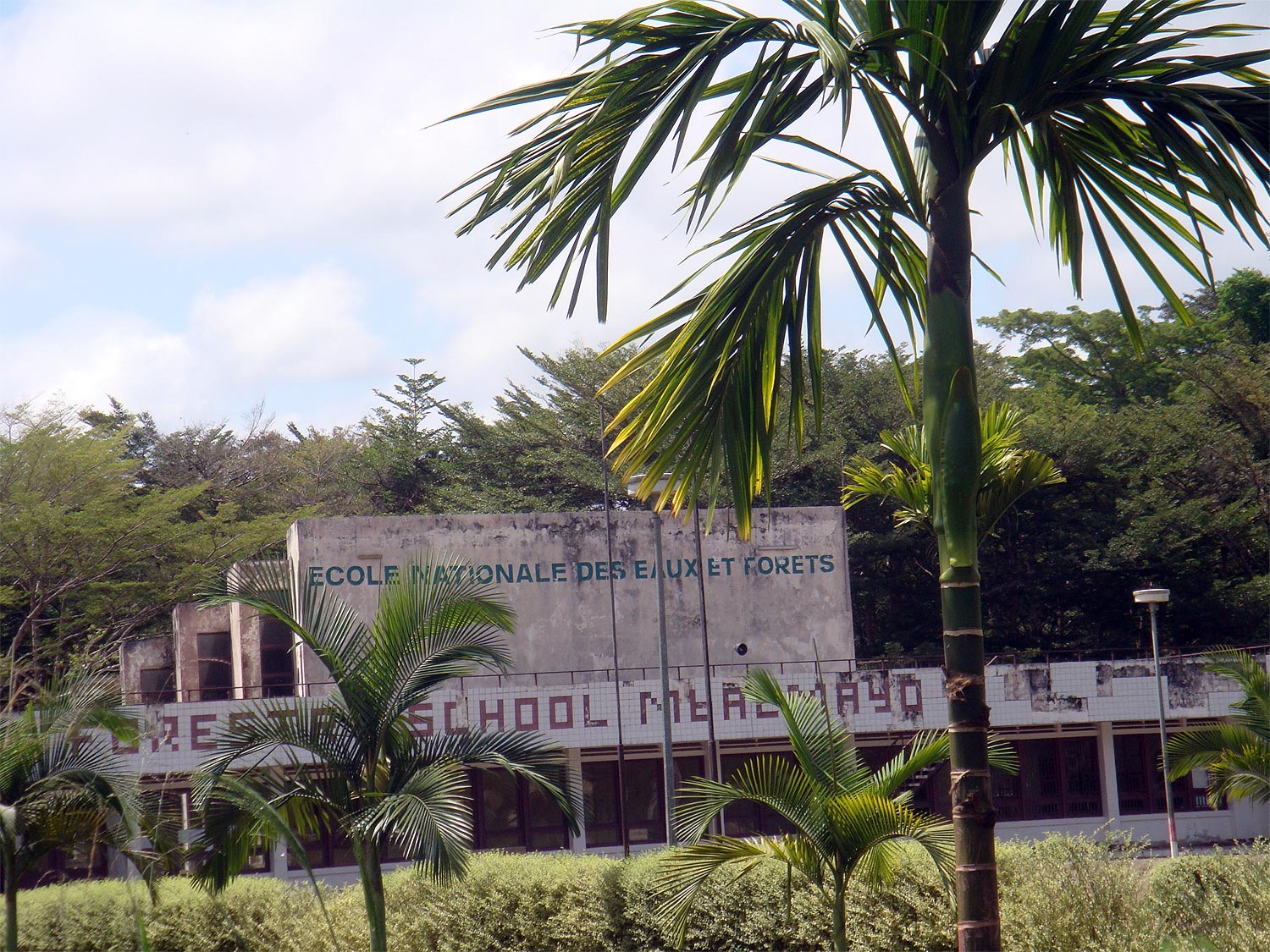
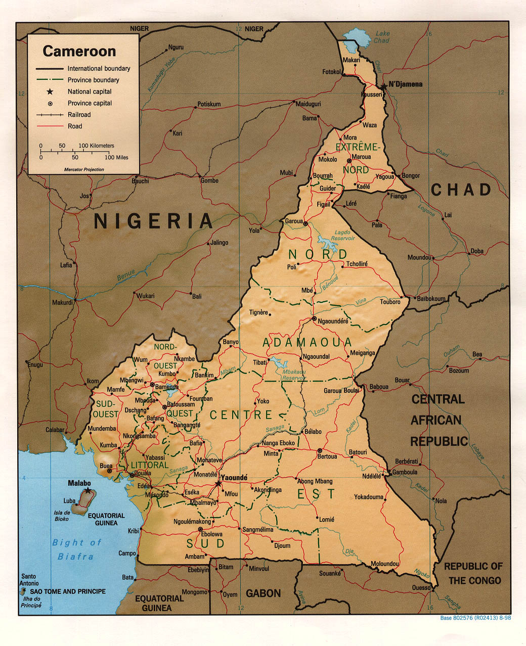
Otele is a town in central Cameroon. Transport It is served by the main line of Cameroon Railways. It is the junction for a short branch line to the river port of Mbalmayo. Climate Köppen-Geiger climate classification system classifies its climate as tropical wet and dry (Aw). See also * List of municipalities of Cameroon * Transport in Cameroon * Railway stations in Cameroon The list of railway stations in Cameroon includes: Stations served by passenger trains Towns served by rail Existing ( gauge plantation railway) * Limbe, Cameroon, Limbe - port, terminal, cement works ---- ( gauge) ---- * Nkongsamba (W ... References {{DEFAULTSORT:Otele Populated places in Cameroon ... [...More Info...] [...Related Items...] OR: [Wikipedia] [Google] [Baidu] |
Railway Stations In Cameroon
The list of railway stations in Cameroon includes: Stations served by passenger trains Towns served by rail Existing ( gauge plantation railway) * Limbe, Cameroon, Limbe - port, terminal, cement works ---- ( gauge) ---- * Nkongsamba (W) – railhead in northwest - rehabilitate * Mbanga, Cameroon, Mbanga (W) – junction in west ** Kumba (W) – branch terminus in west * Bonabéri (W) – port in west ---- * Douala – river port - portland cement, cement works - 62km * Edéa – river crossing Sanaga River ; future junction to ocean port Kribi (114km) * Mésondo * Eséka * Makak located in Center Province * Otélé junction for Mbalmayo * Yaoundé national capital – portland cement, cement works * The railway line was extended from Yaoundé to Ngaoundéré, a distance of 622 km, and was inaugurated in 1974 2. ---- Rehabilitate ---- * Nanga Eboko * Bélabo – ballast quarry and concrete sleeper plant * Ngaoundal * Ngaoundéré – Aluminium in Africa, bauxite – ... [...More Info...] [...Related Items...] OR: [Wikipedia] [Google] [Baidu] |
Flag Of Cameroon
The national flag of Cameroon () was adopted in its present form on 20 May 1975 after Cameroon became a unitary state. It is a vertical tricolour of green, red and yellow Pale (heraldry), pales, with a yellow five-pointed star in its center. There is a wide variation in the size of the central star, although it is always contained within the inside stripe. Description The colour scheme uses the traditional Pan-African colours (Cameroon was the second state to adopt them). The centre stripe is thought to stand for unity: red is the colour of unity, and the star is referred to as "the star of unity". The yellow stands for the sun, and also the savannas in the northern part of the country, while the green is for the forests in the southern part of Cameroon. The previous flag of Cameroon, used from 1961 to 1975, had a similar colour scheme, but with two gold (darker than the third stripe by comparison) stars in the upper half of the green. It was adopted after British Southern Camer ... [...More Info...] [...Related Items...] OR: [Wikipedia] [Google] [Baidu] |
Cameroon
Cameroon, officially the Republic of Cameroon, is a country in Central Africa. It shares boundaries with Nigeria to the west and north, Chad to the northeast, the Central African Republic to the east, and Equatorial Guinea, Gabon, and the Republic of the Congo to the south. Its coastline lies on the Bight of Biafra, part of the Gulf of Guinea, and the Atlantic Ocean. Due to its strategic position at the crossroads between West Africa and Central Africa, it has been categorized as being in both camps. Cameroon's population of nearly 31 million people speak 250 native languages, in addition to the national tongues of English and French, or both. Early inhabitants of the territory included the Sao civilisation around Lake Chad and the Baka people (Cameroon and Gabon), Baka hunter-gatherers in the southeastern rainforest. Portuguese discoveries, Portuguese explorers reached the coast in the 15th century and named the area ''Rio dos Camarões'' (''Shrimp River''), which became ''C ... [...More Info...] [...Related Items...] OR: [Wikipedia] [Google] [Baidu] |
Provinces Of Cameroon
The Republic of Cameroon is divided into ten regions. History Between 1961 and 1972, Cameroon was a federal republic made up of two federated states, East Cameroon and West Cameroon. A unitary system came into being in 1972. The country was then divided into provinces. In 1983, Centre-South Province was divided into Centre and South and at the same time, Adamawa and Far North Provinces were split from North Province. See summary of administrative history in Zeitlyn 2018. In 2008, the President of the Republic of Cameroon, President Paul Biya signed decrees abolishing "provinces" and replacing them with "regions". Hence, all of the country's ten provinces are now known as regions. The Northwest region and Southwest region were granted special status in December 2019, giving them additional powers. File:Carte des États de la République fédérale du Cameroun.png, States of the Federal Republic of Cameroon (1961-1972) File:Cameroon provinces 1972-1983.png, Provinces o ... [...More Info...] [...Related Items...] OR: [Wikipedia] [Google] [Baidu] |
Centre Region (Cameroon)
The Centre Region () occupies 69,000 km2 of the central plains of the Republic of Cameroon. It is bordered to the north by the Adamawa Region, to the south by the South Region, to the east by the East Region, and to the West by the Littoral and West Regions. It is the second largest (after East Region) of Cameroon's regions in land area. Major ethnic groups include the Bassa, Ewondo, and Vute. Yaoundé, capital of Cameroon, is at the heart of the Centre, drawing people from the rest of the country to live and work there. The Centre's towns are also important industrial centres, especially for timber. Agriculture is another important economic factor, especially with regard to the province's most important cash crop, cocoa. Outside of the capital and the plantation zones, most inhabitants are sustenance farmers. 2008 presidential decree abolishes provinces In 2008, the President of the Republic of Cameroon, President Paul Biya signed decrees abolishing "Provinc ... [...More Info...] [...Related Items...] OR: [Wikipedia] [Google] [Baidu] |
Divisions Of Cameroon
The regions of Cameroon are divided into 58 divisions or departments. The divisions are further subdivided into subdivisions (''arrondissements'') and districts. The divisions are listed below, by Macro-Region and region. The constitution divides Cameroon into ten semi-autonomous regions, each under the administration of an elected Regional Council. A presidential decree of 12 November 2008 officially instigated the change from provinces to regions. Each region is headed by a presidentially appointed governor. These leaders are charged with implementing the will of the president, reporting on the general mood and conditions of the regions, administering the civil service, keeping the peace, and overseeing the heads of the smaller administrative units. Governors have broad powers: they may order propaganda in their area and call in the army, gendarmes, and police. All local government officials are employees of the central government's Ministry of Territorial Administration, ... [...More Info...] [...Related Items...] OR: [Wikipedia] [Google] [Baidu] |
Camrail
Camrail is a company operating passenger and freight traffic between the two largest cities in Cameroon and several smaller cities. The company was formed in 1999 and granted a 20-year concession to operate the Cameroon National Railway. The company is a subsidiary of French investment group Bolloré and the railway has been operated by Comazar, a subsidiary of Bolloré, since 1999. According to the Comazar website, the government of Cameroon owns the track while the rolling stock is owned by Camrail. According to a report by the World Bank in 2011, Camrail ranked relatively high amongst African countries for productivity indicators and was considered a regional leader in terms of implementing a concession to a non-state operator. The 2016 Eséka train derailment took place on Camrail tracks and the company was under investigation by the government and was sued by relatives of the 79 passengers who died in the crash. Services Passenger As of May 2014, Camrail operated regula ... [...More Info...] [...Related Items...] OR: [Wikipedia] [Google] [Baidu] |
Mbalmayo
Mbalmayo is a town in Cameroon's Centre Province, Cameroon, Centre Region. The town had 60,091 inhabitants in 2012. It is the capital of the Nyong-et-So'o, Nyong-et-So'o Division It is located at the banks of the Nyong river between Ebolowa and Yaoundé. It is an agricultural centre. History Mbalmayo was founded in 1910, under the German rule of the then Kamerun, by Mbala Meyo, an early ruler of the town. As was the custom before colonialism, the town was named after the chief. The Germans ruled the town and used the Nyong river to transport timber which was a major source of income. It is in the part of Cameroon that the League of Nations made a French protectorate. Economy Mbalmayo is an industrial town that is about 41 km from Yaoundé the Capital of Cameroon. Mbalmayo is located in the Central Region of Cameroon. It is situated along the Nyong River, south of Yaoundé. Since it is deeply entrenched in the dense equatorial forest zone that stretched to the South, ... [...More Info...] [...Related Items...] OR: [Wikipedia] [Google] [Baidu] |
Tropical Wet And Dry Climate
Tropical savanna climate or tropical wet and dry climate is a tropical climate sub-type that corresponds to the Köppen climate classification categories ''Aw'' (for a dry "winter") and ''As'' (for a dry "summer"). The driest month has less than of precipitation and also less than 100-\left (\frac \right)mm of precipitation. This latter fact is in a direct contrast to a tropical monsoon climate, whose driest month sees less than of precipitation but has ''more'' than 100-\left (\frac \right) of precipitation. In essence, a tropical savanna climate tends to either see less overall rainfall than a tropical monsoon climate or have more pronounced dry season(s). It is impossible for a tropical savanna climate to have more than as such would result in a negative value in that equation. In tropical savanna climates, the dry season can become severe, and often drought conditions prevail during the course of the year. Tropical savanna climates often feature tree-studded grasslands due ... [...More Info...] [...Related Items...] OR: [Wikipedia] [Google] [Baidu] |
List Of Municipalities Of Cameroon
This is the list of cities, towns, and villages in the country of Cameroon: Villages * Bodo * Goura, Centre Region * Goura, Far North Region * Ngoila * Nkuv * Mmuock Leteh * Babungo * Baba * Babessi * Bangolan * Bamunka * File:Silicon Mountain as seen in Buea, Cameroon on 26-06-2019.jpg, Buea File:Limbe Atlantic Ocean 1.jpg, Atlantic Ocean, Limbe File:Drill, Limbe wildlife centre.jpg, Drill, Limbe Wildlife Centre File:Pont du Plaisir.jpg, Dschang File:Plage Kribi38.jpg, Kribi Beach File:Beauty of the crick of idenau.jpg, View of a beautiful crick in Idenau See also * Communes of Cameroon * Departments of Cameroon * Regions of Cameroon * Subdivisions of Cameroon References External links Municipalities Municipalities Cameroon, List of municipalities in Municipalities of Cameroon Cameroon Cameroon, officially the Republic of Cameroon, is a country in Central Africa. It shares boundaries with Nigeria to the west and north, Chad to the nort ... [...More Info...] [...Related Items...] OR: [Wikipedia] [Google] [Baidu] |
Transport In Cameroon
This article provides a breakdown of the transportation options available in Cameroon. These options are available to citizens and tourists such as railways, roadways, waterways, pipelines, and airlines. These avenues of transport are used by citizens for personal transportation, of goods, and by tourists for both accessing the country and traveling. Railways Railways in Cameroon are operated by Camrail, a subsidiary of France , French investment group Bolloré. As of May 2014, Camrail operated regular daily services on three routes: * Douala - Kumba * Douala - Yaoundé * Yaoundé - Ngaoundéré * Kribi - Mbalam and Nabeba in Republic of the Congo (Léopoldville), Republic of the Congo - under construction in 2022. * Edéa - Kribi - proposed connection to deep water port. There are no rail links with neighboring countries except Republic of the Congo (Léopoldville), Republic of the Congo. Roadways ''Total highways:'' 50,000 km ''Paved:'' 5,000 km ''Unpaved:' ... [...More Info...] [...Related Items...] OR: [Wikipedia] [Google] [Baidu] |


