|
Ostrovsky (inhabited Locality)
Ostrovsky or Ostrovskoy (russian: Остро́вский or ; masculine), Ostrovskaya (; feminine), or Ostrovskoye (; neuter) is the name of several rural localities in Russia: * Ostrovsky, Tambov Oblast, a settlement in Yekaterinovsky Selsoviet of Morshansky District of Tambov Oblast * Ostrovsky, Tula Oblast, a settlement in Nikolskaya Rural Administration of Shchyokinsky District of Tula Oblast * Ostrovskoy, a ''khutor'' in Nizhneosinovsky Selsoviet of Surovikinsky District of Volgograd Oblast * Ostrovskoye, Kaliningrad Oblast, a settlement in Ozerkovsky Rural Okrug of Gvardeysky District of Kaliningrad Oblast * Ostrovskoye, Klevantsovskoye Settlement, Ostrovsky District, Kostroma Oblast, a railway station in Klevantsovskoye Settlement of Ostrovsky District of Kostroma Oblast * Ostrovskoye, Ostrovskoye (tsentralnoye) Settlement, Ostrovsky District, Kostroma Oblast, a settlement in Ostrovskoye (tsentralnoye) Settlement of Ostrovsky District of Kostroma Oblast * Ostrovskoye, Nizhn ... [...More Info...] [...Related Items...] OR: [Wikipedia] [Google] [Baidu] |
Types Of Inhabited Localities In Russia
The classification system of inhabited localities in Russia and some other post-Soviet states has certain peculiarities compared with those in other countries. Classes During the Soviet time, each of the republics of the Soviet Union, including the Russian SFSR, had its own legislative documents dealing with classification of inhabited localities. After the dissolution of the Soviet Union, the task of developing and maintaining such classification in Russia was delegated to the federal subjects.Articles 71 and 72 of the Constitution of Russia do not name issues of the administrative and territorial structure among the tasks handled on the federal level or jointly with the governments of the federal subjects. As such, all federal subjects pass their own laws establishing the system of the administrative-territorial divisions on their territories. While currently there are certain peculiarities to classifications used in many federal subjects, they are all still largely ba ... [...More Info...] [...Related Items...] OR: [Wikipedia] [Google] [Baidu] |
Ostrovsky District, Kostroma Oblast
Ostrovsky District (russian: Остро́вский райо́н) is an administrativeLaw #112-4-ZKO and municipalLaw #237-ZKO district (raion), one of the twenty-four in Kostroma Oblast, Russia. It is located in the southwest of the oblast. The area of the district is . Its administrative center is the rural locality (a settlement of rural type) of Ostrovskoye. Population: 14,758 ( 2002 Census); The population of Ostrovskoye accounts for 46.3% of the district's total population. Geography Ostrovsky District is located in the southwest of Kostroma Oblast, about 10km north of the Volga River as it runs west to east. The terrain is flat or slightly hilly, with pine-larch forests (southern taiga) covering much of the district. The terrain is flat to slightly hilly, with a glacier-formed landscape of moraines, swamps, and lakes. The runs south to the Volga. Ostrovsky District is 50 km east of the regional city of Kostroma, and about 360 km northeast of Moscow. The ... [...More Info...] [...Related Items...] OR: [Wikipedia] [Google] [Baidu] |
Vologda Oblast
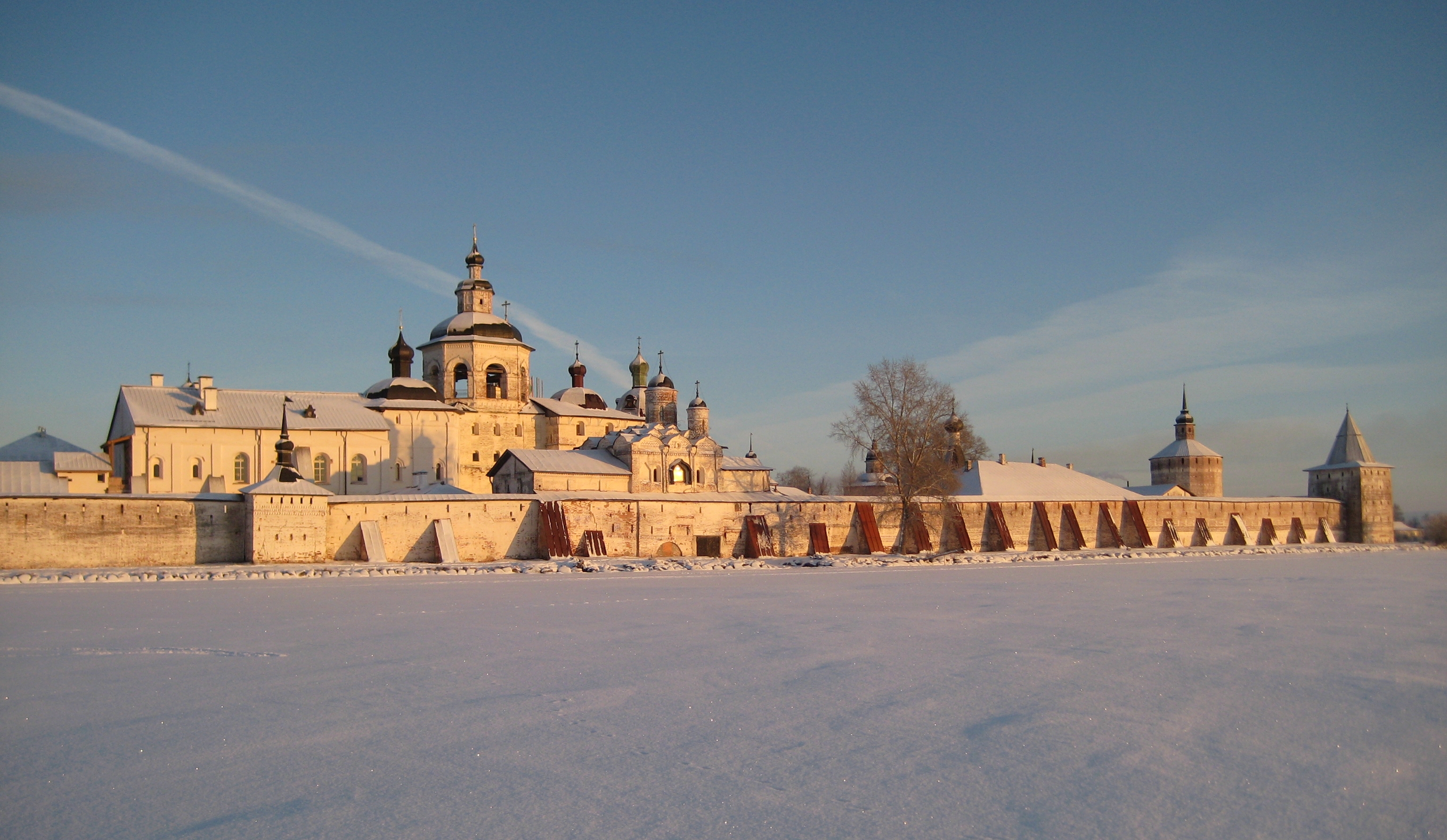
Vologda Oblast ( rus, Вологодская область, p=vəlɐˈɡotskəjə ˈobləsʲtʲ, r=Vologodskaya oblast, ) is a federal subject of Russia (an oblast). Its administrative center is Vologda. The Oblast has a population of 1,202,444 ( 2010 Census). The largest city is Cherepovets, the home of the Severstal metallurgical plant, the largest industrial enterprise in the oblast. Vologda Oblast is rich in historic monuments, such as the Kirillo-Belozersky Monastery, Ferapontov Monastery (a World Heritage Site) with the frescoes of Dionisius, medieval towns of Velikiy Ustyug and Belozersk, and baroque churches of Totma and Ustyuzhna. Large reserves of wood and fresh water are the main natural resources. History The area of Vologda Oblast was settled by Finnic peoples in prehistory, and most of the toponyms in the region are in fact Finnic. Vepsians, who still live in the west of the oblast, are the descendants of that population. Subsequently, the area was colonized ... [...More Info...] [...Related Items...] OR: [Wikipedia] [Google] [Baidu] |
Kirillovsky District
Kirillovsky District (russian: Кири́лловский райо́н) is an administrativeLaw #371-OZ and municipalLaw #1116-OZ district (raion), one of the twenty-six in Vologda Oblast, Russia. It is located in the north of the oblast and borders with Kargopolsky and Konoshsky Districts of Arkhangelsk Oblast in the north, Vozhegodsky and Ust-Kubinsky Districts in the east, Vologodsky District in the southeast, Sheksninsky District in the south, Cherepovetsky District in the southeast, Belozersky and Vashkinsky Districts in the west, and with Vytegorsky District in the northwest. The area of the district is . Its administrative center is the town of Kirillov.Resolution #178 Population: 18,627 ( 2002 Census); The population of Kirillov accounts for 48.7% of the district's total population. Geography The area of the district is elongated from north to south and is split into two roughly equal parts by the divide between the basins of the Arctic Ocean and the Caspian Se ... [...More Info...] [...Related Items...] OR: [Wikipedia] [Google] [Baidu] |
Danilovsky District, Volgograd Oblast
Danilovsky District (russian: Дани́ловский райо́н) is an administrativeLaw #139-OD district (raion), one of the administrative divisions of Volgograd Oblast, thirty-three in Volgograd Oblast, Russia. As a subdivisions of Russia#Municipal divisions, municipal division, it is incorporated as Danilovsky Municipal District.Law #973-OD It is located in the north of the oblast. The area of the district is . Its administrative center is the types of inhabited localities in Russia, urban locality (a urban-type settlement, work settlement) of Danilovka, Volgograd Oblast, Danilovka. As of the Russian Census (2010), 2010 Census, the total population of the district was 16,908, with the population of Danilovka accounting for 31.4% of that number. References Notes Sources * * {{Use mdy dates, date=September 2012 Districts of Volgograd Oblast ... [...More Info...] [...Related Items...] OR: [Wikipedia] [Google] [Baidu] |
Stanitsa
A stanitsa ( rus, станица, p=stɐˈnʲitsə; uk, станиця, stanytsya) is a village inside a Cossack host ( uk, військо, viys’ko; russian: казачье войско, kazach’ye voysko, sometimes translated as "Cossack Army"). Stanitsas (russian: станицы, stanitsy) — Cossack military settlements — were the primary unit of Cossack hosts. While the word ''stanitsa'' survives in modern usage, the stanitsa as a social system in its historic context was effectively destroyed in the aftermath of the 1917 Russian revolution, when the Russian Civil War (1917–1922) and subsequent collectivisation (1928–1940) of the land by the state in the Stalinist period and the Holodomor (1932–1933) destroyed the culture and the economic foundations of stanitsas. Historical definition Historically, the stanitsa was a unit of economic and political organisation of the Cossack peoples — primarily in the southern regions of the Russian Empire. Each stanit ... [...More Info...] [...Related Items...] OR: [Wikipedia] [Google] [Baidu] |
Ostrovskaya, Volgograd Oblast
Ostrovskaya (russian: Островская) is a rural locality (a stanitsa) and the administrative center of Ostrovskoye Rural Settlement, Danilovsky District, Volgograd Oblast, Russia. The population was 1,689 as of 2010. There are 26 streets. Geography Ostrovskaya is located in forest steppe, 45 km northeast of Danilovka Danilovka (russian: Дани́ловка) is the name of several types of inhabited localities in Russia, inhabited localities in Russia. Modern inhabited localities Altai Krai As of 2010, two rural localities in Altai Krai bear this name: *Danilov ... (the district's administrative centre) by road. Orekhovo is the nearest rural locality. References Rural localities in Danilovsky District, Volgograd Oblast {{DanilovskyVGG-geo-stub ... [...More Info...] [...Related Items...] OR: [Wikipedia] [Google] [Baidu] |
Nizhny Novgorod Oblast
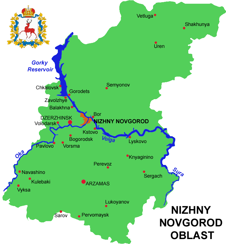
Nizhny Novgorod Oblast (russian: link=no, Нижегородская область, ''Nizhegorodskaya oblast''), is a federal subjects of Russia, federal subject of Russia (an oblast). Its administrative center is the types of inhabited localities in Russia, city of Nizhny Novgorod. It has a population of 3,310,597 as of the Russian Census (2010), 2010 Census. From 1932 to 1990 it was known as Gorky Oblast. The oblast is crossed by the Volga River. Apart from Nizhny Novgorod's metropolitan area (including Dzerzhinsk, Russia, Dzerzhinsk, Bor, Nizhny Novgorod Oblast, Bor and Kstovo) the biggest city is Arzamas. Near the town of Sarov there is the Serafimo-Diveyevsky Monastery, one of the largest convents in Russia, established by Seraphim of Sarov, Saint Seraphim of Sarov. The Makaryev Monastery opposite of the town of Lyskovo, Nizhny Novgorod Oblast, Lyskovo used to be the location of the largest fair in Eastern Europe. Other historic towns include Gorodets, Nizhny Novgorod Oblast ... [...More Info...] [...Related Items...] OR: [Wikipedia] [Google] [Baidu] |
Knyagininsky District
Knyagininsky District (russian: Княги́нинский райо́н) is an administrative district (raion), one of the forty in Nizhny Novgorod Oblast, Russia.Order #3-od Municipally, it is incorporated as Knyagininsky Municipal District.Resolution #670 It is located in the east of the oblast. The area of the district is . Its administrative center is the town A town is a human settlement. Towns are generally larger than villages and smaller than cities, though the criteria to distinguish between them vary considerably in different parts of the world. Origin and use The word "town" shares an ori ... of Knyaginino. Population: 11,922 ( 2010 Census); The population of Knyaginino accounts for 56.3% of the district's total population. History The district was established in 1944. References Notes Sources * * {{Use mdy dates, date=September 2012 Districts of Nizhny Novgorod Oblast States and territories established in 1944 __NOTOC__ ... [...More Info...] [...Related Items...] OR: [Wikipedia] [Google] [Baidu] |
Village
A village is a clustered human settlement or community, larger than a hamlet but smaller than a town (although the word is often used to describe both hamlets and smaller towns), with a population typically ranging from a few hundred to a few thousand. Though villages are often located in rural areas, the term urban village is also applied to certain urban neighborhoods. Villages are normally permanent, with fixed dwellings; however, transient villages can occur. Further, the dwellings of a village are fairly close to one another, not scattered broadly over the landscape, as a dispersed settlement. In the past, villages were a usual form of community for societies that practice subsistence agriculture, and also for some non-agricultural societies. In Great Britain, a hamlet earned the right to be called a village when it built a church. [...More Info...] [...Related Items...] OR: [Wikipedia] [Google] [Baidu] |


