|
Osino, Nevada
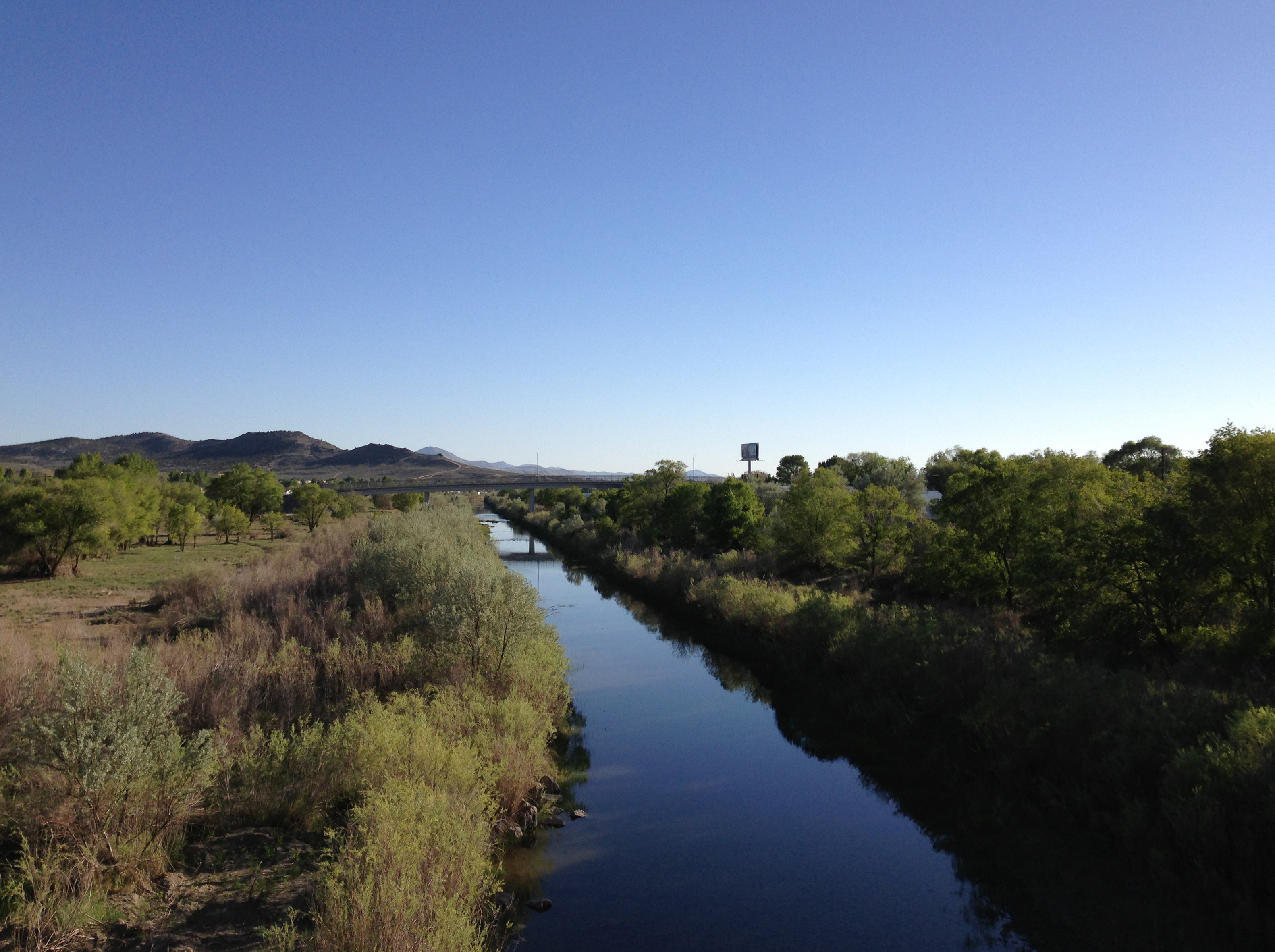
Osino is a census-designated place (CDP) in along the Humboldt River in central Elko County, Nevada, United States. As of the 2018 United States Census American Community Survey it had a population of 661. Geography Osino is located on Interstate 80 (Exit 310) on the northern foothills of two mountain ranges: the Elko Hills (on the south) and the Adobe Range (on the west). It is northeast of Elko and southwest of Wells Wells most commonly refers to: * Wells, Somerset, a cathedral city in Somerset, England * Well, an excavation or structure created in the ground * Wells (name) Wells may also refer to: Places Canada *Wells, British Columbia England * Wells .... Demographics See also * List of census-designated places in Nevada References External links Census-designated places in Elko County, Nevada Census-designated places in Nevada {{ElkoCountyNV-geo-stub ... [...More Info...] [...Related Items...] OR: [Wikipedia] [Google] [Baidu] |
Census-designated Place
A census-designated place (CDP) is a concentration of population defined by the United States Census Bureau for statistical purposes only. CDPs have been used in each decennial census since 1980 as the counterparts of incorporated places, such as self-governing cities, towns, and villages, for the purposes of gathering and correlating statistical data. CDPs are populated areas that generally include one officially designated but currently unincorporated community, for which the CDP is named, plus surrounding inhabited countryside of varying dimensions and, occasionally, other, smaller unincorporated communities as well. CDPs include small rural communities, edge cities, colonias located along the Mexico–United States border, and unincorporated resort and retirement communities and their environs. The boundaries of any CDP may change from decade to decade, and the Census Bureau may de-establish a CDP after a period of study, then re-establish it some decades later. Most unin ... [...More Info...] [...Related Items...] OR: [Wikipedia] [Google] [Baidu] |
List Of Census-designated Places In Nevada
Nevada is a state located in the Western United States. Nevada has several census-designated places (CDPs) which are unincorporated communities lacking elected municipal officers and boundaries with legal status. References External links State of Nevada Census Designated Places - Current/TAB20 - Data as of January 1, 2020 {{Lists of CDPs by state Nevada Nevada ( ; ) is a U.S. state, state in the Western United States, Western region of the United States. It is bordered by Oregon to the northwest, Idaho to the northeast, California to the west, Arizona to the southeast, and Utah to the east. N ... census-designated places ... [...More Info...] [...Related Items...] OR: [Wikipedia] [Google] [Baidu] |
Wells, Nevada
Wells is a small city in Elko County, in northeast Nevada in the western United States. The population was 1,292 at the 2010 census. Wells is located at the junction of Interstate 80 and U.S. Route 93, approximately east of Elko and is part of the Elko micropolitan area. History The site of Wells began as a place called Humboldt Wells along the trail to California. It was subsequently founded as a railroad town along the original Transcontinental Railroad, and was once a stopover for passenger trains. The Humboldt River has its source in springs and a swampy area just west of the city that today is called Humboldt Wells. In the late 19th century, Humboldt Wells was burning down, and in a frantic plea for help, a telegraph was sent that said, "Wells is burning". After this the town was rebuilt and simply referred to as 'Wells'. A magnitude 6.0 earthquake occurred near Wells at 6:16 A.M. on February 21, 2008. Because of its proximity to the epicenter, Wells experienced signifi ... [...More Info...] [...Related Items...] OR: [Wikipedia] [Google] [Baidu] |
Elko, Nevada
Elko (Shoshoni: Natakkoa, "Rocks Piled on One Another") is the largest city in and county seat of Elko County, Nevada, United States. With a 2020 population of 20,564, Elko is currently growing at a rate of 0.31% annually and its population has increased by 11.86% since the 2010 Census, which recorded a population of 18,297. Elko serves as the economic hub of the Ruby Valley, a region with a population of over 55,000. Elko is from Lamoille Canyon and the Ruby Mountains, dubbed the Swiss Alps of Nevada, providing year round access to recreation including hiking, skiing, hunting, and more than 20 alpine lakes. The city straddles the Humboldt River. Most of the residents in Elko live within the Tree Streets, houses lined with trees and greenery. Spring Creek, Nevada, serves as a bedroom community from the city with a population of 13,805. Elko is the principal city of the Elko Micropolitan Statistical Area, a micropolitan area that covers Elko and Eureka counties. It is the la ... [...More Info...] [...Related Items...] OR: [Wikipedia] [Google] [Baidu] |
Adobe Range
The Adobe Range is a minor mountain range of Nevada. Located northwest and north of Elko, Nevada, it runs generally north-south for about , and has an area of about . Its highest point is an unnamed summit of and the named peaks include Sherman Peak (), Twin Peaks (East and West, and respectively) and The Buttes (). The vegetation of the range is primarily sagebrush steppe. Various intermittent creeks feed the Humboldt River, which borders the range to the south and east. Ownership is about half private, and half Bureau of Land Management. Suburbs of Elko back up to the southern part of the Adobes, where the ski area Elko Snobowl is located. Several coal mines are to be found in the northern part of the range. The Adobe Range is a newly developed climbing area, with routes on conglomerate rock Conglomerate () is a clastic sedimentary rock that is composed of a substantial fraction of rounded to subangular gravel-size clasts. A conglomerate typically contains a matrix of ... [...More Info...] [...Related Items...] OR: [Wikipedia] [Google] [Baidu] |
Elko Hills
The Elko Hills are a mountain range in Elko County, in the northeastern section of the state of Nevada in the Great Basin region of the western United States The United States of America (U.S.A. or USA), commonly known as the United States (U.S. or US) or America, is a country primarily located in North America. It consists of 50 states, a federal district, five major unincorporated territorie .... Elko Mountain, the range high-point, and Grindstone Mountain are the range's only named summits. References Mountain ranges of Nevada Mountain ranges of the Great Basin Mountain ranges of Elko County, Nevada {{ElkoCountyNV-geo-stub ... [...More Info...] [...Related Items...] OR: [Wikipedia] [Google] [Baidu] |
Mountain Range
A mountain range or hill range is a series of mountains or hills arranged in a line and connected by high ground. A mountain system or mountain belt is a group of mountain ranges with similarity in form, structure, and alignment that have arisen from the same cause, usually an orogeny. Mountain ranges are formed by a variety of geological processes, but most of the significant ones on Earth are the result of plate tectonics. Mountain ranges are also found on many planetary mass objects in the Solar System and are likely a feature of most terrestrial planets. Mountain ranges are usually segmented by highlands or mountain passes and valleys. Individual mountains within the same mountain range do not necessarily have the same geologic structure or petrology. They may be a mix of different orogenic expressions and terranes, for example thrust sheets, uplifted blocks, fold mountains, and volcanic landforms resulting in a variety of rock types. Major ranges Most geolo ... [...More Info...] [...Related Items...] OR: [Wikipedia] [Google] [Baidu] |
American Community Survey
The American Community Survey (ACS) is a demographics survey program conducted by the U.S. Census Bureau. It regularly gathers information previously contained only in the long form of the decennial census, such as ancestry, citizenship, educational attainment, income, language proficiency, migration, disability, employment, and housing characteristics. These data are used by many public-sector, private-sector, and not-for-profit stakeholders to allocate funding, track shifting demographics, plan for emergencies, and learn about local communities. Sent to approximately 295,000 addresses monthly (or 3.5 million per year), it is the largest household survey that the Census Bureau administers. The American Community Survey gathers information annually in the 50 U.S. states, the District of Columbia, and Puerto Rico — however it does not gather information in four major U.S. territories (American Samoa, Guam, the Northern Mariana Islands, and the U.S. Virgin Islands).http://www3. ... [...More Info...] [...Related Items...] OR: [Wikipedia] [Google] [Baidu] |
Humboldt River
The Humboldt River is an extensive river drainage system located in north-central Nevada. It extends in a general east-to-west direction from its headwaters in the Jarbidge, Independence, and Ruby Mountains in Elko County, to its terminus in the Humboldt Sink, approximately 225 direct miles away in northwest Churchill County. Most estimates put the Humboldt River at to long however, due to the extensive meandering nature of the river, its length may be more closely estimated at 380 miles (612 km). It is located within the Great Basin Watershed and is the third longest river in the watershed behind the Bear River at 355 miles (570 km) and the Sevier River at 325 miles (523 km). The Humboldt River Basin is the largest sub-basin of the Great Basin encompassing an area of 16,840 square miles (43,615 km2). It is the only major river system wholly contained within the state of Nevada. It is the only natural transportation artery across the Great Basin and has hi ... [...More Info...] [...Related Items...] OR: [Wikipedia] [Google] [Baidu] |
GNIS
The Geographic Names Information System (GNIS) is a database of name and locative information about more than two million physical and cultural features throughout the United States and its territories, Antarctica, and the associated states of the Marshall Islands, Federated States of Micronesia, and Palau. It is a type of gazetteer. It was developed by the United States Geological Survey (USGS) in cooperation with the United States Board on Geographic Names (BGN) to promote the standardization of feature names. Data were collected in two phases. Although a third phase was considered, which would have handled name changes where local usages differed from maps, it was never begun. The database is part of a system that includes topographic map names and bibliographic references. The names of books and historic maps that confirm the feature or place name are cited. Variant names, alternatives to official federal names for a feature, are also recorded. Each feature receives a per ... [...More Info...] [...Related Items...] OR: [Wikipedia] [Google] [Baidu] |


