|
Oregon County, Missouri
Oregon County is a county located in the southern portion of the U.S. state of Missouri. As of the 2020 census, the population was 8,635. Its county seat is Alton. The county was officially organized on February 14, 1845, and was named for the Oregon Territory in the northwestern United States. Home to a large area of the Mark Twain National Forest, Oregon County contains more national forest acreage than any county in the state of Missouri. It also contains the Irish Wilderness, the largest federally protected wilderness area in the state. Hiking, backpacking, and horseback riding opportunities abound on the Ozark Trail and the White's Creek Trail. Canoeing, kayaking, jonboating, and fishing are popular on the Eleven Point River, which is Missouri's only National Wild and Scenic River. Eleven Point State Park is under development east of Alton, Missouri that includes 6 miles of Eleven Point River frontage. Grand Gulf State Park is just west of Thayer that includes a collap ... [...More Info...] [...Related Items...] OR: [Wikipedia] [Google] [Baidu] |
Oregon Territory
The Territory of Oregon was an organized incorporated territory of the United States that existed from August 14, 1848, until February 14, 1859, when the southwestern portion of the territory was admitted to the Union as the State of Oregon. Originally claimed by several countries (see Oregon Country), the region was divided between the UK and the US in 1846. When established, the territory encompassed an area that included the current states of Oregon, Washington, and Idaho, as well as parts of Wyoming and Montana. The capital of the territory was first Oregon City, then Salem, followed briefly by Corvallis, then back to Salem, which became the state capital upon Oregon's admission to the Union. Background Originally inhabited by Native Americans, the region that became the Oregon Territory was explored by Europeans first by sea. The first documented voyage of exploration was made in 1777 by the Spanish, and both British and American vessels visited the region not long th ... [...More Info...] [...Related Items...] OR: [Wikipedia] [Google] [Baidu] |
Shannon County, Missouri
Shannon County is a county in the southern portion of the U.S. state of Missouri. As of the 2020 census, the population was 7,031. Its county seat is Eminence. The county was officially organized on January 29, 1841, and was named in honor of George F. "Peg-Leg" Shannon, a member of the Lewis and Clark Expedition. It is the second-largest county by area in Missouri. Missouri's first copper mine was opened in Shannon County in 1846 and Missouri's only manganese mine was opened here during World War II. As of the 2000 census, Shannon County ranked 78th on the list of counties with the lowest per capita income and 46th on the list of counties with the lowest median household incomes in the United States, making it the poorest county in Missouri. History The Great Tri-State Tornado of March 18, 1925 appears to have begun in Moore Township; most likely as constituent tornadoes of a tornado family preceding the infamous very long tack tornado that went on to kill 695 people ac ... [...More Info...] [...Related Items...] OR: [Wikipedia] [Google] [Baidu] |
MO-142
The 14th congressional district of Missouri was a congressional district for the United States House of Representatives in Missouri from 1883 to 1933. List of members representing the district References Election Statistics 1920-presentClerk of the House of Representatives The Clerk of the United States House of Representatives is an officer of the United States House of Representatives, whose primary duty is to act as the chief record-keeper for the House. Along with the other House officers, the Clerk is elec ... * * Congressional Biographical Directory of the United States 1774–present Former congressional districts of the United States 14 Constituencies established in 1883 1883 establishments in Missouri Constituencies disestablished in 1933 1933 disestablishments in Missouri {{US-Congress-stub ... [...More Info...] [...Related Items...] OR: [Wikipedia] [Google] [Baidu] |
Missouri Route 99
Route 99 is a short highway in southern Missouri. Its northern terminus is at U.S. Route 60 just north of Birch Tree in Shannon County; its southern terminus is at U.S. Route 160 south of Thomasville in Oregon County to the SSE. It crosses the Eleven Point River at Thomasville. Just south of Thomasville Route 99 provides access to the west end of the Eleven Point Wild and Scenic River portion of the Mark Twain National Forest Mark Twain National Forest (MTNF) is a U.S. United States National Forest, National Forest located in the southern half of Missouri. MTNF was established on September 11, 1939. It is named for author Mark Twain, a Missouri native. The MTNF cover ....''Thomasville, Missouri,'' 7.5 Minute Topographic Quadrangle, USGS, 1997 Major intersections References 099 Transportation in Oregon County, Missouri Transportation in Shannon County, Missouri {{Missouri-road-stub ... [...More Info...] [...Related Items...] OR: [Wikipedia] [Google] [Baidu] |
Missouri Route 19
Route 19 is a long state highway in Missouri. Its northern terminus is at U.S. Route 61 in New London and its southern terminus is at U.S. Route 63 on the north side of Thayer. Route 19 is one of Missouri's original 1922 highways, though it initially had a northern terminus at Route 14 (now Interstate 44) in Cuba and was later extended north. Route description Route 19 begins at U.S. Route 61 in New London. It then travels mainly south, forming an 8-mile concurrency with U.S. Route 54, 3 miles west of Farber. The highway intersects Interstate 70 near New Florence. It crosses the Missouri River on the Christopher S. Bond Bridge at Hermann. There is a concurrency with Missouri Route 100 through Hermann. It then forms a brief 1 mile concurrency with U.S. Route 50 at Drake. Through Owensville there is a concurrency with Route 28. The highway intersects Interstate 44 at Cuba. South of Cuba, the highway is designated as a scenic highway. It forms a concurrency with R ... [...More Info...] [...Related Items...] OR: [Wikipedia] [Google] [Baidu] |
US 160
U.S. Route 160 (US 160) is a 1,465 mile (2,358 km) long east–west United States highway in the Midwestern and Western United States. The western terminus of the route is at US 89 five miles (8 km) west of Tuba City, Arizona. The eastern terminus is at US 67 and Missouri 158 southwest of Poplar Bluff, Missouri. Its route, if not its number, was made famous in song in 1975, as the road from Wolf Creek Pass to Pagosa Springs, Colorado in C.W. McCall's country music song ''Wolf Creek Pass''. Route description Arizona US 160 begins at US 89 near the western edge of Navajo Nation. Near Tuba City, it intersects State Route 264. It goes through Tonalea and Cow Springs before entering Kayenta, where it intersects U.S. Route 163. It continues northeast through Dennehotso, then has a brief overlap with U.S. Route 191 in Mexican Water. It goes east until Teec Nos Pos, where it intersects U.S. Route 64, then turns northeast to go to the Four Corners and enter ... [...More Info...] [...Related Items...] OR: [Wikipedia] [Google] [Baidu] |
US 63
U.S. Route 63 (US 63) is a , north–south United States Highway primarily in the Midwestern United States, Midwestern and Southern United States. The southern terminus of the route is at Interstate 20 (I-20) in Ruston, Louisiana; the northern terminus is at U.S. Route 2, US 2 west of Ashland, Wisconsin. Route description Louisiana US 63 concurrency (road), runs concurrently with U.S. Route 167 in Louisiana, US 167 for its entire route in Louisiana, from Ruston, Louisiana, Ruston north, to Junction City, Louisiana, Junction City, at the Arkansas state line, a distance of . Arkansas U.S. 63 enters into Arkansas from Louisiana concurrent with U.S. Route 167 in Arkansas, US 167 in Junction City, Arkansas, Junction City. Just a few miles into the state, the two highways run on the eastern edge of El Dorado, Arkansas, El Dorado as an expressway. US 167 splits here, traveling towards Hampton, Arkansas, Hampton. US 63 bypasses the town of Warren, Arkansas, Warren ... [...More Info...] [...Related Items...] OR: [Wikipedia] [Google] [Baidu] |
Howell County, Missouri
Howell County is in southern Missouri. As of the 2020 census, the population was 39,750. The largest city and county seat is West Plains. The county was officially organized on March 2, 1851, and is named after Josiah Howell, a pioneer settler in the Howell Valley. Howell County comprises the West Plains, MO, Micropolitan Statistical Area. History Howell County was organized on March 2, 1857, from Oregon County, and is named for Josiah Howell, who made the first settlement in Howell Valley. The first circuit court met in a log cabin one mile east of West Plains, according to an 1876 account. A small, wooden courthouse was built on the square in West Plains in 1859. It was damaged during the Civil War in 1862. The county was reorganized three years later, but all of the county records were destroyed in an 1866 fire. A second courthouse was built in West Plains in 1869. It was a small, three-room, frame building, about 24 by 30 feet. Geography According to the U.S. Census Bu ... [...More Info...] [...Related Items...] OR: [Wikipedia] [Google] [Baidu] |
Fulton County, Arkansas
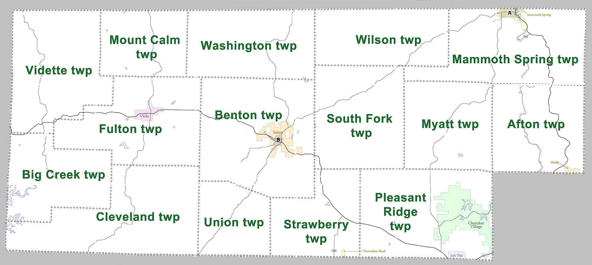
Fulton County is a county located in the U.S. state of Arkansas. As of the 2010 census, the population was 12,245. The county seat is Salem. Fulton County was formed on December 21, 1842, and named for William Fulton, the last governor of the Arkansas Territory. It is an alcohol prohibition or dry county. Geography According to the U.S. Census Bureau, the county has a total area of , of which is land and (0.3%) is water. Major highways * * * * U.S. Highway 62 Business * Highway 9 * Highway 87 * Highway 175 * Highway 223 * Highway 289 * Highway 395 Adjacent counties *Ozark County, Missouri (northwest) * Howell County, Missouri (north) * Oregon County, Missouri (northeast) * Sharp County (east) *Izard County (south) * Baxter County (west) Demographics 2020 census As of the 2020 United States census, there were 12,075 people, 4,973 households, and 3,278 families residing in the county. 2000 census As of the 2000 census, there were 11,642 people, 4,810 househo ... [...More Info...] [...Related Items...] OR: [Wikipedia] [Google] [Baidu] |
Sharp County, Arkansas
Sharp County is a county located in the U.S. state of Arkansas. As of the 2010 census, the population was 17,264. The county seat is Ash Flat. The county was formed on July 18, 1868, and named for Ephraim Sharp, a state legislator from the area. Sharp County was featured on the PBS program ''Independent Lens'' for its 1906 "banishment" of all of its Black residents. A local newspaper at the time was quoted as saying that "The community is better off without them." Geography According to the U.S. Census Bureau, the county has a total area of , of which is land and (0.3%) is water. Major highways * U.S. Highway 62 * U.S. Highway 63 * U.S. Highway 167 * U.S. Highway 412 * Highway 56 * Highway 58 * Highway 175 Adjacent counties * Oregon County, Missouri (north) *Randolph County (northeast) * Lawrence County (southeast) * Independence County (south) *Izard County (southwest) *Fulton County (northwest) Demographics 2020 census As of the 2020 United States census, ther ... [...More Info...] [...Related Items...] OR: [Wikipedia] [Google] [Baidu] |

.jpg)

