|
Opua
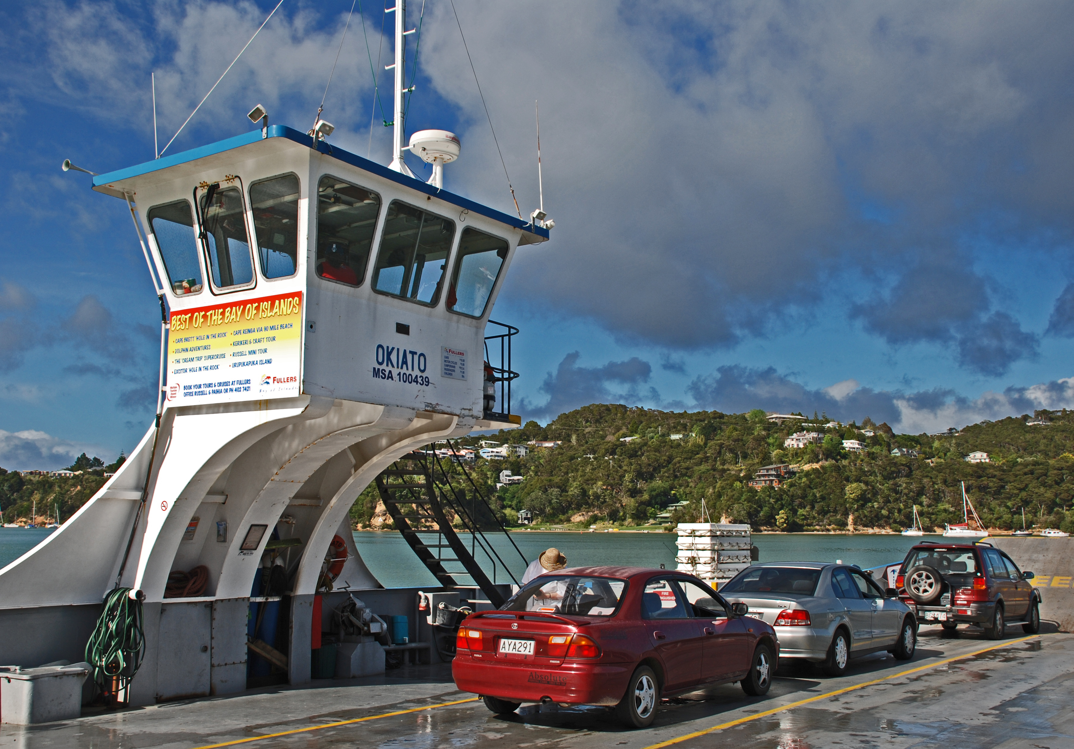
Opua is a locality in the Bay of Islands, in the sub-tropical Northland Region of New Zealand. It is notable as the first port for overseas yachts arriving in the country after crossing the Pacific Ocean. In the original 1870s plans for the town, it was named Newport. The town of Paihia is nearby, and the small settlement of Te Haumi is in between. The car ferry across the Bay of Islands, the main tourist access to Russell, runs between Opua and Okiato. The New Zealand Ministry for Culture and Heritage gives a translation of "place of the flower" for ''Ōpua''. The Waimangaro area north-west of Opua is listed on the Ngāpuhi and Te Puni Kōkiri websites as a traditional meeting point of the Ngāpuhi hapū of Te Uri Ongaonga. Demographics Opua, including Te Haumi to the north, covers and had an estimated population of as of with a population density of people per km2. Opua had a population of 1,137 at the 2018 New Zealand census, an increase of 129 people (12.8%) ... [...More Info...] [...Related Items...] OR: [Wikipedia] [Google] [Baidu] |
Opua Branch
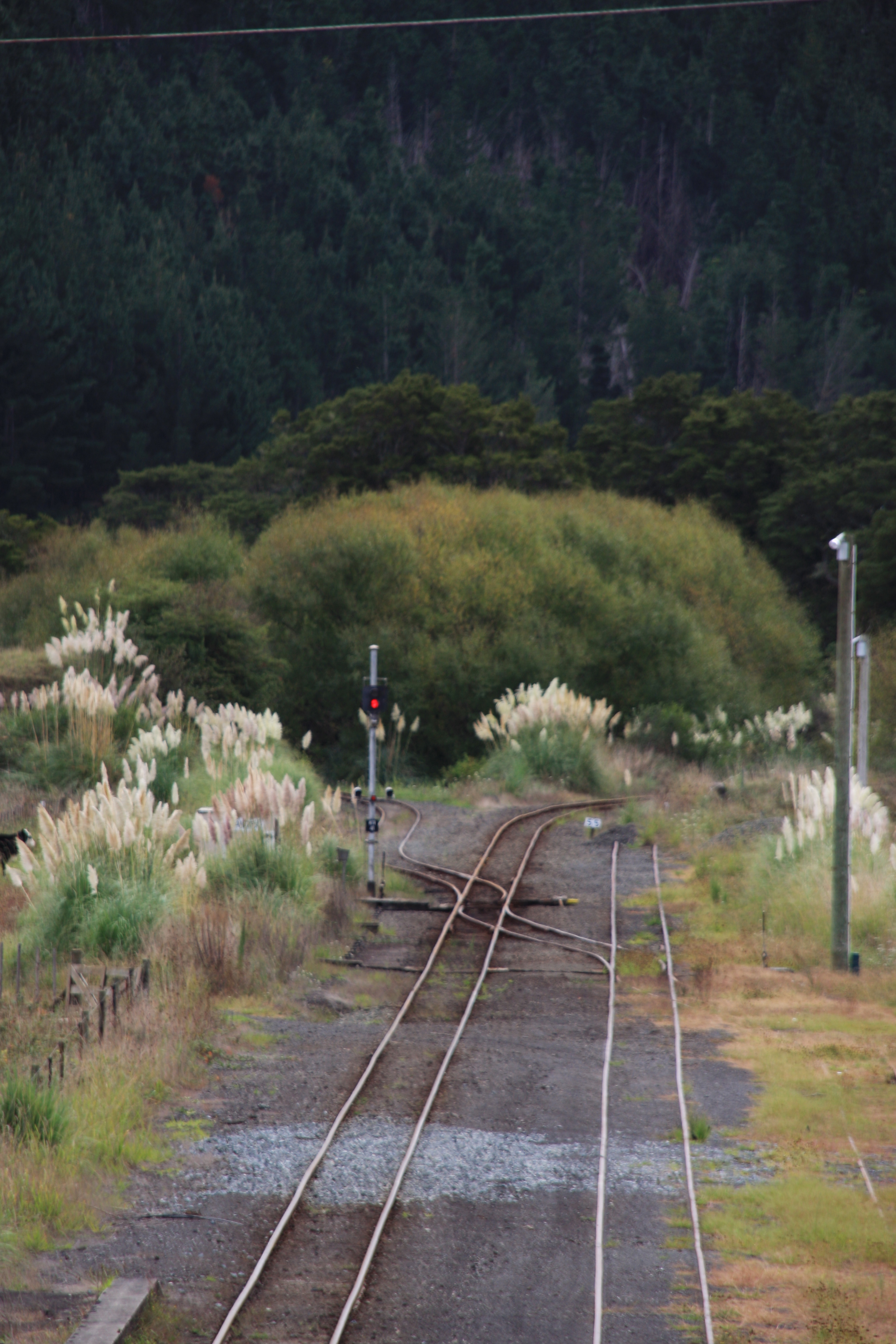
The Opua Branch or Otiria-Opua Industrial Line, partially still operational as the Bay of Islands Vintage Railway, is a former section of the North Auckland Line in the Northland Region of New Zealand, between Otiria and the Bay of Islands township of Opua. The first section was constructed as a bush tramway in 1868 and converted to a railway in the next decade. Today the railway is partially used by the Bay of Islands Vintage Railway, which runs tourist services between Kawakawa and Taumarere. The line's centrepiece is the section where it runs down along the main street of Kawakawa. Construction A tramway was opened in 1868 to carry coal from mines at Kawakawa to the Taumarere wharf at what is now known as Derrick Landing. The rails were wooden, the track gauge was the international standard gauge , and the wagons were pulled by horses. In 1871, some surplus rails, wagons and two steam locomotives were acquired from a railway project near Auckland and the tramway was upg ... [...More Info...] [...Related Items...] OR: [Wikipedia] [Google] [Baidu] |
Opua Railway Station
Opua railway station was a station on the Opua Branch in New Zealand, serving the port of Opua. It had a 5th class station, passenger platform, crane, stationmaster's house, urinals, a x goods shed and an engine shed. In 1940 the turntable was lengthened to . There was a Post Office at the station from 1884 until 1968. There were railway lines on the wharf from at least 1895 until 11 April 1978, when sleepers were placed to prevent access to wharf as it was unsafe. On 13 February 1981 the station closed to all but private siding traffic. When the North Auckland Line was fully opened in 1925, the Opua Express passenger train operated thrice weekly from Auckland to Opua. From November 1956 Opua was served only by mixed trains between Whangarei and Opua, the last running on 18 June 1976. The station, and a large part of the cliff behind it, was demolished between 1966 and 1973 and a new station built in 1968. Moerewa Dairy Factory and Affco Meat Works used the railway for ex ... [...More Info...] [...Related Items...] OR: [Wikipedia] [Google] [Baidu] |
North Auckland Line
The North Auckland Line (designation NAL) is a major section of New Zealand's national rail network, and is made up of the following parts: the portion of track that runs northward from Westfield Junction to Newmarket Station; from there, westward to Waitakere; from there, northward to Otiria via Whangārei. The first section was opened in 1868 and the line was completed in 1925. The line, or sections of it, have been known at various times as the Kaipara Line, the Waikato-Kaipara Line, the Kaipara Branch and the North Auckland Main Trunk. North Auckland Line is a designation for the section of track, not a service route. The southernmost portion from Westfield Junction to Newmarket was originally built as part of the North Island Main Trunk railway, with Newmarket serving as the junction of the two lines. The North Island Main Trunk was re-routed in 1930 via the Westfield Deviation through Glen Innes and Panmure. Westfield-Newmarket was then incorporated into the North Auckl ... [...More Info...] [...Related Items...] OR: [Wikipedia] [Google] [Baidu] |
Northland Express
The ''Northland Express'', also known as the ''Opua Express'', was an express passenger train operated by the New Zealand Railways Department between 1925 and 1956. It ran from Auckland via Whangarei to Opua in the Bay of Islands. Operation On 29 November 1925, the North Auckland Line linking Auckland to Whangarei and other parts of Northland was completed. Soon after passenger expresses began to operate, but the twisting, rugged nature of the railway line meant that they did not achieve particularly fast speeds. The ''Northland Express'' was the premier service north of Auckland and it operated thrice weekly in each direction. Mixed trains operated from the termini of the Okaihau and Dargaville branch lines to connect with the ''Express''. By the 1950s, the ''Northland Express'' was able to maintain a schedule of 5 hours and 20 minutes on the section between Auckland and Whangarei and was operated by steam locomotives such as the J class. In tandem with the ''Northland ... [...More Info...] [...Related Items...] OR: [Wikipedia] [Google] [Baidu] |
Far North District
The Far North District is the northernmost territorial authority district of New Zealand, consisting of the northern part of the Northland Peninsula in the North Island. It stretches from North Cape and Cape Reinga / Te Rerenga Wairua in the north, down to the Bay of Islands, the Hokianga and the town of Kaikohe. The Far North District Council is based in Kaikohe, and has nine ward councillors representing three wards: Te Hiku (in the north), Kaikohe/Hokianga (in the west), Bay of Islands/Whangaroa (in the east). The council is led by the current mayor of Far North, Moko Tepania, who entered the role in 2022. Geography The Far North District is the largest of three territorial authorities making up the Northland Region. The district stretches from the capes and bays at the northern tip of the Aupouri Peninsula past Ninety Mile Beach to the main body of the Northland Peninsula, where it encompasses the Parengarenga Harbour, Whangaroa Harbour and Bay of Islands (on the e ... [...More Info...] [...Related Items...] OR: [Wikipedia] [Google] [Baidu] |
Te Haumi
Te Haumi is a settlement south-east of Paihia and north-west of Opua in the Bay of Islands area of Northland Region, New Zealand. The Rangatira (Chief) Tohitapu Tohitapu also known as Tohi or Toi-Tapu (died 14 July 1833) was a rangatira (chief) of the Te Roroa iwi (tribe) of Northland, New Zealand, and a tohunga and Māori warrior. An account told by a Ngāpuhi informant to British ethnographer John Whi ... lived at Te Haumi until his death in 1833.Smith, S. Percy – Maori Wars of the Nineteenth Century (Christchurch 1910) page 458onlineat New Zealand Electronic Text Centre, NZETC He is remembered in the naming of Tohitapu Road. Demographics Te Haumi is in two SA1 statistical areas which cover . The SA1 areas are part of the larger Opua#Demographics, Opua statistical area. Te Haumi had a population of 375 at the 2018 New Zealand census, an increase of 15 people (4.2%) since the 2013 New Zealand census, 2013 census, and a decrease of 15 people (−3.8%) since the 2006 New Z ... [...More Info...] [...Related Items...] OR: [Wikipedia] [Google] [Baidu] |
Kawakawa, New Zealand
Kawakawa is a small town in the Bay of Islands area of the Northland Region of New Zealand. Kawakawa developed as a service town when coal was found there in the 1860s, but coal mining ceased in the early 20th century. The economy is now based on farming. The town is named after the kawakawa shrub. History and culture Kawakawa starting developing as a town with the mining of coal, which was discovered there in 1861. A horse-drawn tramway was opened in 1868 to carry coal from the mines to the Taumarere wharf. In 1871 two steam locomotives were acquired and the tramway was upgraded to railway standard. In 1884 a railway line from Kawakawa to Opua was opened, and this replaced the line to Taumarere wharf. The area was a location for the late 19th/early 20th century kauri gum digging trade. By 1899 there were about 1,000 residents in the town, which was built mainly on the hillside. In 1899 a fire destroyed all but a few of the buildings. The town was rebuilt on the flat, alongs ... [...More Info...] [...Related Items...] OR: [Wikipedia] [Google] [Baidu] |
Okiato
Okiato or Old Russell is a small town in the Bay of Islands, New Zealand, south of present-day Russell. It was founded in 1840 and served as New Zealand's first national capital until 1841, when the seat of government was moved to Auckland. The car ferry across the Bay of Islands, which provides the main access to Russell, runs between Okiato and Opua. Etymology The name Okiato comes from Māori. The New Zealand Ministry for Culture and Heritage translates ''Ōkiato'' to "place of receptacle for holding sacred objects" . History Pomare, the local Māori chief in the 1830s, sold land at Okiato to a British merchant and ship owner, Captain James Reddy Clendon, who settled there in 1832 and set up a trading station with partner Samuel Stephenson. Clendon became the first United States Consul for New Zealand in 1838 or 1839. When the Treaty of Waitangi was signed in February 1840, Lieutenant-Governor William Hobson instructed the Surveyor-General, Felton Mathew, to repor ... [...More Info...] [...Related Items...] OR: [Wikipedia] [Google] [Baidu] |
Northland Regional Council
The Northland Region ( mi, Te Tai Tokerau) is the northernmost of New Zealand's 16 local government regions. New Zealanders sometimes refer to it as the Winterless North because of its mild climate all throughout the year. The main population centre is the city of Whangārei, and the largest town is Kerikeri. At the 2018 New Zealand census, Northland recorded a population growth spurt of 18.1% since the previous 2013 census, placing it as the fastest growing region in New Zealand, ahead of other strong growth regions such as the Bay of Plenty (2nd with 15%) and Waikato (3rd with 13.5%). Geography The Northland Region occupies the northern 80% (265 km) of the 330 km Northland Peninsula, the southernmost part of which is in the Auckland Region. Stretching from a line at which the peninsula narrows to a width of just 15 km a little north of the town of Wellsford, Northland Region extends north to the tip of the Northland Peninsula, covering an area of 13,940&nb ... [...More Info...] [...Related Items...] OR: [Wikipedia] [Google] [Baidu] |
NZR RM Class (88 Seater)
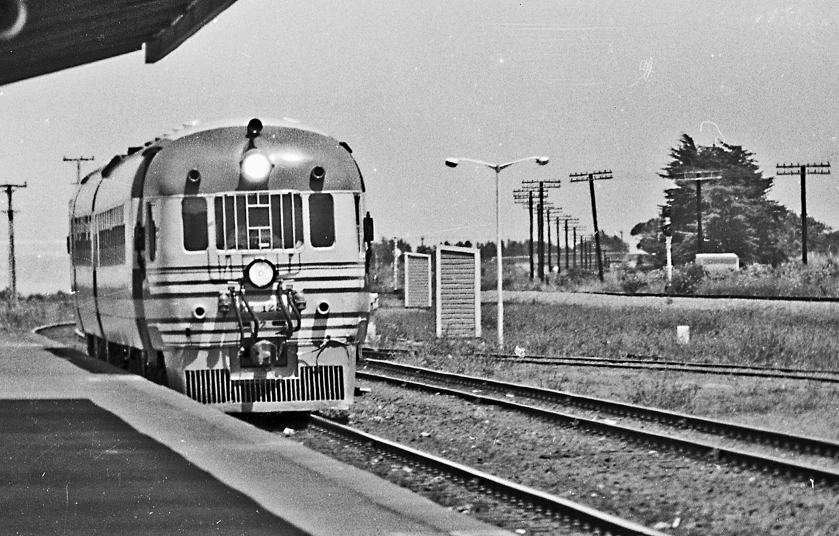
The NZR RM class 88-seaters were a class of railcar used in New Zealand. New Zealand Government Railways (NZR) classified them as RM (Rail Motor), the notation used for all railcars, numbering the 35 sets from RM100 to RM134. They were the most numerous railcars in NZR service. Their purchase and introduction saw the demise of steam-hauled provincial passenger trains and mixed trains, and was part of a deliberate effort to modernise NZR passenger services at a time of increasing competition from private motor vehicles. Being diesel powered and lighter the railcars were less expensive to operate and able to maintain quicker timetables, although became plagued with mechanical and electrical problems, with a number of the class eventually being turned into depowered locomotive-hauled carriages and reclassified as the AC class "Grassgrubs". Background In the early 1950s, NZR was in the process of replacing steam traction with diesel and modernising the railways to cope with vastly i ... [...More Info...] [...Related Items...] OR: [Wikipedia] [Google] [Baidu] |
Northland Region
The Northland Region ( mi, Te Tai Tokerau) is the northernmost of New Zealand's 16 local government regions. New Zealanders sometimes refer to it as the Winterless North because of its mild climate all throughout the year. The main population centre is the city of Whangārei, and the largest town is Kerikeri. At the 2018 New Zealand census, Northland recorded a population growth spurt of 18.1% since the previous 2013 census, placing it as the fastest growing region in New Zealand, ahead of other strong growth regions such as the Bay of Plenty (2nd with 15%) and Waikato (3rd with 13.5%). Geography The Northland Region occupies the northern 80% (265 km) of the 330 km Northland Peninsula, the southernmost part of which is in the Auckland Region. Stretching from a line at which the peninsula narrows to a width of just 15 km a little north of the town of Wellsford, Northland Region extends north to the tip of the Northland Peninsula, covering an area of 13,940&nb ... [...More Info...] [...Related Items...] OR: [Wikipedia] [Google] [Baidu] |
Paihia
Paihia is the main tourist town in the Bay of Islands in the Northland Region of the North Island of New Zealand. It is 60 kilometres north of Whangārei, located close to the historic towns of Russell and Kerikeri. Missionary Henry Williams named the mission station ''Marsden's Vale''. Paihia eventually became the accepted name of the settlement. Nearby to the north is the historic settlement of Waitangi, and the residential and commercial area of Haruru Falls is to the west. The port and township of Opua, and the small settlement of Te Haumi, lie to the south. History and culture Origin of the Name The origin of the name "Paihia" is unclear. A popular attribution, most likely apocryphal, is that when Reverend Henry Williams first arrived in the Bay of Islands searching for a location for his mission station, he told his Māori guide, "Pai here," meaning "Good here," as his Māori vocabulary was limited. European settlement Henry Williams and his wife Marianne settl ... [...More Info...] [...Related Items...] OR: [Wikipedia] [Google] [Baidu] |
.jpg)


