|
Operation Wunderland
Operation Wunderland ("Wonderland") comprised a large-scale operation undertaken in summer 1942 by the German ''Kriegsmarine'' in the waters of the Northern Sea Route close to the Arctic Ocean. The Germans knew that many ships of the Soviet Navy had sought refuge in the Kara Sea because of the protection that its ice pack provided during 10 months of the year. History On 16 August 1942, —under Kommodore Wilhelm Meendsen-Bohlken—left Narvik and entered the Barents Sea. Along with it went U-boats and , as well as destroyers , and . Kara Sea By 19 August, the German fleet rounded Cape Zhelaniya and entered the Kara Sea which was fairly free from ice during the short summer. The next day, the Arado Ar 196 seaplane on board ''Admiral Scheer'' flew to Kravkova Island in the Mona Islands and spotted three groups of Soviet ships, including icebreakers and . Fog and ice floes prevented the German warships from approaching. When they arrived at the Mona Islands, the Russian ships w ... [...More Info...] [...Related Items...] OR: [Wikipedia] [Google] [Baidu] |
Arctic Naval Operations Of World War II
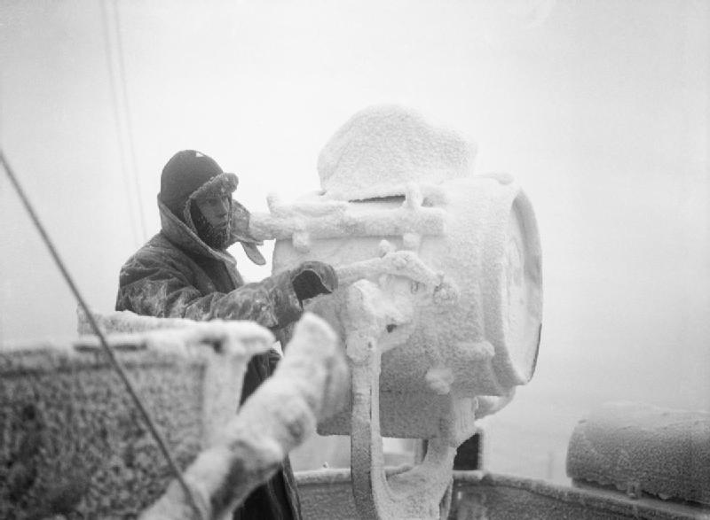
The Arctic Circle defining the "midnight sun" encompasses the Atlantic Ocean from the northern edge of Iceland to the Bering Strait in the Pacific Ocean. Military activity in this area between 1939 and 1945 is often consideredRear Admiral Samuel Eliot Morison's definitive ''History of United States Naval Operations in World War II'' includes operations from the north pole southward in the first volume entitled ''The Battle of the Atlantic''. Eligibility for the United States European–African–Middle Eastern Campaign Medal was defined by Executive Order 9265 to include military service aboard a ship operating in the north polar region eastward from the 75th meridian west longitude to the 60th meridian east longitude. part of the Battle of the Atlantic or of the European Theatre of World War II. Pre-war navigation focused on fishing and the international ore-trade from Narvik and Petsamo. Soviet settlements along the coast and rivers of the Barents Sea and Kara Sea relied upo ... [...More Info...] [...Related Items...] OR: [Wikipedia] [Google] [Baidu] |
Mona Islands
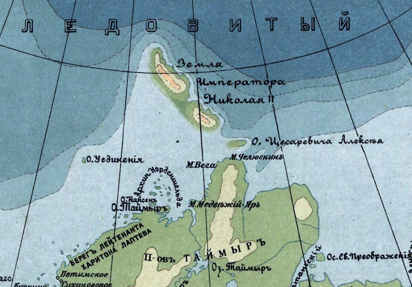
The Mona Islands or Mohn Islands (russian: Острова Мона) is a group of a few scattered small islands covered with tundra vegetation. They are located in the Kara Sea, about 30 km north of the western coast of the Taymyr Peninsula in Siberia, Russia. Etymology The Mona Islands were named by Fridtjof Nansen after Henrik Mohn, a Norwegian meteorologist. Mohn worked out and published the meteorological observations of various polar expeditions, including those of Nansen in the "Fram" (1893-6). "Mona" is a genitive case in Russian, meaning "(islands) of Mon" and this name has stuck, especially since the Germans used ("Mona Inseln"), based on the Russian version of the name, during their campaigns in World War II. Since then "Mona Islands" has become popular and its use has been widespread in this manner for many decades and in many modern maps and atlases. Islands Kravkov Island Kravkov Island (Остров Кравкова) is one of the biggest islands, but it ... [...More Info...] [...Related Items...] OR: [Wikipedia] [Google] [Baidu] |
August 1942 Events
August is the eighth month of the year in the Julian calendar, Julian and Gregorian calendars, and the fifth of seven months to have a length of 31 days. Its zodiac sign is Leo (astrology), Leo and was originally named ''Sextilis'' in Latin because it was the 6th month in the original ten-month Roman calendar under Romulus and Remus, Romulus in 753 BC, with March being the first month of the year. About 700 BC, it became the eighth month when January and February were added to the year before March by King Numa Pompilius, who also gave it 29 days. Julius Caesar added two days when he created the Julian calendar in 46 BC (708 Ab urbe condita, AUC), giving it its modern length of 31 days. In 8 BC, it was renamed in honor of Emperor Augustus. According to a Senatus consultum quoted by Macrobius, he chose this month because it was the time of several of his great triumphs, including the conquest of Egypt. Commonly repeated lore has it that August has 31 days because Augustus ... [...More Info...] [...Related Items...] OR: [Wikipedia] [Google] [Baidu] |
Arctic Convoys Of World War II
The Arctic convoys of World War II were oceangoing convoys which sailed from the United Kingdom, Iceland, and North America to northern ports in the Soviet Union – primarily Arkhangelsk (Archangel) and Murmansk in Russia. There were 78 convoys between August 1941 and May 1945, sailing via several seas of the Atlantic and Arctic oceans, with two gaps with no sailings between July and September 1942, and March and November 1943. About 1,400 merchant ships delivered essential supplies to the Soviet Union under the Anglo-Soviet agreement and US Lend-Lease program, escorted by ships of the Royal Navy, Royal Canadian Navy, and the U.S. Navy. Eighty-five merchant vessels and 16 Royal Navy warships (two cruisers, six destroyers, eight other escort ships) were lost. Nazi Germany's '' Kriegsmarine'' lost a number of vessels including one battleship, three destroyers, 30 U-boats, and many aircraft. The convoys demonstrated the Allies' commitment to helping the Soviet Union, prior to the ... [...More Info...] [...Related Items...] OR: [Wikipedia] [Google] [Baidu] |
Khodovarikha
Khodovarikha (russian: Ходовариха) is a point in the coast of the Pechora Sea located on a landspit projecting eastwards over the bay. Latitude: 68° 57' Longitude: 53° 45' Khodovarikha belongs to the Nenets Autonomous Okrug administrative region, which is an autonomous okrug of Arkhangelsk Oblast. History There is a lighthouse at Khodovarikha that used to be an important beacon for the Russian convoy route coming from the Yugorsky Strait in World War II. It was shelled in 1942 by the Kriegsmarine during Operation Wunderland. The lighthouse ceased operation in 1996. There was a small populated place close by that has been abandoned. However, there is still a functioning weather station A weather station is a facility, either on land or sea, with instruments and equipment for measuring atmospheric conditions to provide information for weather forecasts and to study the weather and climate. The measurements taken include tempera ... in Khodovarikha. Khodovarikha was ... [...More Info...] [...Related Items...] OR: [Wikipedia] [Google] [Baidu] |
Belushya Guba
Belushya Guba (russian: Белу́шья Губа́, lit. ''beluga whale'' ''bay''), also Belushye (), is a work settlement and the administrative center of Novaya Zemlya District of Arkhangelsk Oblast, Russia, located on the Gusinaya Zemlya peninsula of the Yuzhny Island of the Novaya Zemlya arctic archipelago. Its population was reported as a decline of more than 20% from It is the largest settlement on the island. It is the main permanent settlement of the island territory of Novaya Zemlya. A large proportion of its population is made up of military personnel associated with the nuclear test sites located on the island. The whole Novaya Zemlya archipelago, including Belushya Guba, is an area of restricted access (formally, as part of border security zone), and a special permit is needed to visit the archipelago. About northeast of Belushya Guba is the settlement of Rogachevo, the second largest in the archipelago, along with the Rogachevo air base. History Upon vis ... [...More Info...] [...Related Items...] OR: [Wikipedia] [Google] [Baidu] |
Yugorsky Strait
The Yugorsky Strait or Yugor Strait (russian: Югорский Шар, or Yugorsky Shar) is a narrow sound between the Kara Sea and the Pechora Sea. Its maximum width is 10 km and its minimum width only 3 km. Ostrov Storozhevoy, an island 1.6 km in length, lies in the middle of the strait. This sound separates Vaygach Island from the Yugorsky Peninsula on the Russian mainland. The name is derived from Yugaria, an old name for the region to the south of Yugorsky Strait. History The earliest recorded voyage through the Yugorsky Shar, traditionally known as the Arctic "Iron Gateway", into the Kara Sea was made from Nizhny Novgorod by early Russian explorer Uleb in 1032. Russian "Pomors", the coastal dwellers of the White Sea shores, had been exploring this strait since the 11th century. The Arctic's first shipping line, the Great Mangazea Route, from the White Sea to the Ob River and the Yenisei Gulf began operating in the latter part of the 16th century. This li ... [...More Info...] [...Related Items...] OR: [Wikipedia] [Google] [Baidu] |
NKVD
The People's Commissariat for Internal Affairs (russian: Наро́дный комиссариа́т вну́тренних дел, Naródnyy komissariát vnútrennikh del, ), abbreviated NKVD ( ), was the interior ministry of the Soviet Union. Established in 1917 as NKVD of the Russian Soviet Federative Socialist Republic, the agency was originally tasked with conducting regular police work and overseeing the country's prisons and labor camps. It was disbanded in 1930, with its functions being dispersed among other agencies, only to be reinstated as an all-union commissariat in 1934. The functions of the OGPU (the secret police organization) were transferred to the NKVD around the year 1930, giving it a monopoly over law enforcement activities that lasted until the end of World War II. During this period, the NKVD included both ordinary public order activities, and secret police activities. The NKVD is known for its role in political repression and for carrying out the Great ... [...More Info...] [...Related Items...] OR: [Wikipedia] [Google] [Baidu] |
Uyedineniya Island
Uyedineniya Island (also Uedinenia, russian: Остров Уединения; no, Ensomheden) is an island located in the central part of the Kara Sea, roughly midway between Novaya Zemlya and Severnaya Zemlya. Its latitude is 77° 29' N and its longitude 82° 30' E. It is often labelled as Einsamkeit Island (from the German ''Insel der Einsamkeit'') as well as Lonely Island or Solitude Island in English maps. Geography The island is barren and icy throughout the winter months, but some tundra vegetation grows on it in the summer. Its length is and its total area is . Compared to other Arctic islands it is flat and low-lying, with some swamps and small lakes and a long spit of land on its NE side. Its highest point is only about . Owing to its extreme northerly location the weather is bleak and severe and the sea surrounding Uedineniya is covered with pack ice in the winter. Ice floes are commonly found even in the summer. The nearest landmasses are the Izvestiy TS ... [...More Info...] [...Related Items...] OR: [Wikipedia] [Google] [Baidu] |
Dikson (urban-type Settlement)
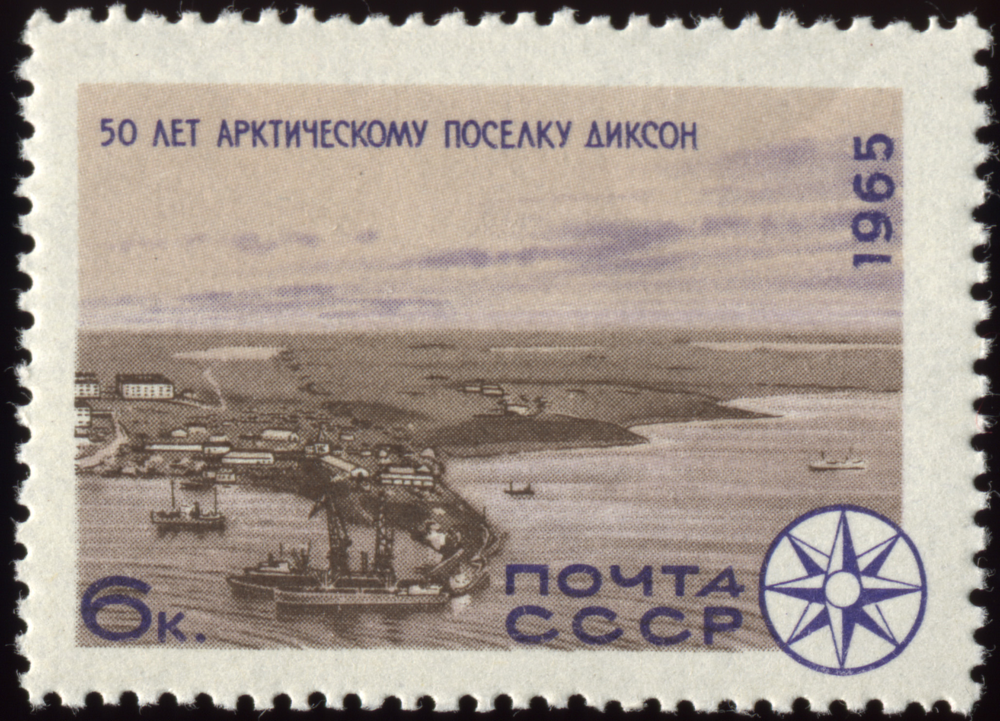
Dikson ( rus, Ди́ксон, , dʲiksən) is a port located in northern Russia and is one of the world's northernmost settlements. Dikson is an urban locality (an urban-type settlement) situated in Taymyrsky Dolgano-Nenetsky District of Krasnoyarsk Krai. It is situated on the Kara Sea, located on a headland at the mouth of the Yenisei Gulf (the Yenisei River estuary), on Russia's Arctic Ocean coast. As of the 2010 Census, its population was 676. Geography Dikson is the northernmost port in Russia and the northernmost settlement on the Asian continent. It is so far north that no civil twilight appears from 8 December to 5 January, but it has 24 hours of civil twilight from 18 April to 26 August. It is one of the world's most isolated settlements. Dikson's inhabitants informally call their settlement "Capital of the Arctic", taken from a popular Soviet song. Dikson and Dikson Island were named after Swedish Arctic pioneer Baron Oscar Dickson. Dickson, along with Aleksa ... [...More Info...] [...Related Items...] OR: [Wikipedia] [Google] [Baidu] |
Dikson Island
Dikson Island (russian: Ди́ксон), initially Dickson, is the name of an island in Taymyrsky Dolgano-Nenetsky District (russian: Таймы́рский Долга́но-Не́нецкий райо́н), Krasnoyarsk Krai, Russia, situated in the Kara Sea near the mouth of the Yenisei River. A nearby urban-type settlement of Dikson, which functions as a port and hydrometeorological centre, is located on the mainland across from the island. It is served by the Dikson Airport. History Dikson Island and its adjoining urban settlement have been named after Swedish Arctic pioneer Baron Oscar Dickson.''The Darkness of Dikson Island'' , Author unknown, russia-channel.com In the 17th century the island was known as ("long") island, or , after its |
Vilkitsky Strait
: Vilkitsky Strait (russian: link=no, пролив Вилькицкого) is a strait between the Taimyr Peninsula and Bolshevik Island in the Severnaya Zemlya archipelago. The strait connects the Kara and Laptev Seas. The length of the Vilkitsky Strait is 128 km, the width approx. 55 km and the depth between 32 m and 210 m. It is covered with drifting ice all year round. The strait was discovered in 1913 by a Russian hydrographic expedition led by Boris Vilkitsky and then named after him in 1918. The Geiberg Islands cover the entrance to the Vilkitsky Strait from the east, and the Firnley Islands do so from the west. The shores on the side of the Taymyr Peninsula are covered with tundra In physical geography, tundra () is a type of biome where tree growth is hindered by frigid temperatures and short growing seasons. The term ''tundra'' comes through Russian (') from the Kildin Sámi word (') meaning "uplands", "treeless moun ... vegetation and scattered stones. The ... [...More Info...] [...Related Items...] OR: [Wikipedia] [Google] [Baidu] |


