|
Operation GYS
Operation GYS, or Operation Gayis ( he, מִבְצָע גַּיִ"ס), short for Golani, Yiftach, Sergei (Negev)—the three participating brigades—was an Israeli military and logistical operation conducted during the second truce of the 1948 Arab–Israeli War. Its objective was to create a corridor to the Israeli enclave in the northern Negev desert, surrounded by the Egyptian army. When the military operation (later called GYS 1) commenced and failed on July 27, 1948, a more modest operation (GYS 2) was attempted on July 31, aimed just to transport goods to the enclave. In GYS 1, the Israelis hoped to capture Fallujah and Iraq al-Manshiyya, thus cutting a wedge through the Egyptian forces and having free passage to the Negev. However, the attack on Iraq al-Manshiyya failed and the forces in Fallujah retreated due to communication problems. In GYS 2, the forces took a safer road to the east of Iraq al-Manshiyya and successfully escorted a convoy of 20 trucks. A third attempt ... [...More Info...] [...Related Items...] OR: [Wikipedia] [Google] [Baidu] |
1948 Arab–Israeli War
The 1948 (or First) Arab–Israeli War was the second and final stage of the 1948 Palestine war. It formally began following the end of the British Mandate for Palestine at midnight on 14 May 1948; the Israeli Declaration of Independence had been issued earlier that day, and a military coalition of Arab states entered the territory of British Palestine in the morning of 15 May. The day after the 29 November 1947 adoption of the United Nations Partition Plan for Palestine – which planned to divide Palestine into an Arab state, a Jewish state, and the Special International Regime encompassing the cities of Jerusalem and Bethlehem – an ambush of two buses carrying Jews took place in an incident regarded as the first in the civil war which broke out after the UN decision. The violence had certain continuities with the past, the Fajja bus attack being a direct response to a Lehi massacre on 19 November of five members of an Arab family, suspected of being British informan ... [...More Info...] [...Related Items...] OR: [Wikipedia] [Google] [Baidu] |
Highway 4 (Israel)
Highway 4 ( he, כּֽבִישׁ אַרְבַּע, ''Kvish Arba' '') is an Israeli highway that runs along Israel's entire Israeli Coastal Plain, coastal plain of the Mediterranean Sea, from the Rosh HaNikra Crossing, Rosh HaNikra border crossing with Lebanon in the Northern District (Israel), North to the Israeli Gaza Strip barrier#Erez Crossing, Erez Border Crossing with the Gaza Strip in the South. The highway follows in part the route of the ancient Via Maris. Until the 1990s and the withdrawal of Israel Defense Forces from most of the Gaza Strip due to the Oslo Accords, Highway 4 continued all the way until Rafah and the Egypt, Egyptian border. The part of the remaining highway in the Gaza Strip is called the Salah al-Din Road. Although the highway is continuous, it is generally considered to be divided into five sections, each with its own nickname and characteristics such as a differing number of lanes and speed limits: *Northern Coastal Highway (Rosh Hanikra–Haifa). This ... [...More Info...] [...Related Items...] OR: [Wikipedia] [Google] [Baidu] |
Bror Hayil
Bror Hayil ( he, בְּרוֹר חַיִל) is a kibbutz in southern Israel. Located near Sderot, it falls under the jurisdiction of Sha'ar HaNegev Regional Council. In it had a population of . Etymology The name Bror Hayil means "selection of soldiers". It may be associated with the Bar Kokhba revolt against the Romans in the first half of the 2nd century CE.Evyatar Friesel (1996The Days and the Seasons: MemoirsWayne State University Press, p44 Name A Jewish village called Bror Hayil existed during the Talmudic era, where is now the ruins of the Palestinian village Burayr, and was the site of a yeshiva headed by rabbi Johanan ben Zakai. According to the Talmud (''Sanhedrin'' 32b), candlelight at night in Bror Hayil was a sign that a male child had been born, and that the villagers were to prepare for the child's impending circumcision. The present kibbutz takes its name from the ancient village of the same name. History Bror Hayil was the only Jewish village founded betwee ... [...More Info...] [...Related Items...] OR: [Wikipedia] [Google] [Baidu] |
Al-Jaladiyya
Al-Jaladiyya was a Palestinian Arab village in the Gaza Subdistrict. It was depopulated during the 1948 Arab-Israeli War on July 8, 1948, by the Giv'ati Brigade. It was located 34 kilometres northeast of Gaza. The Crusades built a castle in the village. There was a school located in the village mosque (built 1890), and when it opened its doors in 1945 it had an enrollment of 43 students. References Bibliography * * (p418 cited in Khalidi, 1992, p. 113) * * (p 85 * * (p. 148) * * * * (p. 270 ) * p.52 * (Robinson and Smith, 1841, vol 3, Appendix 2, ... [...More Info...] [...Related Items...] OR: [Wikipedia] [Google] [Baidu] |
Gat, Israel
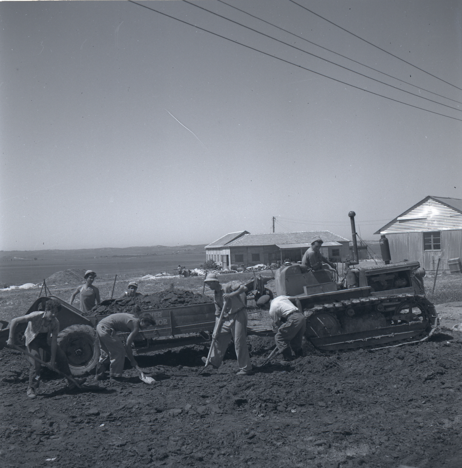
Gat ( he, גַּת) is a kibbutz in southern Israel. Located near Kiryat Gat, it falls under the jurisdiction of Yoav Regional Council. In it had a population of . History Kibbutz Gat was founded in 1934 by Jewish immigrants from Poland, Yugoslavia and Austria. In 1949, after the inhabitants of the nearby Palestinian village of Iraq al-Manshiyya had been expelled, some of their lands were transferred to Kibbutz Gat. Primor, one of Israel's largest juice manufacturers, is operated by the kibbutz. Citramed, another company located in Kibbutz Gat, has developed a method to squeeze out the antibacterial properties in the rind of citrus fruit for use as a natural preservative in health products and the food industry. Ministry of ... [...More Info...] [...Related Items...] OR: [Wikipedia] [Google] [Baidu] |
Operation Danny
Operation Danny ( he, מבצע דני, ''Mivtza Dani'') was an Israeli military offensive launched at the end of the first truce of the 1948 Arab–Israeli War. The objectives were to capture territory east of Tel Aviv and then to push inland and relieve the Jewish population and forces in Jerusalem. The main forces fighting against the IDF were the Arab Legion and Palestinian irregulars It took place on July 9–19, 1948, being launched at the end of the first truce. On 10 July, Glubb Pasha ordered the defending Arab Legion troops to "make arrangements...for a phony war". The operation commander was Yigal Allon and his deputy was Yitzhak Rabin. The total force numbered around 6,000 soldiers. Itzhak Sade Yigal Alon.jpg, Yitzhak Sadeh (left) and Yigal Allon (1948) Palmach Lydda.jpg, 8th Armoured Brigade capture Lydda Airport (1948) File:Yiftach attack.jpg, Yiftach Brigade before the attack on Lydda and Ramle, 1948 Name The operation was named after Palmach officer Daniel " ... [...More Info...] [...Related Items...] OR: [Wikipedia] [Google] [Baidu] |
Karatiyya
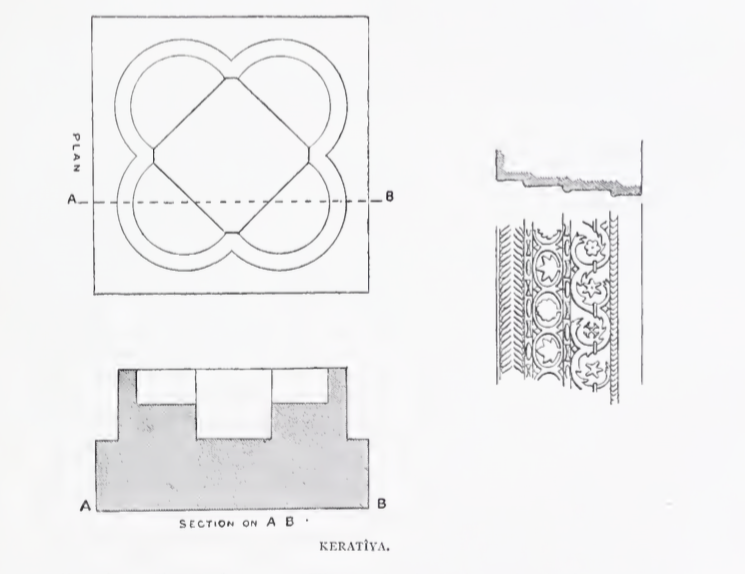
Karatiyya ( ar, كرتيا) was a Palestinian Arab village of 1,370, located northeast of Gaza, situated in a flat area with an elevation of along the coastal plain of Palestine and crossed by Wadi al-Mufrid. History Byzantine ceramics have been found here. In the 12th century, a castle called ''Galatie'' was built on the village site by the Crusaders, it was subsequently captured by the Ayyubids under Saladin in 1187,Khalidi, 1992, p.118 and destroyed in September 1191. The place called ''Kulat el Fenish'' by the village was apparently once a church. The remains were seen in 1875: "The tower on the mound is called Kulat el Fenish. It is a solid block of masonry, standing some 20 or 30 feet in height. Near it lie shafts and bases of white marble, and an elaborate cornice, well and deeply cut. There is also a font, like that at Beit 'Auwa (Sheet XXI.), formed by four intersecting circles, and measuring 37 feet along the diameter, and 2 feet high." In 1226, Arab geogra ... [...More Info...] [...Related Items...] OR: [Wikipedia] [Google] [Baidu] |
Hatta, Gaza
Hatta ( ar, حتا) was a Palestinian Arab village of 1,125 inhabitants that was depopulated after a July 17, 1948 assault by Israeli forces of the Givati Brigade during the 1948 Arab-Israeli war. Following the war the area was incorporated into the State of Israel and Zavdiel and Aluma were established on the land that had belonged to Hatta. Location The village was situated in a flat area on the southern coastal plain. It was probably named after the al-Hut tribe, originally from Najd in central Arabia, who camped near the site at the end of the fifth century A.D.Khalidi, 1992, p. 100 History The Arab geographer Yaqut al-Hamawi (d. 1228) referred to the village as Hattawa and said it was the home of the Islamic scholar ´Amru al-Hattawi. Ottoman era Hatta, like the rest of Palestine, was incorporated into the Ottoman Empire in 1517, and in the tax registers of 1596 it appeared under the name of ''Hatta as-Sajara'' as being in the ''nahiya'' of Gazza, part of the Sanja ... [...More Info...] [...Related Items...] OR: [Wikipedia] [Google] [Baidu] |
Operation Death To The Invader
Operation Death to the Invader ( he, מִבְצָע מָוֶת לַפּוֹלֵשׁ), also Death to the Invaders, was an Israeli military operation during the 1948 Arab–Israeli War. It was carried out on July 16–18, 1948 in the northwestern Negev desert. The operation's objective was to link Jewish villages in the Negev desert with the rest of Israel, after this aim was not achieved in Operation An-Far that ended on July 15. The Egyptians blocked Israeli access to its Negev villages during the first truce of the war (June 11 – July 8), by taking up positions on the Majdal – Bayt Jibrin road, where most of the battles of Death to the Invaders were fought. The operation started with a series of raids on Egyptian bases and Palestinian Arab villages on July 16–17, including Jilya, Qazaza, Idnibba, Mughallis, Zayta, Isdud and Bayt Jibrin. It was followed on July 17–18 by assaults on Bayt 'Affa, Hill 113, Kawkaba and Huleiqat, which all failed. Finally, on July 18, the I ... [...More Info...] [...Related Items...] OR: [Wikipedia] [Google] [Baidu] |
Operation An-Far
Operation An-Far (short for Anti-Farouk) was a military operation launched by Israel's Givati Brigade on the night of July 8–9 during the 1948 Arab–Israeli War. Its objectives were to gain control of approaches in southern Judea and block the advance of the Egyptian army. The fighting continued until July 15, and was followed by Operation Death to the Invader. Background On the ending of the first United Nations Truce on July 8, most of the Israeli army's attention and resources were focused on Operations Danny and Dekel. In the south, the Negev and Givati Brigades failed to link up. But in ten days, the Givati Brigade did succeed in "conquering areas in the northern Negev and in the western Hebron district foothills." Operation Operational Commander Shimon Avidan held meetings at brigade headquarters on July 5 at which plans were outlined. In the first phase, the 1st Battalion was to attack the Tell es-Safi area. The second phase was towards Beit 'Affa, Hatta and Jusayr ... [...More Info...] [...Related Items...] OR: [Wikipedia] [Google] [Baidu] |
Bayt Jibrin
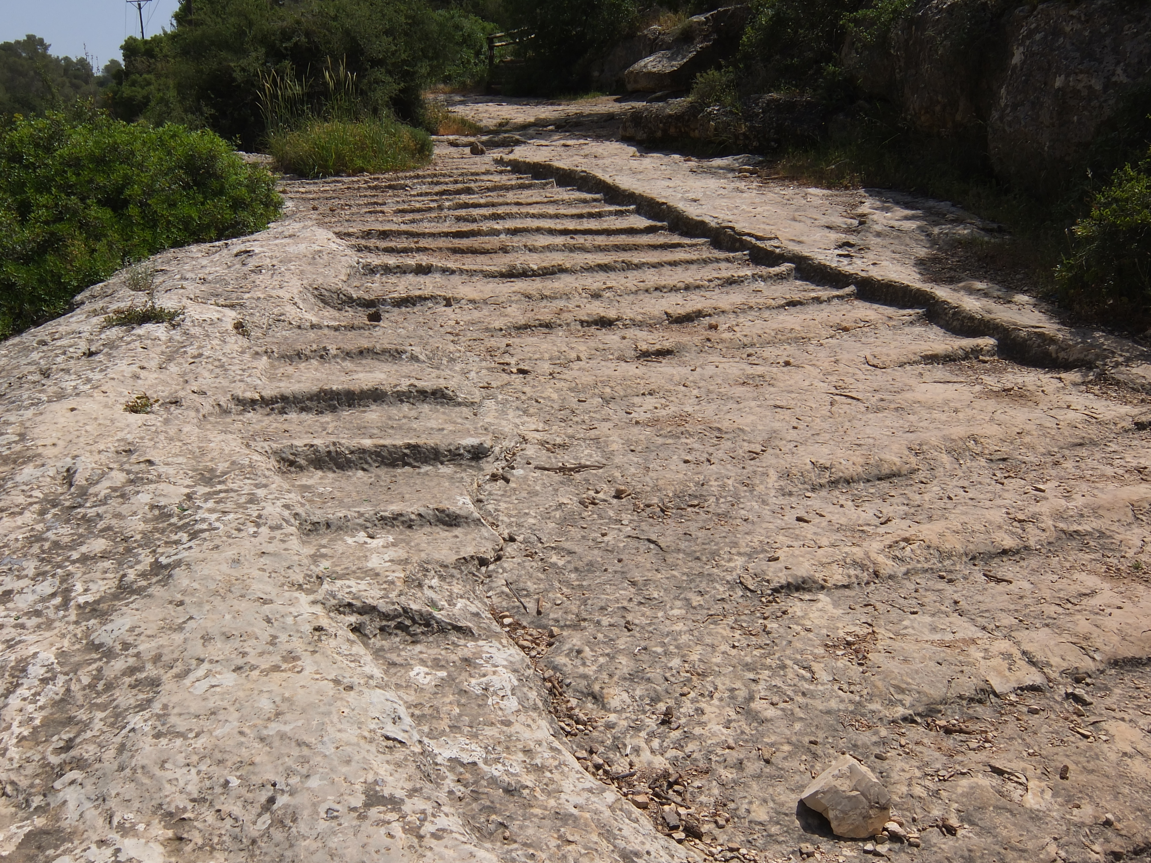
Bayt Jibrin or Beit Jibrin ( ar, بيت جبرين; he, בית גוברין, translit=Beit Gubrin) was a Palestinians, Palestinian village located northwest of the city of Hebron. The village had a total land area of 56,185 dunams or , of which were built-up while the rest remained farmland.''Village Statistics'', Government of Palestine. 1945. Quoted in Hadawi, 1970, p143 During the 8th century BCE, the village, then known as Maresha, was part of the Kingdom of Judah. During the days of Herod the Great, a Jews, Jewish ruler of the Herodian Kingdom of Judea, Herodian Kingdom, the town was the administrative center for the district of Edom#Classical Idumaea, Idumea. After the turmoil of the First Jewish–Roman War and the Bar Kokhba revolt, the town became a thriving Colonia (Roman), Roman colony and a major administrative centre of the Roman Empire under the name of Eleutheropolis. With the rise of Islam in the early 7th century CE, Bayt Jibrin was conquered by Rashidu ... [...More Info...] [...Related Items...] OR: [Wikipedia] [Google] [Baidu] |


.png)

