|
Oomsis
Oomsis is a village in Morobe Province of Papua-New Guinea. It is located east of the valley of the Markham River along the Bulolo Highway Road. It is 51.1 km from Lae, and 11.7 km from Gabensis Gabensis is a village in Wampar Rural LLG, Morobe Province, Papua New Guinea. It lies to the north-west of Lae Lae () is the capital of Morobe Province and is the second-largest city in Papua New Guinea. It is located near the delta of the Markh .... External links Maplandia Populated places in Morobe Province {{MorobeProvince-geo-stub ... [...More Info...] [...Related Items...] OR: [Wikipedia] [Google] [Baidu] |
Gabensis
Gabensis is a village in Wampar Rural LLG, Morobe Province, Papua New Guinea. It lies to the north-west of Lae Lae () is the capital of Morobe Province and is the second-largest city in Papua New Guinea. It is located near the delta of the Markham River and at the start of the Highlands Highway, which is the main land transport corridor between the Highl ..., from Oomsis. In 1999 it had a population of about 1700 people. There is a stream flowing in the vicinity of the same name, Gabensis Creek. References External linksMap of villages in the area Populated places in Morobe Province {{MorobeProvince-geo-stub ... [...More Info...] [...Related Items...] OR: [Wikipedia] [Google] [Baidu] |
Morobe Province
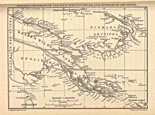
Morobe Province is a province on the northern coast of Papua New Guinea. The provincial capital and largest city is Lae. The province covers 33,705 km2, with a population of 674,810 (2011 census), and since the division of Southern Highlands Province in May 2012 it is the most populous province. It includes the Huon Peninsula, the Markham River, and delta, and coastal territories along the Huon Gulf. The province has nine administrative districts. At least 101 languages are spoken, including Kâte and Yabem language. English language, English and Tok Pisin are common languages in the urban areas, and in some areas pidgin forms of German are mixed with the native language. History Nomenclature The Morobe Province takes its name from former German administration center of ''Morobe'' southeast of the Lae. Under German administration, Morobe (meaning post) was named Adolfhafen for the German Deutsch Neuguinea-Kompagnie's Adolf von Hansemann and German word ''hafen'' (''heɪfən' ... [...More Info...] [...Related Items...] OR: [Wikipedia] [Google] [Baidu] |
Papua-New Guinea
Papua New Guinea (abbreviated PNG; , ; tpi, Papua Niugini; ho, Papua Niu Gini), officially the Independent State of Papua New Guinea ( tpi, Independen Stet bilong Papua Niugini; ho, Independen Stet bilong Papua Niu Gini), is a country in Oceania that comprises the eastern half of the island of New Guinea and its offshore islands in Melanesia (a region of the southwestern Pacific Ocean north of Australia). Its capital, located along its southeastern coast, is Port Moresby. The country is the world's third largest island country, with an area of . At the national level, after being ruled by three external powers since 1884, including nearly 60 years of Australian administration starting during World War I, Papua New Guinea established its sovereignty in 1975. It became an independent Commonwealth realm in 1975 with Elizabeth II as its queen. It also became a member of the Commonwealth of Nations in its own right. There are 839 known languages of Papua New Guinea, one of t ... [...More Info...] [...Related Items...] OR: [Wikipedia] [Google] [Baidu] |
Markham River
The Markham River is a river in eastern Papua New Guinea. It originates in the Finisterre Range and flows for to empty into the Huon Gulf at Lae. The river was named in 1873 by Captain John Moresby, R.N., in honour of Sir Clements Markham, then Secretary of the Royal Geographical Society The Royal Geographical Society (with the Institute of British Geographers), often shortened to RGS, is a learned society and professional body for geography based in the United Kingdom. Founded in 1830 for the advancement of geographical scien .... A single-lane steel bridge, 1690 feet long – by far the longest bridge built in Papua until that time – was opened in January 1955. References Rivers of Papua New Guinea Morobe Province Lae {{PapuaNewGuinea-river-stub ... [...More Info...] [...Related Items...] OR: [Wikipedia] [Google] [Baidu] |
Highway
A highway is any public or private road or other public way on land. It is used for major roads, but also includes other public roads and public tracks. In some areas of the United States, it is used as an equivalent term to controlled-access highway, or a translation for ''autobahn'', '' autoroute'', etc. According to Merriam Webster, the use of the term predates the 12th century. According to Etymonline, "high" is in the sense of "main". In North American and Australian English, major roads such as controlled-access highways or arterial roads are often state highways (Canada: provincial highways). Other roads may be designated "county highways" in the US and Ontario. These classifications refer to the level of government (state, provincial, county) that maintains the roadway. In British English, "highway" is primarily a legal term. Everyday use normally implies roads, while the legal use covers any route or path with a public right of access, including footpaths etc. Th ... [...More Info...] [...Related Items...] OR: [Wikipedia] [Google] [Baidu] |

.jpg)