|
Ondiri Wetland
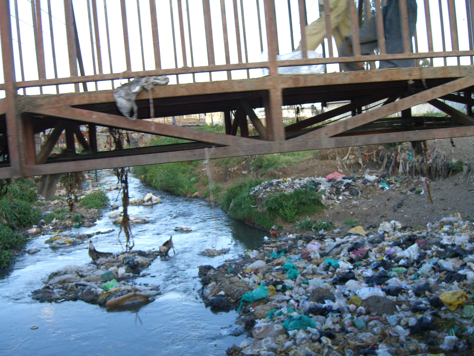
Ondiri Wetland or Ondiri Swamp is a protected wetland and peatbog that is the source of the Nairobi River near Kikuyu, Kenya in Kiambu County. The wetland is under pressure because of water extraction, deforestation Deforestation or forest clearance is the removal of a forest or stand of trees from land that is then converted to non-forest use. Deforestation can involve conversion of forest land to farms, ranches, or urban use. The most concentrated ... and accelerated erosion. Listed in 2021, the project's conservation is part of a larger initiative by the Kenyan government to reduce pollution to major waterways that provide water supply to Nairobi as part of the Thwake Dam project. The waterway is also important for local greenhouse agriculture. Ondiri Wetland covers 3,713,549 square feet and is a source to 40 springs, which provide water to the local community. Ondiri was heavily polluted with pesticides and dumping. In 2004, a study found as few as 41 bird species. ... [...More Info...] [...Related Items...] OR: [Wikipedia] [Google] [Baidu] |
Nairobi River
The Nairobi River is a river that flows across Nairobi, the capital city of Kenya. It is the main river of the Nairobi River Basin, with several parallel streams flowing eastward. All of the Nairobi basin rivers join east of Nairobi and meet the Athi River, which eventually flows into the Indian Ocean. The rivers are mostly narrow and highly polluted, though recent efforts to clean the rivers have improved water quality. The main stream, the Nairobi River, bounds the northern city center, where it is partly canalized. Tributaries The Nairobi River originates from the Ondiri Swamp in Kikuyu. The Nairobi River has several tributaries: *Athi River *Gathara-ini River *Gitathuru River *Kiu River *Mathari River *Mbagathi River *Nairobi River *Ngong River *RuiRuaka River The Motoine River flows to Nairobi Dam, an artificial lake meant to provide potable water to the residents of Nairobi. The stream continues as the Ngong River. Gatharaini stream originates in the marshes of the lo ... [...More Info...] [...Related Items...] OR: [Wikipedia] [Google] [Baidu] |
Kikuyu, Kenya
Kikuyu is a town in Kiambu County, Kenya, which grew from a settlement of colonial missionaries. The town is located about northwest of central Nairobi. It is about 20 minutes from Nairobi via a number of routes, including a dual carriage road, and has a railway station on the Mombasa – Malaba Railway Line. The town is named after the Kikuyu/Gĩkũyũ people, the major ethnicity that settled in the area. As of 2019 the total population is 323,881. Due to its geology and rich soil texture, the chief activities are livestock and crop farming. The jurisdiction also includes Ondiri Wetland which is the source of the Nairobi River. With the recent completion of the Southern Bypass that connects Mombasa to Nairobi via Kikuyu, the town is poised for greater growth as is the only town on the Bypass. Kikuyu hosts a Sub-County Administration which is the administrative division in Kiambu County. History The town has some British colonial history links, like the Right Reverend Musa ... [...More Info...] [...Related Items...] OR: [Wikipedia] [Google] [Baidu] |
Kiambu County
Kiambu County is a county in the former Central Province of Kenya. Its capital is Kiambu and its largest town is Thika. Kiambu County is the second most populous after Nairobi County. Kiambu County borders Nairobi and Kajiado Counties to the South, Machakos to the East, Murang'a to the North and North East, Nyandarua to the North West, and Nakuru to the West and has a population of 2,417,735. The county is 40% rural and 60% urban owing to Nairobi's consistent growth Northwards. The Kikuyu are the dominant tribe in the county. In 2007, Kiambu District was subdivided in two: Kiambu East and Kiambu West. Kiambu West district took Limuru, Lari and Kikuyu divisions, with Limuru as its district capital. Climate The county has an average annual rainfall of and mean temperature of with temperatures as low as in the upper highlands areas of Limuru. The long rains start in mid-March and run to May, and cold runs between July and August. Demographics According to the 2019 cens ... [...More Info...] [...Related Items...] OR: [Wikipedia] [Google] [Baidu] |
Water Extraction
Water extraction (or water withdrawal) is the process of taking water from any source, either temporarily or permanently, for flood control or to obtain water for, for example, irrigation. The extracted water could also be used as drinking water after suitable treatment. Depending on the environmental legislation in the country, controls may be placed on extraction to limit the amount of water that can be removed. The over-extraction of water can lead to dry rivers or declining groundwater levels. The science of hydrogeology is used to determine safe water extraction levels. Water can go through dams that are used to regulate or stop water from coming though, creating hydroelectricity. Effects of overextraction Saltwater intrusion See also * Atmospheric water generator * Desalination * Reclaimed water * Groundwater extraction Water extraction (or water withdrawal) is the process of taking water from any source, either temporarily or permanently, for flood control o ... [...More Info...] [...Related Items...] OR: [Wikipedia] [Google] [Baidu] |
Deforestation
Deforestation or forest clearance is the removal of a forest or stand of trees from land that is then converted to non-forest use. Deforestation can involve conversion of forest land to farms, ranches, or urban use. The most concentrated deforestation occurs in tropical rainforests. About 31% of Earth's land surface is covered by forests at present. This is one-third less than the forest cover before the expansion of agriculture, a half of that loss occurring in the last century. Between 15 million to 18 million hectares of forest, an area the size of Bangladesh, are destroyed every year. On average 2,400 trees are cut down each minute. The Food and Agriculture Organization of the United Nations defines deforestation as the conversion of forest to other land uses (regardless of whether it is human-induced). "Deforestation" and "forest area net change" are not the same: the latter is the sum of all forest losses (deforestation) and all forest gains (forest expansion) in a gi ... [...More Info...] [...Related Items...] OR: [Wikipedia] [Google] [Baidu] |
Soil Erosion
Soil erosion is the denudation or wearing away of the upper layer of soil. It is a form of soil degradation. This natural process is caused by the dynamic activity of erosive agents, that is, water, ice (glaciers), snow, air (wind), plants, and animals (including humans). In accordance with these agents, erosion is sometimes divided into water erosion, glacial erosion, snow erosion, wind (aeolean) erosion, zoogenic erosion and anthropogenic erosion such as tillage erosion. Soil erosion may be a slow process that continues relatively unnoticed, or it may occur at an alarming rate causing a serious loss of topsoil. The loss of soil from farmland may be reflected in reduced crop production potential, lower surface water quality and damaged drainage networks. Soil erosion could also cause sinkholes. Human activities have increased by 10–50 times the rate at which erosion is occurring world-wide. Excessive (or accelerated) erosion causes both "on-site" and "off-site" problems. On- ... [...More Info...] [...Related Items...] OR: [Wikipedia] [Google] [Baidu] |
Thwake Dam
The Thwake Dam or Thwake Multi-purpose Water Development Programme is a dam complex being built on the Athi River in Kenya. The dam is meant to be a multipurpose dam that provides drinking water, agricultural irrigation water, hydropower, and other water supply infrastructure. Water storage is 688 million cubic metres, and is meant for rural homes, Konza and other local jurisdictions. The dam cost KSh. 37 billion and is being built by the China Gezhouba Group Company. The Funding was provided by the African Development Fund. Water pollution concerns The need for potable water from the dam led to a number of conservation projects upstream, trying to create better clean water, such as in Ondiri Wetland. Moreover, many industries had been discharging directly into the river. In July 2021, the dam was criticized by auditor Nancy Gathungu for the lack of clean and safe water to be retained due to pollution locations like Athi River Athi River is a town outside Na ... [...More Info...] [...Related Items...] OR: [Wikipedia] [Google] [Baidu] |


