|
Olomana (mountain)
Olomana is a set of three mountainous peaks on the windward side of Oahu near Kailua and Waimanalo. While historically only the first peak was called Olomana and the second and third Paku'i and Ahiki (the least pointed peak) respectively, most people call the entire section Olomana. Geologically speaking, Olomana is an erosional remnant from within the caldera of the Koʻolau Volcano. Legend In Hawaiian, Olomana means, "divided hill". According to ancient Hawaiian legend, Olomana was a giant warrior who ruled the lands on the Windward side of Oahu from Kualoa to Makapu'u. During this time Ahuapau, the king of Oahu sent the great warrior Palila to battle Olomana, subsequently cutting Olomana in half. His upper torso was said to be in the Pacific Ocean near Kāneʻohe Bay leaving his lower half where Mount Olomana is today. According to the legend of Makalei, the peak Ahiki was named for one of Chief Olomana's favorite ''konohiki'' (headman), and the peak Pakui was named for ... [...More Info...] [...Related Items...] OR: [Wikipedia] [Google] [Baidu] |
Oahu
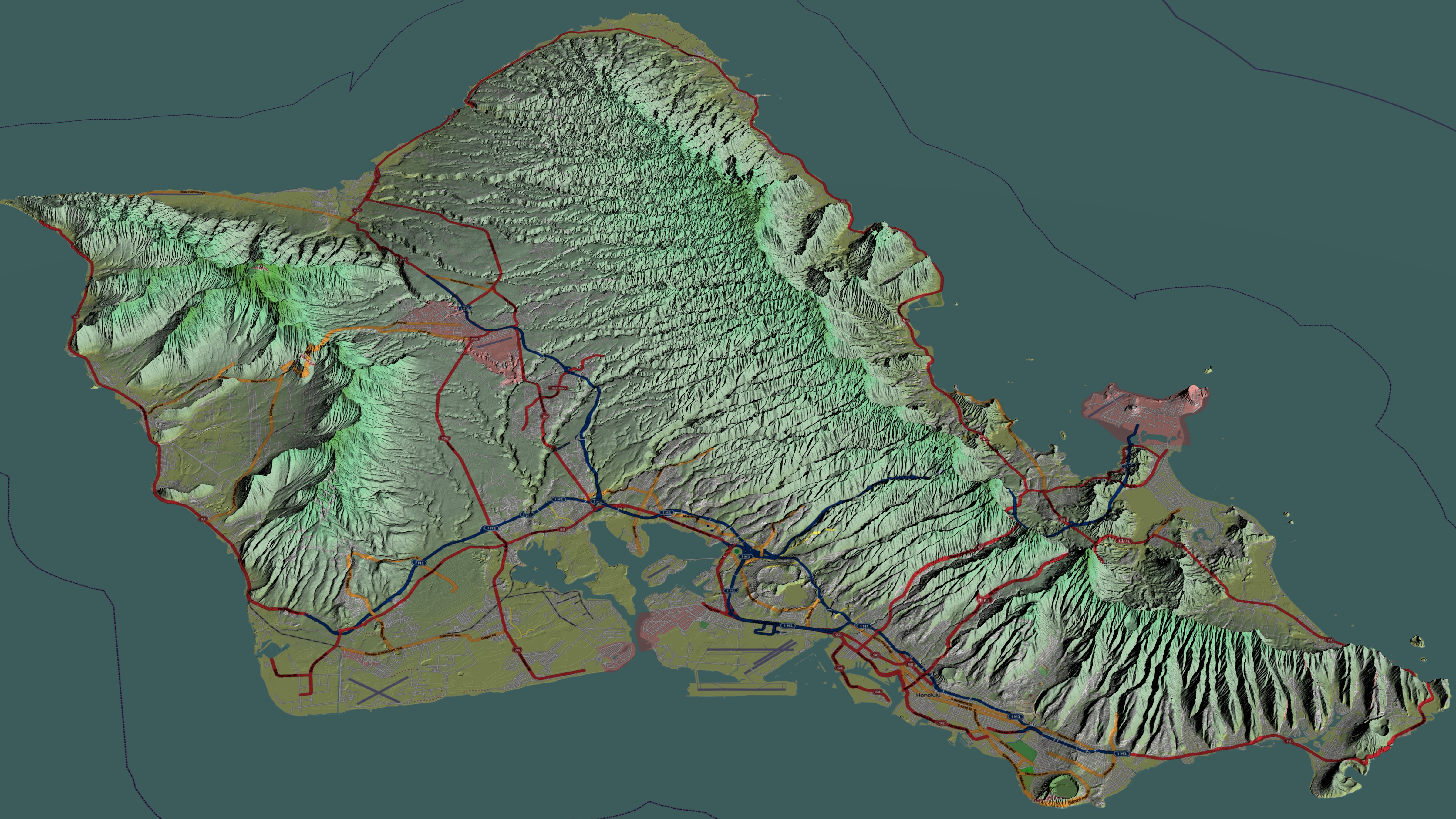
Oahu () (Hawaiian language, Hawaiian: ''Oʻahu'' ()), also known as "The Gathering place#Island of Oʻahu as The Gathering Place, Gathering Place", is the third-largest of the Hawaiian Islands. It is home to roughly one million people—over two-thirds of the population of the U.S. state of Hawaii. The island of O’ahu and the Northwestern Hawaiian Islands constitute the City and County of Honolulu, Hawaii, City and County of Honolulu. The state capital, Honolulu, is on Oʻahu's southeast coast. Oʻahu had a population of 1,016,508 according to the 2020 U.S. Census, up from 953,207 people in 2010 (approximately 70% of the total 1,455,271 population of the State of Hawaii, with approximately 81% of those living in or near the Honolulu urban area). Name The Island of O{{okinaahu in Hawaii is often nicknamed (or translated as) ''"The Gathering Place"''. It appears that O{{okinaahu grew into this nickname; it is currently the most populated Hawaiian islands, Hawaiian Island, how ... [...More Info...] [...Related Items...] OR: [Wikipedia] [Google] [Baidu] |
Honolulu County, Hawaii
Honolulu County (officially known as the City and County of Honolulu, formerly Oahu County) is a consolidated city–county in the U.S. state of Hawaii. The city–county includes both the city of Honolulu (the state's capital and largest city) and the rest of the island of Oʻahu, as well as several minor outlying islands, including all of the Northwestern Hawaiian Islands (islands beyond Niihau) except Midway Atoll. The consolidated city-county was established in the city charter adopted in 1907 and accepted by the Legislature of the Territory of Hawaii. As a municipal corporation and jurisdiction it manages aspects of government traditionally exercised by both municipalities and counties in the rest of the United States. As of the 2020 United States Census, the population was 1,016,508. Because of Hawaii's municipal structure, the United States Census Bureau divides Honolulu County into several census-designated places for statistical purposes. The mayor of Honolulu Co ... [...More Info...] [...Related Items...] OR: [Wikipedia] [Google] [Baidu] |
Hawaii Hotspot
The Hawaii hotspot is a volcanic hotspot located near the namesake Hawaiian Islands, in the northern Pacific Ocean. One of the best known and intensively studied hotspots in the world, the Hawaii plume is responsible for the creation of the Hawaiian–Emperor seamount chain, a mostly undersea volcanic mountain range. Four of these volcanoes are active, two are dormant; more than 123 are extinct, most now preserved as atolls or seamounts. The chain extends from south of the island of Hawaii to the edge of the Aleutian Trench, near the eastern coast of Russia. While most volcanoes are created by geological activity at tectonic plate boundaries, the Hawaii hotspot is located far from plate boundaries. The classic hotspot theory, first proposed in 1963 by John Tuzo Wilson, proposes that a single, fixed mantle plume builds volcanoes that then, cut off from their source by the movement of the Pacific Plate, become increasingly inactive and eventually erode below sea level over mi ... [...More Info...] [...Related Items...] OR: [Wikipedia] [Google] [Baidu] |
Kailua, Honolulu County, Hawaii
Kailua () is a census-designated place (CDP) in Honolulu County, Hawaii, United States. It lies in the Koolaupoko District of the island of Oahu on the windward coast at Kailua Bay. It is in the judicial district and the ahupua'a named Ko'olaupoko. It is northeast of Honolulu – over Nu‘uanu Pali. In the Hawaiian language ''Kailua'' means "two seas" or "two currents", a contraction of the words ''kai'' (meaning "sea" or "sea water") and ''elua'' (meaning "two"); it is so named because of the two former fishponds in the district ( Kawainui and Kaelepulu) or the two currents which run through Kailua Bay. Kailua is primarily a residential community, with a centralized commercial district along Kailua Road. The population was 50,000 in 1992. In 2017 census, the population had dropped to 38,000. The population was 40,514 at the 2020 census. Places of note in Kailua include Kailua Beach Park, Kaōhao or Lanikai Beach, Kawainui Marsh, Maunawili Falls, and Marine Corps ... [...More Info...] [...Related Items...] OR: [Wikipedia] [Google] [Baidu] |
Kualoa Ranch
Kualoa is a private nature reserve and working cattle ranch, as well as a popular tourist attraction and filming location on the windward coast of Oahu in Hawaii. It is about from Honolulu, and from Haleiwa. The ranch consists of 3 valleys: Kaaawa Valley, Kualoa Valley, and Hakipuu Valley. The ranch is located on Hawaii State Route 83 between Kaaawa and Waikane. The main street address is 49-560 Kamehameha Highway, Kāneohe, Hawaii 96744. History The valley was sacred to ancient Hawaiians from the 13th to the 18th century, as Chief Laa-mai-kahiki settled there after visiting Kauai before returning to Tahiti. It was also the site of the sacred drums of Kapahuula and Kaahuulapunawai as well as the sacred Hill of Kauakahiakahoowaha, the key to the sovereignty of the Kingdom of Oahu. As written in the Kumulipo, an ancient Hawaiian genealogical chant, Kualoa is where Papa and Wakea buried their first still born child, Haloa. It is said that the first kalo (taro) plant ... [...More Info...] [...Related Items...] OR: [Wikipedia] [Google] [Baidu] |
Palila
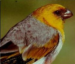
The palila (''Loxioides bailleui'') is a critically endangered finch-billed species of Hawaiian honeycreeper. It has a golden-yellow head and breast, with a light belly, gray back, and greenish wings and tail. The bird has a close ecological relationship with the '' māmane'' tree (''Sophora chrysophylla''), and became endangered due to destruction of the trees and accompanying dry forests. The first specimen of the palila was collected in 1876 at the Greenwell Ranch on the Big Island by Pierre Étienne Théodore Ballieu (1828–1885), who was French consul in Hawai‘i from 1869 to 1878. The type specimen (No. 1876-645) is housed at the Muséum national d'histoire naturelle in Paris. Taxonomy The Hawaiian honeycreepers (Drepanididae) are sometimes included in the true finch family (Fringillidae). Oustalet scientifically described the ''palila'' in 1877. Named ''Loxioides bailleui'' by him, it was for some time united with several other "parrot-billed" Hawaiian honeycreeper spe ... [...More Info...] [...Related Items...] OR: [Wikipedia] [Google] [Baidu] |
Pacific Ocean
The Pacific Ocean is the largest and deepest of Earth's five oceanic divisions. It extends from the Arctic Ocean in the north to the Southern Ocean (or, depending on definition, to Antarctica) in the south, and is bounded by the continents of Asia and Oceania in the west and the Americas in the east. At in area (as defined with a southern Antarctic border), this largest division of the World Ocean—and, in turn, the hydrosphere—covers about 46% of Earth's water surface and about 32% of its total surface area, larger than Earth's entire land area combined .Pacific Ocean . '' Britannica Concise.'' 2008: Encyclopædia Britannica, Inc. The centers of both the |


.jpg)