|
Old Conquest
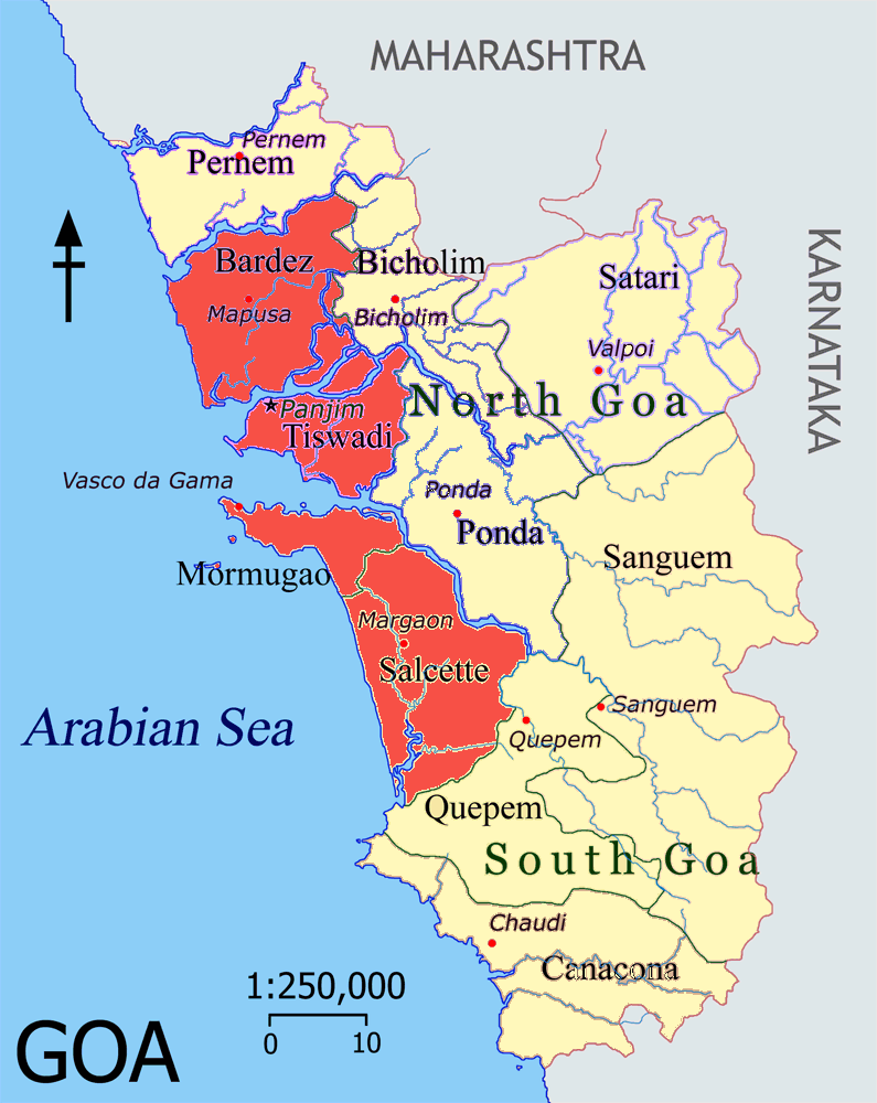
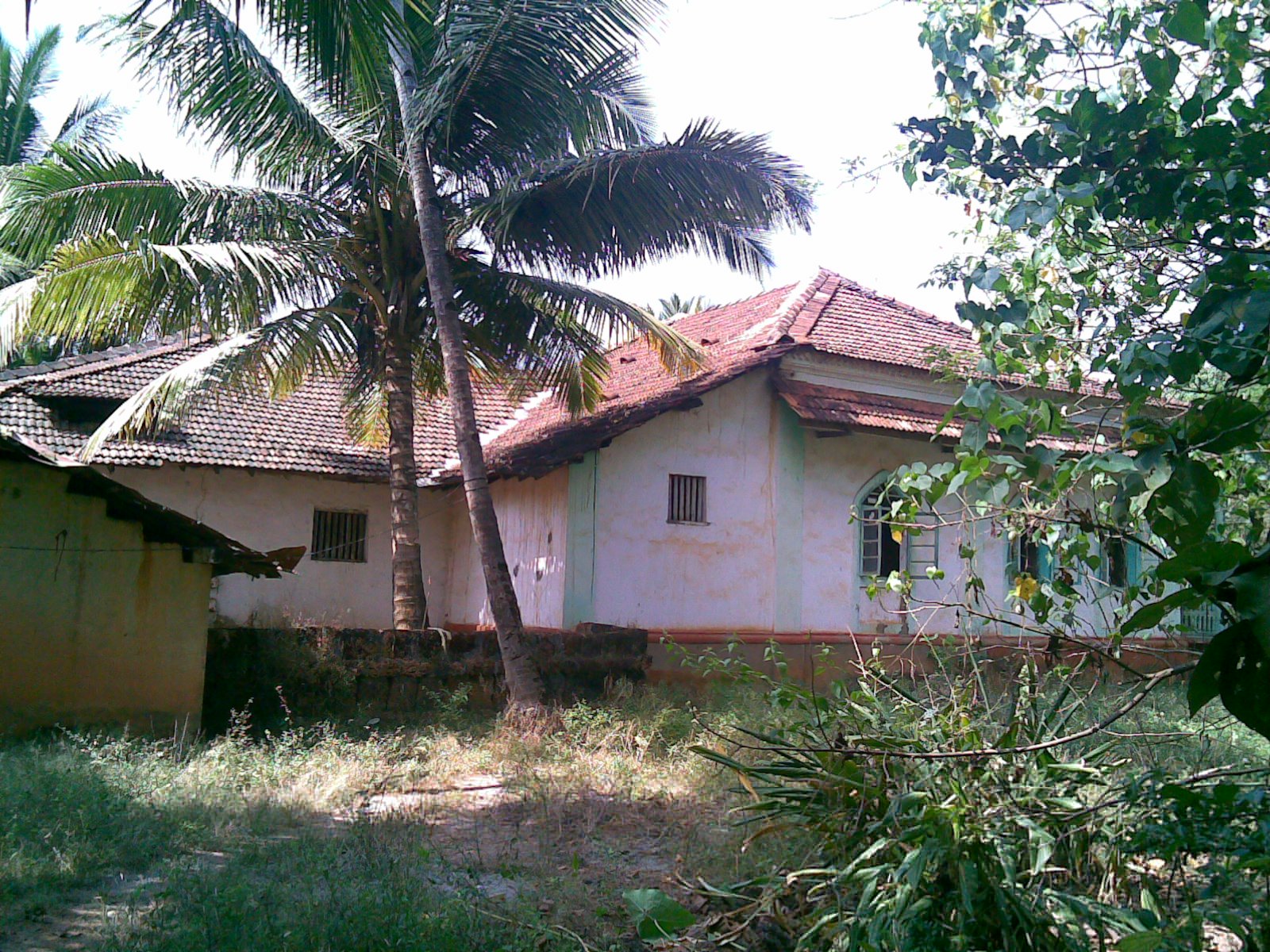
{{Unreferenced, date=November 2008 ''As Velhas Conquistas'' or "the Old Conquests" are a grouping of the areas in Goa which were incorporated into Portuguese India early in the sixteenth century AD; as these areas underwent urbanisation they were elevated to ''concelhos'' (municipalities) by the Portuguese Viceroyalty that ruled from the administrative centre at Velha Goa. Having been acquired in AD 1510 or within the next few years, they formed the oldest parts and the core of Portuguese Goa and remain as the central theme in the history geography and culture of present-day Goa and Damaon. The ''Novas Conquistas'' or New Conquests formed the outer periphery of Goa bordering the erstwhile British India. ''Novas Conquistas'' of present-day Goa shares borders with the Konkan province of Maharashtra, and also with Belgaum and North Canara districts of Carnatica. The three ''concelhos'' of the territory are ''Bardes'' (Bardez), ''Ilhas de Goa'' (Tiswadi), and ''Salcette'' (modern-d ... [...More Info...] [...Related Items...] OR: [Wikipedia] [Google] [Baidu] |
Bardez
''Bardez'' ( kok, Bardes; pt, Bardes; IPA: ) is a ''taluka'' of the North Goa district in the Indian state of Goa. It was a ''concelho'' in the Portuguese State of India before 1961. Etymology The name is credited to the Saraswat Brahmin immigrants who emigrated to the Konkan via Magadha plains in northern India. Bardez, or more properly ''bara'' (twelve) ''desh'' (country), means "twelve countries" (or territories). The form 'country' probably refers to clan territorial limits, or to the Brahmin ''comunidades'', of which the twelve are: # Aldona # Anjuna # Assagao # Candolim # Moira # Nachinola # Olaulim # Pomburpa # Saligao # Sangolda # Serula # Siolim Bardez is delimited on the north by the Chapora River, on the south by the Mandovi River, on the east by the Mapusa River, which originates in Bardez itself near the capital city of Mapusa, and on the west by the Arabian Sea. A native of Bardez is called a ''Bardeskar'' or ''Bardescar'' ( IPA: ) in the Konka ... [...More Info...] [...Related Items...] OR: [Wikipedia] [Google] [Baidu] |
Colonial Goa
Colonial or The Colonial may refer to: * Colonial, of, relating to, or characteristic of a colony or colony (biology) Architecture * American colonial architecture * French Colonial * Spanish Colonial architecture Automobiles * Colonial (1920 automobile), the first American automobile with four-wheel brakes * Colonial (Shaw automobile), a rebranded Shaw sold from 1921 until 1922 * Colonial (1921 automobile), a car from Boston which was sold from 1921 until 1922 Places * The Colonial (Indianapolis, Indiana) * The Colonial (Mansfield, Ohio), a National Register of Historic Places listing in Richland County, Ohio * Ciudad Colonial (Santo Domingo), a historic central neighborhood of Santo Domingo * Colonial Country Club (Memphis), a golf course in Tennessee * Colonial Country Club (Fort Worth), a golf course in Texas ** Fort Worth Invitational or The Colonial, a PGA golf tournament Trains * ''Colonial'' (PRR train), a Pennsylvania Railroad run between Washington, DC and New York C ... [...More Info...] [...Related Items...] OR: [Wikipedia] [Google] [Baidu] |
Ponnje
Panaji (; also known as Panjim) is the capital of the Indian state of Goa and the headquarters of North Goa district. Previously, it was the territorial capital of the former Portuguese India. It lies on the banks of the Mandovi river estuary in the Tiswadi sub-district ''(tehsil)''. With a population of 114,759 in the metropolitan area, Panaji is Goa's largest urban agglomeration, ahead of Margao and Mormugao. Panaji has terraced hills, concrete buildings with balconies and red-tiled roofs, churches, and a riverside promenade. There are avenues lined with gulmohar, acacia and other trees. The baroque Our Lady of the Immaculate Conception Church is located overlooking the main square known as Praça da Igreja. Panaji has been selected as one of hundred Indian cities to be developed as a smart city under the Smart Cities Mission. The city was built with stepped streets and a seven kilometre long promenade on a planned grid system after the Portuguese relocated the capital f ... [...More Info...] [...Related Items...] OR: [Wikipedia] [Google] [Baidu] |
Layman's Terms
Plain English (or layman's terms) are groups of words that are to be clear and easy to know. It usually avoids the use of rare words and uncommon euphemisms to explain the subject. Plain English wording is intended to be suitable for almost anyone, and it allows for good understanding to help readers know a topic. Etymology The term derives from the 16th-century idiom "in plain English", meaning "in clear, straightforward language". Another name for the term, layman's terms, is derived from the idiom " in layman's terms" which refers to language phrased simply enough that a layperson, or common person without expertise on the subject, can understand. History United Kingdom In 1946, writer George Orwell wrote an essay entitled, "Politics and the English Language", where he criticized the dangers of "ugly and inaccurate" contemporary written English. The essay focuses particularly on politics where ''pacification'' can be used to mean "...defenceless villages are bombarded from the ... [...More Info...] [...Related Items...] OR: [Wikipedia] [Google] [Baidu] |
Diu Island
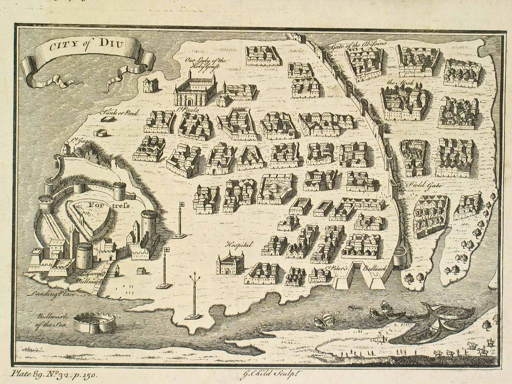
Diu Island, ''Ilha de Dio'' in Indo-Portuguese, is an island off the southern coast of Gujarat's Kathiawar peninsula, separated from the mainland by a tidal creek. It has an area of 40 km², and a population of 44,110 (2001 census). Administratively it belongs to the Diu district of the Dadra and Nagar Haveli and Daman and Diu union territory of India, both Damaon and Diu share the same elected representative as the member of parliament. The island lies 5 km to the east of Diu Head. The town of Diu and Diu Fort are located on the island. There is also a domestic airport, Diu Airport. History Throughout the 15th century, especially under Muzaffar Han, Diu flourished as a major port of the Gujarati state, with a notable fleet. From 1510 it became the seat of the governors of Surat. In 1535 the viceroy Nuno da Cunha made a treaty with Bahadur Sah, the sultan of Khambhat, for the use of the port by Portugal. Despite several attacks by Ottomans and Arabs, the Portuguese, ... [...More Info...] [...Related Items...] OR: [Wikipedia] [Google] [Baidu] |
Damaon
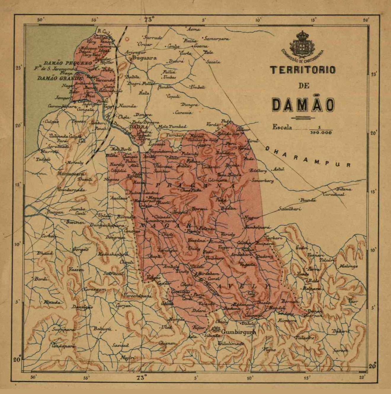
Daman is one of the three districts of the Indian union territory of Dadra and Nagar Haveli and Daman and Diu on the western coast of India, surrounded by Valsad district of Gujarat state on the north, east and south and the Arabian Sea to the west. The district has an area of , and a population of 191,173 at the 2011 census, an increase of 69.256% from the preceding 2001 Census. The district headquarters is Daman. The previous territorial headquarters were in Panjim when it was jointly administered as Goa, Damaon and Diu, until the time of the Goan Opinion Poll. Daman lies at the mouth of the Daman Ganga River. Major industries have units here. The closest railway station is Vapi (7 km). It is also famous for its beach, Portuguese colonial architecture, churches, and for the scenic beauty in the twin towns of Nani-Daman and Moti-Daman, which lie opposite each other across the Daman Ganga. The city of Surat lies to the north, and Mumbai lies approximately 160 km (10 ... [...More Info...] [...Related Items...] OR: [Wikipedia] [Google] [Baidu] |
Tehsil
A tehsil (, also known as tahsil, taluka, or taluk) is a local unit of administrative division in some countries of South Asia. It is a subdistrict of the area within a district including the designated populated place that serves as its administrative centre, with possible additional towns, and usually a number of villages. The terms in India have replaced earlier terms, such as '' pargana'' (''pergunnah'') and ''thana''. In Andhra Pradesh and Telangana, a newer unit called mandal (circle) has come to replace the system of tehsils. It is generally smaller than a tehsil, and is meant for facilitating local self-government in the panchayat system. In West Bengal, Bihar, Jharkhand, community development blocks are the empowered grassroots administrative unit, replacing tehsils. As an entity of local government, the tehsil office (panchayat samiti) exercises certain fiscal and administrative power over the villages and municipalities within its jurisdiction. It is the ultimate execu ... [...More Info...] [...Related Items...] OR: [Wikipedia] [Google] [Baidu] |
Mormugao Taluka
Mormugao is a seaport city situated in the eponymous Mormugao taluka (municipality) of the South district, in the Goa state, India. It has a deep natural harbour and remains Goa's chief port. Towards the end of the Indo-Portuguese era in 1917, thirty-one settlements were carved out of the Salcette area, to form Morumugão with Mormugao seaport as its headquarters. The remaining thirty-five settlements were retained in Salcette which encompass the present-day Salcete ''taluka'' with Margao as its headquarters. Geography Mormugao is located at . It has an average elevation of 2 metres (7 feet). Demographics and Healthcare India census, Mormugao had a population of 97,085. Males constitute 53% of the population and females 47%. Mormugao has an average literacy rate of 75%, higher than the national average of 59.5%: male literacy is 80%, and female literacy is 70%. In Mormugão, 11% of the population is under 6 years of age. Konkani being the state language, Marathi ... [...More Info...] [...Related Items...] OR: [Wikipedia] [Google] [Baidu] |
Salcete
Salcete ( Konkani: ''Saxtti''/''Xaxtti''; pt, Salcette) is a sub-division of the district of South Goa, in the state of Goa, situated by the west coast of India. The Sal river and its backwaters dominate the landscape of Salcete. Historically, the sixty-six settlements south of the River Zuari formed the original Salcette territory. Salcete forms a part of the bigger Konkan region that stretches along the western shoreline of peninsular India. In erstwhile Portuguese Goa, the Salcette ''concelho'' (county) located in the ''Velhas Conquistas'' (Old Conquests) was co-terminous with the undivided Salcette territory (Salcete and Mormugaõ ''talukas''). In 1917, the ''concelho'' was bifurcated into the present-day ''talukas'' of Mormugao and Salcette. The contemporary Salcete ''taluka'' has been classified as a rurban area. Margao serves as the administrative headquarters of both Salcete ''taluka'' and the South Goa district. Etymology "Salcete" is the modern angli ... [...More Info...] [...Related Items...] OR: [Wikipedia] [Google] [Baidu] |
Tiswadi
Tiswadi ( pt, Ilhas de Goa, lit=Islands of Goa, or simply ''Ilhas'') is a sub-district in the district of North Goa, situated in the Indian coastal state of Goa. It is the largest and populous island of Goa situated in the basin of the Zuari and Mandovi rivers. It was one of the first territories to be annexed by Portugal in 1510 AD. Both the state capital Panaji, and the former capital Old Goa are within the sub-district. It is one of 6 major islands between the Mandovi and Zuari rivers. Etymology The word ''Tiswadi'' itself, originated in the late 1970s and it referred to thirty settlements of Goud Saraswat Brahmins who settled when they migrated to Goa. The descendants of these settlers now form the native ''Bammon'' (Brahman) community. Geography It is geographically made up of several small riverine islands within the Mandovi River forming its northern boundary, the Cumbarjua Canal making its eastern border, and the Zuari River making up its southern border. As th ... [...More Info...] [...Related Items...] OR: [Wikipedia] [Google] [Baidu] |
Carnatica
Karnataka (; ISO 15919, ISO: , , also known as Karunāḍu) is a States and union territories of India, state in the southwestern region of India. It was Unification of Karnataka, formed on 1 November 1956, with the passage of the States Reorganisation Act, 1956, States Reorganisation Act. Originally known as Mysore State , it was renamed ''Karnataka'' in 1973. The state corresponds to the Carnatic region. Its capital and largest city is Bangalore, Bengaluru. Karnataka is bordered by the Lakshadweep Sea to the west, Goa to the northwest, Maharashtra to the north, Telangana to the northeast, Andhra Pradesh to the east, Tamil Nadu to the southeast, and Kerala to the southwest. It is the only southern state to have land borders with all of the other four southern Indian sister states. The state covers an area of , or 5.83 percent of the total geographical area of India. It is the List of states and union territories of India by area, sixth-largest Indian state by area. With 61,13 ... [...More Info...] [...Related Items...] OR: [Wikipedia] [Google] [Baidu] |
