|
Old Colony Council
The Mayflower Council of the Boy Scouts of America serves the MetroWest and southeastern regions of Massachusetts. History On March 28, 2017, Knox Trail Council and Old Colony Council voted to merge and create a new, combined council. The merger was executed on May 10, 2017, using the name "Council 251" to represent the new council until August 30, 2017, when the name "Mayflower Council" was selected. The council was headquartered at the former Knox Trail Council headquarters in Marlborough, Massachusetts, and the former Old Colony Council headquarters in Canton, Massachusetts was used as a satellite location. On October 2, 2020, the council moved into its new service center at 83 Cedar Street in Milford. Massachusetts. Districts Mayflower Council is separated into 5 districts. They are: *Cranberry Harbors District *Headwaters District *Metacomet District *Post Road District *Sachem District Camps Mayflower Council owns and operates 3 camps. They are Camp Resolute in Bolton, ... [...More Info...] [...Related Items...] OR: [Wikipedia] [Google] [Baidu] |
Boy Scouts Of America
The Boy Scouts of America (BSA, colloquially the Boy Scouts) is one of the largest scouting organizations and one of the largest youth organizations in the United States, with about 1.2 million youth participants. The BSA was founded in 1910, and since then, about 110 million Americans have participated in BSA programs. BSA is part of the international Scout Movement and became a founding member organization of the World Organization of the Scout Movement in 1922. The stated mission of the Boy Scouts of America is to "prepare young people to make ethical and moral choices over their lifetimes by instilling in them the values of the Scout Oath and Law." Youth are trained in responsible citizenship, character development, and self-reliance through participation in a wide range of outdoor activities, educational programs, and, at older age levels, career-oriented programs in partnership with community organizations. For younger members, the Scout method is part of the ... [...More Info...] [...Related Items...] OR: [Wikipedia] [Google] [Baidu] |
Milford, Massachusetts
Milford is a town in Worcester County, Massachusetts, United States. The population was 30,379 according to the 2020 census. First settled in 1662 and incorporated in 1780, Milford became a booming industrial and quarrying community in the 19th century due to its unique location which includes the nearby source of the Charles River, the Mill River, the Blackstone River watershed, and large quantities of Milford pink granite. History Milford was first settled in 1662 as a part of Mendon after Native Americans, including the Sachem, Quashaamit, granted land to the early settlers. King Philip's War destroyed the town in 1676, but settlers returned in 1680. The Mill River flows through Milford and had several conspicuous fords that were familiar to the Native Americans, and used by the early white settlers. These "mill (river) fords" are said to have given Milford its name. Milford was incorporated April 11, 1780 and the first town hall built in 1819; a brick structure later named ... [...More Info...] [...Related Items...] OR: [Wikipedia] [Google] [Baidu] |
Marlborough, Massachusetts
Marlborough is a city in Middlesex County, Massachusetts, United States. The population was 41,793 at the 2020 census. Marlborough became a prosperous industrial town in the 19th century and made the transition to high technology industry in the late 20th century after the construction of the Massachusetts Turnpike. Marlborough was declared a town in 1660. It was incorporated as a city in 1890 when it changed its municipal charter from a New England town meeting system to a mayor–council government. History John Howe in 1656 was a fur trader and built a house at the intersection of two Indian trails, Nashua Trail and Connecticut path. He could speak the language of the Algonquian Indians though the local tribe referred to themselves as the Pennacooks. The settlers were welcomed by the Indians because they protected them from other tribes they were at war with. In the 1650s, several families left the nearby town of Sudbury, 18 miles west of Boston, to start a new town. The ... [...More Info...] [...Related Items...] OR: [Wikipedia] [Google] [Baidu] |
Canton, Massachusetts
Canton is a town in Norfolk County, Massachusetts, Norfolk County, Massachusetts, United States. The population was 24,370 at the 2020 census. Canton is part of Greater Boston, about 15 miles (24 kilometers) southwest of downtown Boston. History The area that would become Canton was inhabited for tens of thousands of years prior to European colonization of the Americas, European colonization. The Paleo-Indians, Paleo-Indian site Wamsutta, Radiocarbon dating, radiocarbon dated to 12,140 years before present, is located within the bounds of modern day Canton at Signal Hill (Canton, Massachusetts), Signal Hill. At the time of the Puritan migration to New England (1620–1640), Puritan migration to New England in the early 1600s, Canton was seasonally inhabited by the Neponset band of Massachusett under the leadership of sachem Chickatawbut. From the 1630s to the 1670s, increasing encroachment by year-round English settlers on lands traditionally inhabited only part of the year, ... [...More Info...] [...Related Items...] OR: [Wikipedia] [Google] [Baidu] |
Myles Standish State Forest
Myles Standish State Forest is a state forest located in the towns of Plymouth and Carver in southeastern Massachusetts, approximately 45 miles (70 km) south of Boston. It is the largest publicly owned recreation area in this part of Massachusetts and is managed by the Department of Conservation and Recreation (DCR). Description The forest is part of the Atlantic coastal pine barrens ecoregion and consists largely of pitch pine and scrub oak forests—at , one of the largest such forests north of Long Island. The forest surrounds 16 lakes and ponds, including several ecologically significant coastal kettle ponds. Ecology Species commonly found in Southeast Massachusetts pine barrens: Plants Trees * Pitch pine *Bear oak (scrub oak) * Dwarf chestnut oak (scrub oak) Fruit-bearing * Hillside and lowbush blueberry *Black huckleberry *Bearberry * Birds'-foot violet Animals Birds *Eastern towhee *Eastern bluebird *Pine warbler *Prairie warbler *Whip-poor-will Insects * ... [...More Info...] [...Related Items...] OR: [Wikipedia] [Google] [Baidu] |
Plymouth, Massachusetts
Plymouth (; historically known as Plimouth and Plimoth) is a town in Plymouth County, Massachusetts, United States. Located in Greater Boston, the town holds a place of great prominence in American history, folklore, and culture, and is known as "America's Hometown". Plymouth was the site of the colony founded in 1620 by the ''Mayflower'' Pilgrims, where New England was first established. It is the oldest municipality in New England and one of the oldest in the United States. The town has served as the location of several prominent events, one of the more notable being the First Thanksgiving feast. Plymouth served as the capital of Plymouth Colony from its founding in 1620 until the colony's merger with the Massachusetts Bay Colony in 1691. The English explorer John Smith named the area Plymouth (after the city in South West England) and the region 'New England' during his voyage of 1614 (the accompanying map was published in 1616). It was a later coincidence that, after an ab ... [...More Info...] [...Related Items...] OR: [Wikipedia] [Google] [Baidu] |
Nobscot Hill
Nobscot Hill is a USGS name for a high point in Middlesex County, Massachusetts with many public hiking trails, and the hill is located in Framingham and Sudbury. At the summit are various radio towers and a fire tower. Below the summit of Nobscot Hill is the Nobscot Scout Reservation (452 acres) which includes Tippling Rock, a popular viewing location. Surrounding the hill are other large parks and parcels of conservation land, including the Nobscot Conservation Land (118 acres), Callahan State Park (958 acres), the Sudbury Weisblatt Conservation Land, and Wittenborg Woods (83 acres), which are connected by various hiking trails, including the Bay Circuit Trail. Geography The summit of Nobscot Hill commands a 360-degree view including Boston, MetroWest, the Blue Hills, Lower Kearsarge, Mount Monadnock, Mount Wachusett, Mount Agamenticus, and all of the unremarkable bumps to the SouthWest. Currently, the foliage obscures much of the view from the summit, unless one climbs t ... [...More Info...] [...Related Items...] OR: [Wikipedia] [Google] [Baidu] |
Sudbury, Massachusetts
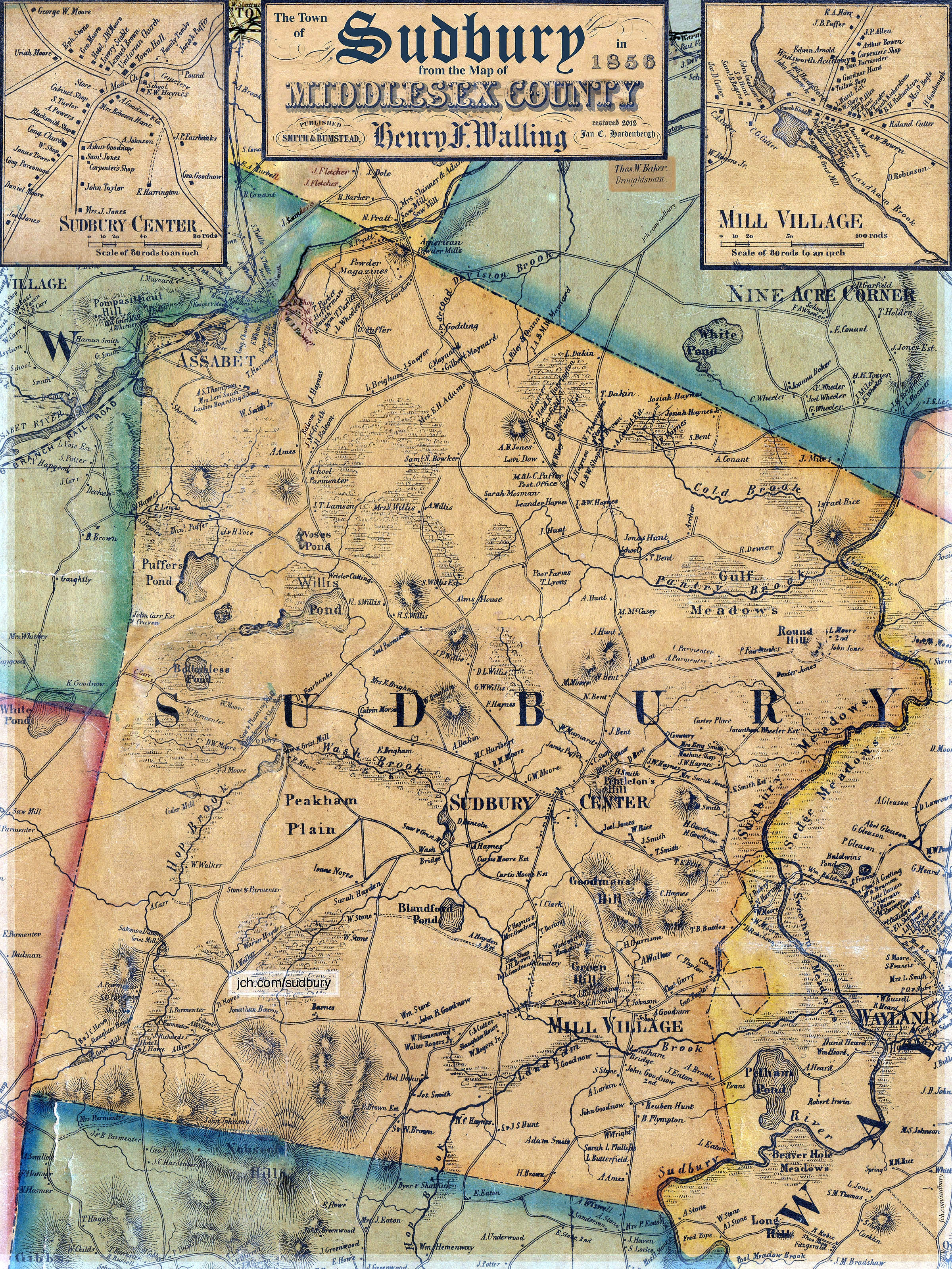
Sudbury is a town in Middlesex County, Massachusetts, United States. At the 2020 census, it had a population of 18,934. The town, located in Greater Boston's MetroWest region, has a rich colonial history. History Incorporated in 1639, the boundaries of Sudbury included (by 1653) what is now Wayland (which split off in 1780, initially as East Sudbury), and parts of present day Framingham, Marlborough, Stow and Maynard (the latter town splitting off in 1871). Nipmuc Indians lived in what is now Sudbury, including Tantamous, a medicine man, and his son Peter Jethro, who deeded a large parcel of land to Sudbury for settlement in 1684.Gutteridge, William H. (1921)''A Brief History of the Town of Maynard, Massachusetts'' Maynard, MA: Town of Maynard, p. 13-16 The original town center and meetinghouse were located near the Sudbury River at what is now known as Wayland's North Cemetery. For the residents on the west side of the river, it was a treacherous passage in the winter and ... [...More Info...] [...Related Items...] OR: [Wikipedia] [Google] [Baidu] |
Order Of The Arrow
The Order of the Arrow (OA) is the honor society of the Boy Scouts of America (BSA), composed of Scouts and Scouters who best exemplify the Scout Oath and Law in their daily lives as elected by their peers. The society was created by E. Urner Goodman, with the assistance of Carroll A. Edson, in 1915 as a means of reinforcing the Scout Oath and the Scout Law. It uses imagery commonly associated with American Indian cultures for its self-invented ceremonies. These ceremonies are usually for recognition of leadership qualities, camping skills, and other scouting ideals as exemplified by their elected peers. Influenced by Scout camp customs, the OA uses "safeguarded" (privy only to members) symbols, handshakes, and private rituals to impart a sense of community. Native Americans have criticized the OA's various symbols and "rituals" as cultural appropriation based on non-Native stereotypes of American Indians. Inducted members, known as ''Arrowmen'' or ''Brothers'' (regardless o ... [...More Info...] [...Related Items...] OR: [Wikipedia] [Google] [Baidu] |
Scouting In Massachusetts
Scouting in Massachusetts includes both Girl Scout and Boy Scouts of America (BSA) organizations. Both were founded in the 1910s in Massachusetts. With a vigorous history, both organizations actively serve thousands of youth in programs that suit the environment in which they live. History By 1910, a scout like group, Boston City Guard, was founded by Frank O. Carpenter of the English High School. In June 1910, the American Boy Scouts started organizing the Department of New England which was operational in August or September under chief department scout General William H. Oakes and based in Boston. On February 1, 2019, Boy Scouts of America started allowing all-girl troops to be formed. A number of all-girl troops have been formed in Massachusetts. Boy Scouts of America in Massachusetts today Cape Cod and the Islands Council The Cape Cod and the Islands Council serves Cape Cod, Martha's Vineyard, and Nantucket, Massachusetts, Nantucket with their headquarters residing in Y ... [...More Info...] [...Related Items...] OR: [Wikipedia] [Google] [Baidu] |
Local Councils Of The Boy Scouts Of America
The program of the Boy Scouts of America is administered through 253 local councils, with each council covering a geographic area that may vary from a single city to an entire state. Each council receives an annual charter from the National Council and is usually incorporated as a charitable organization. Most councils are administratively divided into districts that directly serve Scout units. Councils fall into one of four regions: Western, Central, Southern, and Northeast. Each region is then subdivided into areas. The total number of councils depends on how they are counted: * There are 253 individual local councils * Direct Service covers units outside of local councils— although technically not a council it is assigned a council number * Greater New York Councils has five boroughs, each with an assigned council number * Michigan Crossroads Council has four field service councils, each with an assigned council number Organization The council level organization is simila ... [...More Info...] [...Related Items...] OR: [Wikipedia] [Google] [Baidu] |


