|
Ojiro
is an area located in Kami Town, Mikata District, Hyōgo Prefecture, Japan. As of 2012, the area has an estimated population of 2,200. The total area is 66.16 km2. Ojiro is mostly a mountainous area and prides itself as the homeland of Wagyu cattle. Ojiro is designated as one of The Most Beautiful Villages in Japan, and is the birthplace of Tajiri-go, a Tajima Cattle who is the ancestor of more than 99.9% of Japanese Black wagyu. Ojiro lies entirely within the San'in Kaigan Global Geopark. The area of Ojiro was a town of Mikata. On April 1, 2005, town of Mikata, along with the town of Kasumi, and the town of Muraoka, was merged to create the town of Kami. At that time the portion of Kami that was Mikata renamed as Ojiro-ku (小代区), or Ojiro Ward, because some residents requested to use the traditional place name "Ojiro". Attractionshttp://www.town.mikata-kami.lg.jp/www/contents/1305546570091/files/geokamimap_English.pdf San'in Kaigan Geopark Kami Town Geospot ... [...More Info...] [...Related Items...] OR: [Wikipedia] [Google] [Baidu] |
Mikata, Hyōgo
was a town located in Mikata District, Hyōgo, Japan. As of 2003, the town had an estimated population of 2,523 and a density of 38.13 persons per km2. The total area was 66.16 km2. See Ojiro if you want to know the present situation of this area. This town was created on April 1, 1955, by the amalgamation of the village of Ojiro and the village of Isou. But on April 1, 1961, the portion of Mikata that was Isou merged into the town of Muraoka, because those who in Ojiro and Isou were not friendly. On April 1, 2005, Mikata, along with the town of Kasumi, and the town of Muraoka, was merged to create the town of Kami, and no longer exists as an independent municipality A municipality is usually a single administrative division having corporate status and powers of self-government or jurisdiction as granted by national and regional laws to which it is subordinate. The term ''municipality'' may also mean the go .... The portion of Kami that was Mikata is now known as Oj ... [...More Info...] [...Related Items...] OR: [Wikipedia] [Google] [Baidu] |
Kami, Hyōgo (Mikata)
is a town located in Mikata District, Hyōgo Prefecture, Japan. , the town had an estimated population of 16,256 in 6368 households and a population density of 44 persons per km². The total area of the town is . The Ojiro neighborhood of the town is designated as one of the Most Beautiful Villages in Japan. Kami is the birthplace of Tajiri-go, a Tajima Cattle who is the ancestor of more than 99.9% of Japanese Black ''wagyu''. Geography Kami is located in the northern part of Hyōgo Prefecture and the Kinki region, facing the Sea of Japan in the north. It lies entirely within the San'in Kaigan Geopark. In addition, the mountainous area in the south is within the borders of the Hyōnosen-Ushiroyama-Nagisan Quasi-National Park. The area is part of the snow country and is characterized by heavy accumulations of snow in winter. Neighbouring municipalities Hyōgo Prefecture * Shin'onsen * Toyooka * Yabu Tottori Prefecture * Wakasa Climate Kami has a humid subtropical clim ... [...More Info...] [...Related Items...] OR: [Wikipedia] [Google] [Baidu] |
The Most Beautiful Villages In Japan
is a Japanese nonprofit organization of listing some of the most beautiful villages and towns in Japan. The association is active on enhancement and protection of Japanese rural heritage, cultural fairs & branding and promotion of regional, national and international cooperation of its member villages and towns. Overview Established in 2005, the Association of The Most Beautiful Villages in Japan (titled as, the most beautiful villages in Japan) is an important player in the enhancement and conservation of Japanese rural heritage. In line with the other members such as France, Italy, Belgium, of the federation of the Most Beautiful Villages on Earth, Japan has common interests: authenticity, quality and presentation of the heritage as a source of sustainable development and life. Activities of the association include managing the rights of the use of the title name "the most beautiful villages in Japan" and its branding, providing common research and study platform to the mem ... [...More Info...] [...Related Items...] OR: [Wikipedia] [Google] [Baidu] |
San'in Kaigan Geopark
The is a geopark in Japan. The area was declared a Japanese Geopark in 2008, and a UNESCO Global Geoparks Network, Global Geopark in 2010. The underlying themes of the geopark are "geological features, the natural environment, people's lives, and the formation of the Sea of Japan". This geologically diverse area contains records of the process from when Japan was part of the Asian continent to its present-day formation of the Sea of Japan. People's lives are also diverse in this area because of its geodiversity. Area The San'in Kaigan Geopark is located to the northwest of Osaka and Kyoto and consists of Kyōtango, Kyoto, Kyotango in Kyoto Prefecture, Toyooka, Hyōgo, Toyooka, Kami, Hyōgo (Mikata), Kami, and Shin'onsen, Hyōgo, Shin'onsen in Hyōgo Prefecture, Iwami, Tottori, Iwami, and a major part of Tottori, Tottori, Tottori in Tottori Prefecture. The geopark has an area of 2,458.44 square kilometers. Geosites The geopark includes sites that relate to the surrounding geomorph ... [...More Info...] [...Related Items...] OR: [Wikipedia] [Google] [Baidu] |
San'in Kaigan Global Geopark
The is a geopark in Japan. The area was declared a Japanese Geopark in 2008, and a UNESCO Global Geopark in 2010. The underlying themes of the geopark are "geological features, the natural environment, people's lives, and the formation of the Sea of Japan". This geologically diverse area contains records of the process from when Japan was part of the Asian continent to its present-day formation of the Sea of Japan. People's lives are also diverse in this area because of its geodiversity. Area The San'in Kaigan Geopark is located to the northwest of Osaka and Kyoto and consists of Kyotango in Kyoto Prefecture, Toyooka, Kami, and Shin'onsen in Hyōgo Prefecture, Iwami, and a major part of Tottori in Tottori Prefecture. The geopark has an area of 2,458.44 square kilometers. Geosites The geopark includes sites that relate to the surrounding geomorphology and geology. Examples include the rice terraces and Tajima cattle grazing areas located on the gentle slopes form ... [...More Info...] [...Related Items...] OR: [Wikipedia] [Google] [Baidu] |
Shrine
A shrine ( la, scrinium "case or chest for books or papers"; Old French: ''escrin'' "box or case") is a sacred or holy sacred space, space dedicated to a specific deity, ancestor worship, ancestor, hero, martyr, saint, Daemon (mythology), daemon, or similar figure of respect, wherein they are veneration, venerated or worshipped. Shrines often contain Cult image, idols, relics, or other such objects associated with the figure being venerated. A shrine at which votive offerings are made is called an altar. Shrines are found in many of the world's religions, including Christianity, Islam, Hinduism, Buddhism, Chinese folk religion, Shinto, indigenous Philippine folk religions, and Germanic paganism, Asatru as well as in secular and non-religious settings such as a war memorial. Shrines can be found in various settings, such as Church (building), churches, temples, cemetery, cemeteries, Conservation of South Asian household shrines, museums, or in the home. However, portable shrine ... [...More Info...] [...Related Items...] OR: [Wikipedia] [Google] [Baidu] |
Onsen
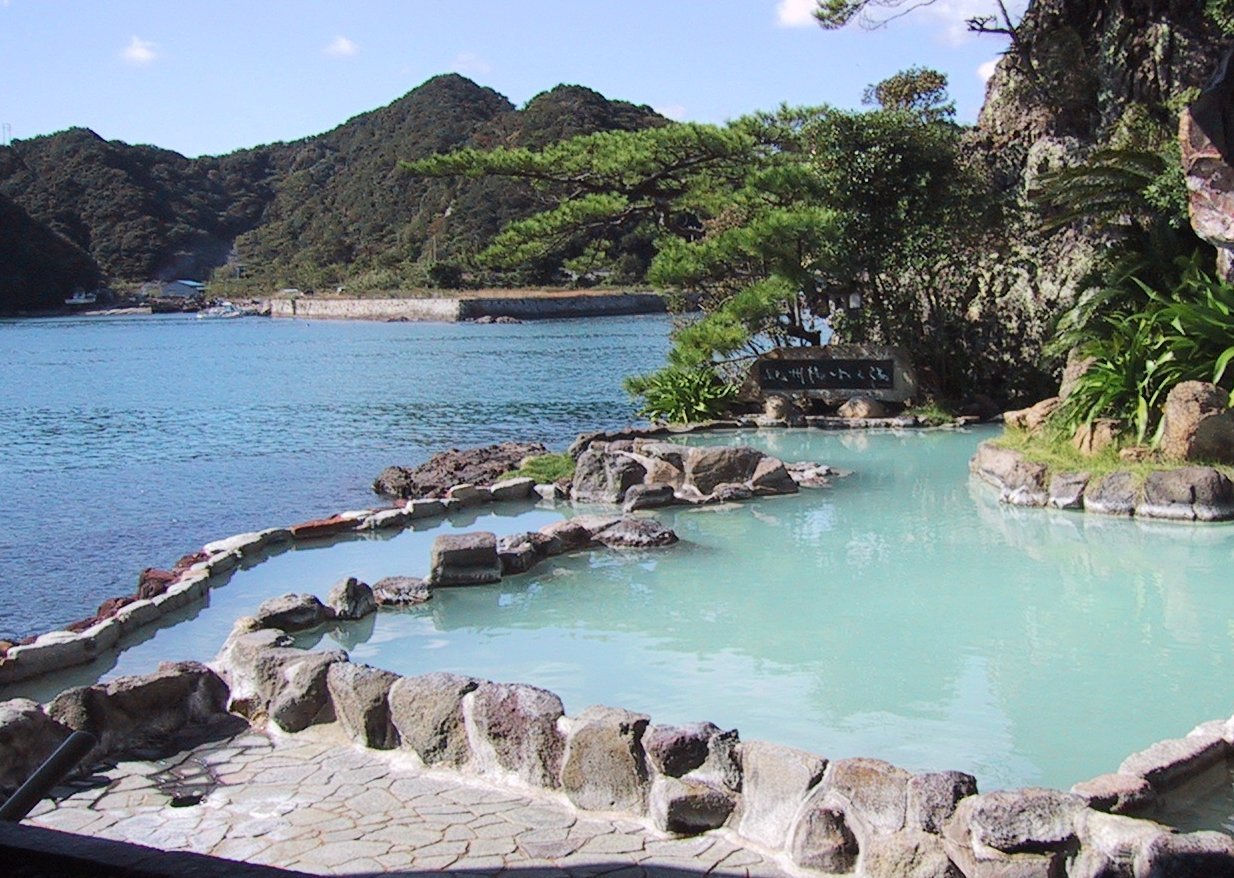
In Japan, are the country's hot springs and the bathing facilities and traditional inns around them. As a volcanically active country, Japan has many onsens scattered throughout all of its major islands. There are approximately 25,000 hot spring sources throughout Japan that provide hot mineral water to about 3,000 genuine onsen establishments. Onsens come in many types and shapes, including and . Baths may be either publicly run by a municipality or privately, often as part of a hotel, ''ryokan'', or . The presence of an onsen is often indicated on signs and maps by the symbol ♨ or the kanji (''yu'', meaning "hot water"). Sometimes the simpler hiragana character ゆ (''yu''), understandable to younger children, is used. Traditionally, onsens were located outdoors, although many inns have now built indoor bathing facilities as well. Nowadays, as most households have their own bath, the number of traditional public baths has decreased, but the number of sightseeing ho ... [...More Info...] [...Related Items...] OR: [Wikipedia] [Google] [Baidu] |
Terrace (agriculture)
In agriculture, a terrace is a piece of sloped plane that has been cut into a series of successively receding flat surfaces or platforms, which resemble steps, for the purposes of more effective farming. This type of landscaping is therefore called terracing. Graduated terrace steps are commonly used to farm on hilly or mountainous terrain. Terraced fields decrease both erosion and surface runoff, and may be used to support growing crops that require irrigation, such as rice. The Rice Terraces of the Philippine Cordilleras have been designated as a UNESCO World Heritage Site because of the significance of this technique. Uses Terraced paddy fields are used widely in rice, wheat and barley farming in east, south, southwest, and southeast Asia, as well as the Mediterranean Basin, Africa, and South America. Drier-climate terrace farming is common throughout the Mediterranean Basin, where they are used for vineyards, olive trees, cork oak, and other crops. Ancient history Te ... [...More Info...] [...Related Items...] OR: [Wikipedia] [Google] [Baidu] |


