|
Ogun State, Nigeria
Ogun State is a states of Nigeria, state in southwestern Nigeria. Created on 3 February 1976 from the former Western State (Nigeria), Western State. Ogun State borders Lagos State to the south, Oyo State and Osun State to the north, Ondo State to the east, and the Republic of Benin to the west. Abeokuta is both Ogun State's capital and most populous city; other important cities in the state include Ijebu Ode, the royal capital of the Ijebu Kingdom, and Sagamu, Nigeria's leading kola nut grower. Ogun state is covered predominantly by rain forest and has wooden savanna in the northwest . Ogun State had a total population of 3,751,140 residents as of 2006, making Ogun State the 16th most populated state in Nigeria In terms of landmass, Ogun State is the 24th largest State in Nigeria with land area of 16,762 kilometer square. Nicknamed the "Gateway to Nigeria", the state is notable for having a high concentration of industrial Estates and being a major manufacturing hub in Nigeria. M ... [...More Info...] [...Related Items...] OR: [Wikipedia] [Google] [Baidu] |
States Of Nigeria
Nigeria is a federation of 36 states and 1 federal capital territory. Each of the 36 states is a semi-autonomous political unit that shares powers with the federal government as enumerated under the Constitution of Nigeria, Constitution of the Federal Republic of Nigeria. The Federal Capital Territory (Nigeria), Federal Capital Territory (FCT), is the capital territory of Nigeria, and it is in this territory that the capital city of Abuja is located. The FCT is not a state but is administered by elected officials who are supervised by the federal government. Each state is subdivided into Local government areas of Nigeria, local government areas (LGAs). There are 774 local governments in Nigeria. Under the constitution, the 36 states are co-equal but not supreme because sovereignty resides with the federal government. The constitution can be amended by the National Assembly (Nigeria), National Assembly, but each amendment must be ratified by two-thirds of the 36 states of the feder ... [...More Info...] [...Related Items...] OR: [Wikipedia] [Google] [Baidu] |
List Of Nigerian States By Area
This table ranks Nigeria's 36 states in order of their surface areas. External links * See also *List of Nigerian states by population *Demographics of Nigeria {{NigerianStateLists Area Area is the quantity that expresses the extent of a region on the plane or on a curved surface. The area of a plane region or ''plane area'' refers to the area of a shape A shape or figure is a graphics, graphical representation of an obje ... Nigeria, area ... [...More Info...] [...Related Items...] OR: [Wikipedia] [Google] [Baidu] |
Benin
Benin ( , ; french: Bénin , ff, Benen), officially the Republic of Benin (french: République du Bénin), and formerly Dahomey, is a country in West Africa. It is bordered by Togo to the west, Nigeria to the east, Burkina Faso to the north-west, and Niger to the north-east. The majority of its population lives on the southern coastline of the Bight of Benin, part of the Gulf of Guinea in the northernmost tropical portion of the Atlantic Ocean. The capital is Porto-Novo, and the seat of government is in Cotonou, the most populous city and economic capital. Benin covers an area of and its population in was estimated to be approximately million. It is a tropical nation, dependent on agriculture, and is an exporter of palm oil and cotton. Some employment and income arise from subsistence farming. The official language of Benin is French, with indigenous languages such as Fon, Bariba, Yoruba and Dendi also spoken. The largest religious group in Benin is Sunni Islam (27 ... [...More Info...] [...Related Items...] OR: [Wikipedia] [Google] [Baidu] |
Ondo State
Ondo State ( yo, Ìpínlẹ̀ Oǹdó) is a state in southwestern Nigeria. It was created on 3 February 1976 from the former Western State. It borders Ekiti State to the north, Kogi State to the northeast, Edo State to the east, Delta State to the southeast, Ogun State to the southwest, Osun State to the northwest, and the Atlantic Ocean to the south. The state's capital is Akure, the former capital of the ancient Akure Kingdom. The State includes mangrove-swamp forest near the Bights of Benin. Nicknamed the "Sunshine State", Ondo State is the 19th most populated state in the country, and the 25th-largest state by landmass. The state is predominantly Yoruba, and the Yoruba language is commonly spoken. The state economy is dominated by the petroleum industry. Cocoa production, asphalt mining, and activities related to the state's extensive coastline also are part of the economy. It is the home to the Idanre inselberg hills, playing host to the highest geographical point in the ... [...More Info...] [...Related Items...] OR: [Wikipedia] [Google] [Baidu] |
Osun State
Osun State (; yo, Ìpínlẹ̀ Ọ̀ṣun), occasionally known as the State of Osun by the state government, is a state in southwestern Nigeria; bounded to the east by Ekiti and Ondo states, to the north by Kwara State, to the south by Ogun State and to the west by Oyo State. Named for the River Osun—a vital river which flows through the state—the state was formed from the southeast of Oyo State on 27 August 1991 and has its capital as the city of Osogbo. Of the 36 states of Nigeria, Osun is the ninth smallest in area and nineteenth most populous with an estimated population of about 4.7 million as of 2016. Geographically, the state is divided between the Nigerian lowland forests in most of the state and the drier Guinean forest–savanna mosaic in the north. The major geographical features are rivers including the state's namesake, the River Osun which bisects the state's interior before forming much of the state's southwestern border with Oyo State and flowing south. ... [...More Info...] [...Related Items...] OR: [Wikipedia] [Google] [Baidu] |
Oyo State
Oyo State is an inland state in southwestern Nigeria. Its capital is Ibadan, the third most populous city in the country and formerly the second most populous city in Africa. Oyo State is bordered to the north by Kwara State, to the east by Osun State, and to the southwest by Ogun State and the Republic of Benin. With a projected population of 7,840,864 in 2016, Oyo State is the fifth most populous in the Nigeria. The vast majority of Oyo State residents are Yoruba, and the Yoruba language remains dominant. Nicknamed the "Pace Setter State", present-day Oyo State sits on territory formerly ruled by various kingdoms and empires. The Oyo Empire was a powerful Yoruba empire that ruled in much of the area from c. 1300 to 1896. Built in the 1830s, modern city of Oyo is considered a remnant of the imperial era, being referred to as "New Ọyọ" (''Ọ̀yọ́ Àtìbà'') to distinguish itself from the former capital to the north, 'Old Oyo' (''Ọ̀yọ́-Ilé''). The Alaafin of Oyo ... [...More Info...] [...Related Items...] OR: [Wikipedia] [Google] [Baidu] |
Lagos State
Lagos State ( yo, Ìpínlẹ̀ Èkó) is a States of Nigeria, state in South West (Nigeria), southwestern Nigeria. Of the 36 States of Nigeria, states, it is both the List of Nigerian states by population, most populous and List of Nigerian states by area, smallest in area. Bounded to the south by the Bight of Benin and to the west by the Benin–Nigeria border, international border with Benin Republic, Lagos State borders Ogun State to the east and north making it the only Nigerian state to border only one other state. Named for the city of Lagos—the List of urban areas in Africa by population, most populous city in Africa—the state was formed from the Western Region, Nigeria, Western Region and the former Federal Capital Territory on 27 May 1967. Geographically, Lagos State is dominated by bodies of water with nearly a quarter of the state's area being lagoons, creeks, and rivers. The largest of these bodies are the Lagos Lagoon, Lagos and Lekki Lagoon, Lekki lagoons in the ... [...More Info...] [...Related Items...] OR: [Wikipedia] [Google] [Baidu] |
Western State (Nigeria)
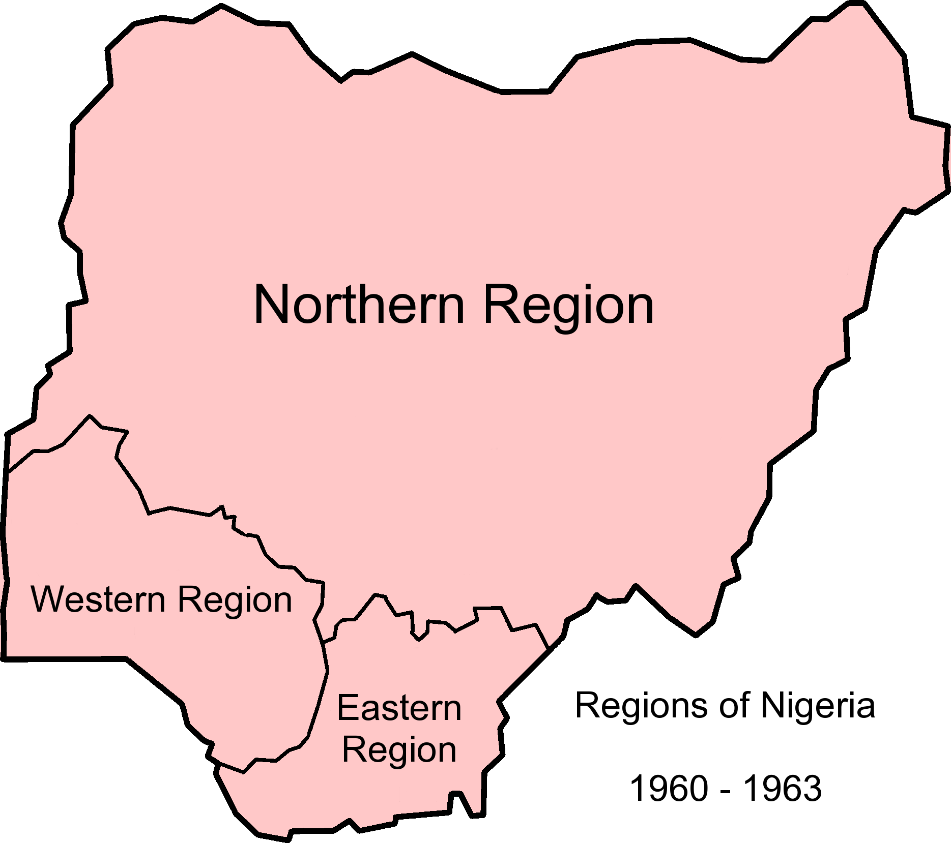
The former Western State of Nigeria was formed in 1967 when the Western Region was subdivided into the states of Lagos and Western State. Its capital was Ibadan, which was the capital of the old region. In 1976, the state was subdivided into three new states, Ogun, Ondo and Oyo. The region now consist of nine states, across three geopolitical zones: Delta, Edo, Ekiti, Kwara, Lagos, Ogun, Ondo, Osun, and Oyo States. Oyo State is the largest state in South West. It covers an area of 28,454km2. Lagos Lagos (Nigerian English: ; ) is the largest city in Nigeria and the List of cities in Africa by population, second most populous city in Africa, with a population of 15.4 million as of 2015 within the city proper. Lagos was the national ca ... can be said to be the most prominent state with over 20 million people residing therein. See also * 18-1900s Yoruba country References Further reading * Former Nigerian administrative divisions States and territories e ... [...More Info...] [...Related Items...] OR: [Wikipedia] [Google] [Baidu] |
Nigeria
Nigeria ( ), , ig, Naìjíríyà, yo, Nàìjíríà, pcm, Naijá , ff, Naajeeriya, kcg, Naijeriya officially the Federal Republic of Nigeria, is a country in West Africa. It is situated between the Sahel to the north and the Gulf of Guinea to the south in the Atlantic Ocean. It covers an area of , and with a population of over 225 million, it is the most populous country in Africa, and the world's sixth-most populous country. Nigeria borders Niger in the north, Chad in the northeast, Cameroon in the east, and Benin in the west. Nigeria is a federal republic comprising of 36 states and the Federal Capital Territory, where the capital, Abuja, is located. The largest city in Nigeria is Lagos, one of the largest metropolitan areas in the world and the second-largest in Africa. Nigeria has been home to several indigenous pre-colonial states and kingdoms since the second millennium BC, with the Nok civilization in the 15th century BC, marking the first ... [...More Info...] [...Related Items...] OR: [Wikipedia] [Google] [Baidu] |
States Of Nigeria
Nigeria is a federation of 36 states and 1 federal capital territory. Each of the 36 states is a semi-autonomous political unit that shares powers with the federal government as enumerated under the Constitution of Nigeria, Constitution of the Federal Republic of Nigeria. The Federal Capital Territory (Nigeria), Federal Capital Territory (FCT), is the capital territory of Nigeria, and it is in this territory that the capital city of Abuja is located. The FCT is not a state but is administered by elected officials who are supervised by the federal government. Each state is subdivided into Local government areas of Nigeria, local government areas (LGAs). There are 774 local governments in Nigeria. Under the constitution, the 36 states are co-equal but not supreme because sovereignty resides with the federal government. The constitution can be amended by the National Assembly (Nigeria), National Assembly, but each amendment must be ratified by two-thirds of the 36 states of the feder ... [...More Info...] [...Related Items...] OR: [Wikipedia] [Google] [Baidu] |
List Of Nigerian States By Human Development Index
This article presents two lists of Nigerian states by Human Development Index (HDI), including the Federal Capital Territory. The first list from the Radboud University Nijmegen ranks the states by the international HDI-methology. The second list ranks the states by an own methology from the United Nations Development Programme. List (2019, Radboud University) Nigerian states by Human Development Index as of 2019, including the Federal Capital Territory. A country with a comparable value in the same year is also listed. List (2016, UNDP) Nigerian states by Human Development Index as of 2016, including the Federal Capital Territory A territory is an area of land, sea, or space, particularly belonging or connected to a country, person, or animal. In international politics, a territory is usually either the total area from which a state may extract power resources or a .... References {{DEFAULTSORT:Nigerian states by Human Development Index Ranked lists of ... [...More Info...] [...Related Items...] OR: [Wikipedia] [Google] [Baidu] |
Human Development Index
The Human Development Index (HDI) is a statistic composite index of life expectancy, education (mean years of schooling completed and expected years of schooling upon entering the education system), and per capita income indicators, which is used to rank countries into four tiers of human development. A country scores a higher level of HDI when the lifespan is higher, the education level is higher, and the gross national income GNI (PPP) per capita is higher. It was developed by Pakistani economist Mahbub ul Haq and was further used to measure a country's development by the United Nations Development Programme (UNDP)'s Human Development Report Office. The 2010 Human Development Report introduced an Inequality-adjusted Human Development Index (IHDI). While the simple HDI remains useful, it stated that "the IHDI is the actual level of human development (accounting for inequality), while the HDI can be viewed as an index of 'potential' human development (or the maximum l ... [...More Info...] [...Related Items...] OR: [Wikipedia] [Google] [Baidu] |


