|
Odin's Raven
''Odin's Raven'' is a 2/3 scale Viking ship replica, replica of the Gokstad ship, which was sailed from Trondheim to Peel, Isle of Man, by a joint Manx people, Manx and Norwegians, Norwegian crew. The project formed part of the 1979 Tynwald#History of Tynwald, Manx Millennium Celebrations, and was conceived and planned by local businessman Robin Bigland. People > 'In the company of Vikings', 04/08/2009; Archived 13/11/2014">BBC > Isle of Man > People > 'In the company of Vikings', 04/08/2009; Archived 13/11/2014''bbc.co.uk/isleofman'', Accessed 12 May 2017 Technical details ''Odin's Raven'' is in length, Beam (nautical), beam, and Draft (hull), draft to keel, ( draft to steering oar). She was built at Rød Båtbyggeri, Fredrikstad, Elingaardskilen, near the entrance to Oslofjord. Technical advice was obtained from Alan Binns of Hull University, who sailed for the first half of the voyage; Eric Rudstrom, a fembøring sailor; and Rolf Hansen, who had extensive experience of saili ... [...More Info...] [...Related Items...] OR: [Wikipedia] [Google] [Baidu] |
Viking Ship Replica
Viking ship replicas are one of the more common types of ship replica. ''Viking'', the very first Viking ship replica, was built by the Rødsverven shipyard in Sandefjord, Norway. In 1893 it sailed across the Atlantic Ocean to Chicago in the United States for the World's Columbian Exposition. Formerly located in Lincoln Park, Chicago, Illinois, the ''Viking'' is currently undergoing conservation in Geneva, Illinois, United States. There are a considerable number of modern reconstructions of Viking Age ships in service around Northern Europe and North America. The Viking Ship Museum in Roskilde, Denmark, has been particularly prolific in building accurate reconstructions of archaeological finds in its collection. Europe Denmark * ''Freja Byrding'' - Hejlsminde, Denmark (, 5-8 persons, Skuldelev ships 3) * ''Havhingsten fra Glendalough'' ("Sea Stallion from Glendalough") - Roskilde, Denmark, 2004 (, 60-100 persons, Skuldelev ships 2) * ''Heidrun'' - Skælskør * ''Helge As ... [...More Info...] [...Related Items...] OR: [Wikipedia] [Google] [Baidu] |
Ålesund
Ålesund () sometimes spelled Aalesund in English, is a municipality in Møre og Romsdal County, Norway. It is part of the traditional district of Sunnmøre and the centre of the Ålesund Region. The town of Ålesund is the administrative centre of Ålesund Municipality, as well as the principal shipping town of the Sunnmøre district. The town is a sea port and is noted for its concentration of Art Nouveau architecture. Although sometimes internationally spelled by its older name ''Aalesund'', this spelling is obsolete in Norwegian. However, the local football club Aalesunds FK still carries that spelling, having been founded before the official change. The municipality is the 184th largest by area out of the 356 municipalities in Norway. Ålesund is the 13th most populous municipality in Norway with a population of 67,114. The municipality's population density is and its population has increased by 9.9% over the previous 10-year period. General information In 1793, t ... [...More Info...] [...Related Items...] OR: [Wikipedia] [Google] [Baidu] |
Tobermory, Mull
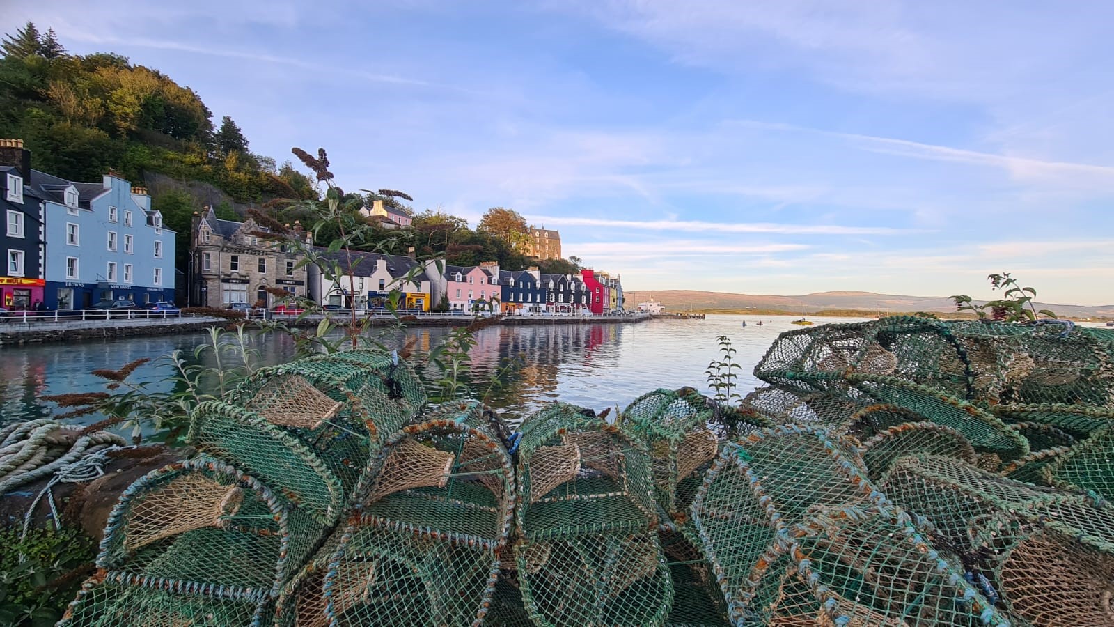
Tobermory (; gd, Tobar Mhoire) is the capital of, and until 1973 the only burgh on, the Isle of Mull in the Scottish Inner Hebrides. It is located on the east coast of Mishnish, the most northerly part of the island, near the northern entrance of the Sound of Mull. The village was founded as a fishing port in 1788; its layout was based on the designs of Dumfriesshire engineer Thomas Telford. It has a current population of about 1,000. Etymology The name ''Tobermory'' is derived from the Gaelic ', meaning "Mary's well". The name refers to a well located nearby which was dedicated in ancient times to the Virgin Mary. Prehistory and archaeology Archaeological Excavations have taken place at Baliscate just outside of the town. The site was first noted by Hylda Marsh and Beverley Langhorn as part of the Scotland's Rural Past. In 2009, it was partially excavated Time Team and a further longer excavation took place in 2012 as part of a community archaeology project through the Mul ... [...More Info...] [...Related Items...] OR: [Wikipedia] [Google] [Baidu] |
Kyle Of Lochalsh
Kyle of Lochalsh (from the Scottish Gaelic, Gaelic ''Caol Loch Aillse'', "strait of the foaming loch") is a village in the historic county of Ross-shire on the northwest coast of Scotland, located around west-southwest of Inverness. It is located on the Lochalsh peninsula, at the entrance to Loch Alsh, opposite the village of Kyleakin on the Isle of Skye. A ferry used to connect the two villages until it was replaced by the Skye Bridge, about to the west, in 1995. Geography The village is the transport and shopping centre for the area as well as having a harbour and marina with pontoons for maritime visitors. The Plock offers a local woodland hike and viewpoint over the peninsula. The Plock was formerly home to a golf course. It is owned by the Kyle of Lochalsh Community Trust, who also own the adjacent building which was formerly the toll building for the Skye Bridge. The surrounding scenery and wildlife are regarded as attractions of the village, as is the slow pace of lif ... [...More Info...] [...Related Items...] OR: [Wikipedia] [Google] [Baidu] |
Skye
The Isle of Skye, or simply Skye (; gd, An t-Eilean Sgitheanach or ; sco, Isle o Skye), is the largest and northernmost of the major islands in the Inner Hebrides of Scotland. The island's peninsulas radiate from a mountainous hub dominated by the Cuillin, the rocky slopes of which provide some of the most dramatic mountain scenery in the country. Slesser (1981) p. 19. Although has been suggested to describe a winged shape, no definitive agreement exists as to the name's origins. The island has been occupied since the Mesolithic period, and over its history has been occupied at various times by Celtic tribes including the Picts and the Gaels, Scandinavian Vikings, and most notably the powerful integrated Norse-Gaels clans of MacLeod and MacDonald. The island was considered to be under Norwegian suzerainty until the 1266 Treaty of Perth, which transferred control over to Scotland. The 18th-century Jacobite risings led to the breaking-up of the clan system and later clearanc ... [...More Info...] [...Related Items...] OR: [Wikipedia] [Google] [Baidu] |
Portree
Portree (; gd, Port Rìgh, ) is the largest town on, and capital of, the Isle of Skye in the Inner Hebrides of Scotland. Murray, W.H. (1966) ''The Hebrides''. London. Heinemann. Pages 154-155. It is the location for the only secondary school on the island, Portree High School. Public transport services are limited to buses. Portree has a harbour, fringed by cliffs, with a pier designed by Thomas Telford. Attractions in the town include the Aros centre which celebrates the island's Gaelic heritage. Further arts provision is made through arts organisation ATLAS Arts, a Creative Scotland regularly-funded organisation. The town also serves as a centre for tourists exploring the island.Haswell-Smith, Hamish. (2004) ''The Scottish Islands''. Edinburgh. Canongate. Pages 173-4 Around 939 people (37.72% of the population) can speak Scottish Gaelic. The A855 road leads north out of the town, passing through villages such as Achachork, Staffin and passes the rocky landscape of the Sto ... [...More Info...] [...Related Items...] OR: [Wikipedia] [Google] [Baidu] |
Stornoway
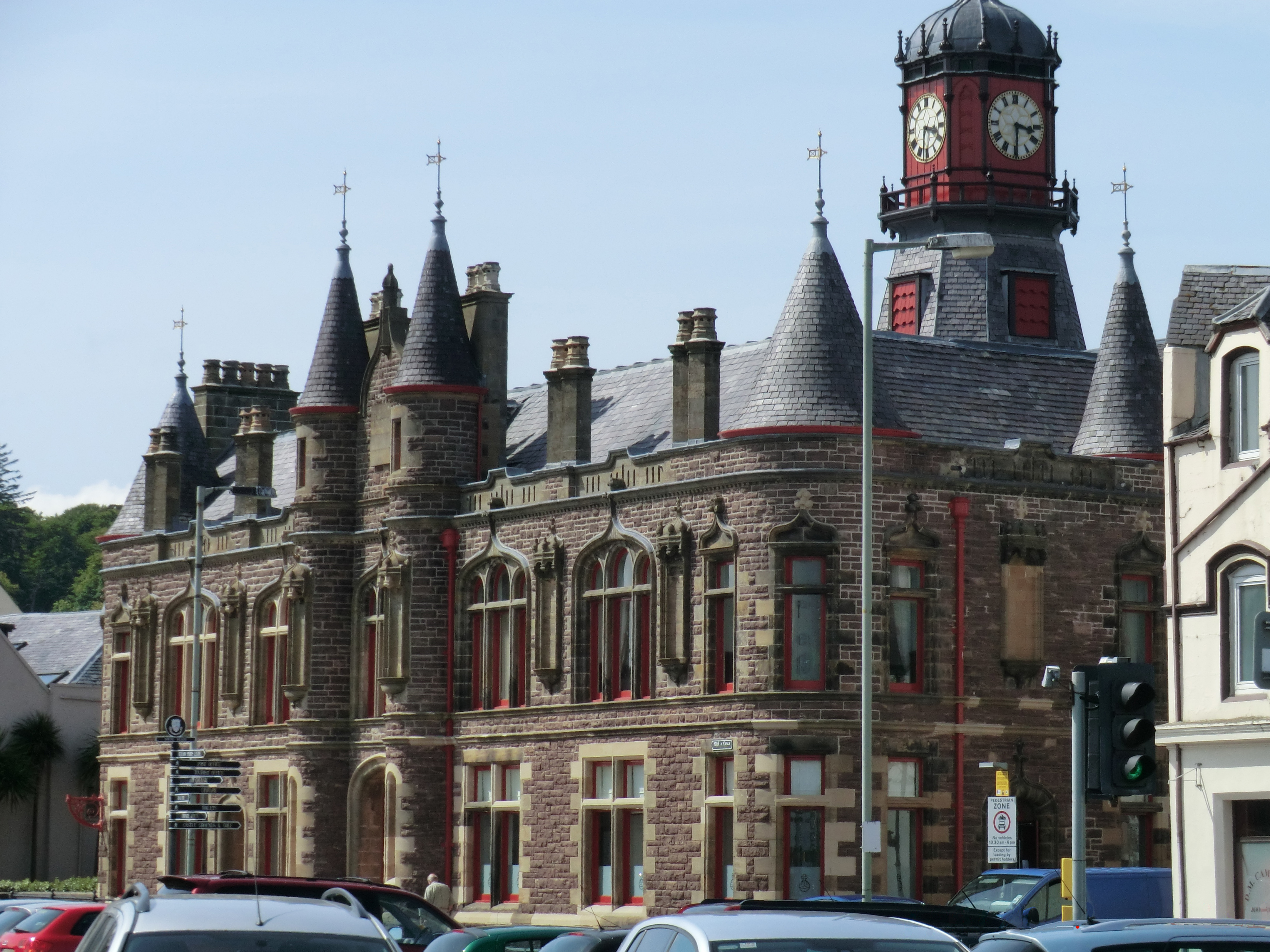
Stornoway (; gd, Steòrnabhagh; sco, Stornowa) is the main town of the Western Isles and the capital of Lewis and Harris in Scotland. The town's population is around 6,953, making it by far the largest town in the Outer Hebrides, as well as the third largest island town in Scotland after Kirkwall in Orkney and Lerwick in Shetland. The traditional civil parish of Stornoway, which includes various nearby villages, has a combined population of just over 10,000. The Comhairle nan Eilean Siar measures population in a different area: the ''Stornoway settlement'' area, Laxdale, Sandwick and Newmarket; in 2019, the estimated population for this area was 6,953. Stornoway is an important port and the major town and administrative centre of the Outer Hebrides. It is home to ''Comhairle nan Eilean Siar'' (the Western Isles Council) and a variety of educational, sporting and media establishments. Until relatively recently, observance of the Christian Sabbath (Sunday) has been associate ... [...More Info...] [...Related Items...] OR: [Wikipedia] [Google] [Baidu] |
Isle Of Lewis
The Isle of Lewis ( gd, Eilean Leòdhais) or simply Lewis ( gd, Leòdhas, ) is the northern part of Lewis and Harris, the largest island of the Western Isles or Outer Hebrides archipelago in Scotland. The two parts are frequently referred to as if they were separate islands. The total area of Lewis is . Lewis is, in general, the lower-lying part of the island: the other part, Harris, is more mountainous. Due to its larger area and flatter, more fertile land, Lewis contains three-quarters of the population of the Western Isles, and the largest settlement, Stornoway. The island's diverse habitats are home to an assortment of flora and fauna, such as the golden eagle, red deer and seal, and are recognised in a number of conservation areas. Lewis has a Presbyterian tradition and a rich history. It was once part of the Norse Kingdom of the Isles. Today, life is very different from elsewhere in Scotland, with Sabbath observance, the Scottish Gaelic language and peat cutting retainin ... [...More Info...] [...Related Items...] OR: [Wikipedia] [Google] [Baidu] |
Point (Outer Hebrides)
Point ( gd, An Rubha), also known as the Eye Peninsula, is a peninsula some 11 km long in the Outer Hebrides (or Western Isles), Scotland. The majority of Point is connected to the rest of the Isle of Lewis by a narrow isthmus, one mile in length and at one point barely 100 metres wide. The peninsula is just 6 km east of the regional capital of Stornoway, however the district of Point actually starts at the Parkend estate on Stornoway's outskirts. Point is home to around 2,600 people and is one of the few districts of the Western Isles where the population is increasing. There are about 17 villages and hamlets in Point: (listed west to east) Melbost (Mealabost) (Including Stornoway Airport), Branahuie (Bràigh na h-Aoidhe), Aignish (Aiginis), Knock (An Cnoc), Swordale (Suardail), Garrabost, Lower Bayble (Pabail Iarach), Eagleton (Baile na h-Iolaire), Upper Bayble (Pabail Uarach), Shulishader (Sulaisiader, usually referred to as Shader), Sheshader (Seisiader), Flesherin ... [...More Info...] [...Related Items...] OR: [Wikipedia] [Google] [Baidu] |
Sule Skerry
Sule Skerry is a remote skerry in the North Atlantic off the north coast of Scotland. Geography Sule Skerry lies west of the Orkney Mainland at . Sule Skerry's sole neighbour, Sule Stack, lies to the southwest; the remote islands of Rona and Sula Sgeir lie approximately further west. Sule Skerry and Sule Stack are both a part of the Orkney Islands council area. Sule Skerry is in area and about long. It reaches a height of . Pub. 141, Scotland. It is formed of |
Rousay
Rousay (, sco, Rousee; non, Hrólfsey meaning Rolf's Island) is a small, hilly island about north of Mainland, the largest island in the Orkney Islands of Scotland. It has been nicknamed "Egypt of the north", due to its archaeological diversity and importance. Like its neighbours Egilsay and Wyre, it can be reached by ro-ro ferry from Tingwall. This service is operated by Orkney Ferries, and can take up to 95 passengers (reduced to 50 in winter), and 10 cars. The ferry links the islands of Rousay, Egilsay, and Wyre with each other, and with the mainland of Orkney. Demographics In the 2001 census, Rousay had a population of 212. Most employment is in farming, fishing or fish-farming; craft businesses and seasonal tourism-related work are present. Geography and natural history It is separated from mainland Orkney by Eynhallow Sound. One road circles the island, about long, and most arable land lies in the few hundred yards between it and the coastline. With an area of ... [...More Info...] [...Related Items...] OR: [Wikipedia] [Google] [Baidu] |
Kirkwall
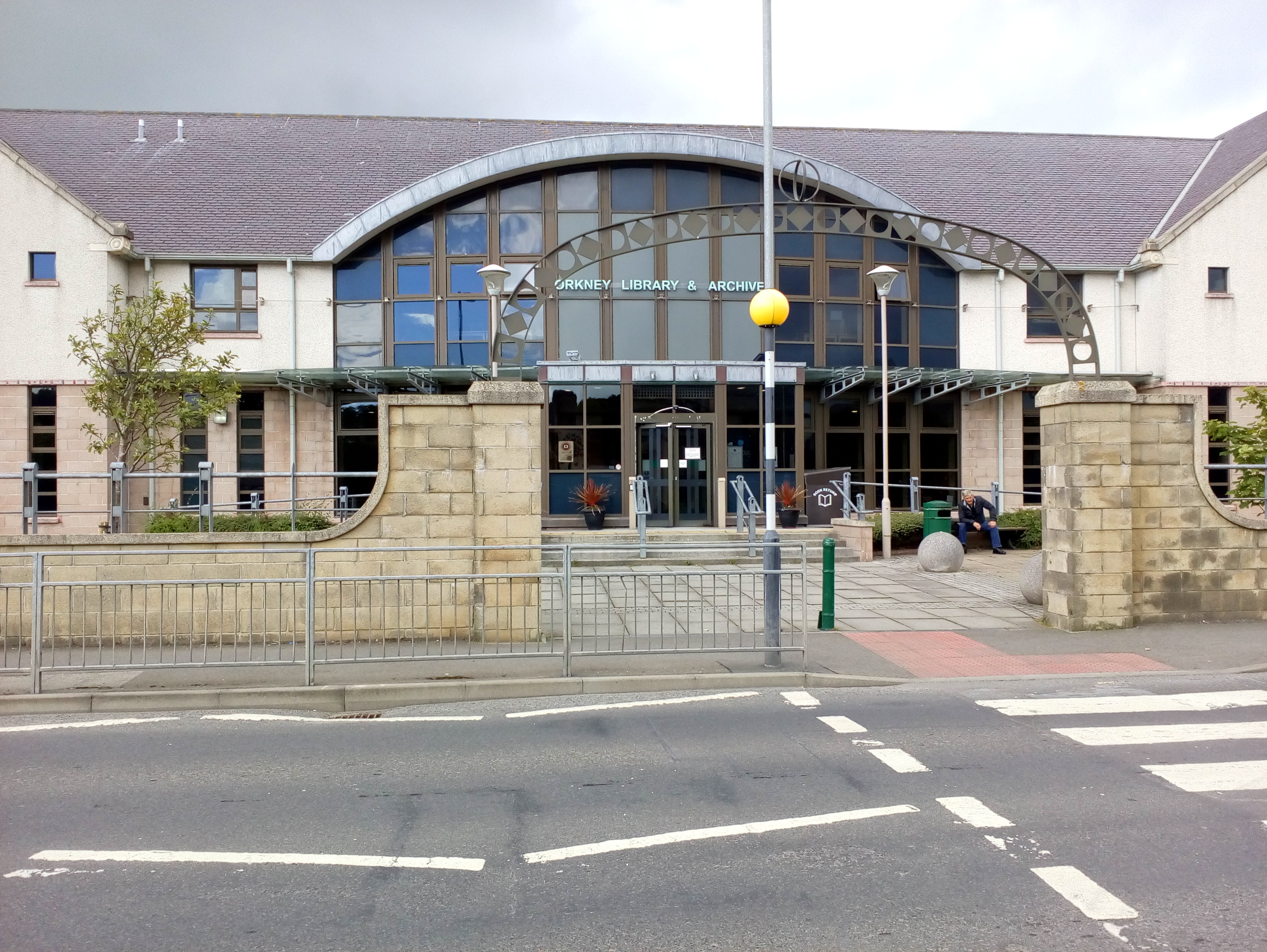
Kirkwall ( sco, Kirkwaa, gd, Bàgh na h-Eaglaise, nrn, Kirkavå) is the largest town in Orkney, an archipelago to the north of mainland Scotland. The name Kirkwall comes from the Norse name (''Church Bay''), which later changed to ''Kirkvoe'', ''Kirkwaa'' and ''Kirkwall''. Kirkwall was formerly the site of an ancient Norse town founded approximately 1000 years ago. Today, it is a transport hub with ferries to many locations. History The town was first mentioned in in the year 1046, when it was recorded as the residence of , the Earl of Orkney, who was killed by his uncle Thorfinn the Mighty. In 1486, King James III of Scotland elevated Kirkwall to the status of a royal burgh. On the western edge of the town, surrounded by Hatston Industrial Estate, there is a prehistoric monument, known as the "Grain Earth House" (see Historic Scotland). It is a short, low, stone-walled passage, deep underground, leading to a small pillared chamber. This kind of earth house (or "souterrai ... [...More Info...] [...Related Items...] OR: [Wikipedia] [Google] [Baidu] |


.jpg)


