|
Odenbach
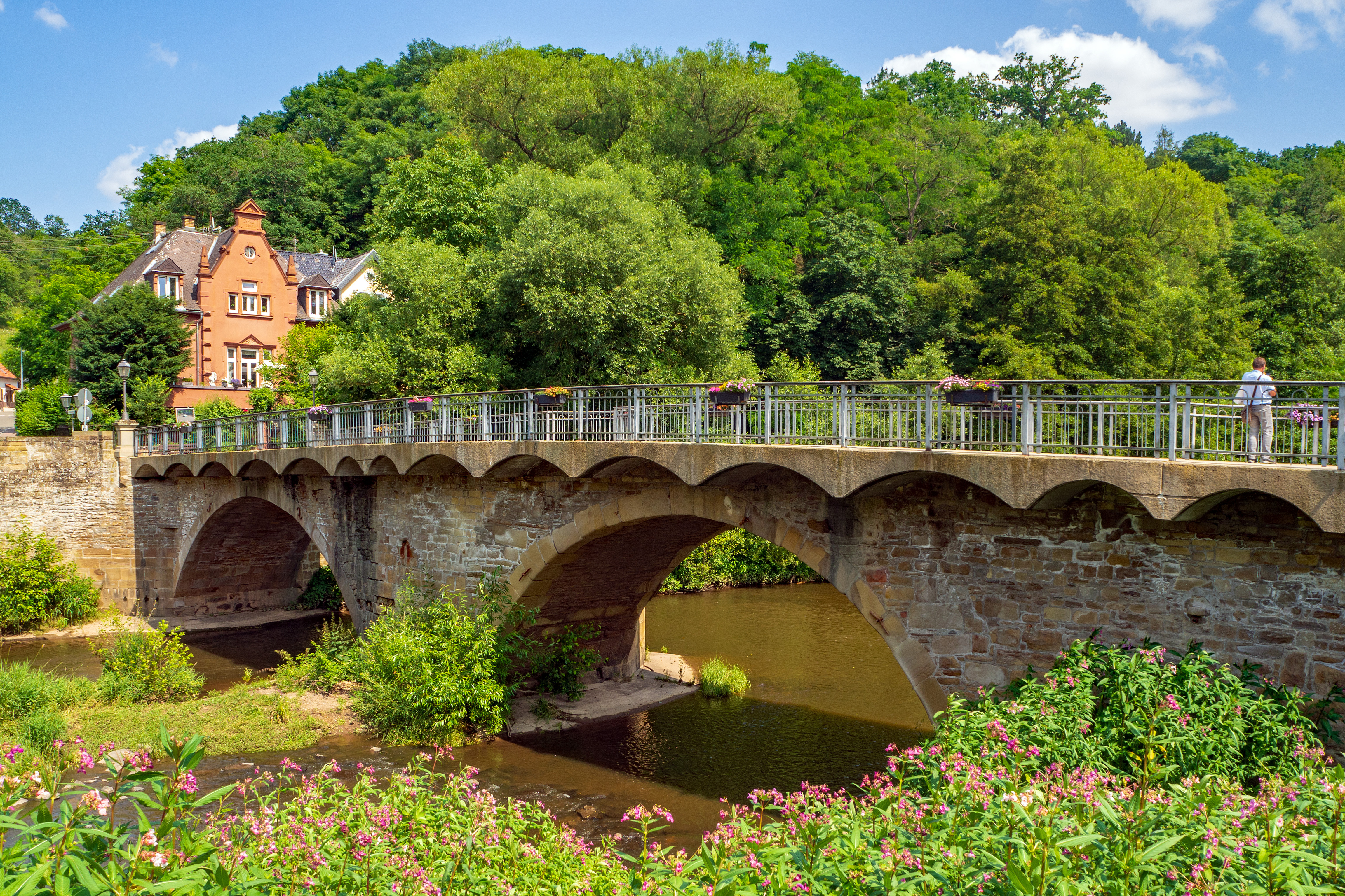
Odenbach is an ''Ortsgemeinde'' – a municipality belonging to a ''Verbandsgemeinde'', a kind of collective municipality – in the Kusel district in Rhineland-Palatinate, Germany. It belongs to the ''Verbandsgemeinde'' Lauterecken-Wolfstein. Geography Location The municipality lies northeast of Lauterecken at the mouth of its eponymous river, the Odenbach, where it empties into the river Glan in the North Palatine Uplands. Odenbach also lies on ''Bundesstraße'' 420. The village lies on both sides of the Glan where the valley floor's elevation is 155 m above sea level. The valleys are squeezed somewhat into a narrow gap by various mountains. Foremost of these on the Glan's left bank are the Bennerberg (308 m) and the Bornberg with its outliers stretching towards Meisenheim, while on the right bank are the Galgenberg (326 m above sea level) and the Hagelkreuz (357 m). Furthermore, in the gore formed by the Glan and Odenbach is the plateau of the Hellerwald a ... [...More Info...] [...Related Items...] OR: [Wikipedia] [Google] [Baidu] |
Odenbach (Glan)
The Odenbach is a orographically right bank tributary of the Glan in the counties of Kaiserslautern and Kusel in the German state of Rhineland-Palatinate. Geography Course The Odenbach rises about north of Kaiserslautern in the North Palatine Uplands near the hamlet of Sonnenhof. It flows – mainly in a north-northwesterly direction – through the municipalities of Schneckenhausen, Schallodenbach and Niederkirchen in the county of Kaiserslautern and through Hefersweiler, Reipoltskirchen, Ginsweiler and Adenbach in the county of Kusel, before emptying into the Glan in the eponymous village of Odenbach after a distance of just under 23 kilometres. Catchment The catchment of the Odenbach covers an area of and consist of 50% arable land, 25.6% pasture, 20.2% woodland and 4.2% settlements. [...More Info...] [...Related Items...] OR: [Wikipedia] [Google] [Baidu] |
Adenbach
Adenbach is an ''Ortsgemeinde'' – a municipality belonging to a ''Verbandsgemeinde'', a kind of collective municipality – in the Kusel district in Rhineland-Palatinate, Germany. It belongs to the ''Verbandsgemeinde'' Lauterecken-Wolfstein. Geography Location The municipality lies in the Odenbach valley in the North Palatine Uplands in the Western Palatinate. The municipal area measures 294 ha, of which 20 ha is wooded and 10 ha is settled. Neighbouring municipalities Adenbach borders in the northwest and north on the municipality of Odenbach, in the east and southeast on the municipality of Becherbach, in the south on the municipality of Ginsweiler and in the southwest on the municipality of Cronenberg. Constituent communities Adenbach's ''Ortsteile'' are the main village site, also called Adenbach, and the outlying homesteads of Brühlerhof, Langwiesenhof, Bornweiderhof and Brucherhof. Municipality’s layout On the east side of the north-south thoroughf ... [...More Info...] [...Related Items...] OR: [Wikipedia] [Google] [Baidu] |
Medard
Medard () is an ''Ortsgemeinde'' – a Municipalities of Germany, municipality belonging to a ''Verbandsgemeinde'', a kind of collective municipality – in the Kusel (district), Kusel Districts of Germany, district in Rhineland-Palatinate, Germany. It belongs to the Lauterecken-Wolfstein, ''Verbandsgemeinde'' Lauterecken-Wolfstein. Geography Location The municipality lies on the river Glan (Nahe), Glan in the Western Palatinate (region), Palatinate at an elevation of some 160 m above sea level, mainly on the river's left bank for a stretch of about a kilometre towards the northeast. The elevations around the village reach heights of roughly 300 m above sea level (Ohlbachskopf 316 m, Marialskopf 290 m). The municipal area measures 599 ha, of which roughly 25 ha is settled and 138 ha is wooded. The village is surrounded by slopes with meadow orchards. From Medard, outings for hikers and canoeists are possible. Neighbouring municipalities Medard b ... [...More Info...] [...Related Items...] OR: [Wikipedia] [Google] [Baidu] |
Reiffelbach
Reiffelbach is an ''Ortsgemeinde'' – a municipality belonging to a ''Verbandsgemeinde'', a kind of collective municipality – in the Bad Kreuznach district in Rhineland-Palatinate, Germany. It belongs to the ''Verbandsgemeinde'' of Meisenheim, whose seat is in the like-named town. Geography Location Reiffelbach, a clump village, lies on the like-named brook, the Reiffelbach, east of the Glan in the North Palatine Uplands. The municipal area measures 446 ha and the village sits at an elevation of 326 m above sea level. Land use Woodlands today occupy more than 100 ha of the municipal area. Until the first afforestation efforts in the 1950s, there were only broadleaf forests in Reiffelbach, with the predominant species being beeches and oaks. Subsequent private afforestation projects were undertaken, on the forestry office's advice, with spruce and Douglas-fir trees. In 1932, the forest in the “Muhl” (rural cadastral area) was cleared and meadows were l ... [...More Info...] [...Related Items...] OR: [Wikipedia] [Google] [Baidu] |
Becherbach (Bad Kreuznach)
Becherbach is an ''Ortsgemeinde'' – a municipality belonging to a ''Verbandsgemeinde'', a kind of collective municipality – in the Bad Kreuznach district in Rhineland-Palatinate, Germany. It belongs to the ''Verbandsgemeinde'' of Meisenheim, whose seat is in the like-named town. Becherbach should not be confused with Becherbach bei Kirn, which lies in the same district. Geography Location Becherbach lies in the Palatinate south of Meisenheim and east of Lauterecken. Nearby towns are the district seat, Bad Kreuznach, which lies 24 km to the northeast, Birkenfeld, lying 35 km to the west and Kaiserslautern, lying 23 km to the south. Neighbouring municipalities Clockwise from the north, Becherbach's neighbours are the municipality of Reiffelbach, the municipality of Schmittweiler (both in the Bad Kreuznach district), the municipality of Waldgrehweiler (in the Donnersbergkreis), the municipality of Nußbach, the municipality of Reipoltskirchen, the municipality ... [...More Info...] [...Related Items...] OR: [Wikipedia] [Google] [Baidu] |
Cronenberg, Rhineland-Palatinate
Cronenberg is an ''Ortsgemeinde'' – a municipality belonging to a ''Verbandsgemeinde'', a kind of collective municipality – in the Kusel district in Rhineland-Palatinate, Germany. It belongs to the ''Verbandsgemeinde'' of Lauterecken-Wolfstein. Geography Location The municipality lies in the North Palatine Uplands in the Western Palatinate on a raised flat-topped ridge between the Sulzbach and Odenbach valleys, at a steep slope dropping off into the Sulzbach valley. Cronenberg lies east of Lauterecken at an elevation of some 280 m above sea level. The Sulzbach itself rises near Hohenöllen and near Medard it empties into the river Glan. The gentle elevations around the village reach up to some 300 m above sea level. The municipal area measures 265 ha, of which roughly 2.5 ha is settled and 80 ha is wooded. Neighbouring municipalities Cronenberg borders in the northeast on the municipalities of Adenbach and Odenbach, in the east on the municipality o ... [...More Info...] [...Related Items...] OR: [Wikipedia] [Google] [Baidu] |
Lauterecken
Lauterecken () is a town in the Kusel district in Rhineland-Palatinate, Germany. It is the seat of the ''Verbandsgemeinde'' Lauterecken-Wolfstein, to which it also belongs. Lauterecken bears the nickname ''Veldenzstadt'', after the comital family that once held sway here. It is also a state-recognized tourism resort town, and in terms of state planning is laid out as a lower centre. Geography Location The town lies in the North Palatine Uplands in a hollow at the mouth of the Lauter, where it empties into the Glan, and likewise at the mouth of the Grumbach, which also empties into the Glan. Lauterecken lies at an elevation of some 170 m above sea level. Elevations on each side of the dales mostly reach some 300 m above sea level, with the highest elevation being found at the peak known as die Platt (322 m above sea level). Lauterecken is found roughly 20 km northeast of Kusel, and 25 km northwest of Kaiserslautern. The municipal area measures 893 ha, ... [...More Info...] [...Related Items...] OR: [Wikipedia] [Google] [Baidu] |
Meisenheim
Meisenheim () is a town in the Bad Kreuznach (district), Bad Kreuznach Districts of Germany, district in Rhineland-Palatinate, Germany. It belongs to the Meisenheim (Verbandsgemeinde), like-named ''Verbandsgemeinde'', and is also its seat. Meisenheim is a state-recognized recreational resort (''Erholungsort'') and it is set out as a Central place theory, middle centre in state planning. Geography Location Meisenheim lies in the valley of the River Glan (Nahe), Glan at the northern edge of the North Palatine Uplands. The municipal area measures 1 324 ha. Neighbouring municipalities Clockwise from the north, Meisenheim's neighbours are Raumbach, Rehborn, Callbach, Reiffelbach, Odenbach, Breitenheim and Desloch, all of which likewise lie within the Bad Kreuznach district, except for Odenbach, which lies in the neighbouring Kusel (district), Kusel district. Constituent communities Also belonging to Meisenheim are the outlying homesteads of Hof Wieseck, Keddarterhof and ... [...More Info...] [...Related Items...] OR: [Wikipedia] [Google] [Baidu] |
Glan (Nahe)
The Glan () is a river in southwestern Germany, right tributary of the Nahe. It is approximately long. It rises in the Saarland, northwest of Homburg. It flows generally north, through Rhineland-Palatinate, and empties into the Nahe near Odernheim am Glan, at Staudernheim, across the Nahe from Bad Sobernheim. Other towns along the Glan are Altenglan, Glan-Münchweiler, Lauterecken and Meisenheim. Etymology The Celtic root of the name comes either from ''glann'' (shining) or from '' glen'' (U-shaped valley). See also *List of rivers of Saarland *List of rivers of Rhineland-Palatinate A list of rivers of Rhineland-Palatinate, Germany: A * Aar * Adenauer Bach * Ahr * Alf * Alfbach *Appelbach *Asdorf * Aubach B * Birzenbach *Blattbach * Breitenbach * Brexbach * Brohlbach, tributary of the Moselle * Brohlbach, tributary of the ... References Rivers and lakes of Western Palatinate Rivers of Saarland North Palatinate Rivers of Germany {{RhinelandPalatinate- ... [...More Info...] [...Related Items...] OR: [Wikipedia] [Google] [Baidu] |
Lauterecken-Wolfstein
Lauterecken-Wolfstein is a ''Verbandsgemeinde'' ("collective municipality") in the district of Kusel, Rhineland-Palatinate, Germany. The seat of the ''Verbandsgemeinde'' is in Lauterecken. It was formed on 1 July 2014 by the merger of the former ''Verbandsgemeinden'' Lauterecken Lauterecken () is a town in the Kusel district in Rhineland-Palatinate, Germany. It is the seat of the ''Verbandsgemeinde'' Lauterecken-Wolfstein, to which it also belongs. Lauterecken bears the nickname ''Veldenzstadt'', after the comital family t ... and Wolfstein. The ''Verbandsgemeinde'' Lauterecken-Wolfstein consists of the following ''Ortsgemeinden'' ("local municipalities"): External links Official website Verbandsgemeinde in Rhineland-Palatinate {{RhinelandPalatinate-geo-stub ... [...More Info...] [...Related Items...] OR: [Wikipedia] [Google] [Baidu] |
Kusel (district)
Kusel () is a district (''Kreis'') in the south of Rhineland-Palatinate, Germany. Neighboring districts are (from north-west clockwise) Birkenfeld, Bad Kreuznach, Donnersbergkreis, Kaiserslautern, Saarpfalz and Sankt Wendel (the last two belonging to the state of Saarland). History The district of Kusel was created at the beginning of the 19th century. In 1939 it was renamed as ''Landkreis Kusel''. The boundary was altered slightly as part of the communal reform of 1969/72 with some parts of the district of Birkenfeld being added to Kusel. Geography The district of Kusel lies in the North Palatine Uplands (''Nordpfälzer Bergland''), to the north of the industrial areas of the Saarland. The largest rivers are the Lauter (also called the Waldlauter, to distinguish it from other rivers in German-speaking Europe named Lauter) and the Glan. Coat of arms The German blazon reads: ''Gespalten: Vorne in Schwarz ein linksgewendeter, rot bewehrter goldener Löwe, hinten in Silber ein ... [...More Info...] [...Related Items...] OR: [Wikipedia] [Google] [Baidu] |
First World War
World War I (28 July 1914 11 November 1918), often abbreviated as WWI, was one of the deadliest global conflicts in history. Belligerents included much of Europe, the Russian Empire, the United States, and the Ottoman Empire, with fighting occurring throughout Europe, the Middle East, Africa, the Pacific, and parts of Asia. An estimated 9 million soldiers were killed in combat, plus another 23 million wounded, while 5 million civilians died as a result of military action, hunger, and disease. Millions more died in genocides within the Ottoman Empire and in the 1918 influenza pandemic, which was exacerbated by the movement of combatants during the war. Prior to 1914, the European great powers were divided between the Triple Entente (comprising France, Russia, and Britain) and the Triple Alliance (containing Germany, Austria-Hungary, and Italy). Tensions in the Balkans came to a head on 28 June 1914, following the assassination of Archduke Franz Ferdina ... [...More Info...] [...Related Items...] OR: [Wikipedia] [Google] [Baidu] |


