|
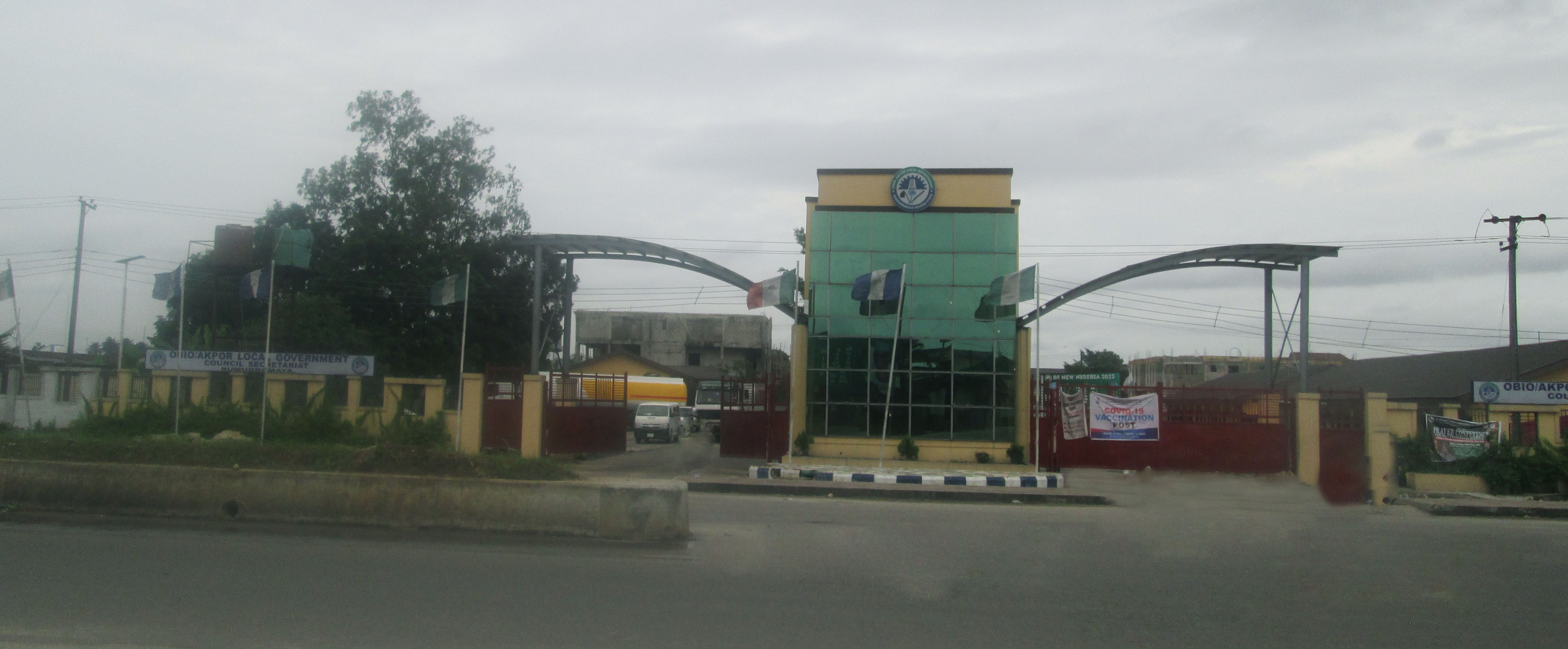
Obio-Akpor I (Assembly Constituency)
Obio-Akpor is a local government area in the metropolis of Port Harcourt, one of the major centres of economic activities in Nigeria, and one of the major cities of the Niger Delta, located in Rivers State. The local government area covers 260 km2 and at the 2006 Census held a population of 464,789. Its postal code or ZIP code is 500102. Obio-Akpor has its headquarters at Rumuodomaya and it is peopled by the Ikwerre Geography Obio-Akpor is bounded by Port Harcourt (local government area) to the south, Oyigbo and Eleme to the east, Ikwerre and Etche to the north, and Emohua to the west. It is located between latitudes 4°45'N and 4°60'N and longitudes 6°50'E and 8°00'E. Climate Geology and relief Covering around 90 sq mi, Obio-Akpor is generally a lowland area with average elevation below 30 metres above sea level. Its geology comprises basically of alluvial sedimentary basin and basement complex. The thick mangrove forest, raffia palms and light rainforest are t ... [...More Info...] [...Related Items...] OR: [Wikipedia] [Google] [Baidu] |
Port Harcourt (local Government Area)
Port Harcourt Local Government Area (PHALGA) is a local government area of Rivers State in southern Nigeria. It is one of the 23 local government areas created for the state. Its administrative seat is located in Port Harcourt. Although the local government consists of two different ethnic groups the Ikwerre and Obulom (Abuloma). Geography Port Harcourt local government area is included in the Greater Port Harcourt region. It is situated southeast of Ahoada and about northwest of Bori. It is bounded to the south by Okrika, to the east by Eleme, to the north by Obio-Akpor and to the west by Degema. It has a total size of 109 square kilometres (42 sq mi). Towns, urban communities and neighbourhoods * Azuabie Town * Abuloma * Agip * Amadi Ama * Borokiri * Bundu Ama * D-line * Diobu * Eagle Island * Elekahia * Fimie Ama * Marine Base * New GRA * Nkpogu * Nkpolu Oroworukwo * Ogbunabali * Old GRA * Old Port Harcourt Township * Oroabali * Oroada * Orochiri * Orogbum * Oro ... [...More Info...] [...Related Items...] OR: [Wikipedia] [Google] [Baidu] |
Elelenwo
Elelenwo is a town in the metropolitan area of Port Harcourt, Nigeria, a country in West Africa. It is home to several state-owned media establishments, including Rivers State Television (RSTV) and Radio Rivers. Location Elelenwo shares a border to the south with Eleme, beyond which lies Okrika Island. Otigba and Woji are on the western border, with Trans Amadi lying further west. Oil Mill Market is on the northern border and Rumukoroshe is even further north. Iriebe is on the eastern border and the Oyigbo local government area is east of Iriebe. Overview Elelenwo consists largely of mixed-income apartment buildings, public and privately owned estates, and single-family homes of varying styles. The Elelenwo police station is the only police station in town. Education Elelenwo residents have access to a handful of Port Harcourt public and private schools, including: Public schools *State Primary School *Community Boys Secondary School Private schools *Topline Schools ... [...More Info...] [...Related Items...] OR: [Wikipedia] [Google] [Baidu] |
Choba, Port Harcourt
Choba or Choba, Port Harcourt is a neighbourhood in Port Harcourt, Rivers State, Nigeria. It is located to the northwest of the Port Harcourt central business district, on the eastern bank of the New Calabar River. Choba was originally a Ikwerre village on the outer fringes of Port Harcourt, governed by a paramount king. The current king is Eze Raymond Echendu. As Port Harcourt has expanded Choba has been assimilated into the greater city conurbation. Choba is one of 17 electoral wards administered by the Obio-Akpor Local Government Council The Obio-Akpor Local Government Council is located in Rivers State, Nigeria. It is the governing body for Obio-Akpor, a second-order administrative division. The council was created on 3 May 1989 to handle government at the local level. It performs .... The population in 1991, according to the national census, was 10,968, in 1996 it was estimated to have increased to 12,980, and 27,253 in 2008. It has a straight road which leads to ... [...More Info...] [...Related Items...] OR: [Wikipedia] [Google] [Baidu] |
Ada-George Road
Ada-George Road also known as Ada-George is a town in Rivers State, Port Harcourt, Nigeria. History The name Ada-George Road was originated from the second governor of river state, Rufus Ada George. Geography Ada-George Road is consist of two express way left & right linking to Location Bus stop which has an unfinished project flyover constructed by Julius Berger and Agip Bus stop A bus stop is a place where buses stop for passengers to get on and off the bus. The construction of bus stops tends to reflect the level of usage, where stops at busy locations may have shelters, seating, and possibly electronic passenger .... References {{reflist Towns in Rivers State Obio-Akpor Geography of Port Harcourt ... [...More Info...] [...Related Items...] OR: [Wikipedia] [Google] [Baidu] |
Soil
Soil, also commonly referred to as earth or dirt, is a mixture of organic matter, minerals, gases, liquids, and organisms that together support life. Some scientific definitions distinguish ''dirt'' from ''soil'' by restricting the former term specifically to displaced soil. Soil consists of a solid phase of minerals and organic matter (the soil matrix), as well as a porous phase that holds gases (the soil atmosphere) and water (the soil solution). Accordingly, soil is a three-state system of solids, liquids, and gases. Soil is a product of several factors: the influence of climate, relief (elevation, orientation, and slope of terrain), organisms, and the soil's parent materials (original minerals) interacting over time. It continually undergoes development by way of numerous physical, chemical and biological processes, which include weathering with associated erosion. Given its complexity and strong internal connectedness, soil ecologists regard soil as an ecosystem. Most ... [...More Info...] [...Related Items...] OR: [Wikipedia] [Google] [Baidu] |
Rain
Rain is water droplets that have condensed from atmospheric water vapor and then fall under gravity. Rain is a major component of the water cycle and is responsible for depositing most of the fresh water on the Earth. It provides water for hydroelectric power plants, crop irrigation, and suitable conditions for many types of ecosystems. The major cause of rain production is moisture moving along three-dimensional zones of temperature and moisture contrasts known as weather fronts. If enough moisture and upward motion is present, precipitation falls from convective clouds (those with strong upward vertical motion) such as cumulonimbus (thunder clouds) which can organize into narrow rainbands. In mountainous areas, heavy precipitation is possible where upslope flow is maximized within windward sides of the terrain at elevation which forces moist air to condense and fall out as rainfall along the sides of mountains. On the leeward side of mountains, desert climates can exi ... [...More Info...] [...Related Items...] OR: [Wikipedia] [Google] [Baidu] |
Tropical Rainforest
Tropical rainforests are rainforests that occur in areas of tropical rainforest climate in which there is no dry season – all months have an average precipitation of at least 60 mm – and may also be referred to as ''lowland equatorial evergreen rainforest''. True rainforests are typically found between 10 degrees north and south of the equator (see map); they are a sub-set of the tropical forest biome that occurs roughly within the 28-degree latitudes (in the equatorial zone between the Tropic of Cancer and Tropic of Capricorn). Within the World Wildlife Fund's biome classification, tropical rainforests are a type of tropical moist broadleaf forest (or tropical wet forest) that also includes the more extensive seasonal tropical forests. Overview Tropical rainforests are characterized by two words: hot and wet. Mean monthly temperatures exceed during all months of the year. Average annual rainfall is no less than and can exceed although it typically lies betwe ... [...More Info...] [...Related Items...] OR: [Wikipedia] [Google] [Baidu] |
Raffia Palm
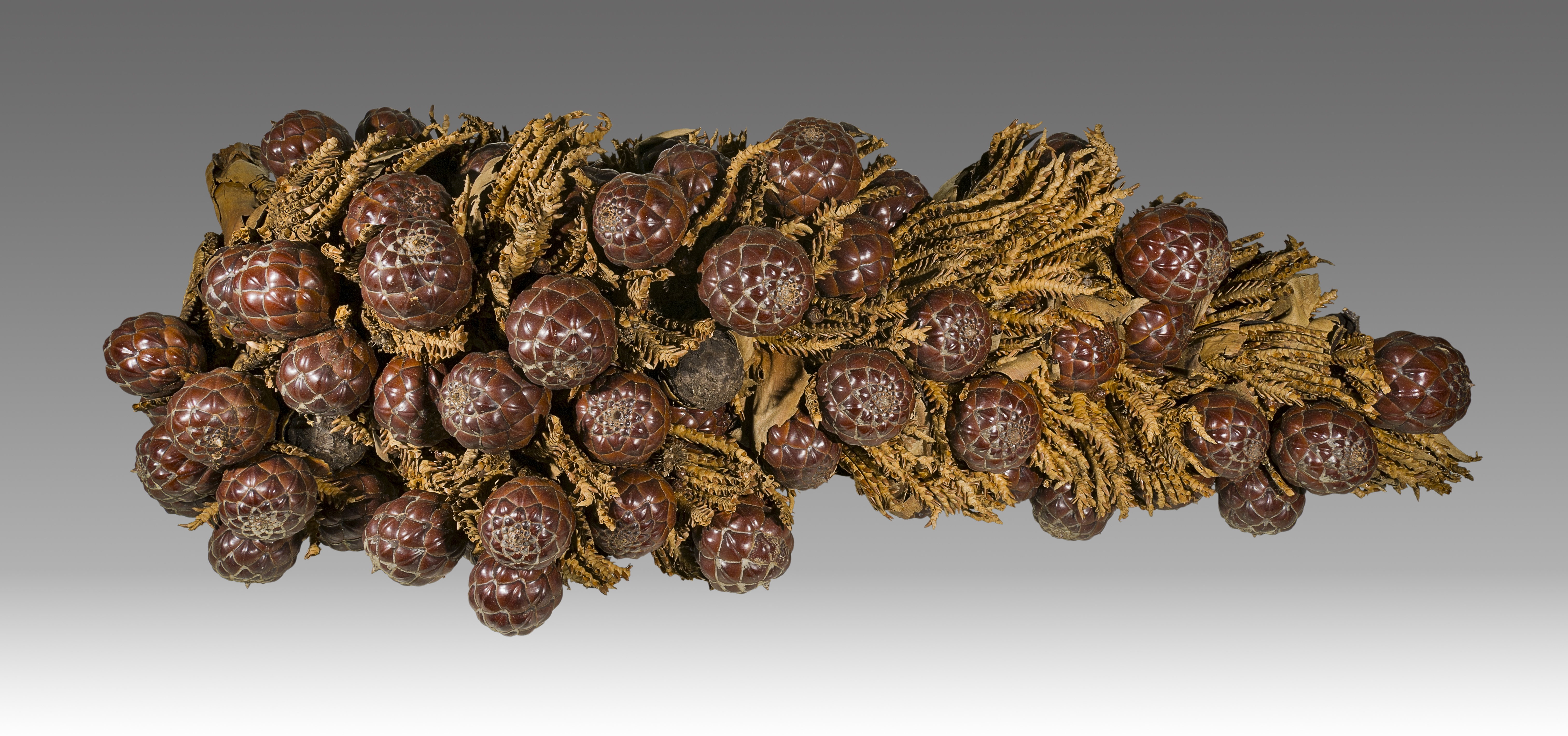
Raffia palms (''Raphia'') are a genus of about twenty species of palms native to tropical regions of Africa, and especially Madagascar, with one species (''R. taedigera'') also occurring in Central and South America. ''R. taedigera'' is the source of raffia fibers, which are the veins of the leaves, and this species produces a fruit called "brazilia pods", "uxi nuts" or "uxi pods". They grow up to tall and are remarkable for their compound pinnate leaves, the longest in the plant kingdom; leaves of ''R. regalis'' up to long and wide are known. The plants are monocarpic, meaning that they flower once and then die after the seeds are mature. Some species have individual stems which die after fruiting, but have a root system which remains alive and sends up new stems which fruit. Cultivation and uses Fiber Raffia fiber is produced from the membrane on the underside of the leaf fronds. The membrane is taken off to create a long thin fiber, which can be rolled together for added ... [...More Info...] [...Related Items...] OR: [Wikipedia] [Google] [Baidu] |
Mangrove Forest
Mangrove forests, also called mangrove swamps, mangrove thickets or mangals, are productive wetlands that occur in coastal intertidal zones. Mangrove forests grow mainly at tropical and subtropical latitudes because mangroves cannot withstand freezing temperatures. There are about 80 different species of mangroves, all of which grow in areas with low-oxygen soil, where slow-moving waters allow fine sediments to accumulate.What is a mangrove forest? National Ocean Service, NOAA. Updated: 25 March 2021. Retrieved: 4 October 2021. Many mangrove forests can be recognised by their dense tangle of prop roots that make the trees appear to be standing on stilts above the water. This tangle of roots allows the trees to handle the daily rise and fall of tides, which means that most mangroves get flooded at least twice per day ... [...More Info...] [...Related Items...] OR: [Wikipedia] [Google] [Baidu] |
Upland And Lowland
Upland and lowland are conditional descriptions of a plain based on elevation above sea level. In studies of the ecology of freshwater rivers, habitats are classified as upland or lowland. Definitions Upland and lowland are portions of plain that are conditionally categorized by their elevation above the sea level. Lowlands are usually no higher than , while uplands are somewhere around to . On unusual occasions, certain lowlands such as the Caspian Depression lie below sea level. Upland habitats are cold, clear and rocky whose rivers are fast-flowing in mountainous areas; lowland habitats are warm with slow-flowing rivers found in relatively flat lowland areas, with water that is frequently colored by sediment and organic matter. These classifications overlap with the geological definitions of "upland" and "lowland". In geology an "upland" is generally considered to be land that is at a higher elevation than the alluvial plain or stream terrace, which are considered t ... [...More Info...] [...Related Items...] OR: [Wikipedia] [Google] [Baidu] |
Emohua
Emohua is a local government area in Rivers State, Nigeria. Its headquarters are in the town of Emohua. Emohua consists of fourteen political wards. Emohua LGA has fertile land that favours primary production such as farming. The presence of water bodies gives room for activities of primary production such as sand dredging and fishing. Furthermore, the presence, popularity and proximity of its markets Market is a term used to describe concepts such as: * Market (economics), system in which parties engage in transactions according to supply and demand * Market economy *Marketplace, a physical marketplace or public market Geography *Märket, a ... favour secondary production such as oil milling, cassava processing rice processing, yam processing, meat processing (abattoir) and wood milling and poultry. Landmarks Rivers State university Emohua Campus (Socal Sciences) It has an area of and a population of 201,901 at the 2006 census. The postal code of the area is 511. Refe ... [...More Info...] [...Related Items...] OR: [Wikipedia] [Google] [Baidu] |


.jpg)

