|
Oberharz
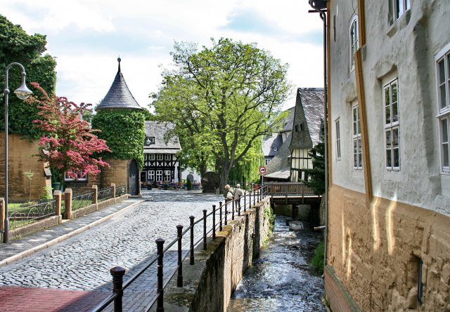
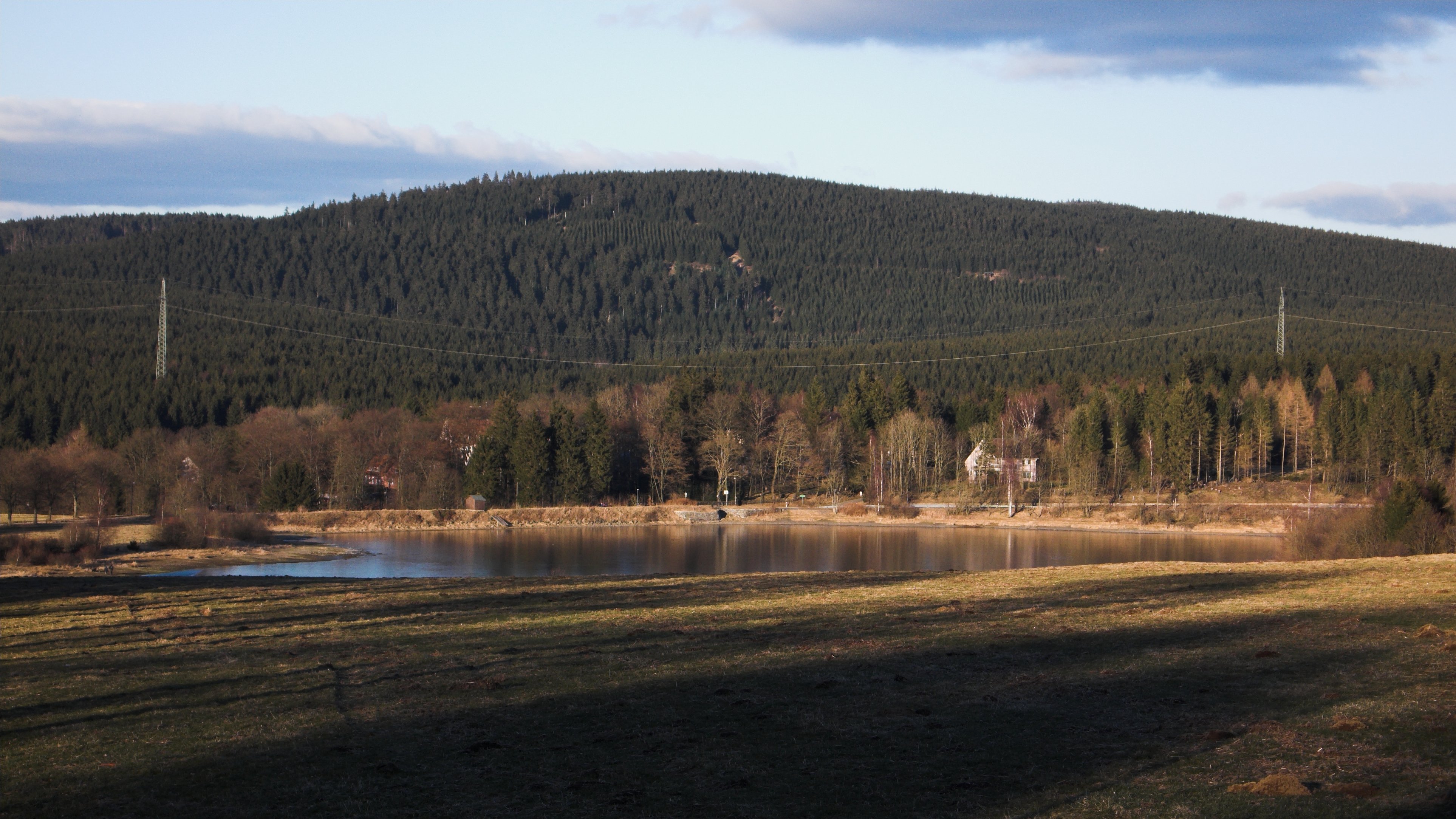
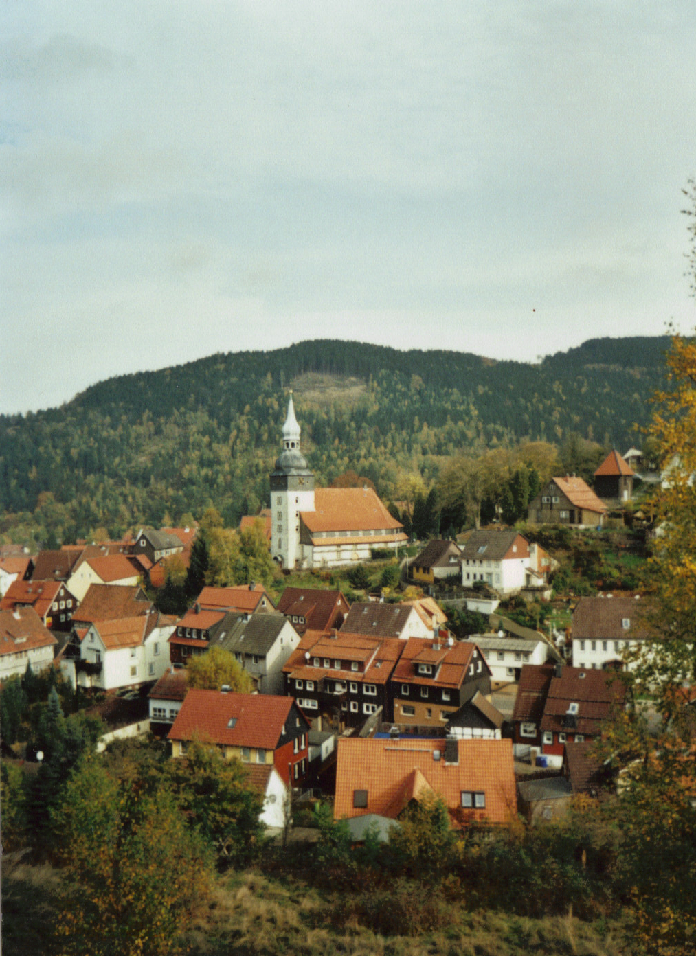
The Upper Harz (german: Oberharz, ) refers to the northwestern and higher part of the Harz mountain range in Germany. The exact boundaries of this geographical region may be defined differently depending on the context. In its traditional sense, the term Upper Harz covers the area of the seven historical mining towns (''Bergstädte'') - Clausthal, Zellerfeld, Andreasberg, Altenau, Lautenthal, Wildemann and Grund - in the present-day German federal state of Lower Saxony. Orographically, it comprises the Harz catchment areas of the Söse, Innerste and Grane, Oker and Abzucht mountain streams, all part of the larger Weser watershed. Much of the Upper Harz area is up to Normalnull, above sea level. In a wider sense, it also comprises the adjacent High Harz (''Hochharz'') range in the east, climbing to over in the Brocken massif. Geography The region is centred on the geological structure of the region around the municipality of Clausthal-Zellerfeld, merged in 1924. From the Clau ... [...More Info...] [...Related Items...] OR: [Wikipedia] [Google] [Baidu] |
Upper Harz Water Regale
The Upper Harz Water Regale (german: Oberharzer Wasserregal, ) is a system of dams, reservoirs, ditches and other structures, much of which was built from the 16th to 19th centuries to divert and store the water that drove the water wheels of the mines in the Upper Harz region of Germany. The term ''regale'', here, refers to the granting of royal privileges or rights (''droit de régale'') in this case to permit the use of water for mining operations in the Harz mountains of Germany. The Upper Harz Water Regale is one of the largest and most important historic mining water management systems in the world. The facilities developed for the generation of water power have been placed under protection since 1978 as cultural monuments. The majority are still used, albeit nowadays their purpose is primarily to support rural conservation (the preservation of a historic cultural landscape), nature conservation, tourism and swimming. From a water management perspective, several of the res ... [...More Info...] [...Related Items...] OR: [Wikipedia] [Google] [Baidu] |
Mining In The Upper Harz
Mining in the Upper Harz region of central Germany was a major industry for several centuries, especially for the production of silver, lead, copper, and, latterly, zinc as well. Great wealth was accumulated from the mining of silver from the 16th to the 19th centuries, as well as from important technical inventions. The centre of the mining industry was the group of seven Upper Harz mining towns of Clausthal, Zellerfeld, Sankt Andreasberg, Wildemann, Grund, Lautenthal und Altenau. History The Upper Harz was once one of the most important mining regions in Germany. The major products of its mines were silver, copper, lead, iron and, from the 19th century, zinc as well. The main source of income, however, was silver. From the 16th to the middle of the 19th centuries about 40–50% of the entire German silver production originated in the Upper Harz. The taxes raised from this contributed significantly to the revenue of the royal houses in Hanover and Brunswick-Wolfenbüttel and ... [...More Info...] [...Related Items...] OR: [Wikipedia] [Google] [Baidu] |
Oberharz (Samtgemeinde)
Oberharz () is a former ''Samtgemeinde'' ("collective municipality") in the district of Goslar, in Lower Saxony, Germany. It was situated in the western part of the Harz, approx. 15 km southwest of Goslar. Its seat was in the town Clausthal-Zellerfeld. It was disbanded in January 2015, when its member municipalities merged into the town Clausthal-Zellerfeld. The ''Samtgemeinde'' Oberharz consisted of the following municipalities: * Altenau * Clausthal-Zellerfeld * Schulenberg im Oberharz * Wildemann Wildemann () is a town and a former municipality in the district of Goslar, in Lower Saxony, Germany. It has been part of the town Clausthal-Zellerfeld since January 1, 2015. It is situated in the west of the Harz, northwest of Clausthal-Zellerfel ... References Former Samtgemeinden in Lower Saxony Goslar (district) {{Goslar-geo-stub ... [...More Info...] [...Related Items...] OR: [Wikipedia] [Google] [Baidu] |
Harz
The Harz () is a highland area in northern Germany. It has the highest elevations for that region, and its rugged terrain extends across parts of Lower Saxony, Saxony-Anhalt, and Thuringia. The name ''Harz'' derives from the Middle High German word ''Hardt'' or ''Hart'' (hill forest). The name ''Hercynia'' derives from a Celtic name and could refer to other mountain forests, but has also been applied to the geology of the Harz. The Brocken is the highest summit in the Harz with an elevation of above sea level. The Wurmberg () is the highest peak located entirely within the state of Lower Saxony. Geography Location and extent The Harz has a length of , stretching from the town of Seesen in the northwest to Eisleben in the east, and a width of . It occupies an area of , and is divided into the Upper Harz (''Oberharz'') in the northwest, which is up to 800 m high, apart from the 1,100 m high Brocken massif, and the Lower Harz (''Unterharz'') in the east which is up to aroun ... [...More Info...] [...Related Items...] OR: [Wikipedia] [Google] [Baidu] |
Altenau, Lower Saxony
Altenau () is a town and a former municipality in the district of Goslar, in Lower Saxony, Germany. Since 1 January 2015 it is part of the town Clausthal-Zellerfeld. It is situated in the middle of the Harz mountains, between Clausthal-Zellerfeld and the Brocken. It was part of the former ''Samtgemeinde'' ("collective municipality") Oberharz. Geography The place is centrally located in the Upper Harz. Clausthal-Zellerfeld in the west is about ten kilometers, Goslar in the north about 15 km and Osterode am Harz in the southwest about 25 km away. To the east of the mountain town, twelve kilometers away, is the summit of the Brocken, which can be seen from many places in Altenau. The Oker flows through Altenau from south to north . Other streams flow into the Oker in the urban area and give Altenau a townscape with numerous valleys and hilltops. The area is heavily forested. Districts The Torfhaus settlement about ten kilometers away belongs to Altenau . This is at ... [...More Info...] [...Related Items...] OR: [Wikipedia] [Google] [Baidu] |
Wildemann
Wildemann () is a town and a former municipality in the district of Goslar, in Lower Saxony, Germany. It has been part of the town Clausthal-Zellerfeld since January 1, 2015. It is situated in the west of the Harz, northwest of Clausthal-Zellerfeld. It was part of the former ''Samtgemeinde'' ("collective municipality") Oberharz. History Wildemann was founded in 1529 by miners from the Ore Mountains. They were sent by the Guelph Dukes to take mining in the Harz to a larger scale again. The forecast after they sighted a while penetration into the inhospitable Innerstetal Wilden Mann, who with a savage lived wife. His traces were located exactly where the largest ore deposits were. Attempts to catch him have failed. Nor did he respond to calls. Eventually he was shot at with arrows, which injured him so much that he could be captured. In captivity he neither spoke nor was he persuaded to work; he only seemed to be interested in the deposits of the ore. When it was decided to take h ... [...More Info...] [...Related Items...] OR: [Wikipedia] [Google] [Baidu] |
Clausthal-Zellerfeld
Clausthal-Zellerfeld is a town in Lower Saxony, Germany. It is located in the southwestern part of the Harz mountains. Its population is approximately 15,000. The City is the location of the Clausthal University of Technology. The health resort is located in the Upper Harz at an altitude between 390 and 821 m above sea level. Geography Clausthal-Zellerfeld is located on the Upper Harz Plateau. The environment is less mountainous compared to most of the Harz, but only hilly. As a result, the immediate surrounding area is less wooded and there are more meadow areas. Scattered in and around Clausthal-Zellerfeld are numerous dams and streams of the Upper Harz Water Regale. The depression between Clausthal and Zellerfeld marks a natural "borderline". Southwest extends the "Small Clausthal valley". City districts * Altenau-Schulenberg im Oberharz (since 2015) * Buntenbock (since 1972) * Clausthal-Zellerfeld * Wildemann (since 2015) History Clausthal-Zellerfeld originally c ... [...More Info...] [...Related Items...] OR: [Wikipedia] [Google] [Baidu] |
Goslar
Goslar (; Eastphalian: ''Goslär'') is a historic town in Lower Saxony, Germany. It is the administrative centre of the district of Goslar and located on the northwestern slopes of the Harz mountain range. The Old Town of Goslar and the Mines of Rammelsberg are UNESCO World Heritage Sites for their millenium-long testimony to the history of ore mining and their political importance for the Holy Roman Empire and Hanseatic League. Each year Goslar awards the Kaiserring to an international artist, called the "Nobel Prize" of the art world. Geography Goslar is situated in the middle of the upper half of Germany, about south of Brunswick and about southeast of the state capital, Hanover. The Schalke mountain is the highest elevation within the municipal boundaries at . The lowest point of is near the Oker river. Geographically, Goslar forms the boundary between the Hildesheim Börde which is part of the Northern German Plain, and the Harz range, which is the highest, norther ... [...More Info...] [...Related Items...] OR: [Wikipedia] [Google] [Baidu] |
Schalke (Harz)
The Schalke is a mountain, , in the Upper Harz in the German state of Lower Saxony. It lies in Goslar district north of Clausthal-Zellerfeld and west of Schulenberg. From 1959 there was a French listening post on the summit, which was supplemented in 1968 by a 64 m high concrete tower. This tower stood empty from 1993 and was demolished on 11 October 2002; the entire facility being removed in September 2003. Other listening posts in the Harz were located on the Wurmberg and the Stöberhai. Towers that still exist include those on the Ravensberg and the Bocksberg, the latter not far from the Schalke. The observation tower, which was about 10.5 m high, stood about 50 metres southeast of the listening post until 2002 and, following the demolition of the latter, was moved back to its original site on the summit. However it only has good views towards the east and south. The view extends from the Brocken past the Wurmberg and Hanskühnenburg to Clausthal-Zellerfeld ... [...More Info...] [...Related Items...] OR: [Wikipedia] [Google] [Baidu] |
Lautenthal
The formerly free mining town ('' Bergstadt'') of Lautenthal in Germany is a state-recognised, climatic spa with around 1,570 inhabitants and has been part of the borough of Langelsheim since 1972. Geography Lautenthal lies in the Innerste valley between Clausthal-Zellerfeld and Langelsheim in the northwestern Upper Harz. The town is located at a height of about in a valley bowl, the surrounding mountains being up to . The two rivers of the Innerste and the Laute flow through the town. Towards Langelsheim the Innerste is impounded by the Innerste Dam. History Mining of copper, lead and silver in the area around Lautenthal started about 1225. In the middle of the 14th century, however, the Harz was depopulated because of plague and mining came to an end. Mining in the Harz was started again in 1524. Lautenthal was founded in 1538 as a mining settlement on the river Laute, a small tributary of the Innerste, and had already been given the status of a town by 1580. Sixte ... [...More Info...] [...Related Items...] OR: [Wikipedia] [Google] [Baidu] |
Bruchberg
At , the Bruchberg in the Upper Harz is the second highest mountain in Lower Saxony and the third highest in the Harz mountains in North Germany. It lies between Altenau and Torfhaus in the middle of the Harz National Park. The Bruchberg is more like a plateau and has no real summit. This plateau is partly covered with trees, but on the sunny southern slopes the trees have largely died as a result of bark beetle infestation (see photograph below). Following this insect destruction, a new natural forest, rich in its variety of species, is now growing in the heart of the Harz National Park. Geography The ''Wolfswarte'', at ,Harzer WandernadelStempelstelle 135 – ''Wolfswarte'' auf harzer-wandernadel.de is generally considered as the summit, even if it is not the highest elevation on the Bruchberg. It is a domed hilltop ('' Kuppe'') made of weathered Acker-Bruchberg quartzite. The ''Wolfswarte'' rises east of the mountain town of Altenau and, in good visibility, the Brocken can ... [...More Info...] [...Related Items...] OR: [Wikipedia] [Google] [Baidu] |
Brocken
The Brocken, also sometimes referred to as the Blocksberg, is the highest peak in the Harz mountain range and also the highest peak in Northern Germany; it is near Schierke in the German state of Saxony-Anhalt between the rivers Weser and Elbe. Although its elevation of is below alpine dimensions, its microclimate resembles that of mountains of about . The peak above the tree line tends to have a snow cover from September to May, and mists and fogs shroud it up to 300 days of the year. The mean annual temperature is only . It is the easternmost mountain in northern Germany; travelling east in a straight line, the next prominent elevation would be in the Ural Mountains in Russia. The Brocken has always played a role in legends and has been connected with witches and devils; Johann Wolfgang von Goethe took up the legends in his play ''Faust''. The Brocken spectre is a common phenomenon on this misty mountain, where a climber's shadow cast upon fog creates eerie optical effects. ... [...More Info...] [...Related Items...] OR: [Wikipedia] [Google] [Baidu] |


