|
Obergum
Obergum is part of the town Winsum ( Groningen, Netherlands) that lies north of the Winsumerdiep. Originally it was a separate village. Winsum and Obergum have been connected since 1808 by the bridge ''De Boog'' (The Arch). The village is built around a wierde A ''terp'', also known as a ''wierde, woerd, warf, warft, werf, werve, wurt'' or ''værft'', is an artificial dwelling mound found on the North European Plain that has been created to provide safe ground during storm surges, high tides an ... (hill) on which a 13th-century Romanesque church stands, called the St. Nicholas Chapel. References External links * {{Authority control Populated places in Groningen (province) Het Hogeland ... [...More Info...] [...Related Items...] OR: [Wikipedia] [Google] [Baidu] |
Winsum
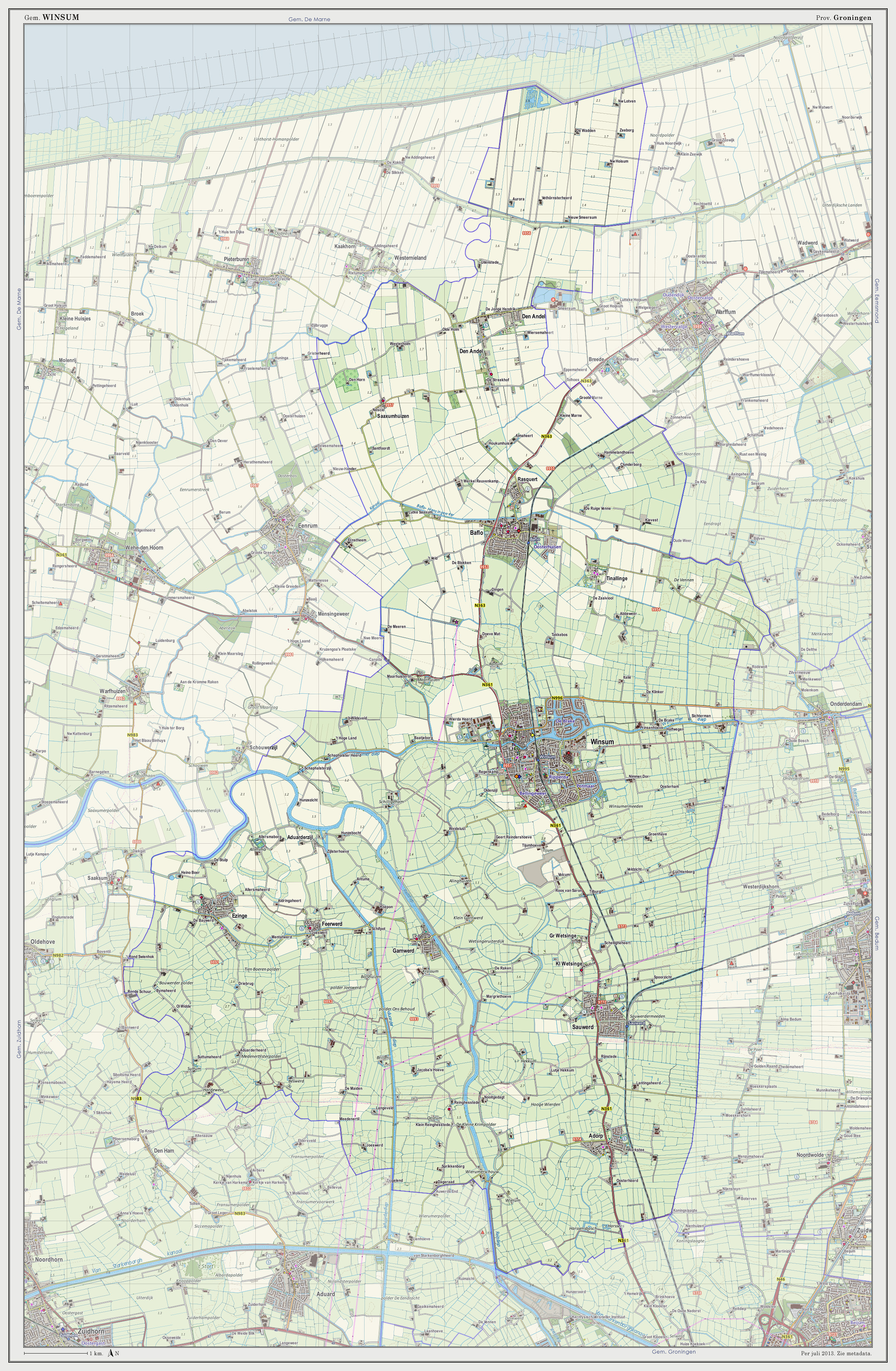
Winsum () is a town and a former municipality in the northeastern Netherlands. On 1 January 2019 the municipality merged with the municipalities of Bedum, De Marne and Eemsmond to form the new municipality Het Hogeland. The town of Winsum was officially established in 1057 as the fusion of three historic villages: Obergum (North), Winsum (center) and Bellingeweer (South). The majority of the town's 8,000 inhabitants commute to the nearby city Groningen. The town boasts two traditional Dutch wind mills, two historic churches, two canals, and one of the Netherlands' oldest taverns. The two mills, "De Ster" ("The Star") and "De Vriendschap" ("The Friendship") were built in 1851 and 1801 respectively. The building that the tavern "De Gouden Karper" ("The Golden Carp") now occupies has been in use as a tavern since the 16th century, and is the oldest (unverified) in the Netherlands. Twin town Winsum is twinned with Sport Cycling Winsum hosted the start and finish of stage ... [...More Info...] [...Related Items...] OR: [Wikipedia] [Google] [Baidu] |
Village
A village is a clustered human settlement or community, larger than a hamlet but smaller than a town (although the word is often used to describe both hamlets and smaller towns), with a population typically ranging from a few hundred to a few thousand. Though villages are often located in rural areas, the term urban village is also applied to certain urban neighborhoods. Villages are normally permanent, with fixed dwellings; however, transient villages can occur. Further, the dwellings of a village are fairly close to one another, not scattered broadly over the landscape, as a dispersed settlement. In the past, villages were a usual form of community for societies that practice subsistence agriculture, and also for some non-agricultural societies. In Great Britain, a hamlet earned the right to be called a village when it built a church. [...More Info...] [...Related Items...] OR: [Wikipedia] [Google] [Baidu] |
Groningen (province)
Groningen (; gos, Grunn; fry, Grinslân) is the northeasternmost province of the Netherlands. It borders on Friesland to the west, Drenthe to the south, the German state of Lower Saxony to the east, and the Wadden Sea to the north. As of February 2020, Groningen had a population of 586,309 and a total area of . Historically the area was at different times part of Frisia, the Frankish Empire, the Holy Roman Empire, and the Dutch Republic, the precursor state of the modern Netherlands. In the 14th century, the city of Groningen became a member of the Hanseatic League. The provincial capital and the largest city in the province is the city of Groningen (231,299 inhabitants). Since 2016, René Paas has been the King's Commissioner in the province. A coalition of GroenLinks, the Labour Party, ChristianUnion, People's Party for Freedom and Democracy, Democrats 66, and Christian Democratic Appeal forms the executive branch. The province is divided into 10 municipalities. T ... [...More Info...] [...Related Items...] OR: [Wikipedia] [Google] [Baidu] |
Netherlands
) , anthem = ( en, "William of Nassau") , image_map = , map_caption = , subdivision_type = Sovereign state , subdivision_name = Kingdom of the Netherlands , established_title = Before independence , established_date = Spanish Netherlands , established_title2 = Act of Abjuration , established_date2 = 26 July 1581 , established_title3 = Peace of Münster , established_date3 = 30 January 1648 , established_title4 = Kingdom established , established_date4 = 16 March 1815 , established_title5 = Liberation Day (Netherlands), Liberation Day , established_date5 = 5 May 1945 , established_title6 = Charter for the Kingdom of the Netherlands, Kingdom Charter , established_date6 = 15 December 1954 , established_title7 = Dissolution of the Netherlands Antilles, Caribbean reorganisation , established_date7 = 10 October 2010 , official_languages = Dutch language, Dutch , languages_type = Regional languages , languages_sub = yes , languages = , languages2_type = Reco ... [...More Info...] [...Related Items...] OR: [Wikipedia] [Google] [Baidu] |
Het Hogeland
Het Hogeland is a municipality in the north of the province of Groningen (province), Groningen in the northeast of the Netherlands. History The municipality of Het Hogeland was established on 1 January 2019 by merging the municipalities of Bedum, De Marne, Eemsmond and Winsum. Geography Het Hogeland is located around in the north of the province of Groningen (province), Groningen and in the northeast of the Netherlands. The population centers in the municipality are: Broek (Groningen), Broek, Eemshaven, Eenrum, Ellerhuizen, Eppenhuizen, Hornhuizen, Houwerzijl, Kantens, Kleine Huisjes, Kloosterburen, Kruisweg, Het Hogeland, Kruisweg, Lauwersoog, Leens, Mensingeweer, Molenrij, Niekerk, Het Hogeland, Niekerk, Noordwolde, Groningen, Noordwolde, Oldenzijl, Onderdendam, Oosteinde, Groningen, Oosteinde, Oosternieland, Oudeschip, Pieterburen, Roodeschool, Rottum, Groningen, Rottum, Schouwerzijl, Startenhuizen, Stitswerd, Uithuizen, Uithuizermeeden, Ulrum, Usquert, Vierhuizen, War ... [...More Info...] [...Related Items...] OR: [Wikipedia] [Google] [Baidu] |
Wierde
A ''terp'', also known as a ''wierde, woerd, warf, warft, werf, werve, wurt'' or ''værft'', is an artificial dwelling mound found on the North European Plain that has been created to provide safe ground during storm surges, high tides and sea or river flooding. The various terms used reflect the regional dialects of the North European region. In English sources, ''terp'' appears to be by far the most common term used. These mounds occur in the coastal parts of the Netherlands (in the provinces of Zeeland, Friesland and Groningen), in southern parts of Denmark and in the north-western parts of Germany where, before dykes were made, floodwater interfered with daily life. These can be found especially in the region Ostfriesland and Kreis Nordfriesland in Germany. In Kreis Nordfriesland on the Halligen, people still live on terps unprotected by dykes. Terps also occur in the Rhine and Meuse river plains in the central part of the Netherlands. Furthermore, terps can be found m ... [...More Info...] [...Related Items...] OR: [Wikipedia] [Google] [Baidu] |
Romanesque Architecture
Romanesque architecture is an architectural style of medieval Europe characterized by semi-circular arches. There is no consensus for the beginning date of the Romanesque style, with proposals ranging from the 6th to the 11th century, this later date being the most commonly held. In the 12th century it developed into the Gothic style, marked by pointed arches. Examples of Romanesque architecture can be found across the continent, making it the first pan-European architectural style since Imperial Roman architecture. The Romanesque style in England and Sicily is traditionally referred to as Norman architecture. Combining features of ancient Roman and Byzantine buildings and other local traditions, Romanesque architecture is known by its massive quality, thick walls, round arches, sturdy pillars, barrel vaults, large towers and decorative arcading. Each building has clearly defined forms, frequently of very regular, symmetrical plan; the overall appearance is one of simplic ... [...More Info...] [...Related Items...] OR: [Wikipedia] [Google] [Baidu] |
Populated Places In Groningen (province)
Population typically refers to the number of people in a single area, whether it be a city or town, region, country, continent, or the world. Governments typically quantify the size of the resident population within their jurisdiction using a census, a process of collecting, analysing, compiling, and publishing data regarding a population. Perspectives of various disciplines Social sciences In sociology and population geography, population refers to a group of human beings with some predefined criterion in common, such as location, race, ethnicity, nationality, or religion. Demography is a social science which entails the statistical study of populations. Ecology In ecology, a population is a group of organisms of the same species who inhabit the same particular geographical area and are capable of interbreeding. The area of a sexual population is the area where inter-breeding is possible between any pair within the area and more probable than cross-breeding with ind ... [...More Info...] [...Related Items...] OR: [Wikipedia] [Google] [Baidu] |


