|
Oakham Rural District
Oakham was a rural district in Rutland, England from 1894 to 1974, covering the north of the county. The rural district had its origins in the Oakham Rural Sanitary District, formed in 1875. Oakham RSD had an identical area to Oakham poor law union, and consisted of thirty-one civil parishes of which twenty-nine were in Rutland and two in Leicestershire. The Local Government Act 1894 redesignated the area as Oakham Rural District, at the same time transferring the Leicestershire parishes of Cold Overton and Knossington to Melton Mowbray Rural District. The rural district included the town of Oakham until 1911, when it was constituted as Oakham Urban District. The Rural District Council continued to be based in the town, however. Parishes The rural district consisted of the following parishes:F A Youngs Jr., ''Guide to the Local Administrative Units of England'', Vol.II: Northern England, London, 1991 * Ashwell *Barleythorpe * Barrow *Braunston *Brooke * Burley * Cottesmo ... [...More Info...] [...Related Items...] OR: [Wikipedia] [Google] [Baidu] |
Sanitary District
Sanitary districts were established in England and Wales in 1872 and in Ireland in 1878. The districts were of two types, based on existing structures: *Urban sanitary districts in towns with existing local government bodies *Rural sanitary districts in the remaining rural areas of poor law unions. Each district was governed by a sanitary authority and was responsible for various public health matters such as providing clean drinking water, sewers, street cleaning, and clearing slum housing. In England and Wales, both rural and urban sanitary districts were replaced in 1894 by the Local Government Act 1894 by the more general rural districts and urban districts. A similar reform was carried out in Ireland in 1899 by the Local Government (Ireland) Act 1898. England and Wales Sanitary districts were formed under the terms of the Public Health Act 1872. Instead of creating new bodies, existing authorities were given additional responsibilities. The sanitary districts were crea ... [...More Info...] [...Related Items...] OR: [Wikipedia] [Google] [Baidu] |
Barrow, Rutland
Barrow is a village and civil parish in the county of Rutland in the East Midlands of England. It is located about five miles (8 km) north-east of Oakham. At the 2011 census the population remained less than 100 and is included in the civil parish In England, a civil parish is a type of administrative parish used for local government. It is a territorial designation which is the lowest tier of local government below districts and counties, or their combined form, the unitary authority ... of Cottesmore. The village's name means 'Burial-mound/hill', probably signifying to the one on the crest of the hill near The Green. References External links Rutland Website – Barrow Barrow Stables www.barrowstables.com Villages in Rutland Civil parishes in Rutland {{Rutland-geo-stub ... [...More Info...] [...Related Items...] OR: [Wikipedia] [Google] [Baidu] |
Langham, Rutland
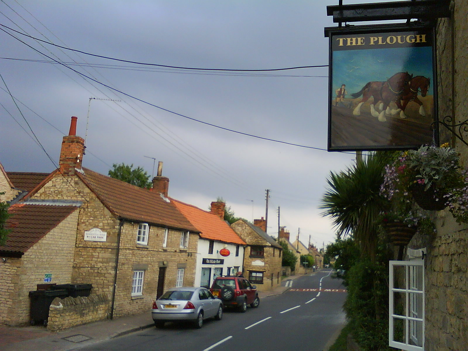
Langham is a village and civil parish in Rutland in the East Midlands of England. The village is about north-west of Oakham, on the A606 main road linking Oakham and Melton Mowbray. The village's name means 'homestead/village which is long or hemmed-in land which is long'. It has two pubs, the Wheatsheaf and the Noel Arms, and a Church of England primary school. Langham Lodge is a Grade II listed house on the edge of the village. The Church of England parish church of Saints Peter and Paul dates in part from the late 13th century and is a Grade I listed building. There is also a Baptist Chapel, built in 1854. Notable inhabitants include Simon Langham, a 14th-century monk who became Archbishop of Canterbury; Major General John Brocklehurst, 1st Baron Ranksborough CB CVO (13 May 1852 – 28 February 1921), a soldier, courtier and Liberal politician - there is a memorial to the latter in the village church; and Alicia Kearns Alicia Alexandra Martha Kearns (born 11 Novembe ... [...More Info...] [...Related Items...] OR: [Wikipedia] [Google] [Baidu] |
Horn, Rutland
Horn is a former civil parish, now in the parish of Exton and Horn, in the county of Rutland in the East Midlands of England. In 2001 it had a population of 9, which was included in the civil parish of Empingham at the 2011 census. The parish is part of the Exton Hall estate of the Earls of Gainsborough. The civil parish, with just three properties, was abolished on 1 April 2016 and merged with Exton to form Exton and Horn. History The village's name means 'Horn-shaped feature'. It has been thought that this alludes to a slight bend in the North Brook, yet the earthworks of the village are likewise situated close to a ridge. The village of Horn was mentioned in the Domesday survey, as 'Two hides in Horn of which Langfer had been tenant under Edward the Confessor were held of the king by the Bishop of Durham'. In 1287, Richard son of Richard de Seyton had a manor house at ''Horne'' and in 1378 Sir John Seyton had his capital messuage here, although the manor was reportedly valuel ... [...More Info...] [...Related Items...] OR: [Wikipedia] [Google] [Baidu] |
Hambleton, Rutland
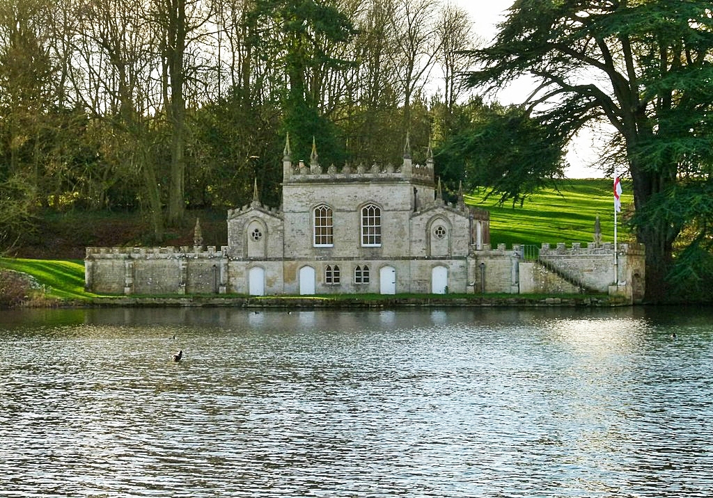
Hambleton is a village and civil parish in Rutland, England. It is about two miles (3 km) east of Oakham. Description The village's name means 'maimed hill'. It has been thought that the hill in the village looks as if it has been sliced off. In 2001 Hambleton had a population of 140, increasing to 203 at the 2011 census. Since the construction of Rutland Water in the 1970s, the village has been closed off on three sides by water and the area is known as the Hambleton Peninsula. The parish originally included the settlements of Upper Hambleton, Middle Hambleton and Nether Hambleton. The latter two have now been almost completely submerged by the construction of Rutland Water (originally known as Empingham Reservoir). The Jacobean Old Hall in Middle Hambleton (built in 1611) is now situated on the water's edge. The village contains the 12th-century St Andrew's Church, Hambleton, a pub called The Finch's Arms and a hotel and restaurant, Hambleton Hall. The church, much ... [...More Info...] [...Related Items...] OR: [Wikipedia] [Google] [Baidu] |
Gunthorpe, Rutland
Gunthorpe is a civil parish and a hamlet in the county of Rutland in the East Midlands of England. The village's name means 'outlying farm/settlement of Gunni'. The population of Gunthorpe grew to several hundred before being devastated by the plague which ravaged Great Britain and much of Europe from 1347 to 1351. Today, Gunthorpe remains as one of Rutland's smallest inhabited hamlets, with just 10 houses and 16 residents. Despite being dissected by the railway and the main Oakham to Uppingham A6003 road, the tiny hamlet of Gunthorpe remains a lively idyll, which typifies the agricultural heart of the county of Rutland. Set in the rolling hills adjoining the River Gwash, approximately 2½ miles south of Oakham and on the western shores of Rutland Water, Gunthorpe has several footpaths and bridleways which offer some of the county's most enjoyable, all-year round views. The population of the civil parish remained less than 100 at the 2011 census and was included in the civil pa ... [...More Info...] [...Related Items...] OR: [Wikipedia] [Google] [Baidu] |
Greetham, Rutland
Greetham is a village and civil parish in the county of Rutland in the East Midlands of England. The village's name means 'homestead/village which is gravelly' or 'hemmed-in land which is gravelly'. The village is on the B668 road between the county town of Oakham and the A1 and on the north–south Viking Way long distance footpath linking the Humber Bridge and Oakham. The population of the civil parish at the 2001 census was 609 increasing to 638 at the 2011 census. The oldest parts of the Church of England parish church of St Mary the Virgin are Norman, but the church today is largely as it was rebuilt in the 13th–15th centuries. The west tower and spire are 13th or 14th century and the south porch was built in 1673. The church was restored in 1897 by Jethro Cossins. The church is a Grade I listed building. It is on Historic England’s Heritage at Risk Register, at priority category: C - "slow decay; no solution agreed". Leicestershire and Rutland Wildlife Trust owns ... [...More Info...] [...Related Items...] OR: [Wikipedia] [Google] [Baidu] |
Exton, Rutland
Exton is a village in Rutland, England. The population was 607 at the 2011 census. The civil parish was abolished in 2016 and merged with Horn to form Exton and Horn. The village The village's name means 'farm/settlement which has oxen'. The village includes a tree-planted green overlooked by the Fox and Hounds pub. Close to the green is the war memorial to the dead of Exton and Whitwell and to relatives of the Earl of Gainsborough; the names include Tom Cecil Noel MC and Bar and Maurice Dease VC. The memorial was designed by Alfred Young Nutt. In the south of the parish towards Rutland Water is Barnsdale Gardens which were created by Geoff Hamilton of the BBC television series '' Gardeners' World''. Further south, on the north shore of Rutland Water, stands what was the Barnsdale country house and is now the Barnsdale Hall Hotel and Country Club. Barnsdale was a large country house, built in 1890 as a hunting lodge for Earl Fitzwilliam by architect E. J. May. It is ... [...More Info...] [...Related Items...] OR: [Wikipedia] [Google] [Baidu] |
Empingham
Empingham is a village in the county of Rutland in the East Midlands of England. The population of the civil parish was 815 at the 2001 census including Horn and increasing to 880 at the 2011 census. It lies close to the dam of Rutland Water and the A606 runs through the village. During construction, Empingham Reservoir was the name of the reservoir but it was renamed Rutland Water to preserve the name of the county which was being merged with Leicestershire. The village's name means 'farm/settlement of the people of Empa'.http://kepn.nottingham.ac.uk/map/place/Rutland/Empingham% The church of St Peter was a Peculiar of the see of Lincoln. When the diocese of Peterborough was created, this church remained tied to Lincoln Cathedral and the title of a Prebend there. To the north east on the Great North Road (now A1) the Battle of Empingham was fought in 1470 as part of the Wars of the Roses. The battle is also known as Battle of Losecoat Field (or Losecote Field), supposedly ... [...More Info...] [...Related Items...] OR: [Wikipedia] [Google] [Baidu] |
Egleton
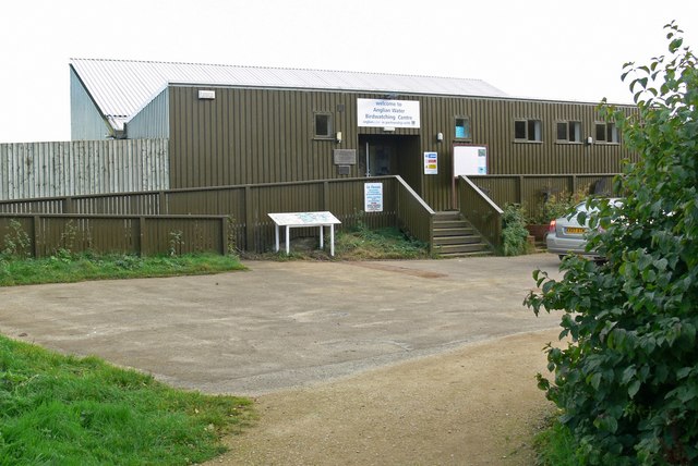
Egleton is a small village and civil parish in the county of Rutland in the East Midlands of England. It is situated south east of Oakham, and is close to the western shore of Rutland Water. The population of the village remained less than 100 at the 2011 census and was included with the parish of Burley. St Edmund's Church, the Church of England parish church, is a Grade I listed building. It has a notable Norman Norman or Normans may refer to: Ethnic and cultural identity * The Normans, a people partly descended from Norse Vikings who settled in the territory of Normandy in France in the 10th and 11th centuries ** People or things connected with the Norm ... tympanum. The village's name means 'farm/settlement of Ecgwulf'. Shallow lagoons of the reservoir come close to the village on the south and east and more are planned as a result of increased take of supplies from Rutland Water. An area of ancient meadows, rich in orchids, lies to the east. ThAnglian Water Birdwat ... [...More Info...] [...Related Items...] OR: [Wikipedia] [Google] [Baidu] |
Edith Weston
Edith Weston is a village and civil parish in the county of Rutland in the East Midlands of England. The population of the civil parish was 1,042 at the 2001 census, including Normanton and increasing to 1,359 at the 2011 census. It is on the south-eastern shore of Rutland Water and is home of the main sailing club and a fishing lodge. The village is named after Edith of Wessex (1029–1075), the queen of Edward the Confessor and sister of Harold Godwinson. The Grade I listed church is dedicated to St Mary the Virgin and includes stained glass by Paul Woodroffe and Hugh Arnold; the organ is by Samuel Green of London and dated 1787. The village pub is the Wheatsheaf on King Edward's Way. St George's Barracks is located to the south and east of the village; this was previously RAF North Luffenham. In August 2007 16th Regiment Royal Artillery, equipped with the Rapier FSC, moved here from Woolwich. Edith Weston features in the Alan Sillitoe novel ''Down From the Hill ... [...More Info...] [...Related Items...] OR: [Wikipedia] [Google] [Baidu] |
Cottesmore, Rutland
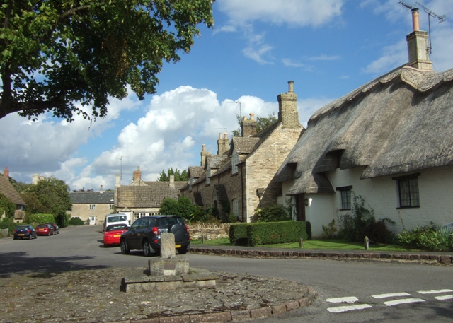
Cottesmore (often pronounced Cotts'more) is a village and civil parish in the north of the county of Rutland in the East Midlands of England. In terms of population it is the largest village in Rutland, and the third-largest settlement after Oakham and Uppingham. This is due in part to the presence of Kendrew Barracks (formerly RAF Cottesmore). The village's name means 'moor of Cott'. At the time of Edward the Confessor (mid 11th century), "Manors Cottesmore" was held, together with Greetham, Rutland, Greetham, by Saxon called Goda. Goda held 12 carucates of land, three of which were held in tax to the Danegeld. The King held three carucates in demesne and three socmen with 40 villeins and six bordarii held 20 carucates. Of the land held by the manor, one Goisfridus held half a carucate; he had one plough and eight villeins. Cottesmore also had of meadow and a wood measuring a mile in length by seven furlongs in breadth. St Nicholas' Church, Cottesmore is a Grade II* listed ... [...More Info...] [...Related Items...] OR: [Wikipedia] [Google] [Baidu] |


.jpg)