|
Nymet Rowland
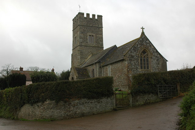
Nymet Rowland is a small village, and civil parish of the same name, in central Devon, England, north of Dartmoor. It takes part of its name from "Nymet", the old name for the nearby River Yeo. It is located just to the west of Lapford and south of Nymet Bridge, within the Mid Devon local authority area. Historically it formed part of Winkleigh Hundred; today the North Tawton North Tawton is a small town in Devon, England, situated on the river Taw. It is administered by West Devon Council. The population of the electoral ward at the census 2011 was 2,026. History Romans crossed the River Taw at what is now Newla ... hundred. It falls within the Cadbury Deanery for ecclesiastical purposes. Description Nymet Rowland has a 15th-century church (St. Bartholomew). Traces of the 12th-century church remain in the S. doorway, and in the crude font. History Nymet Rowland achieved brief prominence in the 1870s as the home of the Cheritons (nicknamed by the media the "North Devo ... [...More Info...] [...Related Items...] OR: [Wikipedia] [Google] [Baidu] |
Civil Parish
In England, a civil parish is a type of administrative parish used for local government. It is a territorial designation which is the lowest tier of local government below districts and counties, or their combined form, the unitary authority. Civil parishes can trace their origin to the ancient system of ecclesiastical parishes, which historically played a role in both secular and religious administration. Civil and religious parishes were formally differentiated in the 19th century and are now entirely separate. Civil parishes in their modern form came into being through the Local Government Act 1894, which established elected parish councils to take on the secular functions of the parish vestry. A civil parish can range in size from a sparsely populated rural area with fewer than a hundred inhabitants, to a large town with a population in the tens of thousands. This scope is similar to that of municipalities in Continental Europe, such as the communes of France. However, ... [...More Info...] [...Related Items...] OR: [Wikipedia] [Google] [Baidu] |
Devon
Devon ( , historically known as Devonshire , ) is a ceremonial and non-metropolitan county in South West England. The most populous settlement in Devon is the city of Plymouth, followed by Devon's county town, the city of Exeter. Devon is a coastal county with cliffs and sandy beaches. Home to the largest open space in southern England, Dartmoor (), the county is predominately rural and has a relatively low population density for an English county. The county is bordered by Somerset to the north east, Dorset to the east, and Cornwall to the west. The county is split into the non-metropolitan districts of East Devon, Mid Devon, North Devon, South Hams, Teignbridge, Torridge, West Devon, Exeter, and the unitary authority areas of Plymouth, and Torbay. Combined as a ceremonial county, Devon's area is and its population is about 1.2 million. Devon derives its name from Dumnonia (the shift from ''m'' to ''v'' is a typical Celtic consonant shift). During the Briti ... [...More Info...] [...Related Items...] OR: [Wikipedia] [Google] [Baidu] |
Dartmoor
Dartmoor is an upland area in southern Devon, England. The moorland and surrounding land has been protected by National Park status since 1951. Dartmoor National Park covers . The granite which forms the uplands dates from the Carboniferous Period of geological history. The landscape consists of moorland capped with many exposed granite hilltops known as tors, providing habitats for Dartmoor wildlife. The highest point is High Willhays, above sea level. The entire area is rich in antiquities and archaeology. Dartmoor National Park is managed by the Dartmoor National Park Authority, whose 22 members are drawn from Devon County Council, local district councils and Government. Parts of Dartmoor have been used as military firing ranges for over 200 years. The public is granted extensive land access rights on Dartmoor (including restricted access to the firing ranges) and it is a popular tourist destination. Physical geography Geology Dartmoor includes the largest area of ... [...More Info...] [...Related Items...] OR: [Wikipedia] [Google] [Baidu] |
River Yeo (Lapford)
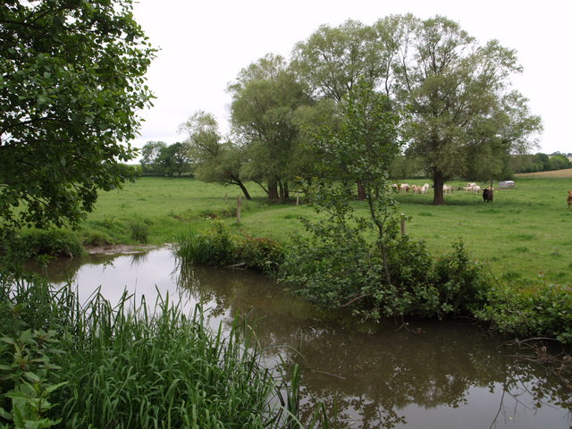
The Lapford Yeo, also known as the River Yeo, is a tributary of the River Taw in Devon, England. It is one of several rivers of the same name, including another tributary of the Taw, the Barnstaple Yeo. The Lapford Yeo also flows within 2 miles of the headwaters of another River Yeo, which is a tributary of the River Creedy. The Lapford Yeo rises near South Tawton. It flows north through Bow and Zeal Monachorum to Lapford. It joins the Taw 1.5 miles below Lapford, just below Nymet Bridge. Its largest tributary is the River Dalch, which joins the Yeo near Lapford. The river's catchment area is almost twice the size of the Taw's catchment area above the confluence, but has significantly lower rainfall than the upper Taw valley. The river was earlier called the Nymet, thought to be a Celtic word meaning 'shrine'. Several Nymet place-names remain in the area, including Nymet Tracey and Nymet Rowland Nymet Rowland is a small village, and civil parish of the same name, i ... [...More Info...] [...Related Items...] OR: [Wikipedia] [Google] [Baidu] |
Lapford
Lapford is a village and civil parish in Mid Devon in the English county of Devon. It had a population of 993 in 2001, reducing to 867 at the 2011 census. Lapford is part of Taw Valley ward whose population at the above census was 1,629. Churches There are three churches in the village. St Thomas of Canterbury C of E church, Lapford Community Church and Lapford Congregational church. Originally a Norman chapel, the church of St Thomas of Canterbury is listed Grade I and partly dates back to shortly after the murder of Thomas Becket (1170), having been almost completely rebuilt, extended and then re-dedicated on the orders of King Henry II by William de Tracey, one of the assassins. De Tracey was lord of the manor of Bradninch, which then included most of what is now Lapford. It was further rebuilt and extended in the 15th & 16th centuries. The wall paintings and plasterwork were lost at the time of the Reformation and the original 12th-century chancel was rebuilt in th ... [...More Info...] [...Related Items...] OR: [Wikipedia] [Google] [Baidu] |
Mid Devon
Mid Devon is a local government district in Devon, England. Its council is based in Tiverton. The district was formed under the Local Government Act 1972, on 1 April 1974 by the merger of the borough of Tiverton and Crediton urban district together with Tiverton Rural District, and Crediton Rural District. It was originally called Tiverton District, but was renamed in 1978 by resolution of the district council. Geography Mid Devon shares borders with several other Devon districts as well as the county of Somerset. Neighbouring districts include Exeter, East Devon, North Devon, Teignbridge, West Devon and Torridge. The area of Mid Devon, according to the Office for National Statistics Census table KS101EW is 91293.48 hectares, or 912.9348 sq kilometers, or 352.5 square miles. Rivers The Exe, the Culm, the Yeo, the Dalch, the Little Dart, the Taw, the Dart, the Brockley, the Creedy and the Spratford Stream flow through the district. Raddon Top Raddon Top (772 ... [...More Info...] [...Related Items...] OR: [Wikipedia] [Google] [Baidu] |
Winkleigh
Winkleigh is a civil parish and small village in Devon, England. It is part of the local government area of Torridge District Council. The population of the parish at the 2011 census was 1,305, compared to 1,079 in 1901. The population of the electoral ward in 2011 was 2,068. History During World War II, the RAF Winkleigh Airfield was used by the RNoAF from 1944 as the main training Centre in the UK after Norway shifted from Little Norway in Toronto Canada to re-locate the training facilities to a place nearer to the War theatre. The former RAF base is now the site of the West of England Transport Collection, which stores over 200 cars, lorries and buses of historical interest. It is not normally open to the public. In 1975 the deaths of three members of the Luxton family at nearby West Chapple Farm, brought media interest to the area. A book ''Earth to Earth'' by John Cornwell was published about this murder and suicide case in 1982. The village was the location of Inch's ... [...More Info...] [...Related Items...] OR: [Wikipedia] [Google] [Baidu] |
Hundred (country Subdivision)
A hundred is an administrative division that is geographically part of a larger region. It was formerly used in England, Wales, some parts of the United States, Denmark, Southern Schleswig, Sweden, Finland, Norway, the Bishopric of Ösel–Wiek, Curonia, the Ukrainian state of the Cossack Hetmanate and in Cumberland County in the British Colony of New South Wales. It is still used in other places, including in Australia (in South Australia and the Northern Territory). Other terms for the hundred in English and other languages include ''wapentake'', ''herred'' (Danish and Bokmål Norwegian), ''herad'' ( Nynorsk Norwegian), ''hérað'' (Icelandic), ''härad'' or ''hundare'' (Swedish), ''Harde'' (German), ''hiird'' ( North Frisian), ''satakunta'' or ''kihlakunta'' (Finnish), ''kihelkond'' (Estonian), ''kiligunda'' (Livonian), ''cantref'' (Welsh) and ''sotnia'' (Slavic). In Ireland, a similar subdivision of counties is referred to as a barony, and a hundred is a subdivision of a part ... [...More Info...] [...Related Items...] OR: [Wikipedia] [Google] [Baidu] |
North Tawton
North Tawton is a small town in Devon, England, situated on the river Taw. It is administered by West Devon Council. The population of the electoral ward at the census 2011 was 2,026. History Romans crossed the River Taw at what is now Newland Mill, a little outside the present town, and established a succession of military camps there over the years. The Roman fort is believed to have had the name ''Nemetostatio'', meaning "The road-station of the sacred groves", and may have been located on the site of an ancient druidic sanctuary. It covered an area of roughly 600 ft (185m) east-west by 390 ft (120m), and was located adjoining the Roman road between ''Isca Dumnoniorum'' (Exeter) and Okehampton. In addition, the site of a temporary marching camp has been identified half a mile to the north. By the time of the Domesday survey (1086), there were six farm / manor holdings in what is now North Tawton Parish, including that of Tawton which was the forerunner of the tow ... [...More Info...] [...Related Items...] OR: [Wikipedia] [Google] [Baidu] |
Cadbury, Devon
Cadbury is a village in Devon Devon ( , historically known as Devonshire , ) is a ceremonial and non-metropolitan county in South West England. The most populous settlement in Devon is the city of Plymouth, followed by Devon's county town, the city of Exeter. Devo ..., England. Cadbury Castle is nearby. The 15th-century Church of St Michael and All Angels features a Norman font. The church was restored in 1857 by William White, with Frederick Coleridge serving as its vicar from 1855 to 1906. References External links * Villages in Mid Devon District {{Devon-geo-stub ... [...More Info...] [...Related Items...] OR: [Wikipedia] [Google] [Baidu] |


.jpg)