|
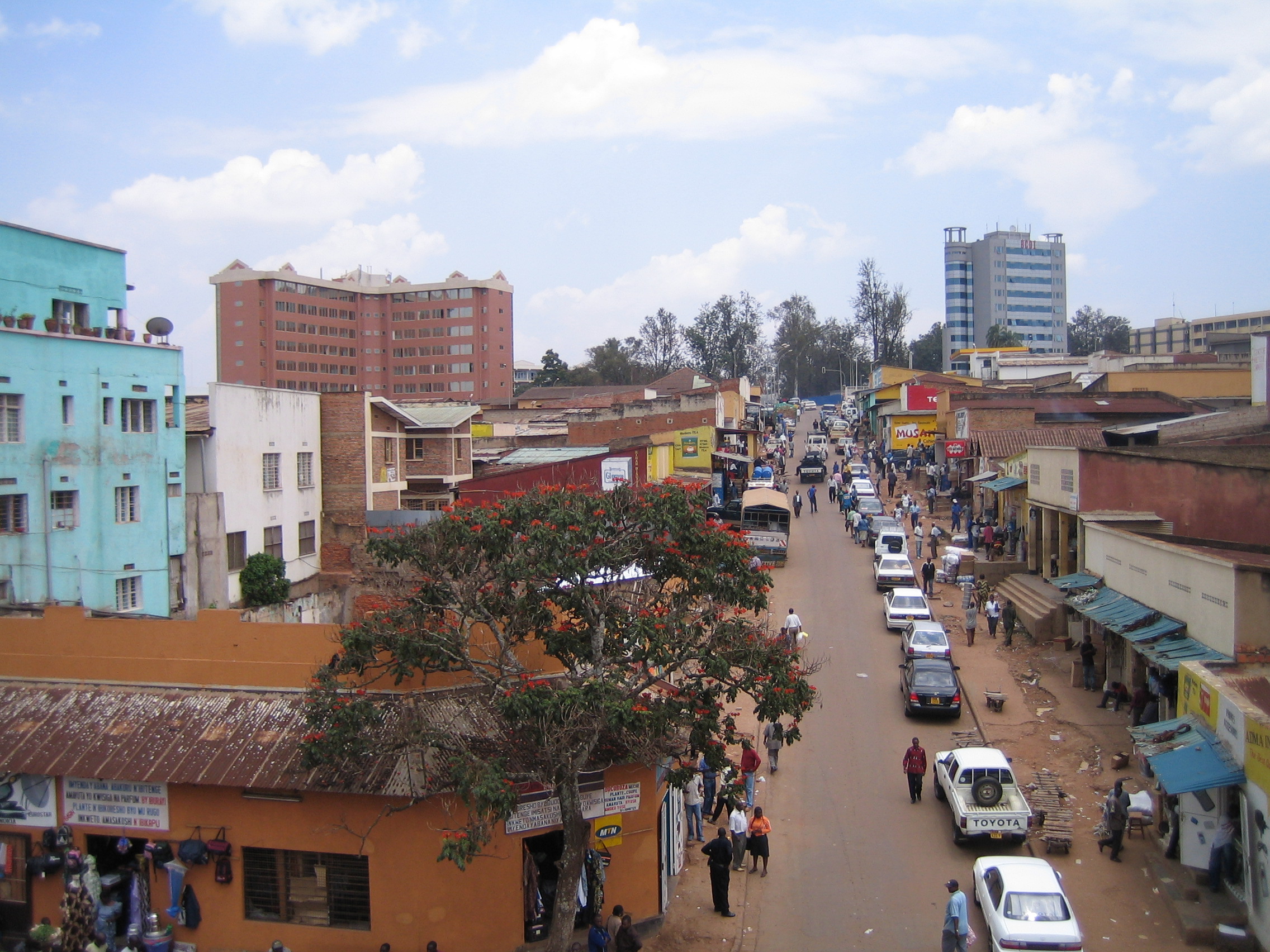
Nyarugenge District
Nyarugenge is a district (''akarere'') in Kigali Province, Rwanda. Its heart is the city centre of Kigali (which is towards the west of the urban area and the province), and contains most of the city's businesses. Sectors Nyarugenge district is divided into 10 sectors (''imirenge''): Gitega, Kanyinya, Kigali, Kimisagara, Mageragere, Muhima, Nyakabanda, Nyamirambo, Nyarugenge and Rwezamenyo. Education ''Lycée de Kigali Lycée de Kigali (LDK) is a secondary school in Kiyovu Cell, Nyarugenge Sector, Nyarugenge District, Kigali, Rwanda. It has A Level The A-Level (Advanced Level) is a subject-based qualification conferred as part of the General Certificate ...'' (LDK) is in Kiyovu Cell, Nyarugenge Sector, Nyarugenge District. ." [...More Info...] [...Related Items...] OR: [Wikipedia] [Google] [Baidu] |
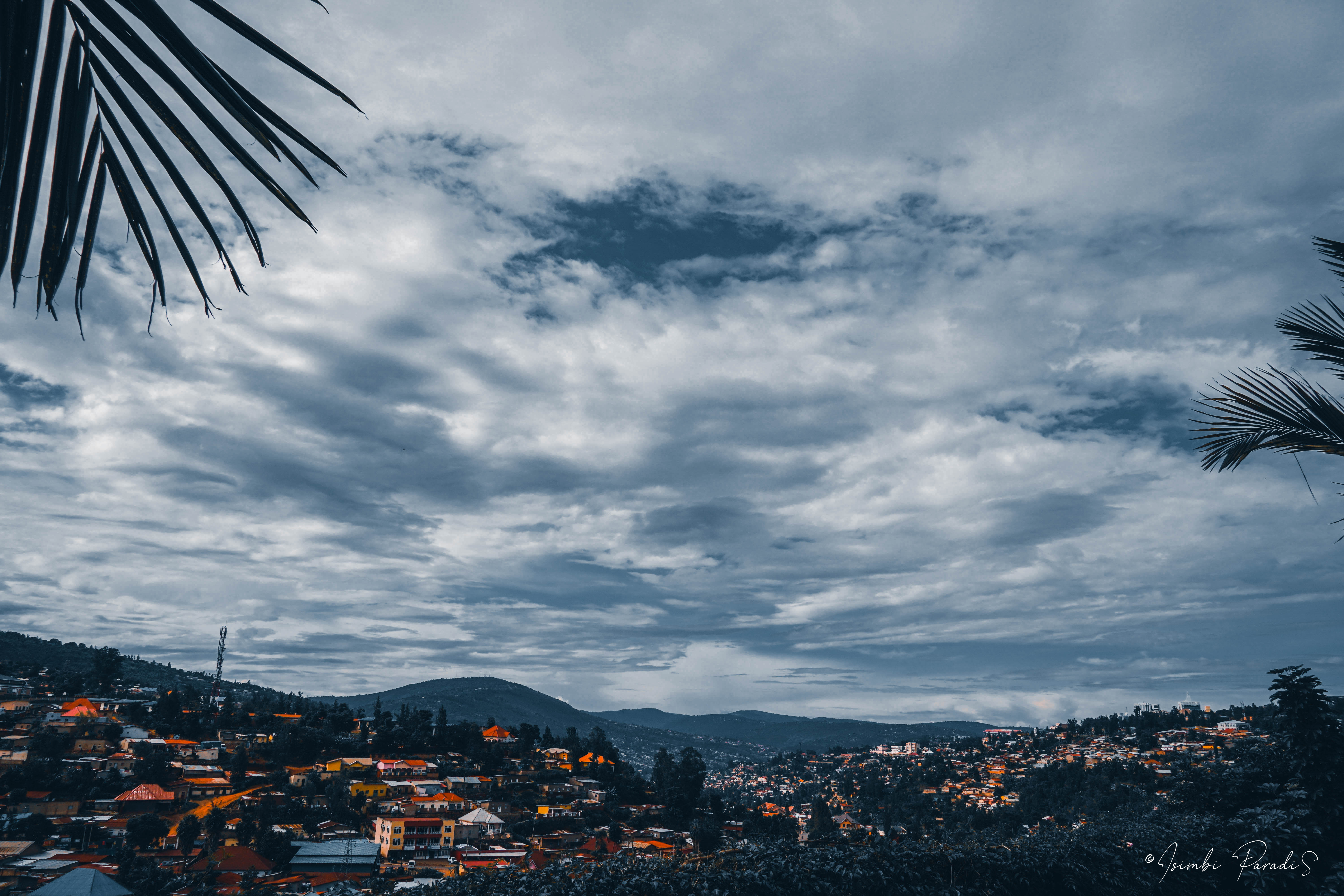
Kigali Hills View
Kigali () is the capital and largest city of Rwanda. It is near the nation's geographic centre in a region of rolling hills, with a series of valleys and ridges joined by steep slopes. As a primate city, Kigali has been Rwanda's economic, cultural, and transport hub since it became the capital following independence from Belgian rule in 1962. In an area controlled by the Kingdom of Rwanda from the 17th century and then by the German Empire, the city was founded in 1907 when Richard Kandt, the colonial resident, chose the site for his headquarters, citing its central location, views and security. Foreign merchants began to trade in the city during the German era, and Kandt opened some government-run schools for Tutsi Rwandan students. Belgium took control of Rwanda and Burundi during World War I, forming the mandate of Ruanda-Urundi. Kigali remained the seat of colonial administration for Rwanda but Ruanda-Urundi's capital was at Usumbura (now Bujumbura) in Burundi and Kigali ... [...More Info...] [...Related Items...] OR: [Wikipedia] [Google] [Baidu] |
District
A district is a type of administrative division that, in some countries, is managed by the local government. Across the world, areas known as "districts" vary greatly in size, spanning regions or counties, several municipalities, subdivisions of municipalities, school district, or political district. By country/region Afghanistan In Afghanistan, a district (Persian ps, ولسوالۍ ) is a subdivision of a province. There are almost 400 districts in the country. Australia Electoral districts are used in state elections. Districts were also used in several states as cadastral units for land titles. Some were used as squatting districts. New South Wales had several different types of districts used in the 21st century. Austria In Austria, the word is used with different meanings in three different contexts: * Some of the tasks of the administrative branch of the national and regional governments are fulfilled by the 95 district administrative offices (). The area a dis ... [...More Info...] [...Related Items...] OR: [Wikipedia] [Google] [Baidu] |
Rwanda
Rwanda (; rw, u Rwanda ), officially the Republic of Rwanda, is a landlocked country in the Great Rift Valley of Central Africa, where the African Great Lakes region and Southeast Africa converge. Located a few degrees south of the Equator, Rwanda is bordered by Uganda, Tanzania, Burundi, and the Democratic Republic of the Congo. It is highly elevated, giving it the soubriquet "land of a thousand hills", with its geography dominated by mountains in the west and savanna to the southeast, with numerous lakes throughout the country. The climate is temperate to subtropical, with two rainy seasons and two dry seasons each year. Rwanda has a population of over 12.6 million living on of land, and is the most densely populated mainland African country; among countries larger than 10,000 km2, it is the fifth most densely populated country in the world. One million people live in the Capital city, capital and largest city Kigali. Hunter-gatherers settled the territory in the St ... [...More Info...] [...Related Items...] OR: [Wikipedia] [Google] [Baidu] |
Kigali Province, Rwanda
Kigali () is the capital and largest city of Rwanda. It is near the nation's geographic centre in a region of rolling hills, with a series of valleys and ridges joined by steep slopes. As a primate city, Kigali has been Rwanda's economic, cultural, and transport hub since it became the capital following independence from Belgian rule in 1962. In an area controlled by the Kingdom of Rwanda from the 17th century and then by the German Empire, the city was founded in 1907 when Richard Kandt, the colonial resident, chose the site for his headquarters, citing its central location, views and security. Foreign merchants began to trade in the city during the German era, and Kandt opened some government-run schools for Tutsi Rwandan students. Belgium took control of Rwanda and Burundi during World War I, forming the mandate of Ruanda-Urundi. Kigali remained the seat of colonial administration for Rwanda but Ruanda-Urundi's capital was at Usumbura (now Bujumbura) in Burundi and Kigali ... [...More Info...] [...Related Items...] OR: [Wikipedia] [Google] [Baidu] |
Nyarugenge
Nyarugenge is a sector (''umurenge'') located in Nyarugenge District, Kigali Province, Rwanda. Location It is located in the southwest part of the city of Kigali. The coordinates of Nyarugenge Sector are:1°58'02.0"S, 30°03'20.0"E (Latitude:-1.967222; Longitude:30.055556). Overview It is primarily a commercial sector, with plenty of businesses located there. AB Bank Rwanda, a microfinance bank maintains a branch in the sector. In March 2018, Commercial Bank of Africa (Rwanda) established a branch in this area. Nyarugenge District Nyarugenge District is divided into 10 sectors Sector may refer to: Places * Sector, West Virginia, U.S. Geometry * Circular sector, the portion of a disc enclosed by two radii and a circular arc * Hyperbolic sector, a region enclosed by two radii and a hyperbolic arc * Spherical sector, a p ... (''imirenge''): Gitega, Kanyinya, Kigali, Kimisagara, Mageragere, Muhima, Nyakabanda, Nyamirambo, Nyarugenge, and Rwezamenyo. References External lin ... [...More Info...] [...Related Items...] OR: [Wikipedia] [Google] [Baidu] |
Districts Of Rwanda
The five Provinces of Rwanda, provinces of Rwanda are divided into 30 districts (Kinyarwanda: ''uturere'', sing. ''akarere''). Each district is in turn divided into Sectors of Rwanda, sectors (Kinyarwanda: ''imirenge'', sing. ''umurenge''), which are in turn divided into ''cells'' (Kinyarwanda: ''utugali'', sing. ''akagali''), which are in turn divided into Imidugudu, ''villages'' (Kinyarwanda: ''imidugudu'', sing. ''umudugudu''). Prior to 2002, Rwanda was composed of prefectures, subprefectures (which were sometimes called "districts") and 154 communes (Kinyarwanda: ''imijyi'', sing. ''umujyi''). In 2002, communes were replaced by two kinds of divisions called districts and municipalities (Kinyarwanda: ''akarere'' and ''umujyi''). In 2006, the number of districts was reduced from 106 to 30. The districts are listed below, by province. Current list of districts by province Eastern Province # Bugesera District, Bugesera # Gatsibo District, Gatsibo # Kayonza District, Kayonza ... [...More Info...] [...Related Items...] OR: [Wikipedia] [Google] [Baidu] |
Kigali
Kigali () is the Capital (political), capital and largest city of Rwanda. It is near the nation's geographic centre in a region of rolling hills, with a series of valleys and ridges joined by steep slopes. As a primate city, Kigali has been Rwanda's economic, cultural, and transport hub since it became the capital following independence from Belgian rule in 1962. In an area controlled by the Kingdom of Rwanda from the 17th century and then German East Africa, by the German Empire, the city was founded in 1907 when Richard Kandt, List of colonial residents of Rwanda, the colonial resident, chose the site for his headquarters, citing its central location, views and security. Foreign merchants began to trade in the city during the German era, and Kandt opened some government-run schools for Tutsi Rwandan students. Belgium East African campaign (World War I), took control of Rwanda and Burundi during World War I, forming the mandate of Ruanda-Urundi. Kigali remained the seat of colo ... [...More Info...] [...Related Items...] OR: [Wikipedia] [Google] [Baidu] |
Sectors Of Rwanda
Sectors (Kinyarwanda: ''Imirenge'', sing. ''umurenge'', French: ''Secteurs'') are the third level administrative subdivision in Rwanda. The Provinces of Rwanda are subdivided into 30 district A district is a type of administrative division that, in some countries, is managed by the local government. Across the world, areas known as "districts" vary greatly in size, spanning regions or counties, several municipalities, subdivisions o ...s (Rwanda: ''uturere'', sing. ''akarere''). Each district is in turn divided into sectors. There are 416 Sectors. This entire administrative structure is undergoing a process of decentralisation – devolving greater authority to local governments and municipalities – following an administrative reorganisation begun in 2002. Ministry of Local Government, Government of Rwanda, ... [...More Info...] [...Related Items...] OR: [Wikipedia] [Google] [Baidu] |
Lycée De Kigali
Lycée de Kigali (LDK) is a secondary school in Kiyovu Cell, Nyarugenge Sector, Nyarugenge District, Kigali, Rwanda. It has A Level and O Level The O-Level (Ordinary Level) is a subject-based qualification conferred as part of the General Certificate of Education. It was introduced in place of the School Certificate in 1951 as part of an educational reform alongside the more in-depth ... tracks. In 1974 the French government established the school, and it opened officially in 1975 and the Rwandan government took charge of the school in 1982. Lycée de Kigali celebrated 40 years of its existence on Friday July 31, 2015. The school currently has over 6,000 boys and girls in its alumni. as of 2019, LDK accommodated over 1, 400 students for both O and A levels. This school is partnership between Government of Rwanda and Parents. School motto "Strive to excel" School Vision To be the center of Excellency enlightened and dignified ladies and gentlemen rooted in academ ... [...More Info...] [...Related Items...] OR: [Wikipedia] [Google] [Baidu] |
Kigali Province
Kigali () is the capital and largest city of Rwanda. It is near the nation's geographic centre in a region of rolling hills, with a series of valleys and ridges joined by steep slopes. As a primate city, Kigali has been Rwanda's economic, cultural, and transport hub since it became the capital following independence from Belgian rule in 1962. In an area controlled by the Kingdom of Rwanda from the 17th century and then by the German Empire, the city was founded in 1907 when Richard Kandt, the colonial resident, chose the site for his headquarters, citing its central location, views and security. Foreign merchants began to trade in the city during the German era, and Kandt opened some government-run schools for Tutsi Rwandan students. Belgium took control of Rwanda and Burundi during World War I, forming the mandate of Ruanda-Urundi. Kigali remained the seat of colonial administration for Rwanda but Ruanda-Urundi's capital was at Usumbura (now Bujumbura) in Burundi and ... [...More Info...] [...Related Items...] OR: [Wikipedia] [Google] [Baidu] |


.jpg)