|
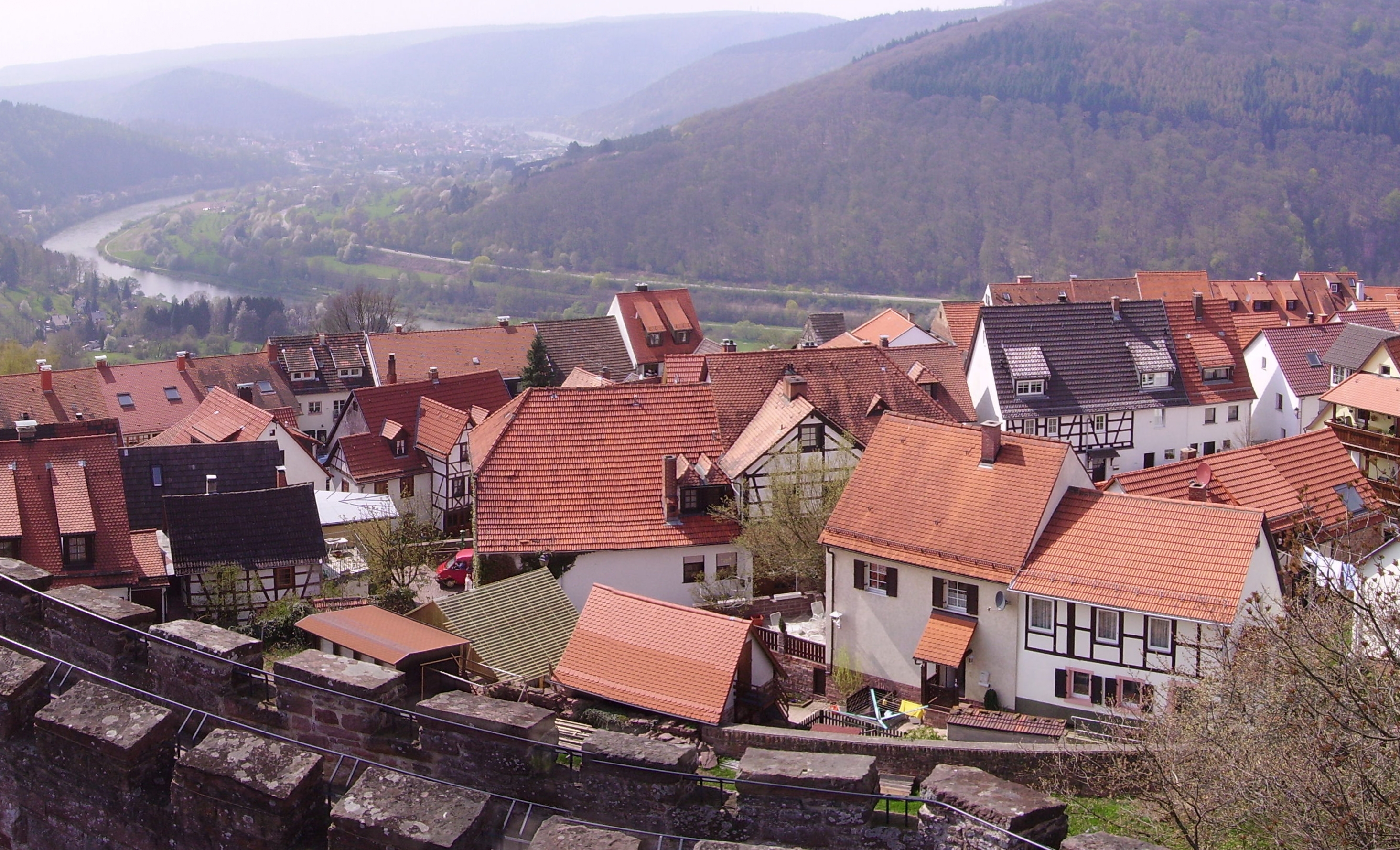
Nußloch
is a municipality in the Rhein-Neckar-Kreis (Baden-Württemberg), about 10 km south of Heidelberg. It is on a much traveled tourist route: Bergstraße ("Mountain Road") and Bertha Benz Memorial Route. The hamlet Maisbach also belongs to Nußloch. History Nußloch was first mentioned on December 31, 766 in a deed of gift to the Lorsch Abbey. A married couple of strong faith donated a vineyard to the monastery from their property in Nußloch. It has been under the control of the Palatinate at the latest since 1269. The hamlet Maisbach was annexed April 1, 1937. Literally translated, the German name ''Nußloch'' means "Nut Hole". Government Nußloch has a municipal council with 18 members according to the municipal code of Baden-Württemberg. The mayor also has a seat and a vote in the municipal council as a regular member. Municipal Council Sister cities The community of Nußloch has sister city relationships to the following communities: * Andernos-les-Bains in Franc ... [...More Info...] [...Related Items...] OR: [Wikipedia] [Google] [Baidu] |
Rhein-Neckar-Kreis
The Rhein-Neckar-Kreis is a district in the northwest of Baden-Württemberg, Germany. The administrative headquarters are based in the city Heidelberg, which is a district-free city. As of 2019, the district is the most populous in Baden-Württemberg. History The district was created in 1973 by merging the previous districts of Heidelberg, Mannheim and Sinsheim. Geography The district is named after the two main rivers which flow through the district, the Rhine and Neckar. The highest elevation is 580 m near the 584 m tall peak of the Odenwald mountain Stiefelhöhe, located near Heiligkreuzsteinach. The lowest elevation with 92 m is in Ilvesheim, located in the Neckar valley. Sights Government The district is governed by a district assembly (''Kreistag'') and a district executive (''Landrat''). The eligible voters of the district elect the Kreistag every 5 years. This body in turn elects the Landrat every 8 years. The Landrat is the legal representative of the district as wel ... [...More Info...] [...Related Items...] OR: [Wikipedia] [Google] [Baidu] |
Bertha Benz Memorial Route
The Bertha Benz Memorial Route is a German tourist and theme route in Baden-Württemberg and member of the European Route of Industrial Heritage. It opened in 2008 and follows the tracks of the world's first long distance road trip by a vehicle powered with an internal combustion engine, in 1888. History Bertha Benz's husband, Karl Benz, patented the first automobile designed to produce its own power in January 1886 (Reichspatent No. 37435). In early August 1888, without her husband's knowledge, Bertha Benz, with her sons Richard (aged 14) and Eugen (aged 15), drove in Benz's newly constructed Patent Motorwagen No. 3 automobile, from Mannheim to her own birthplace, Pforzheim, becoming the first person to drive an automobile powered with an internal combustion engine over more than a very short distance. The distance was about . Distances driven before this historic trip were short, being merely trials with mechanical assistants. Although the ostensible purpose of the trip ... [...More Info...] [...Related Items...] OR: [Wikipedia] [Google] [Baidu] |
Nagyatád
Nagyatád is a town in Somogy County, Hungary and the seat of Nagyatád District. ''Bodvica'', ''Henész'' and ''Kivadár'' are parts of Nagyatád. Etymology Its name derives from the Turkish word ''ata'' ( hu, atya, apa, en, father). Geography It lies on the southern side of ''Inner Somogy'', 60 km south of Lake Balaton on the main road 68. History Nagyatád was established during the Hungarian conquest by the ''Horka'' tribe. However this region was already inhabited in prehistoric times. It was first mentioned in 1190 in official documents. At that time the settlement was situated at the northern part of today's Nagyatád. It was also mentioned in 1382 as ''Populi et cives in villa Athad'' and was part of ''Segesd County''. It was of Queen Elizabeth, later it belonged to the ''Anthimi'' then to the Batthyány family. In 1395 ''György Kis de Kővágóörs'' got the village. But in 1403 it was already in the hands of ''János Anthimi''. It got market town rights in 1475 ... [...More Info...] [...Related Items...] OR: [Wikipedia] [Google] [Baidu] |
Andernos-les-Bains
Andernos-les-Bains (; oc, Endarnòs) is a Communes of France, commune in the Gironde Departments of France, department, southwestern France. Andernos-les-Bains is a located on the northeast shore of Arcachon Bay. To its northwest is the town of Arès. Andernos-les-Bains consists of four other small communities: Taussat, Cassy, Lanton and Audenge. All these villages have oyster farms and small fisheries. For many years, the oyster and fishing industry provided the main income to the area. More recently, tourism has become a strong economic factor in the area. The bay's Portuguese oysters died out during 1970-1972 because of gill disease. In 1974 another oyster, the Pacific oyster, developed a disease caused by the paint used on fishing boats. An oil tanker spill in 1978 further damaged the oyster industry, which continued to suffer around the bay until 1981. Since 2000 the oyster industry has been recovering and now nearly 15,000 metric tons are produced per year. Andernos-les-Ba ... [...More Info...] [...Related Items...] OR: [Wikipedia] [Google] [Baidu] |
Flag Of France
The national flag of France (french: link=no, drapeau français) is a tricolour featuring three vertical bands coloured blue ( hoist side), white, and red. It is known to English speakers as the ''Tricolour'' (), although the flag of Ireland and others are also so known. The design was adopted after the French Revolution; while not the first tricolour, it became one of the most influential flags in history. The tricolour scheme was later adopted by many other nations in Europe and elsewhere, and, according to the ''Encyclopædia Britannica'' has historically stood "in symbolic opposition to the autocratic and clericalist royal standards of the past". Before the tricolour was adopted the royal government used many flags, the best known being a blue shield and gold fleur-de-lis (the Royal Arms of France) on a white background, or state flag. Early in the French Revolution, the Paris militia, which played a prominent role in the storming of the Bastille, wore a cockade of blue ... [...More Info...] [...Related Items...] OR: [Wikipedia] [Google] [Baidu] |
Spain
, image_flag = Bandera de España.svg , image_coat = Escudo de España (mazonado).svg , national_motto = ''Plus ultra'' (Latin)(English: "Further Beyond") , national_anthem = (English: "Royal March") , image_map = , map_caption = , image_map2 = , capital = Madrid , coordinates = , largest_city = Madrid , languages_type = Official language , languages = Spanish language, Spanish , ethnic_groups = , ethnic_groups_year = , ethnic_groups_ref = , religion = , religion_ref = , religion_year = 2020 , demonym = , government_type = Unitary state, Unitary Parliamentary system, parliamentary constitutional monarchy , leader_title1 = Monarchy of Spain, Monarch , leader_name1 = Felipe VI , leader_title2 = Prime Minister of Spain ... [...More Info...] [...Related Items...] OR: [Wikipedia] [Google] [Baidu] |
Segorbe
Segorbe is a municipality in the mountainous coastal province of Castelló, autonomous community of Valencia, Spain. The former Palace of the Dukes of Medinaceli now houses the city's mayor. Segorbe's bull-running week (''semana de Toros'') in September attracts 200,000 visitors each year. Geography The municipal district area is crossed by the Palancia River from north west to south east. It is located on the natural way from Aragón to Valencian Community, between the Serra d'Espadà on the north and Serra Calderona on the south. The urban area is located at 358 m height, placed over two hills emerging from the bank of the river. History The area of Segorbe was inhabited as early as the mid-Palaeolithic Age, as testified by archaeological remains. Segorbe was once identified as the ancient ''Segobriga'', described by Pliny the Elder as the capital of Celtiberia. However, archaeological excavations have uncovered an extensive Roman city in La Mancha which has been iden ... [...More Info...] [...Related Items...] OR: [Wikipedia] [Google] [Baidu] |
Flag Of Spain
The national flag of Spain ( es, Bandera de España), as it is defined in the Constitution of 1978, consists of three horizontal stripes: red, yellow and red, the yellow stripe being twice the size of each red stripe. Traditionally, the middle stripe was defined by the more archaic term of , and hence the popular name (red- weld). The origin of the current flag of Spain is the naval ensign of 1785, under Charles III of Spain. It was chosen by Charles III himself among 12 different flags designed by Antonio Valdés y Bazán (all proposed flags were presented in a drawing which is in the Naval Museum of Madrid). The flag remained marine-focused for much of the next 50 years, flying over coastal fortresses, marine barracks and other naval property. During the Peninsular War the flag could also be found on marine regiments fighting inland. Not until 1820 was the first Spanish land unit (The La Princesa Regiment) provided with one and it was not until 1843 that Queen Isabell ... [...More Info...] [...Related Items...] OR: [Wikipedia] [Google] [Baidu] |
Hungary
Hungary ( hu, Magyarország ) is a landlocked country in Central Europe. Spanning of the Carpathian Basin, it is bordered by Slovakia to the north, Ukraine to the northeast, Romania to the east and southeast, Serbia to the south, Croatia and Slovenia to the southwest, and Austria to the west. Hungary has a population of nearly 9 million, mostly ethnic Hungarians and a significant Romani minority. Hungarian, the official language, is the world's most widely spoken Uralic language and among the few non-Indo-European languages widely spoken in Europe. Budapest is the country's capital and largest city; other major urban areas include Debrecen, Szeged, Miskolc, Pécs, and Győr. The territory of present-day Hungary has for centuries been a crossroads for various peoples, including Celts, Romans, Germanic tribes, Huns, West Slavs and the Avars. The foundation of the Hungarian state was established in the late 9th century AD with the conquest of the Carpathian Basin by Hungar ... [...More Info...] [...Related Items...] OR: [Wikipedia] [Google] [Baidu] |
Flag Of Hungary
The national flag of Hungary ( hu, Magyarország zászlaja) is a horizontal tricolour of red, white and green (red-white-green). In this exact form, it has been the official flag of Hungary since 23 May 1957. The flag's form originates from national republican movements of the 18th and 19th centuries, while its colours are from the Middle Ages. The current Hungarian tricolour flag is the same as the republican movement flag of the United Kingdom (used since 1816) and the colours in that form were already used at least since the coronation of Leopold II in 1790, predating the first use of the Italian Tricolour in 1797. Current flag The modern flag of Hungary originated from the national freedom movement from before 1848, which culminated in the Hungarian Revolution of 1848. The revolution was not only in opposition against the monarchy but also the Habsburg Empire, as well as to form an independent republic. Accordingly, the Hungarian flag features a tricolour element, which is ... [...More Info...] [...Related Items...] OR: [Wikipedia] [Google] [Baidu] |
France
France (), officially the French Republic ( ), is a country primarily located in Western Europe. It also comprises of Overseas France, overseas regions and territories in the Americas and the Atlantic Ocean, Atlantic, Pacific Ocean, Pacific and Indian Oceans. Its Metropolitan France, metropolitan area extends from the Rhine to the Atlantic Ocean and from the Mediterranean Sea to the English Channel and the North Sea; overseas territories include French Guiana in South America, Saint Pierre and Miquelon in the North Atlantic, the French West Indies, and many islands in Oceania and the Indian Ocean. Due to its several coastal territories, France has the largest exclusive economic zone in the world. France borders Belgium, Luxembourg, Germany, Switzerland, Monaco, Italy, Andorra, and Spain in continental Europe, as well as the Kingdom of the Netherlands, Netherlands, Suriname, and Brazil in the Americas via its overseas territories in French Guiana and Saint Martin (island), ... [...More Info...] [...Related Items...] OR: [Wikipedia] [Google] [Baidu] |


