|
Nuzhat Al-Qulub
The ''Nuzhat al-Qulub'' (also spelled ''Nozhat al-Qolub''; fa, نزهةالقلوب, "Hearts' Bliss") is a Persian geographical treatise written in the 1340s by Hamdallah Mustawfi. It is the earliest surviving work to have a map focused on Iran. Background The date when Hamdallah Mustawfi completed the book is uncertain. According to Charles P. Melville, it was completed in 1344; A. C. S. Peacock says that it was completed "no later than 1340";; Nadja Danilenko says that it was completed 1340; Peter Jackson says that it was completed in 1340 or soon afterwards; Linda Komaroff says that it was probably completed in the 1340s. The ''Nuzhat al-Qulub'' is considered Mustawfi's most prominent work and is virtually the only source to describe the geography and affairs of the Mongol Ilkhanid Empire. The source gives vital information about the government, commerce, economic life, sectarian conflicts, tax-collection and other similar topics. Just like his previous works of ''Tarikh- ... [...More Info...] [...Related Items...] OR: [Wikipedia] [Google] [Baidu] |
Hamdullah Al-Mustawfi Al-Qazwini (d
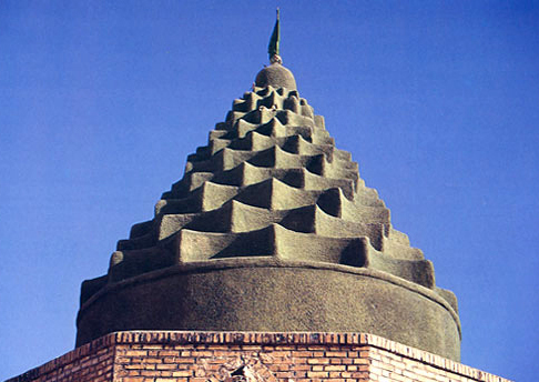
Hamdallah Mustawfi Qazvini ( fa, حمدالله مستوفى قزوینی, Ḥamdallāh Mustawfī Qazvīnī; 1281 – after 1339/40) was a Persian official, historian, geographer and poet. He lived during the last era of the Mongol Ilkhanate, and the interregnum that followed. A native of Qazvin, Mustawfi belonged to family of ''mustawfis'' (financial accountants), thus his name. He was a close associate of the prominent vizier and historian Rashid al-Din Hamadani, who inspired him to write historical and geographical works. Mustawfi is the author of three works; ''Tarikh-i guzida'' ("Excerpt History"), '' Zafarnamah'' ("Book of Victory") and ''Nuzhat al-Qulub'' ("Hearts' Bliss"), respectively. A highly influential figure, Mustawfi's way of conceptualizing the history and geography of Iran has been emulated by other historians since the 13th-century. He is buried in a dome-shaped mausoleum in his native Qazvin. Biography Mustawfi was born in 1281 in the town of Qazvin, locat ... [...More Info...] [...Related Items...] OR: [Wikipedia] [Google] [Baidu] |
Syria (region)
Syria (Hieroglyphic Luwian: 𔒂𔒠 ''Sura/i''; gr, Συρία) or Sham ( ar, ٱلشَّام, ash-Shām) is the name of a historical region located east of the Mediterranean Sea in Western Asia, broadly synonymous with the Levant. Other synonyms are Greater Syria or Syria-Palestine. The region boundaries have changed throughout history. In modern times, the term "Syria" alone is used to refer to the Arab Republic of Syria. The term is originally derived from Assyria, an ancient civilization centered in northern Mesopotamia, modern-day Iraq. During the Hellenistic period, the term Syria was applied to the entire Levant as Coele-Syria. Under Roman rule, the term was used to refer to the province of Syria, later divided into Syria Phoenicia and Coele Syria, and to the province of Syria Palaestina. Under the Byzantines, the provinces of Syria Prima and Syria Secunda emerged out of Coele Syria. After the Muslim conquest of the Levant, the term was superseded by the Ara ... [...More Info...] [...Related Items...] OR: [Wikipedia] [Google] [Baidu] |
Makran
Makran ( fa, مكران), mentioned in some sources as Mecran and Mokrān, is the coastal region of Baluchistan. It is a semi-desert coastal strip in Balochistan, in Pakistan and Iran, along the coast of the Gulf of Oman. It extends westwards, from the Sonmiani Bay to the northwest of Karachi in the east, to the fringes of the region of Bashkardia/Bāšgerd in the southern part of the Sistān and Balučestān province of modern Iran. Makrān is thus bisected by the modern political boundary between Pakistan and Iran. Etymology The southern part of Balochistan is called ''Kech Makran'' on Pakistani side and Makran on the Iranian side which is also the name of a former Iranian province. The location corresponds to that of the Maka satrapy in Achaemenid times. The Sumerian trading partners of Magan are identified with Makran. In Varahamihira's Brihat Samhita, there is a mention of a tribe called ''Makara'' inhabiting the lands west of India. Arrian used the term '' Ichthyophagi ... [...More Info...] [...Related Items...] OR: [Wikipedia] [Google] [Baidu] |
Khuzestan
Khuzestan Province (also spelled Xuzestan; fa, استان خوزستان ''Ostān-e Xūzestān'') is one of the 31 provinces of Iran. It is in the southwest of the country, bordering Iraq and the Persian Gulf. Its capital is Ahvaz and it covers an area of . Since 2014, it has been part of Iran's Region 4. Historically, one of the most important regions of the Ancient Near East, Khuzestan is what historians refer to as ancient Elam, whose capital was in Susa. The Achaemenid Old Persian term for Elam was ''Hujiyā'' when they conquered it from the Elamites, which is present in the modern name. Khuzestan, meaning "the Land of the Khuz", refers to the original inhabitants of this province, the "Susian" people (Old Persian "Huza" or ''Huja'', as in the inscription at the tomb of Darius the Great at Naqsh-e Rostam). They are the Shushan of the Hebrew sources where they are recorded as "Hauja" or "Huja". In Middle Persian, the term evolves into "Khuz" and "Kuzi". The pre-Islamic Par ... [...More Info...] [...Related Items...] OR: [Wikipedia] [Google] [Baidu] |
Diyar Rabi'a
Diyar Rabi'a ( ar, دِيَارُ رَبِيعَةَ, Diyār Rabīʿa, abode of Rabi'a) is the medieval Arabic name of the easternmost and largest of the three provinces of the Jazira (Upper Mesopotamia), the other two being Diyar Bakr and Diyar Mudar. According to the medieval geographer al-Baladhuri, all three provinces were named after the main Arab tribes that were settled there by Mu'awiyah in the course of the Muslim conquests of the 7th century. The Diyar Rabi'a was settled by the Rabi'a tribe. Diyar Rabi'a encompasses the upper reaches of the river Khabur and its tributaries, i.e. the regions of Tur Abdin and Beth Arabaye, as well as both shores of the river Tigris from the vicinity of Jazirat ibn Umar in the north to the boundary with Iraq in the area of Tikrit in the south, including the lower reaches of the Upper Zab and Lower Zab. The main city of the province was Mosul (Arabic al-Mawsil), with other important urban centres at Balad, Jazirat ibn Umar, al-Sinn, Ba ... [...More Info...] [...Related Items...] OR: [Wikipedia] [Google] [Baidu] |
Greater Armenia
Greater Armenia ( hy, Մեծ Հայք, translit=Mets Hayk) is the name given to the Armenian state that emerged on the Armenian Highlands during the reign of King Artaxias I at the turn of the 2nd century BC. The term was used to refer principally to the fifteen provinces that made up Armenian kingdoms throughout the classical, late antique, and medieval periods by contemporary Armenian and non-Armenian authors alike. Extent Though its borders were never exactly defined, Greater Armenia usually referred to the stretch of land beginning from the Euphrates River to the west, the region of Artsakh and parts of what are now Azerbaijan and Iranian Azerbaijan to the east, parts of the modern state of Georgia to the north, with its southern boundary rounding the northern tip of Mesopotamia. The Romans referred to it in Latin as ''Armenia Maior'' while the Greek-speaking peoples called it ''Armenia Megale'' (), to differentiate it from Lesser Armenia (''Pok'r Hayk′'', in Latin ... [...More Info...] [...Related Items...] OR: [Wikipedia] [Google] [Baidu] |
Georgia (country)
Georgia (, ; ) is a transcontinental country at the intersection of Eastern Europe and Western Asia. It is part of the Caucasus region, bounded by the Black Sea to the west, by Russia to the north and northeast, by Turkey to the southwest, by Armenia to the south, and by Azerbaijan to the southeast. The country covers an area of , and has a population of 3.7 million people. Tbilisi is its capital as well as its largest city, home to roughly a third of the Georgian population. During the classical era, several independent kingdoms became established in what is now Georgia, such as Colchis and Iberia. In the early 4th century, ethnic Georgians officially adopted Christianity, which contributed to the spiritual and political unification of the early Georgian states. In the Middle Ages, the unified Kingdom of Georgia emerged and reached its Golden Age during the reign of King David IV and Queen Tamar in the 12th and early 13th centuries. Thereafter, the kingdom decl ... [...More Info...] [...Related Items...] OR: [Wikipedia] [Google] [Baidu] |
Shirvan
Shirvan (from fa, شروان, translit=Shirvān; az, Şirvan; Tat: ''Şirvan''), also spelled as Sharvān, Shirwan, Shervan, Sherwan and Šervān, is a historical Iranian region in the eastern Caucasus, known by this name in both pre-Islamic Sasanian and Islamic times. Today, the region is an industrially and agriculturally developed part of the Azerbaijan Republic that stretches between the western shores of the Caspian Sea and the Kura River, centered on the Shirvan Plain. History Etymology Vladimir Minorsky believes that names such as Sharvān (Shirwān), Lāyzān and Baylaqān are Iranian names from the Iranian languages of the coast of the Caspian Sea. There are several explanations about this name: * Shirvan or Sharvan are changed forms of the word "Shahrbān" ( fa, شهربان, links=no) which means "the governor". The word "Shahrban" has been used since Achaemenian Dynasty as "Xshathrapawn" (satrap) to refer to different states of the kingdom. * Shervan in Per ... [...More Info...] [...Related Items...] OR: [Wikipedia] [Google] [Baidu] |
Mugan Plain
Mughan plain ( az, Muğan düzü, مغان دوزو; ) is a plain stretching from northwestern Iran to the southern part of the Republic of Azerbaijan. The highest density of irrigation canals is in the section of the Mughan plain which lies in the Republic of Azerbaijan. It is located on the bank of the Aras river extending to Iran. The Mughan plain consists of five cities: Bilehard, Parsabad, Jafarabad, Germi and Aslan Duz. One-third of the plain is located in Iran and the rest is in Azerbaijan. From 1353 to 1372, Garmi was the center of this city. After that, Mughan was divided into three cities, Bileh Savar, Garmi and Parsabad. The soil of this plain is very fertile. History Prehistory Alikomektepe The ancient settlement of Alikomektepe, dating to 5000 BC, is located in the Mughan plain and covers an area of over 1 hectare.Махмудов Ф.Р., Нариманов П.Г., 1974. Поселение Аликемек-тепеси. АО 1973 г. М. (Russian) Early levels b ... [...More Info...] [...Related Items...] OR: [Wikipedia] [Google] [Baidu] |

.jpg)


