|
Nordmøre Museum
The Nordmørsmusea AS is a Norwegian regional cultural history museum for the Nordmøre district in Møre og Romsdal County. The museum has its head office in Kristiansund at Storgata 19.Möbius, Aaron, & Michael Möbius. 2011. ''Stefan Loose Reiseführer Norwegen''. Cologne: DuMont Reiseverlag, p. 351. The museum currently has branches in all of the municipalities in Nordmøre: In Smøla (the Smøla museum and Norwegian Marsh Museum), in Averøy and Eide (the Old Kvernes Rural Museum), Tingvoll, Surnadal (the Åsen Village Museum, Kleiva Poet's Home, and Svinvik Arboretum), Rindal, Aure Aure may refer to: Places France * Aure, Ardennes, a commune of the Ardennes ''département'' * Aure (river), a river in northwestern France Norway * Aure, Norway, a municipality in Møre og Romsdal county * Aure (village), a village in Aure Mun ... (the Kråksund Fishing Museum), Halsa (a museum dedicated to the traditional ''geitbåt'' 'goat boat' and the Husasnotra boat-building area), ... [...More Info...] [...Related Items...] OR: [Wikipedia] [Google] [Baidu] |
Norway
Norway, officially the Kingdom of Norway, is a Nordic country in Northern Europe, the mainland territory of which comprises the western and northernmost portion of the Scandinavian Peninsula. The remote Arctic island of Jan Mayen and the archipelago of Svalbard also form part of Norway. Bouvet Island, located in the Subantarctic, is a dependency of Norway; it also lays claims to the Antarctic territories of Peter I Island and Queen Maud Land. The capital and largest city in Norway is Oslo. Norway has a total area of and had a population of 5,425,270 in January 2022. The country shares a long eastern border with Sweden at a length of . It is bordered by Finland and Russia to the northeast and the Skagerrak strait to the south, on the other side of which are Denmark and the United Kingdom. Norway has an extensive coastline, facing the North Atlantic Ocean and the Barents Sea. The maritime influence dominates Norway's climate, with mild lowland temperatures on the se ... [...More Info...] [...Related Items...] OR: [Wikipedia] [Google] [Baidu] |
Nordmøre
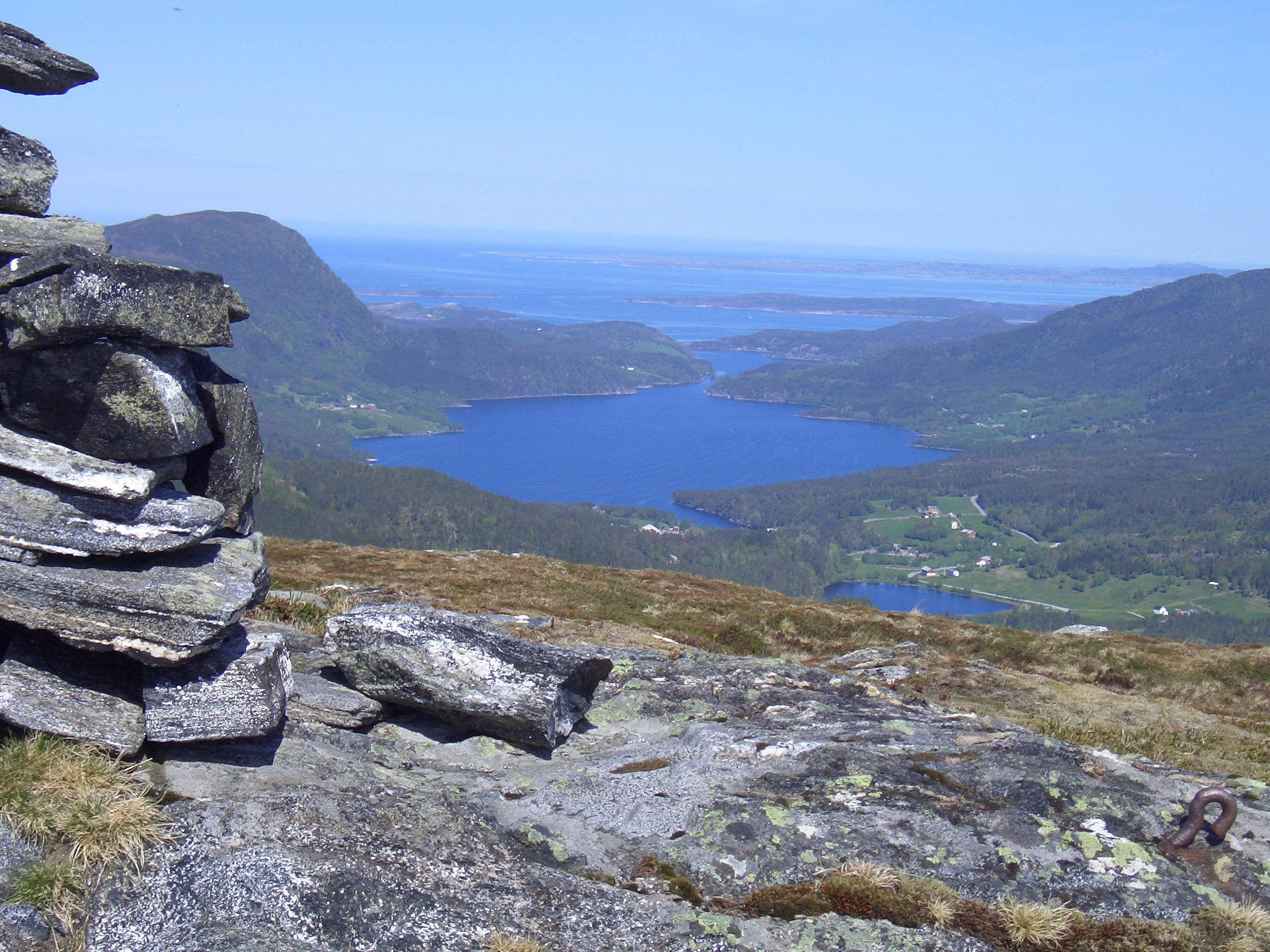
Nordmøre (English: North- Møre) is a traditional district in the Norwegian county of Møre og Romsdal. The area comprises the northern third of the county including the municipalities of Kristiansund, Averøy, Tingvoll, Surnadal, Aure, Halsa, Eide, Sunndal, Gjemnes, and Smøla. The only town in Nordmøre is Kristiansund. Of these ten municipalities, three are located (mainly) on islands: Kristiansund, Averøy, and Smøla and seven lie on the coast (including between, adjacent to, or at the end of, fjords): Tingvoll, Surnadal, Aure, Halsa, Eide, Sunndal, and Gjemnes; no municipalities are completely landlocked. Historically, the municipality of Rindal was part of the county and region, but it was transferred to Trøndelag county on 1 January 2019. In the early Viking Age, before Harald Fairhair, Nordmøre was a petty kingdom whose ruler was known as the ''Mørejarl'' (literally: "Møre-Earl"). Then, Nordmøre also included the municipalities north and west of Orkdal municipal ... [...More Info...] [...Related Items...] OR: [Wikipedia] [Google] [Baidu] |
Møre Og Romsdal
Møre og Romsdal (; en, Møre and Romsdal) is a county in the northernmost part of Western Norway. It borders the counties of Trøndelag, Innlandet, and Vestland. The county administration is located in the town of Molde, while Ålesund is the largest town. The county is governed by the Møre og Romsdal County Municipality which includes an elected county council and a county mayor. The national government is represented by the county governor. Name The name ''Møre og Romsdal'' was created in 1936. The first element refers to the districts of Nordmøre and Sunnmøre, and the last element refers to Romsdal. Until 1919, the county was called "Romsdalens amt", and from 1919 to 1935 "Møre fylke". For hundreds of years (1660-1919), the region was called ''Romsdalen amt'', after the Romsdalen valley in the present-day Rauma Municipality. The Old Norse form of the name was ''Raumsdalr''. The first element is the genitive case of the name ''Raumr'' derived from the name of the ... [...More Info...] [...Related Items...] OR: [Wikipedia] [Google] [Baidu] |
Kristiansund
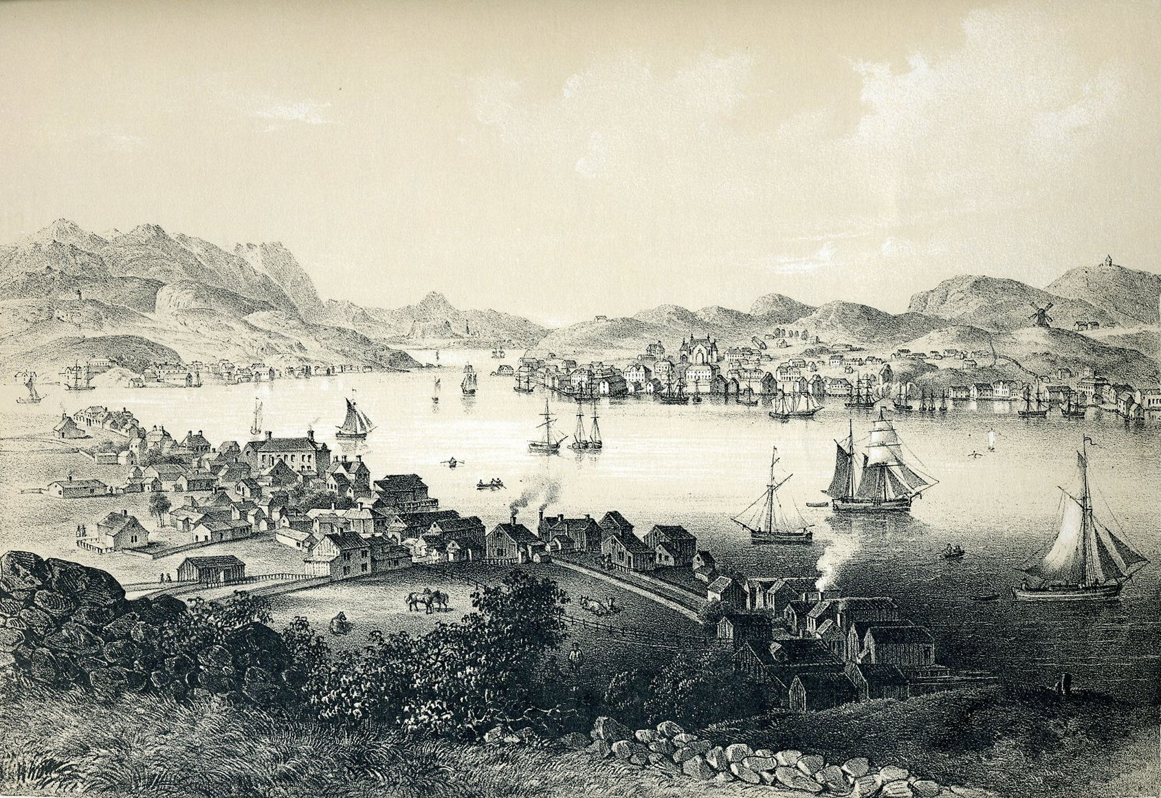
Kristiansund (, ; historically spelled Christianssund and earlier named Fosna) is a municipality on the western coast of Norway in the Nordmøre district of Møre og Romsdal county. The administrative center of the municipality is the town of Kristiansund (established in 1742), which is the major town for the whole Nordmøre region. Other notable settlements in the municipality include the villages of Kvalvåg, Rensvik, and Nedre Frei. The municipality is the 333rd largest by area out of the 356 municipalities in Norway. Kristiansund is the 52nd most populous municipality in Norway with a population of 24,013. The municipality's population density is and its population has increased by 0.8% over the previous 10-year period. General information The parish of ''Christianssund'' was established as a municipality on 1 January 1838 (see formannskapsdistrikt law). Initially, the small island municipality included just the town of Christianssund and its immediate surrounding area ... [...More Info...] [...Related Items...] OR: [Wikipedia] [Google] [Baidu] |
Smøla
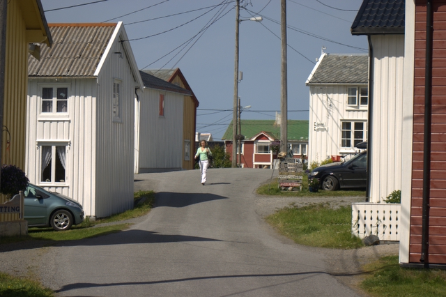
Smøla is a municipality in Møre og Romsdal county, Norway. It is part of the Nordmøre region. The administrative centre of the municipality is the village of Hopen, other villages include Dyrnes, Råket, and Veiholmen. The municipality is the 272nd largest by area out of the 356 municipalities in Norway. Smøla is the 273rd most populous municipality in Norway with a population of 2,120. The municipality's population density is and its population has decreased by 2.8% over the previous 10-year period. General information The municipality of Smøla was established on 1 January 1960 after the merger of the municipalities of Edøy (population: 1,135), Brattvær (population: 1,361), and Hopen (population: 1,550). The initial population of Smøla was 4,046. The boundaries have not changed since that time. Name The municipality is named after the main island of Smøla ( non, Smyl or ). The name is probably related to the modern Norwegian words ''smule'' and ''smuldre'' w ... [...More Info...] [...Related Items...] OR: [Wikipedia] [Google] [Baidu] |
Averøy
Averøy is a municipality in Møre og Romsdal county, Norway. It is part of the region of Nordmøre. The administrative centre of the municipality is the village of Bruhagen. Other villages in the municipality include Bremsnes, Kornstad, Kvernes, Kårvåg, Langøy, Sveggen, and Vebenstad. The municipality includes the main island of Averøya and the many small islands surrounding it. The Kornstadfjorden, Kvernesfjorden, and Bremsnesfjorden surround the municipality on three sides and the open ocean on the fourth side. The Hestskjær Lighthouse and Stavnes Lighthouse are located in the northern part of the municipality. The municipality is the 312th largest by area out of the 356 municipalities in Norway. Averøy is the 164th most populous municipality in Norway with a population of 5,828. The municipality's population density is and its population has increased by 4.2% over the previous 10-year period. General information The municipality of Averøy was established on ... [...More Info...] [...Related Items...] OR: [Wikipedia] [Google] [Baidu] |
Eide
Parallel ATA (PATA), originally , also known as IDE, is a standard interface designed for IBM PC-compatible computers. It was first developed by Western Digital and Compaq in 1986 for compatible hard drives and CD or DVD drives. The connection is used for storage devices such as hard disk drives, floppy disk drives, and optical disc drives in computers. The standard is maintained by the X3/INCITS committee. It uses the underlying (ATA) and Packet Interface (ATAPI) standards. The Parallel ATA standard is the result of a long history of incremental technical development, which began with the original AT Attachment interface, developed for use in early PC AT equipment. The ATA interface itself evolved in several stages from Western Digital's original Integrated Drive Electronics (IDE) interface. As a result, many near-synonyms for ATA/ATAPI and its previous incarnations are still in common informal use, in particular Extended IDE (EIDE) and Ultra ATA (UATA). After the introduc ... [...More Info...] [...Related Items...] OR: [Wikipedia] [Google] [Baidu] |
Tingvoll
Tingvoll is a municipality in Møre og Romsdal county, Norway. It is part of the Nordmøre region. The administrative centre is the village of Tingvollvågen. Other villages include Meisingset, Kvisvik, and Torjulvågen. The municipality covers a peninsula on the mainland as well as a few surrounding islands. Norwegian National Road 70 and European route E39 both run through the municipality. The municipality is the 253rd largest by area out of the 356 municipalities in Norway. Tingvoll is the 226th most populous municipality in Norway with a population of 2,960. The municipality's population density is and its population has decreased by 4.5% over the previous 10-year period. General information The parish of Tingvoll was established as a municipality on 1 January 1838 (see formannskapsdistrikt law). On 1 January 1866, the northern part of the municipality (population: 1,222) was separated to form the new Straumsnes Municipality. On 1 January 1874, a part of Stangvik M ... [...More Info...] [...Related Items...] OR: [Wikipedia] [Google] [Baidu] |
Surnadal
Surnadal () is a municipality in Møre og Romsdal county, Norway. It is part of the Nordmøre region. The administrative centre is the village of Skei. Other villages in Surnadal include Glærem, Mo, Stangvik, Surnadalsøra, Sylte, Todalsøra, and Åsskard. A mild climate and rich soil make Surnadal well suited for agriculture. The local economy is based on agriculture, forestry, and industrial production, in addition to services. The municipality is the 68th largest by area out of the 356 municipalities in Norway. Surnadal is the 163rd most populous municipality in Norway with a population of 5,849. The municipality's population density is and its population has decreased by 1.7% over the previous 10-year period. General information The parish of Surnadal was established as a municipality on 1 January 1838 (see formannskapsdistrikt law). In 1858, the eastern district (population: 2,684) was separated from Surnadal to form the new Rindal Municipality. This left Surnadal w ... [...More Info...] [...Related Items...] OR: [Wikipedia] [Google] [Baidu] |
Rindal
Rindal is a municipality in Trøndelag county, Norway. It is part of the Orkdalen region. The administrative centre is the village of Rindal. Other villages in the municipality include Tiset and Romundstad. The municipality centres on agriculture and forestry services. The municipality is the 185th largest by area out of the 356 municipalities in Norway. Rindal is the 281st most populous municipality in Norway with a population of 1,980. The municipality's population density is and its population has decreased by 5.2% over the previous 10-year period. General information The parish of Rindal was established as a municipality in 1858 when it was separated from Surnadal Municipality. It was originally located within Møre og Romsdal county. The initial population of Rindal was 2,684. On 1 January 2008, the Fossdalen farm (population: 4) was transferred from Rindal (in Møre og Romsdal county) to Hemne Municipality (in Sør-Trøndelag county). On 1 January 2019, the municipa ... [...More Info...] [...Related Items...] OR: [Wikipedia] [Google] [Baidu] |
Aure, Norway
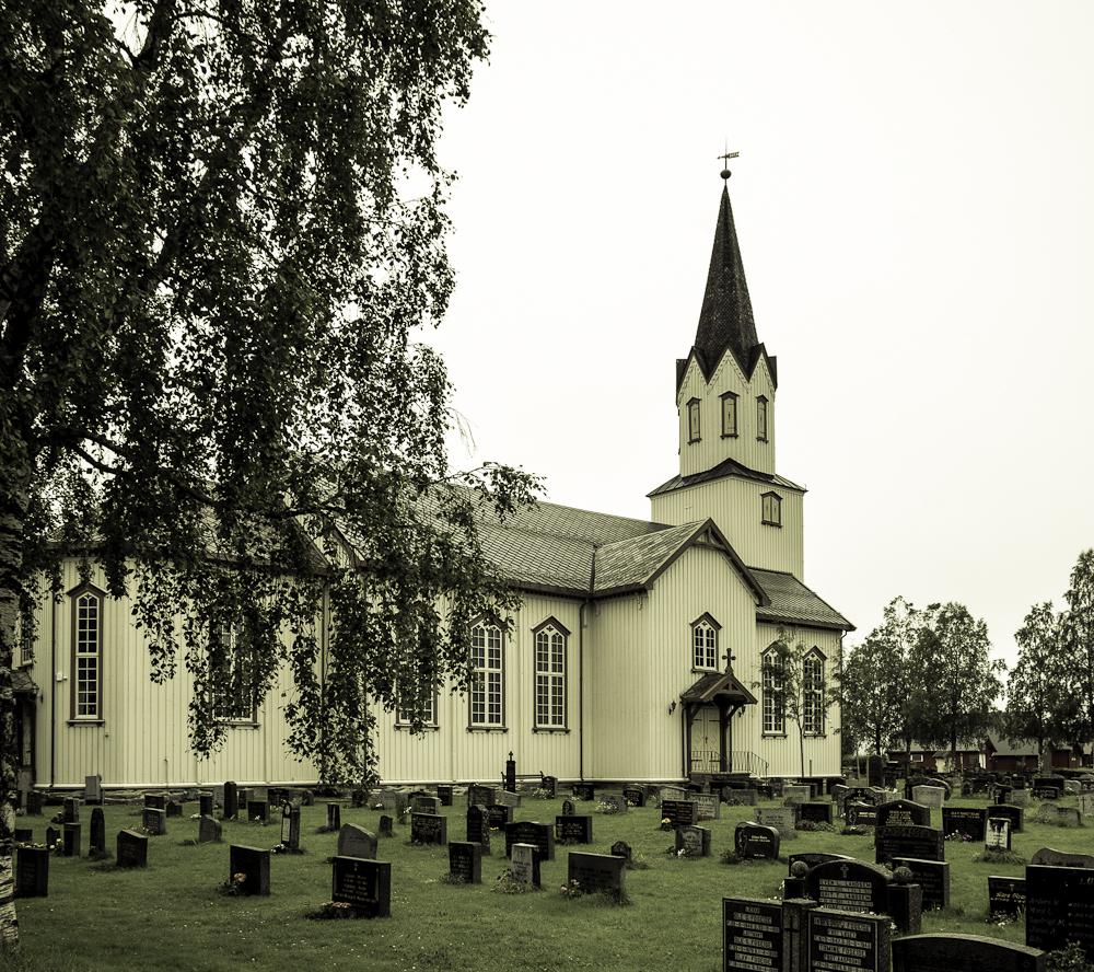
Aure is a municipality in Møre og Romsdal county, Norway. It is part of the region of Nordmøre. The administrative centre is the village of Aure. Other villages in Aure include Gullstein, Stemshaug, Todalen, Tjeldbergodden, Arasvika, and Tømmervåg. Aure has one of the largest wooden churches in Norway, Aure Church. The municipality is the 179th largest by area out of the 356 municipalities in Norway. Aure is the 218th most populous municipality in Norway with a population of 3,384. The municipality's population density is and its population has decreased by 3.6% over the previous 10-year period. General information The municipality was established on 1 January 1838 (see formannskapsdistrikt law). On 1 January 1894, the southern district of Aure (population: 942) was separated to form the new municipality of Valsøyfjord. Then on 1 July 1914, the northeastern district of Aure (population: 851) was separated to form the new municipality of Stemshaug. During the 1960s, ... [...More Info...] [...Related Items...] OR: [Wikipedia] [Google] [Baidu] |
Halsa
Halsa is a former municipality in Møre og Romsdal county, Norway. The municipality existed from 1838 until 2020 when it became part of Heim Municipality in Trondelag county. It was part of the Nordmøre region. The administrative centre of Halsa was the village of Liabøen. Other villages in the municipality included Todalen, Halsanaustan, Valsøyfjord, Engan, Hjellnes, and Valsøybotnen. At the time of its dissolution in 2020, the municipality was the 279th largest by area out of the 422 municipalities in Norway. Halsa was the 349th most populous municipality in Norway with a population of 1,571. The municipality's population density was and its population has decreased by 6% over the last decade. General information The parish of Halsa was established as a municipality on 1 January 1838 (see formannskapsdistrikt law). On 1 January 1868, an unpopulated area of Halsa was transferred to the neighboring municipality of Straumsnes. On 1 January 1879, a part of Halsa (popu ... [...More Info...] [...Related Items...] OR: [Wikipedia] [Google] [Baidu] |
