|
Nizhegorodsky City District, Nizhny Novgorod
Nizhegorodsky City District (russian: Нижегородский район) is a central administrative district (raion) in Upper City of Nizhny Novgorod, Russia. The main strategic, historical, political and cultural district of the city. Centre of district is popular among tourists. Here is the Kremlin, the Minin and Pozharsky Square, Bolshaya Pokrovskaya Street, Rozhdestvenskaya Street Rozhdestvenskaya Street – (russian: link=no, Рождественская улица ''Nativity Street'') an historic street in Nizhny Novgorod. Is a unique open-air museum, there are only stone houses, the history of the oldest of which dates ..., the monument to Minin and Pozharsky and other landmarks. In the central part of the district are the main political institutions. It is strategically important. References {{More citations needed, date=August 2016 City districts of Nizhny Novgorod ... [...More Info...] [...Related Items...] OR: [Wikipedia] [Google] [Baidu] |
Nizhny Novgorod Oblast
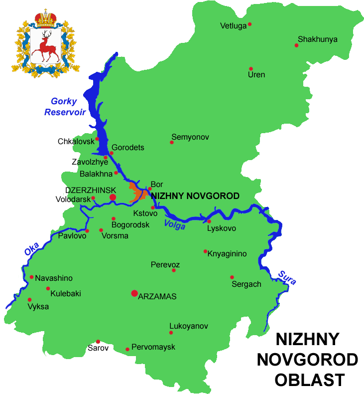
Nizhny Novgorod Oblast (russian: link=no, Нижегородская область, ''Nizhegorodskaya oblast''), is a federal subjects of Russia, federal subject of Russia (an oblast). Its administrative center is the types of inhabited localities in Russia, city of Nizhny Novgorod. It has a population of 3,310,597 as of the Russian Census (2010), 2010 Census. From 1932 to 1990 it was known as Gorky Oblast. The oblast is crossed by the Volga River. Apart from Nizhny Novgorod's metropolitan area (including Dzerzhinsk, Russia, Dzerzhinsk, Bor, Nizhny Novgorod Oblast, Bor and Kstovo) the biggest city is Arzamas. Near the town of Sarov there is the Serafimo-Diveyevsky Monastery, one of the largest convents in Russia, established by Seraphim of Sarov, Saint Seraphim of Sarov. The Makaryev Monastery opposite of the town of Lyskovo, Nizhny Novgorod Oblast, Lyskovo used to be the location of the largest fair in Eastern Europe. Other historic towns include Gorodets, Nizhny Novgorod Oblast ... [...More Info...] [...Related Items...] OR: [Wikipedia] [Google] [Baidu] |
Nizhny Novgorod
Nizhny Novgorod ( ; rus, links=no, Нижний Новгород, a=Ru-Nizhny Novgorod.ogg, p=ˈnʲiʐnʲɪj ˈnovɡərət ), colloquially shortened to Nizhny, from the 13th to the 17th century Novgorod of the Lower Land, formerly known as Gorky (, ; 1932–1990), is the administrative centre of Nizhny Novgorod Oblast and the Volga Federal District. The city is located at the confluence of the Oka and the Volga rivers in Central Russia, with a population of over 1.2 million residents, up to roughly 1.7 million residents in the urban agglomeration. Nizhny Novgorod is the sixth-largest city in Russia, the second-most populous city on the Volga, as well as the Volga Federal District. It is an important economic, transportation, scientific, educational and cultural center in Russia and the vast Volga-Vyatka economic region, and is the main center of river tourism in Russia. In the historic part of the city there are many universities, theaters, museums and churches. The city w ... [...More Info...] [...Related Items...] OR: [Wikipedia] [Google] [Baidu] |
Nizhny Novgorod Kremlin
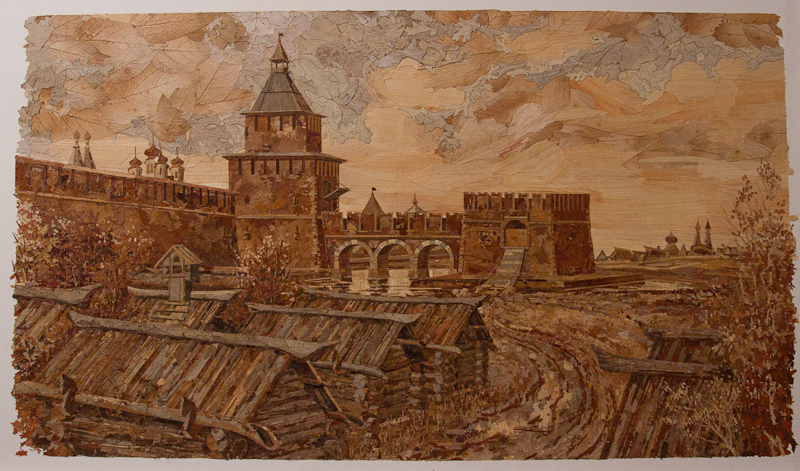
The Nizhny Novgorod Kremlin ( rus, Нижегородский кремль, Nizhegorodskiy Kreml') is a fortress in Nizhny Novgorod, the historic city center. History The first attempt to replace the wooden fort with a stone kremlin was recorded in 1374, but construction was limited to a single tower, known as the Dmitrovskaya Tower (this has not survived). Under the rule of Ivan III, Nizhny Novgorod played the role of a guard city, having a permanent garrison; it served as a place for gathering troops for Moscow’s actions against the Khanate of Kazan. In order to strengthen the defenses of the city, construction works on the walls began again. Construction of the stone Kremlin of Nizhny Novgorod began in 1500 with the building of the Ivanovskaya Tower; the main work commenced in 1508 and by 1515 a grandiose building was completed. The oak walls that formed the old fortifications were destroyed by a huge fire in 1513. The two kilometer wall was reinforced by 13 towers (one ... [...More Info...] [...Related Items...] OR: [Wikipedia] [Google] [Baidu] |
Zelyony Gorod
Zelyony Gorod (russian: Зелёный Го́род, lit. ''green city'') is an urban locality (a resort settlement under the administrative jurisdiction of the city of oblast significance of Nizhny Novgorod) in Nizhny Novgorod Oblast, Russia, located in a forested area to the southeast of Nizhny Novgorod and surrounded by the territory of Kstovsky District. Population: The forested area around the settlement is a surviving part of a much larger forest area that existed here centuries ago. Geographically, it is located Nizhny Novgorod and Kstovo, and is bounded roughly by Highway M-7 and Pavlovo- Royka- Zeletsino railway from the north and the Kudma River The Kudma (russian: Кудьма, ''Kud'ma'') is a river in Nizhny Novgorod Oblast of Russia, a right tributary of the Volga. It is long, and has a drainage basin of . [...More Info...] [...Related Items...] OR: [Wikipedia] [Google] [Baidu] |
Raion
A raion (also spelt rayon) is a type of administrative unit of several post-Soviet states. The term is used for both a type of subnational entity and a division of a city. The word is from the French (meaning 'honeycomb, department'), and is commonly translated as "district" in English. A raion is a standardized administrative entity across most of the former Soviet Union and is usually a subdivision two steps below the national level, such as a subdivision of an oblast. However, in smaller USSR republics, it could be the primary level of administrative division. After the fall of the Soviet Union, some of the republics kept the ''raion'' (e.g. Azerbaijan, Belarus, Ukraine, Russia, Moldova, Kazakhstan, Kyrgyzstan) while others dropped it (e.g. Georgia, Uzbekistan, Estonia, Lithuania, Latvia, Armenia, Tajikistan, Turkmenistan). In Bulgaria, it refers to an internal administrative subdivision of a city not related to the administrative division of the country as a whole, or, i ... [...More Info...] [...Related Items...] OR: [Wikipedia] [Google] [Baidu] |
Russia
Russia (, , ), or the Russian Federation, is a List of transcontinental countries, transcontinental country spanning Eastern Europe and North Asia, Northern Asia. It is the List of countries and dependencies by area, largest country in the world, with its internationally recognised territory covering , and encompassing one-eighth of Earth's inhabitable landmass. Russia extends across Time in Russia, eleven time zones and shares Borders of Russia, land boundaries with fourteen countries, more than List of countries and territories by land borders, any other country but China. It is the List of countries and dependencies by population, world's ninth-most populous country and List of European countries by population, Europe's most populous country, with a population of 146 million people. The country's capital and List of cities and towns in Russia by population, largest city is Moscow, the List of European cities by population within city limits, largest city entirely within E ... [...More Info...] [...Related Items...] OR: [Wikipedia] [Google] [Baidu] |
Russian Census (2002)
The Russian Census of 2002 (russian: Всеросси́йская пе́репись населе́ния 2002 го́да) was the first census of the Russian Federation since the dissolution of the Soviet Union, carried out on October 9 through October 16, 2002. It was carried out by the Russian Federal Service of State Statistics (Rosstat). Data collection The census data were collected as of midnight October 9, 2002. Resident population The census was primarily intended to collect statistical information about the resident population of Russian Federation. The resident population included: * Russian citizens living in Russia (including those temporarily away from the country, provided the absence from the country was expected to last less than one year); * non-citizens (i.e. foreign citizens and stateless persons) who were any of the following: ** legal permanent residents; ** persons who have arrived in the country with the intent to settle permanently or to seek asylum, regar ... [...More Info...] [...Related Items...] OR: [Wikipedia] [Google] [Baidu] |
Minin And Pozharsky Square
The Minin and Pozharsky Square (. Short-name: Minin Square) is the main square of Nizhny Novgorod. It is a social and cultural center of the city, the venue of the most important celebrations. It is located in the historical centre of the old town from the southeast side of the Kremlin. The square connects the central streets of the city: Bolshaya Pokrovskaya, Varvarskaya, Ulyanov, Minin, Upper Volga embankment and Zelensky Descent. There are many architectural monuments, the Minin University, Lobachevsky University and the Medical University; monuments to Minin, Chkalov; Exhibition Complex, as well as the first city fountain. The square is the roadway. Movement on it overlaps only on holidays and at the time of other events. History Russian tsardom Before the square began to take shape, wooden houses, forges and a deep moat filled with water to prevent penetration into the Kremlin were located in its place. Initially, the square was unofficially called the Verkhneposad ... [...More Info...] [...Related Items...] OR: [Wikipedia] [Google] [Baidu] |
Bolshaya Pokrovskaya Street
Bolshaya Pokrovskaya Street (russian: Большая Покровская улица, lit=Greater Intercession Street. Short-name - Pokrovka) is the high street in the historical centre of Nizhny Novgorod and one of its oldest streets. Until 1917 it was considered a street for noblemen. Formed as the main street of the city by the end of the 18th century. It is considered an analogue of the Arbat in Moscow or 6-7 Lines of Vasilyevsky Island in St. Petersburg. History Russian Empire The street began to form in the Middle Ages. Then its direction was set on the road to Moscow. After the visit of Empress Catherine II, a new regular city plan was developed, providing for a quarterly system. In 1823 - 1824 the bell tower at the church of the Protection of the Holy Virgin (russian: Церковь Покрова Пресвятой Богородицы) was built. Since then, the street has become known as the Bolshaya Pokrovskaya. Most often the street was called "Pokrovka". At t ... [...More Info...] [...Related Items...] OR: [Wikipedia] [Google] [Baidu] |
Rozhdestvenskaya Street
Rozhdestvenskaya Street – (russian: link=no, Рождественская улица ''Nativity Street'') an historic street in Nizhny Novgorod. Is a unique open-air museum, there are only stone houses, the history of the oldest of which dates back to the middle of the 18th century. Officially there are 35 monuments of architecture. The most famous landmark is the ''Church of the Nativity''. History Russian tsardom and Russian empire The settlement on the site of the modern Rozhdesvenskaya street began literally from the time the city was founded. It is known that in the 14th century, this territory was part of the border of wood-reinforced fortifications known as the Lesser Ostrog. The 17th century was a period of economic growth in the history of Nizhny Novgorod. At the beginning of the century, the street was called Kosmodemyanskaya by the church of Cosmas and Damian located in the center of the Lower Posad. But in 1653 a stone Christmas temple was built and the stre ... [...More Info...] [...Related Items...] OR: [Wikipedia] [Google] [Baidu] |
Historic Centre Of Nizhny Novgorod
The historic centre of Nizhny Novgorod (also old Nizhny Novgorod, the old town) is the downtown of Nizhny Novgorod with historical buildings in the borders up to 1917. A large number of ancient buildings, natural landmarks and historic districts are found in the area. In the old city there are buildings of different epochs and architectural styles, including Neo-Byzantine, Stroganov's Baroque, Empire, Modern. These include the medieval Kremlin, 19th-century mansions and Stalinist monumental houses. Sites The site contains the following objects # Historic centre of Nizhny Novgorod (downtown); #* The Kremlin; #* Upper Posad; #* Lower Posad; #* Zapochainye; #* Dyatlov Hills; # Historic centre of Kanavino (midtown); #* The Fair; #* The Spit (Strelka); #* Moskovsky railway station and Revolution Square; # Historic centre of Sormovo; #* The Sormovo Factory. Location The old city is located on two hills: Kremlevsky and Ilyinsky. On the Kremlevsky hill is the Kremlin itself and ... [...More Info...] [...Related Items...] OR: [Wikipedia] [Google] [Baidu] |


