|
Ninemile Canyon (Utah)
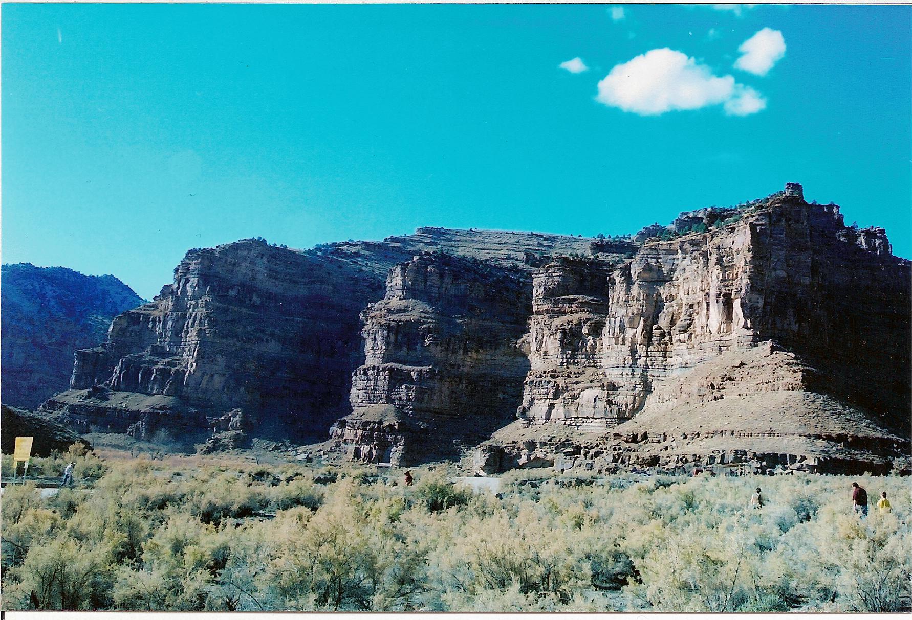
Ninemile Canyon (also Nine Mile Canyon) is a canyon, approximately long, located in Carbon and Duchesne counties in eastern Utah, United States. Promoted as "the world's longest art gallery", the canyon is known for its extensive rock art, most of it created by the Fremont culture and the Ute people. The rock art, shelters, and granaries left behind by the Fremont make Ninemile Canyon a destination for archaeologists and tourists alike. The canyon became a main transport corridor in the region during the 1880s. Settlers established a number of ranches in Ninemile Canyon, and even a short-lived town named Harper. No longer heavily traveled, the rugged canyon road was used mostly for recreation and tourism through the end of the 20th century. The discovery of rich deposits of natural gas deep beneath the West Tavaputs Plateau has brought an influx of industrial truck traffic since 2002. The large amounts of fugitive dust produced by the trucks' passage may be damaging the rock ar ... [...More Info...] [...Related Items...] OR: [Wikipedia] [Google] [Baidu] |
Book Cliffs
The Book Cliffs are a series of desert mountains and cliffs in western Colorado and eastern Utah in the western United States. They are so named because the cliffs of Cretaceous sandstone that cap many of the south-facing buttes appear similar to a shelf of books. Stratigraphy The Book Cliffs are one of the world's best places to study sequence stratigraphy. In the 1980s, Exxon scientists used the Cretaceous strata of the Book Cliffs to develop the science of sequence stratigraphy. The Book Cliffs have preserved excellent strata of the foreland basin of the ancient Western Interior Seaway that stretched north from the Gulf of Mexico to the Yukon in the Cretaceous Period. Components of deltaic and shallow marine reservoirs are very well preserved in the Book Cliffs. Wildlife Large mammals found in the Book Cliffs include coyotes, mountain lions, bobcats, mule deer, elk, black bears, pronghorn, American bison as an extension of the Henry Mountains bison herd and bighorn sheep. ... [...More Info...] [...Related Items...] OR: [Wikipedia] [Google] [Baidu] |
Pictograph
A pictogram, also called a pictogramme, pictograph, or simply picto, and in computer usage an icon, is a graphic symbol that conveys its meaning through its pictorial resemblance to a physical object. Pictographs are often used in writing and graphic systems in which the characters are to a considerable extent pictorial in appearance. A pictogram may also be used in subjects such as leisure, tourism, and geography. Pictography is a form of writing which uses representational, pictorial drawings, similarly to cuneiform and, to some extent, hieroglyphic writing, which also uses drawings as phonetic letters or determinative rhymes. Some pictograms, such as Hazards pictograms, are elements of formal languages. "Pictograph" has a different definition in the field of prehistoric art (which includes recent art by traditional societies), where it means art painted on rock surfaces. This is in comparison to petroglyphs, where the images are carved or incised. Such images may or may no ... [...More Info...] [...Related Items...] OR: [Wikipedia] [Google] [Baidu] |
Petroglyph
A petroglyph is an image created by removing part of a rock surface by incising, picking, carving, or abrading, as a form of rock art. Outside North America, scholars often use terms such as "carving", "engraving", or other descriptions of the technique to refer to such images. Petroglyphs are found worldwide, and are often associated with prehistoric peoples. The word comes from the Greek prefix , from meaning "stone", and meaning "carve", and was originally coined in French as . Another form of petroglyph, normally found in literate cultures, a rock relief or rock-cut relief is a relief sculpture carved on "living rock" such as a cliff, rather than a detached piece of stone. While these relief carvings are a category of rock art, sometimes found in conjunction with rock-cut architecture, they tend to be omitted in most works on rock art, which concentrate on engravings and paintings by prehistoric or nonliterate cultures. Some of these reliefs exploit the rock's nat ... [...More Info...] [...Related Items...] OR: [Wikipedia] [Google] [Baidu] |
North America
North America is a continent in the Northern Hemisphere and almost entirely within the Western Hemisphere. It is bordered to the north by the Arctic Ocean, to the east by the Atlantic Ocean, to the southeast by South America and the Caribbean Sea, and to the west and south by the Pacific Ocean. Because it is on the North American Plate, North American Tectonic Plate, Greenland is included as a part of North America geographically. North America covers an area of about , about 16.5% of Earth's land area and about 4.8% of its total surface. North America is the third-largest continent by area, following Asia and Africa, and the list of continents and continental subregions by population, fourth by population after Asia, Africa, and Europe. In 2013, its population was estimated at nearly 579 million people in List of sovereign states and dependent territories in North America, 23 independent states, or about 7.5% of the world's population. In Americas (terminology)#Human ge ... [...More Info...] [...Related Items...] OR: [Wikipedia] [Google] [Baidu] |
Minnie Maud
Minnie Maud is the name of a creek and canyon in eastern Utah that is noted as the western starting point of the Ninemile Canyon petroglyphs section. Minnie Maud Creek is a stream whose headwaters begin where the West Tavaputs Plateau and Wasatch Plateau meet the Uinta Mountains. The creek flows through a comparatively narrow valley and has limited irrigation possibilities. It has a general easterly course and merges with Nine Mile Creek. Minnie Maud Creek drains into Nine Mile Creek which reaches the Green River in Desolation Canyon. Minnie Maud Canyon which is formed by Minnie Maud Creek is relatively narrow and lacks Fremont Cultural ruins and writings that are abundant in Nine Mile Canyon. Due to its narrow nature, Minnie Maud Canyon was never permanently settled, although a school district that served residents in Nine Mile Canyon was briefly opened in the canyon in 1896 and took the name Minnie Maud. Minnie Maud School District lacked the necessary funds and closed in 1 ... [...More Info...] [...Related Items...] OR: [Wikipedia] [Google] [Baidu] |
Desolation Canyon
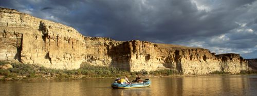
Desolation Canyon is a remote canyon on the Green River (Colorado River tributary), Green River in eastern Utah, United States that is listed on the National Register of Historic Places (NRHP). It is said to be one of the most remote areas in the contiguous United States. Description The canyon begins in southwestern Uintah County, Utah, Uintah County and then meanders roughly south along (and becomes) the border, county line between Uintah and Carbon County, Utah, Carbon counties (including the entire eastern border of Carbon County). Continuing its southerly meander, it then becomes the county line between Emery County, Utah, Emery and Grand County, Utah, Grand counties, until it reaches its mouth in the Roan Cliffs. (The Green River continues flowing south through Gray Canyon (Utah), Gray Canyon.) Desolation Canyon is situated between the West Tavaputs Plateau on the west and the East Tavaputs Plateau on the east. At its deepest point, a relief of over exists from river level ... [...More Info...] [...Related Items...] OR: [Wikipedia] [Google] [Baidu] |
Green River (Colorado River)
The Green River, located in the western United States, is the chief tributary of the Colorado River. The watershed of the river, known as the Green River Basin, covers parts of the U.S. states of Wyoming, Utah, and Colorado. The Green River is long, beginning in the Wind River Mountains of Wyoming and flowing through Wyoming and Utah for most of its course, except for a short segment of in western Colorado. Much of the route traverses the arid Colorado Plateau, where the river has carved some of the most spectacular canyons in the United States. The Green is slightly smaller than Colorado when the two rivers merge but typically carries a larger load of silt. The average yearly mean flow of the river at Green River, Utah is per second. The status of the Green River as a tributary of the Colorado River came about mainly for political reasons. In earlier nomenclature, the Colorado River began at its confluence with the Green River. Above the confluence, Colorado was called the ... [...More Info...] [...Related Items...] OR: [Wikipedia] [Google] [Baidu] |
Tributary
A tributary, or affluent, is a stream or river that flows into a larger stream or main stem (or parent) river or a lake. A tributary does not flow directly into a sea or ocean. Tributaries and the main stem river drain the surrounding drainage basin of its surface water and groundwater, leading the water out into an ocean. The Irtysh is a chief tributary of the Ob river and is also the longest tributary river in the world with a length of . The Madeira River is the largest tributary river by volume in the world with an average discharge of . A confluence, where two or more bodies of water meet, usually refers to the joining of tributaries. The opposite to a tributary is a distributary, a river or stream that branches off from and flows away from the main stream. PhysicalGeography.net, Michael Pidwirny & S ... [...More Info...] [...Related Items...] OR: [Wikipedia] [Google] [Baidu] |
Stream
A stream is a continuous body of water, body of surface water Current (stream), flowing within the stream bed, bed and bank (geography), banks of a channel (geography), channel. Depending on its location or certain characteristics, a stream may be referred to by a variety of local or regional names. Long large streams are usually called rivers, while smaller, less voluminous and more intermittent river, intermittent streams are known as streamlets, brooks or creeks. The flow of a stream is controlled by three inputs – surface runoff (from precipitation or meltwater), daylighting (streams), daylighted subterranean river, subterranean water, and surfaced groundwater (Spring (hydrology), spring water). The surface and subterranean water are highly variable between periods of rainfall. Groundwater, on the other hand, has a relatively constant input and is controlled more by long-term patterns of precipitation. The stream encompasses surface, subsurface and groundwater fluxes th ... [...More Info...] [...Related Items...] OR: [Wikipedia] [Google] [Baidu] |
Myton, Utah
Myton is a city in Duchesne County, Utah, United States. Established in 1905, Myton had a population of 569 at the 2010 census. Geography Myton is located in eastern Duchesne County along U.S. Routes 40 and 191. Duchesne, the county seat, is to the west, and Roosevelt, the largest city by population in Duchesne County, is to the northeast. According to the United States Census Bureau, the city has a total area of , all land. Myton is on the south side of the Duchesne River, an east-flowing tributary of the Green River. Climate According to the Köppen Climate Classification system, Myton has a semi-arid climate, abbreviated ''BSk'' on climate maps. In 1974, Myton recorded a mere of precipitation for the entire year, the record lowest for a calendar year in Utah, and the second-lowest figure ever recorded in the US outside the southwestern deserts. Demographics As of the census of 2000, there were 539 people, 163 households, and 131 families residing in the city. The p ... [...More Info...] [...Related Items...] OR: [Wikipedia] [Google] [Baidu] |


.jpg)


_nahe_dem_Weiherdamm_in_Wildbergerhütte.jpg)