|
Newer Volcanics Province
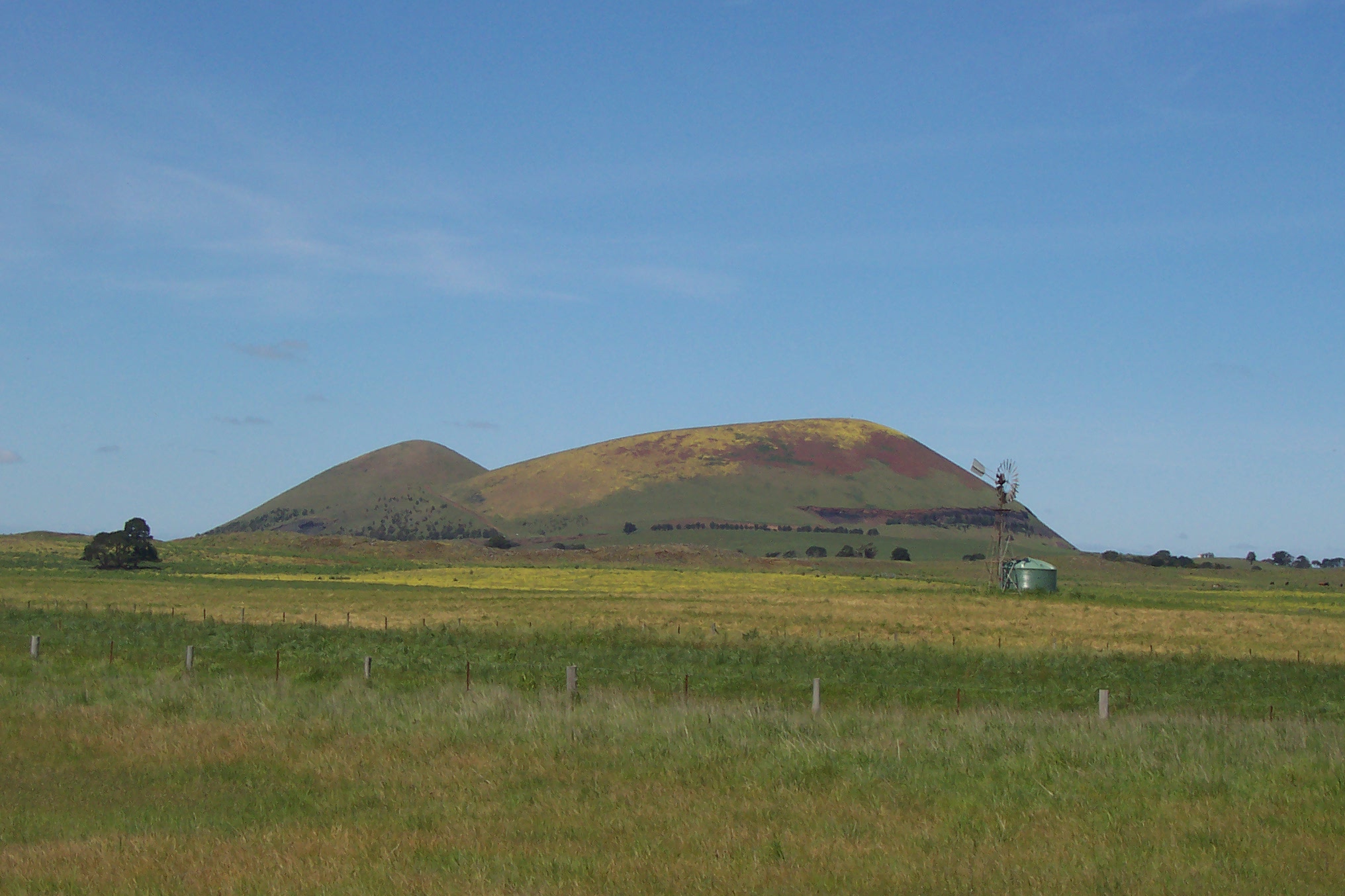
The Newer Volcanics Province is a geological area which is a volcanic field, formed by the East Australia hotspot across south-eastern Australia. It covers an area of , with over 400 small shield volcanoes and volcanic vents. The area contains the youngest volcanoes in Australia. The volcanoes date from the Late-Pleistocene to Holocene ages. The area is characterised by flat lava flows, forming a plain above which rise numerous small scoria cones, tuff rings, and maars. The most recent eruptions in the region took place at Mount Schank and Mount Gambier, estimated about 5000 years BP, when several maars were formed and associated lava flows spread around the cones. Volcanoes Prominent volcanoes within the province include: *Mount Schank *Mount Napier *Mount Gambier (including Blue Lake) *Tower Hill * Mount Elephant *Mount Eccles (Budj Bim), with associated Tyrendarra lava flow * Mount Leura * Mount Noorat * Mount Buninyong * Lake Bullen Merri * Lake Purrumbete * Red ... [...More Info...] [...Related Items...] OR: [Wikipedia] [Google] [Baidu] |
Victoria (Australia)
Victoria is a state in southeastern Australia. It is the second-smallest state with a land area of , the second most populated state (after New South Wales) with a population of over 6.5 million, and the most densely populated state in Australia (28 per km2). Victoria is bordered by New South Wales to the north and South Australia to the west, and is bounded by the Bass Strait to the south (with the exception of a small land border with Tasmania located along Boundary Islet), the Great Australian Bight portion of the Southern Ocean to the southwest, and the Tasman Sea (a marginal sea of the South Pacific Ocean) to the southeast. The state encompasses a range of climates and geographical features from its temperate coastal and central regions to the Victorian Alps in the northeast and the semi-arid north-west. The majority of the Victorian population is concentrated in the central-south area surrounding Port Phillip Bay, and in particular within the metropolit ... [...More Info...] [...Related Items...] OR: [Wikipedia] [Google] [Baidu] |
Mount Gambier (volcano)
Mount Gambier, also known as Berrin, is a maar complex in South Australia associated with the Newer Volcanics Province. The complex contains four maars, the most well-known one of which is Blue Lake / Warwar. The others are Valley Lake / Ketla Malpi, Leg of Mutton Lake / Yatton Loo and Brownes Lake / Kroweratwari. The complex is partially surrounded by the city of Mount Gambier. History Mount Gambier is one of Australia's youngest volcanoes, but estimates of the age have ranged from over 28,000 to less than 4,300. The most recent estimate, based on radiocarbon dating of plant fibres in the main crater ( Blue Lake) suggests an eruption a little before 6000 years ago. It is believed to be dormant rather than extinct. Mount Gambier is thought to have formed by a mantle plume centre called the East Australia hotspot which may currently lie offshore. The Boandik (or Bungandidj) people occupied the area before the colonisation of South Australia. They referred to the peak of th ... [...More Info...] [...Related Items...] OR: [Wikipedia] [Google] [Baidu] |
Lake Bullen Merri
Lake Bullen Merri and its smaller northern neighbour Lake Gnotuk are a pair of crater lakes near Camperdown in south western Victoria, Australia. Lake Bullen Merri has brackish water quality whereas Lake Gnotuk is hyper saline (twice as salty than seawater). Lake Bullen Merri Lake Bullen Merri has a maximum depth of , with a clover leaf outline indicating that it was probably formed by two overlapping maar volcanoes. The lake is depicted in work by Eugene von Guerard Johann Joseph Eugene von GuérardHis first name is variously spelled "Eugen", "Eugene", "Eugène", one source mentions "Jean" (instead of "Johann"); his surname is spelled "Guerard" or "Guérard". The most frequent combination is that used by t .... The edge of the lake was marked by a stone in the late 1800s by James Dawson; from this and von Guerard's painting, it can be deduced that the level of the lake has dropped considerably in the last 100 years. On the south side of the lake there is a yacht cl ... [...More Info...] [...Related Items...] OR: [Wikipedia] [Google] [Baidu] |
Mount Buninyong
Mount Buninyong is an extinct volcano in western Victoria, Australia rising to AHD. It lies within the Mount Buninyong Scenic Reserve, north of the town of Buninyong and south of Ballarat, on the regional city's rural-urban fringe. Snow falls on Mt. Buninyong on average 6 days a year, and in heavy winters it may be snowcapped for a short period. Location and features The mountain was originally named Mount Bonan Yowing, which is said to derive from an Aboriginal word meaning 'a man lying on his back with his knee raised'. It was from its peak that Thomas Learmonth and a group of squatters first viewed in 1837 what would become the Ballarat district. It is one of the more recognizable landmarks in the entire Goldfields region. Mount Buninyong is located on crown land. Much of it is a public reserve with a substantial native forest that is a major koala habitat. It is an important piece of regional infrastructure as a site for multiple communications antenna for radio and ... [...More Info...] [...Related Items...] OR: [Wikipedia] [Google] [Baidu] |
Mount Noorat
Mount Noorat is a dormant volcano, situated on Glenormiston Road north of the township of Noorat, and approximately six kilometres north of Terang, Victoria, Australia. The last eruption is estimated to have occurred between 5,000 and 20,000 years ago. Mount Noorat is a major volcano of the Newer Volcanics Province of Victoria, with a peak height of 310 metres above sea level and a crater between 160 and 200 metres. It is characterised by multiple vents, a complex topography, and the deepest scoria enclosed crater in Victoria. The mount illustrates a transition from maar eruption to scoria cone development, and includes megacryst and xenolith. Legacy The Mount was historically a traditional meeting and trading place for the district's Indigenous peoples, the Kirrae Wuurong, who exchanged stones, spears, skins and other material. Its scoria was used on the district's early roads. See also * List of mountains in Victoria *List of volcanoes in Australia This is a li ... [...More Info...] [...Related Items...] OR: [Wikipedia] [Google] [Baidu] |
Mount Leura
Mount Leura is a 313-metre scoria cone surrounding a dry crater 100 m deep and is the central and most obvious component of a larger volcanic complex southeast of the town of Camperdown located in western Victoria, Australia, south west of the state capital, Melbourne. The inactive volcano is thought to have last erupted between 5,000 and 20,000 years ago. The name means "big nose" in local aboriginal dialect. Leura Maar Mount Leura, together with nearby Mount Sugarloaf, forms part of a large extinct volcanic complex known as the "Leura Maar". The complex includes a broad shallow maar crater measuring 2.5 km by 1.7 km surrounded by a low tuff ring, inside which are the secondary eruption points of Mount Leura and several smaller unnamed mounds and cones of scoria. These may represent eruptions along a north–south fissure. The walls of the cone are alternating layers of tuff and scoria with numerous blocks and volcanic bombs. Mount Sugarloaf is a perfect coni ... [...More Info...] [...Related Items...] OR: [Wikipedia] [Google] [Baidu] |
Mount Eccles
Budj Bim, also known as Mount Eccles, is a dormant volcano near Macarthur in southwestern Victoria, Australia. It lies within the geologically-defined area known as the Newer Volcanics Province, which is the youngest volcanic area in Australia and stretches from western Victoria to south-eastern South Australia. It is situated within the Budj Bim National Park. Budj Bim is the Gunditjmara name, meaning "High Head". The roughly conical peak rises . The peak is a scoria hill that was thrown up beside a group of three overlapping volcanic craters that now contain Lake Surprise. A line of smaller craters and scoria cones runs to the southeast. Lava flows extend to form a shield volcano and are fed by several lava channels, or "lava canals" as they are known locally. This lava flow, known as the Tyrendarra lava flow, changed the drainage pattern of the region, and created large wetlands. Large areas to the west and south-west of the mountain have been heritage-listed. The Budj Bi ... [...More Info...] [...Related Items...] OR: [Wikipedia] [Google] [Baidu] |
Tower Hill (volcano)
Tower Hill is an inactive volcano on the south-west coast of Victoria, Australia, approximately west of Melbourne, and north-west of Warrnambool. The Tower Hill crater is roughly wide and high, with a gradient of between 10% to 80% at the higher points. Within the crater, a series of later volcanic explosions formed a number of scoria cones and spheres, surrounded by a crater lake. Being a giant nested maar, Tower Hill is of international geological significance. The Dhauwurdwurrung name for the volcano is ''Koroitj''. History Aboriginal Australian kitchen middens at Tower Hill contain 5000-year-old Tasmanian devil bones. Greenstone axe heads and other artefacts excavated from the tuff indicate that Aboriginal people were resident in the area when the volcano erupted. A basalt tool dubbed the "Bushfield Axe", found buried under volcanic ash near Tower Hill in 1947, was particularly significant. The archaeological evidence aligns with local people's oral histories of vo ... [...More Info...] [...Related Items...] OR: [Wikipedia] [Google] [Baidu] |
Blue Lake (South Australia)
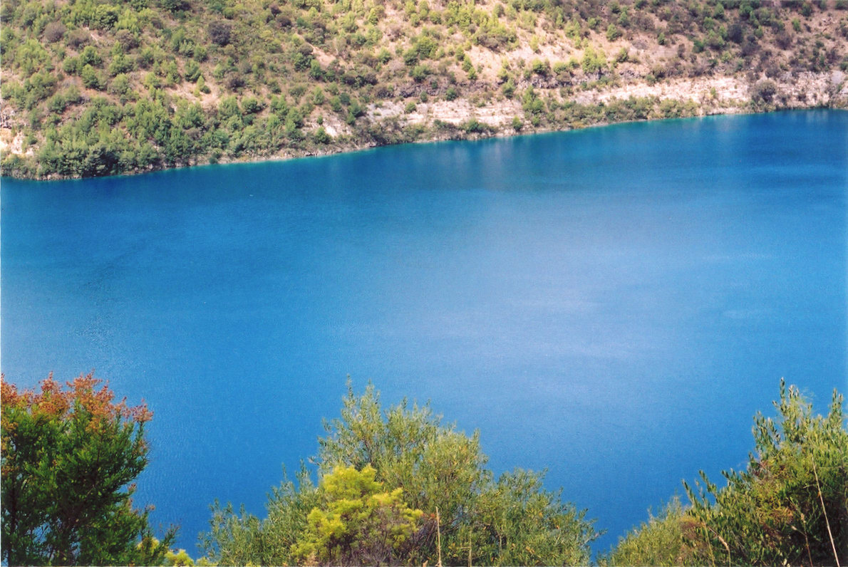
Blue Lake / Warwar (The Blue Lake) is a large, monomictic, crater lake located in a dormant volcanic maar associated with the Mount Gambier maar complex. The lake is situated near in the Limestone Coast region of South Australia, and is one of four volcanic crater lakes originally on Mount Gambier maar. Of the four lakes, only two remain, the other one being Valley Lake / Ketla Malpi; the other two, Leg of Mutton Lake / Yatton Loo and Brownes Lake / Kroweratwari, have dried up as the water table has dropped. History Conflicting dates have been estimated for the last eruption of the volcano: of 4,300 years ago, of 28,000 years ago, and a little before 6,000 years ago. If the youngest date is correct, this could be the most recent volcanic eruption on the Australian mainland. The Boandik (or Bungandidj) people occupied the area before the colonisation of South Australia. Description Blue Lake / Warwar is one of four lakes in the extinct volcano complex. Sites of ... [...More Info...] [...Related Items...] OR: [Wikipedia] [Google] [Baidu] |
Mount Elephant
Mount Elephant is a conical breached scoria cone formed by a dormant volcano, located 1 km from the town of Derrinallum in southwestern Victoria, Australia. It is a prominent landmark that forms the eastern gateway to the Kanawinka Geopark from the Hamilton Highway at Derrinallum. Formation and history Scoria cones are small volcanoes with relatively steep sides, usually formed as the result of a single major episode of volcanic activity. Lava lakes often form in the centre of scoria cones; if the lava in such a lake breaches the side of the cone, the result is a breached scoria cone, such as Mount Elephant. The volcano first erupted approximately 184,000 years ago, within a tolerance of 38,000 years, according to argon-argon dating research first published 21 February 2017. There are approximately 200 breached scoria cones in Victoria. During early European settlement, the mountain was known as "Swagmans Lighthouse" or the "light house of the western district". Mount ... [...More Info...] [...Related Items...] OR: [Wikipedia] [Google] [Baidu] |
Mount Napier
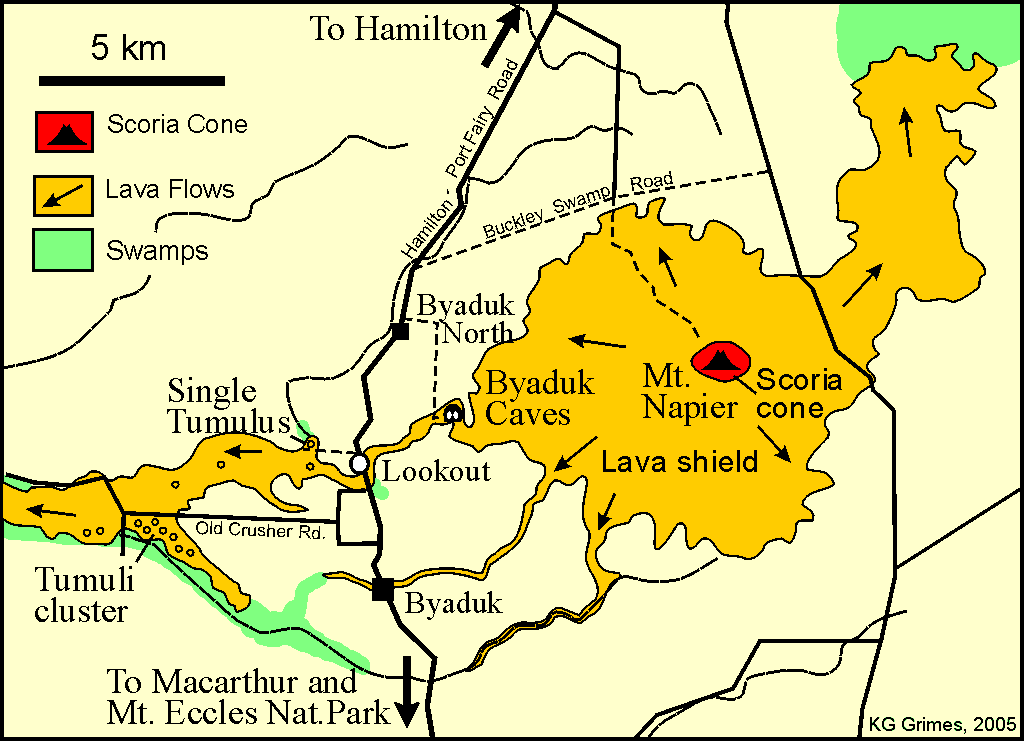
Mount Napier in Victoria, Australia, is one of the youngest volcanoes in Australia. It erupted about 32,000 years ago. It was named by Major Thomas Mitchell after the three Napier brothers, who he had served alongside during the Peninsular War. Mitchell named it in August 1836, during his third expedition across south-eastern Australia. The local Aboriginal name for the mount is Tapoc. Mount Napier State Park is located 270 kilometres west of Melbourne and 17 km south of Hamilton. Location and features Mount Napier or Tapoc in the local Aboriginal language, has a composite lava shield with a superimposed scoria cone. The cone rises above the surrounding plains to an elevation of , making it the highest point on the Western District Plains of Victoria. Mount Napier is part of the Newer Volcanics Province, which is the youngest volcanic region in Australia. The Newer Volcanics Province covers an area of and contains over 400 vents. The Mount Napier Lava Flow follow ... [...More Info...] [...Related Items...] OR: [Wikipedia] [Google] [Baidu] |
Volcanic Cone
Volcanic cones are among the simplest volcanic landforms. They are built by ejecta from a volcanic vent, piling up around the vent in the shape of a cone with a central crater. Volcanic cones are of different types, depending upon the nature and size of the fragments ejected during the eruption. Types of volcanic cones include stratocones, spatter cones, tuff cones, and cinder cones. Stratocone Stratocones are large cone-shaped volcanoes made up of lava flows, explosively erupted pyroclastic rocks, and igneous intrusives that are typically centered around a cylindrical vent. Unlike shield volcanoes, they are characterized by a steep profile and periodic, often alternating, explosive eruptions and effusive eruptions. Some have collapsed craters called calderas. The central core of a stratocone is commonly dominated by a central core of intrusive rocks that range from around to over several kilometers in diameter. This central core is surrounded by multiple generations of ... [...More Info...] [...Related Items...] OR: [Wikipedia] [Google] [Baidu] |


.jpg)


