|
Newbarns
Newbarns is an area and electoral ward of Barrow-in-Furness, Cumbria, England. It is bordered by Hawcoat, Parkside, Risedale and Roose, the local population stood at 5,515 in 2001, decreasing to 5,487 at the 2011 Census. Newbarns covers an area of 2.78 square kilometres and lies east of Abbey Road, encompassing Furness Abbey in its entirety, Barrow Sixth Form College and St. Bernard's Catholic High School. Newbarns is extremely diverse, with the majority of the south of the ward being amongst the 6% to 10% most deprived areas of the country, while north Newbarns contains Croslands Park, Barrow's most expensive street and is within the 25% of least deprived areas nationwide. The ward itself will be combined with Hawcoat ward in April 2023 following formation of the new Westmorland and Furness Local Authority. History The area centred on Hector Street marks the original Newbarns village which pre dates much of Barrow and originally lay within the Parish of Dalton-in-Furness ... [...More Info...] [...Related Items...] OR: [Wikipedia] [Google] [Baidu] |
Barrow-in-Furness
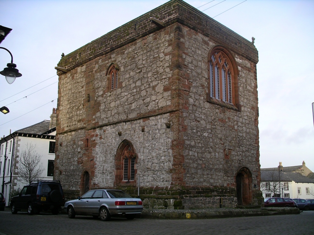
Barrow-in-Furness is a port town in Cumbria, England. Historically in Lancashire, it was incorporated as a municipal borough in 1867 and merged with Dalton-in-Furness Urban District in 1974 to form the Borough of Barrow-in-Furness. In 2023 the borough will merge with Eden and South Lakeland districts to form a new unitary authority; Westmorland and Furness. At the tip of the Furness peninsula, close to the Lake District, it is bordered by Morecambe Bay, the Duddon Estuary and the Irish Sea. In 2011, Barrow's population was 56,745, making it the second largest urban area in Cumbria after Carlisle. Natives of Barrow, as well as the local dialect, are known as Barrovian. In the Middle Ages, Barrow was a small hamlet within the parish of Dalton-in-Furness with Furness Abbey, now on the outskirts of the town, controlling the local economy before its dissolution in 1537. The iron prospector Henry Schneider arrived in Furness in 1839 and, with other investors, opened the Furness Railwa ... [...More Info...] [...Related Items...] OR: [Wikipedia] [Google] [Baidu] |
Hawcoat
Hawcoat is an area and electoral ward of Barrow-in-Furness, Cumbria, England. Historically part of Lancashire, it is one of Barrow's most northerly wards and is bordered by Roose, Newbarns, Parkside, Ormsgill and the town of Dalton-in-Furness to the north. The ward itself will be combined with Newbarns ward in April 2023 following formation of the new Westmorland and Furness Local Authority. Geography Hawcoat lies on small hill on the southwest of the Furness Peninsula, rising up from Walney Channel to its west and peaking at 84m. From its peak there are quite extensive views incorporating the Isle of Man, Snowdonia, Blackpool, across Morecambe Bay Ingleborough, the Howgills, and the fells of the Lake District. The small stream of Dane Ghyll rises to the east of the high ground, and flows south and east into Mill Beck at Furness Abbey in the Valley of the Deadly Nightshade, providing a clear eastern boundary to the area. Hawcoat forms the north-eastern part of Barrow-in-Furness ... [...More Info...] [...Related Items...] OR: [Wikipedia] [Google] [Baidu] |
Risedale
Risedale is an area and ward of Barrow-in-Furness, Cumbria, England. It is bordered by Barrow town centre, Parkside, Newbarns and Roose and had a population of 5,663 in 2001,increasing to 6,294 at the 2011 Census. The ward itself will be combined with Roosecote ward in April 2023 following formation of the new Westmorland and Furness Local Authority. Risedale is a fairly deprived district, with figures for unemployment being higher than Barrow and national average. Council housing makes up much of the southern area of the ward (in the form of Broadway, Gateway, Longway and Westway). References {{Barrow-in-FurnessRisedale
[...More Info...] [...Related Items...] OR: [Wikipedia] [Google] [Baidu] |
Barrow-in-Furness (borough)
Barrow-in-Furness is a local government district with borough status in Cumbria, England. It is named after its main town, Barrow-in-Furness. Other settlements include Dalton-in-Furness and Askam-in-Furness. It is the smallest district in the county, but is the most densely populated, with 924 people per square kilometre. The population was 71,980 in 2001, reducing to 69,087 at the 2011 Census. In July 2021 the Ministry of Housing, Communities and Local Government announced that in April 2023, Cumbria will be reorganised into two unitary authorities. Barrow-in-Furness Borough Council is to be abolished and its functions transferred to a new authority, to be known as Westmorland and Furness, which will cover the current districts of Barrow-in-Furness, Eden and South Lakeland. In April 2022 Gareth Davies became the first person to run every single street in the Borough of Barrow-In-Furness. Covering all 1,026 streets over an end to end distance of 201 miles. Background The ar ... [...More Info...] [...Related Items...] OR: [Wikipedia] [Google] [Baidu] |
Furness Abbey
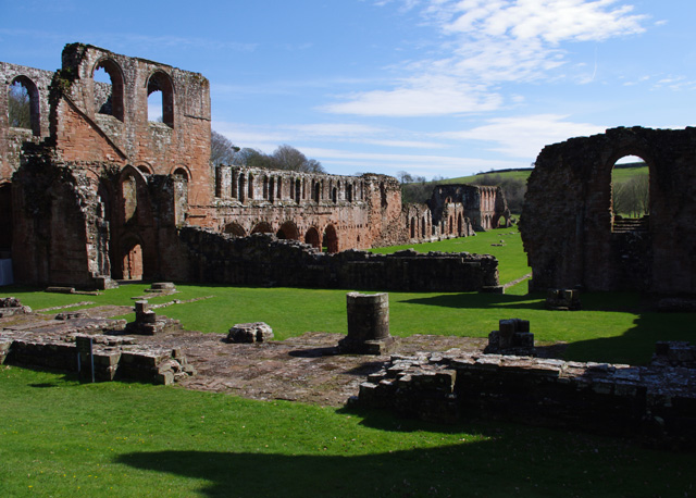
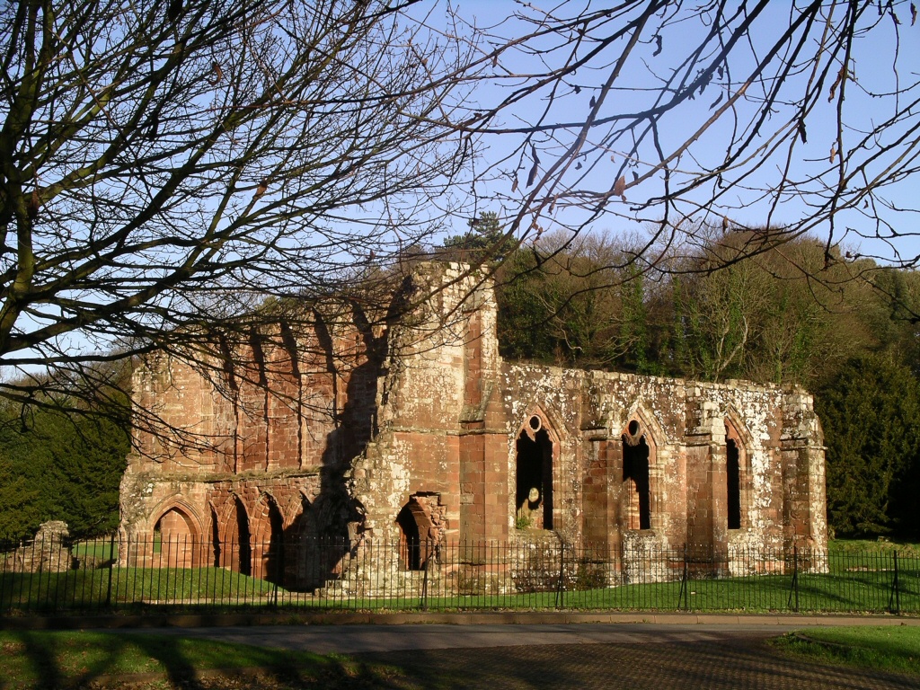
Furness Abbey, or St. Mary of Furness, is a former Catholic monastery located to the north of Barrow-in-Furness, Cumbria, England. The abbey dates back to 1123 and was once the second-wealthiest and most powerful Cistercian monastery in the country, behind Fountains Abbey, prior to its dissolution during the English Reformation.History of the abbey The abbey contains a number of individual Grade I s and is a . History of the abbey Early history [...More Info...] [...Related Items...] OR: [Wikipedia] [Google] [Baidu] |
Parkside, Barrow-in-Furness
Parkside is an area and electoral ward of Barrow-in-Furness, Cumbria, England. It is bordered by Hindpool, Ormsgill, Hawcoat, Newbarns and Risedale and had a population of 5,742 in 2001, reducing to 5,584 at the 2011 Census. It is one of the town's most centralised wards and contains Barrow's main park (hence the ward's name), as well as the newly established Furness Academy. Abbey Road - Barrow's principal road runs down the entire western side of Parkside. The majority of housing to the west of Abbey Road is terraced and semi-detached, whilst the eastern side of Parkside is predominantly parkland and fields with the exception of some semi and detached housing. The ward itself will be combined with Ormsgill ward in April 2023 following formation of the new Westmorland and Furness Local Authority. There are a number of place of worship in Parkside including Abbey Road Baptist Church, Spring Mount Christian Fellowship and Trinity Church Centre. Barrow's first synagogue ... [...More Info...] [...Related Items...] OR: [Wikipedia] [Google] [Baidu] |
Dalton-in-Furness
Dalton-in-Furness is a town and former civil parish in the Borough of Barrow-in-Furness, Cumbria, England. In 2011 it had a population of 7,827. It is located north east of Barrow-in-Furness. History Dalton is mentioned in the Domesday Book, written as "Daltune" as one of the townships forming the Manor of Hougun held by Tostig Godwinson, Earl of Northumbria. Historically, it was the capital of Furness. The ancient parish of Dalton covered the area which is now occupied by the borough of Barrow-in-Furness. The town is now in the civil parish of Dalton Town with Newton. Historically a part of Lancashire, the town is associated with a number of famous artists, including George Romney. In 1961 the parish had a population of 10,316. Dalton in Furness was formerly a civil parish, it was abolished in 1974 and became an unparished area, on 1 April 1987 the unparished area was abolished to form the parishes of "Askam and Ireleth", "Dalton Town with Newton" and "Lindal and Marton". The ... [...More Info...] [...Related Items...] OR: [Wikipedia] [Google] [Baidu] |
Westmorland And Furness
Westmorland and Furness is a future unitary authority area in north-west England, which will come into being on 1 April 2023 on the abolition of Cumbria County Council, together with Cumberland. The council will cover the areas currently served by the districts of Barrow-in-Furness, Eden and South Lakeland, which will also cease to function. It will include all of the area of the historic county of Westmorland as well as the Furness district of historic Lancashire. It will also incorporate a very small part of historic Yorkshire together with about a quarter of the area of the historic county of Cumberland. The district will sit within the ceremonial county of Cumbria, which will no longer have any administrative function. The first elections to the new authority took place in May 2022, with the Westmorland and Furness Council acting as a 'shadow authority' until the abolition of the three former districts and Cumbria County Council on 1 April 2023. Background Elections to ... [...More Info...] [...Related Items...] OR: [Wikipedia] [Google] [Baidu] |
Barrow Sixth Form College
Barrow Sixth Form College, part of Furness College, is in the outskirts of Barrow-in-Furness, Cumbria, England. Barrow Sixth Form College was established in 1979 to fulfil the role of the main A level provider in Barrow following the merger of the two Barrow Grammar Schools and their change to deliver education to only 11 to 16 year-olds. It is the only sixth form college in Cumbria. A levels and Cambridge Technical qualifications are taught in buildings that have been specially designed for students over the age of sixteen. It includes facilities for physically disabled students and is a satellite campus for Beaumont. The college primarily educates students within the age range of 16–18 years, as well as courses for adult learners. In August 2016, the college gained chartered college status. This membership is awarded to the higher performing further education colleges and training providers in the UK. The college is also a member of the National Skills Academy for Nuclear. P ... [...More Info...] [...Related Items...] OR: [Wikipedia] [Google] [Baidu] |
Roose
Roose or Roosecote is a suburb and ward of Barrow-in-Furness, Cumbria, England. The word 'roose' is Celtic for "moor" or "heath" and the suffix 'cote' of Roosecote means "hut" or "huts" (the word 'cottage' is derived from 'cote'). Before the building of Roose Cottages and the arrival of the Cornish miners Roose was pronounced with a hard S, as in goose; now it is locally pronounced 'Rooze', due to the Cornish accent. Roose is served by Roose railway station, one of the few remaining stations on the Furness Line in the Barrow area. The ward of Roose also encompass the settlements of Rampside and Stank, as well as Piel Island and Roa Island, it extends as far north as Abbot's Wood Nature Reserve. The ward itself will be combined with Risedale ward in April 2023 following formation of the new Westmorland and Furness Local Authority. History Roose has been in existence since at least 945 AD. Roose is mentioned in the Domesday Book as one of the townships forming the Manor of Hougu ... [...More Info...] [...Related Items...] OR: [Wikipedia] [Google] [Baidu] |


