 |
Newark And New York Railroad Bridge
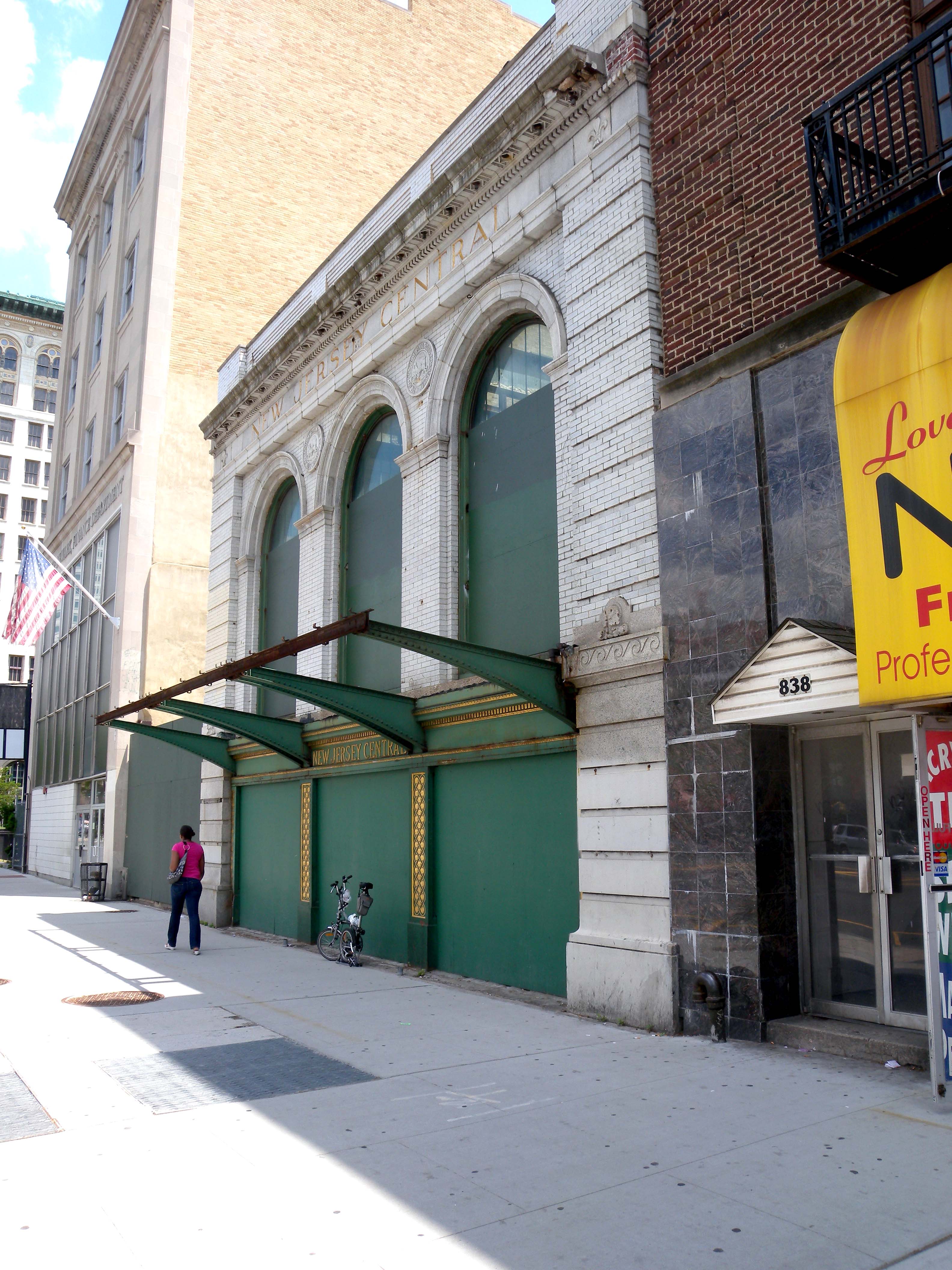
The Newark and New York Railroad was a passenger rail line that ran between Downtown Newark and the Communipaw Terminal at the mouth of the North River (Hudson River) in Jersey City, bridging the Hackensack River and Passaic River just north of their mouths at the Newark Bay in northeastern New Jersey. The Central Railroad of New Jersey operated it from its opening in 1869. Though operations ended in 1946; portions remained in use until 1967. History Opened on July 23, 1869 and operated by the Central Railroad of New Jersey (CNJ), the railroad provided a direct route between Newark and its Jersey City terminal, where passengers could transfer to ferries to New York. The line cost $300,000 per mile, unprecedented at the time, earning it the sobriquet "the country's costliest railroad". In 1872 a connection south was added at a junction called Newark Transfer to Elizabeth, where it joined the railroad's main line, which crossed Newark Bay at Bayonne on the predecessor of ... [...More Info...] [...Related Items...] OR: [Wikipedia] [Google] [Baidu] |
.jpg) |
CRRNJ Newark Lafayette Broad Jeh
The Central Railroad of New Jersey, also known as the Jersey Central or Jersey Central Lines , was a Class I railroad with origins in the 1830s. It was absorbed into Conrail in April 1976 along with several other prominent bankrupt railroads of the Northeastern United States. History The earliest railroad ancestor of the CNJ was the Elizabethtown & Somerville Railroad, incorporated in 1831 and opened from Elizabethport to Elizabeth, New Jersey in 1836. Horses gave way to steam in 1839, and the railroad was extended west, reaching Somerville at the beginning of 1842. The Somerville & Easton Railroad was incorporated in 1847 and began building westward. In 1849 it purchased the Elizabethtown & Somerville and adopted a new name: Central Railroad Company of New Jersey. The line reached Phillipsburg, on the east bank of the Delaware River, in 1852. It was extended east across Newark Bay to Jersey City in 1864, and it gradually acquired branches to Flemington, Newark, Perth Amboy, Ch ... [...More Info...] [...Related Items...] OR: [Wikipedia] [Google] [Baidu] |
|
CRRNJ Newark Bay Bridge
The Newark Bay Bridge of the Central Railroad of New Jersey (CNJ) was a railroad bridge in New Jersey that connected Elizabethport and Bayonne at the southern end of Newark Bay. Its third and final incarnation was a four-track vertical-lift design that opened in 1926, replacing a bascule bridge from 1904 which superseded the original swing bridge from 1887. The bridge served the main line of the CNJ, carrying daily interstate trains as well as commuter trains. History Between 1887 and the late 1980s, the rail bridge across Newark Bay existed in three forms. As train service grew in both frequency and complexity through the early 20th century, the bridge was replaced twice to accommodate additional trackage and heavier trains. Original bridge (1887) The first railway structure to span the bay was erected in 1887, and consisted of simple wooden trestle pile bridge approaches joined near the eastern side of the waterway by a steel center-pier swing bridge. Built within a ... [...More Info...] [...Related Items...] OR: [Wikipedia] [Google] [Baidu] |
|
_1945.jpg) |
Hackensack Drawbridge
The Hackensack Drawbridge (also known as the HD Draw) was a double-track railroad movable bridge across the mouth of the Hackensack River between Jersey City and Kearny, New Jersey.(June 23, 1940)Authority Calls Hackensack Span Menace; Wants Drawbridge Rebuilt or Abandoned ''The New York Times'' (reporting that the Port of New York Authority was recommending that the bridge be either rebuilt or abandoned because it offered limited clearance) It was operational until 1946, when a steamship crashed into it. Built and maintained by the Central Railroad of New Jersey (CNJ), the bridge was part of the Newark and New York Railroad, a rail line characterized as the "costliest railroad" by W. H. Schmidt Jr., a columnist for ''Trains''.Schmidt, W.H. (May 1946), "Costliest Railroad Now Half Abandoned", ''Trains'', pg. 52. Opened on July 23, 1869, the line was routed between terminals at Newark and Jersey City, where passengers could transfer to ferries to New York. It also crossed the Pa ... [...More Info...] [...Related Items...] OR: [Wikipedia] [Google] [Baidu] |
 |
Pennsylvania Railroad
The Pennsylvania Railroad (reporting mark PRR), legal name The Pennsylvania Railroad Company also known as the "Pennsy", was an American Class I railroad that was established in 1846 and headquartered in Philadelphia, Pennsylvania. It was named for the commonwealth in which it was established. By 1882, Pennsylvania Railroad had become the largest railroad (by traffic and revenue), the largest transportation enterprise, and the largest corporation in the world. Its budget was second only to the U.S. government. Over the years, it acquired, merged with, or owned part of at least 800 other rail lines and companies. At the end of 1926, it operated of rail line;This mileage includes companies independently operated. PRR miles of all tracks, which includes first (or main), second, third, fourth, and sidings, totalled 28,040.49 at the end of 1926. in the 1920s, it carried nearly three times the traffic as other railroads of comparable length, such as the Union Pacific and Atchison, T ... [...More Info...] [...Related Items...] OR: [Wikipedia] [Google] [Baidu] |
 |
Ironbound, Newark
The Ironbound is a neighborhood in the city of Newark in Essex County, New Jersey, United States. It is a large working-class multi-ethnic community, covering approximately of well maintained streets and homes. Historically, the area was called "Dutch Neck," "Down Neck," or simply "the Neck," due to the appearance of the curve of the Passaic River.Lawlor, Julia"If You're Thinking of Living In/The Ironbound; A Home Away From Home for Immigrants" ''The New York Times'', January 11, 2004. Accessed June 26, 2013. The Ironbound is part of Newark's East Ward and is directly east of Newark Penn Station and Downtown Newark, and south and west of the river, over which passes the Jackson Street Bridge, connecting to Harrison and Kearny. The area became a major transmission "hotspot" of the COVID-19 pandemic in late 2020. Early history The name "The Ironbound" is said to derive from the large metalworking industry in the area or from the network of railroad tracks that surrounded the ... [...More Info...] [...Related Items...] OR: [Wikipedia] [Google] [Baidu] |
 |
New Barbadoes Neck
New Barbadoes Neck is the name given in the colonial era for the peninsula in northeastern New Jersey, US between the lower Hackensack and Passaic Rivers, in what is now western Hudson County and southern Bergen County. The neck begins in the south at Kearny Point in the Newark Bay and is characterized by a ridge (creating the valley of the Passaic) along the west and part of the New Jersey Meadowlands (the flood plain of the Hackensack) on the east. Native Americans and Netherlanders The neck was part of an area called Meghgectecock by the Lenape. It was the territory of the group called the Hackensack. The name of ''masgichteu-cunk'' meaning ''where May-apples grow'', from a moist-woodland perennial that bears edible yellow berries. The name Achter Col was given during the New Netherland era in the mid-17th century, and can be translated a ''rear mountain pass'' or ''behind the ridge'', in reference to the access it provided to the hinterlands beyond the Hudson Palisa ... [...More Info...] [...Related Items...] OR: [Wikipedia] [Google] [Baidu] |
|
Kearny Point
Kearny may refer to: People *Cresson Kearny (1914–2003, American author and researcher **Kearny fallout meter ** Kearny air pump * Eleanor Kearny Carr (1840–1912), American planter and political hostess, First Lady of North Carolina *Jillian Kearny, a pseudonym of Ron Goulart *Lawrence Kearny (1789–1868), American naval officer and diplomat * Philip Kearny (1815–1862), American major general * Stephen W. Kearny (1794–1848), American brigadier general, Military Governor of New Mexico and California Places * Kearny, Arizona *Kearny, New Jersey *Kearny County, Kansas *Fort Kearny, in Nebraska * Fort Kearny (Washington, D.C.), an American Civil War fort *Fort Phil Kearny, a late 1860s fort along the Bozeman Trail in Wyoming *Kearny Street, in San Francisco, California Other *Kearny Airport (other) *Kearny High School (other) There is more than one school named Kearny High School: * Kearny High School (California) * Kearny High School (New Jersey) {{Scho ... [...More Info...] [...Related Items...] OR: [Wikipedia] [Google] [Baidu] |
|
 |
Portsmouth, New Hampshire
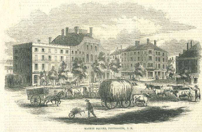
Portsmouth is a city in Rockingham County, New Hampshire, United States. At the 2020 census it had a population of 21,956. A historic seaport and popular summer tourist destination on the Piscataqua River bordering the state of Maine, Portsmouth was formerly the home of the Strategic Air Command's Pease Air Force Base, since converted to Portsmouth International Airport at Pease. History American Indians of the Abenaki and other Algonquian languages-speaking nations, and their predecessors, inhabited the territory of coastal New Hampshire for thousands of years before European contact. The first known European to explore and write about the area was Martin Pring in 1603. The Piscataqua River is a tidal estuary with a swift current, but forms a good natural harbor. The west bank of the harbor was settled by European colonists in 1630 and named Strawbery Banke, after the many wild Fragaria, strawberries growing there. The village was protected by Fort William and Mary on wh ... [...More Info...] [...Related Items...] OR: [Wikipedia] [Google] [Baidu] |
|
Arcadia Publishing
Arcadia Publishing is an American Publishing, publisher of neighborhood, local history, local, and regional history of the United States in pictorial form.(analysis of the successful ''Images of America'' series). Arcadia Publishing also runs the History Press, which publishes text-driven books on American history and folklore. History It was founded in Dover, New Hampshire, in 1993 by United Kingdom-based Tempus Publishing, but became independent after being acquired by its CEO in 2004. The corporate office is in Mount Pleasant, South Carolina. It has a catalog of more than 12,000 titles, and italong with its subsidiary, The History Presspublishes 900 new titles every year. Its formula for regional publishing is to use local writers or historians to write about their community using 180 to 240 black-and-white photographs with captions and introductory paragraphs in a 128 page book. The ''Images of America'' series is the company's largest product line. Other series include ''Im ... [...More Info...] [...Related Items...] OR: [Wikipedia] [Google] [Baidu] |
|
 |
Right-of-way (transportation)
A right-of-way (ROW) is a right to make a way over a piece of land, usually to and from another piece of land. A right of way is a type of easement granted or reserved over the land for transportation purposes, such as a highway, public footpath, rail transport, canal, as well as electrical transmission lines, oil and gas pipelines. In the case of an easement, it may revert to its original owners if the facility is abandoned. This American English term is also used to denote the land itself. A right of way is granted or reserved over the land for transportation purposes, usually for private access to private land and, historically for a highway, public footpath, rail transport, canal, as well as electrical transmission lines, oil and gas pipelines.Henry Campbell Black: ''Right-of-way.'' In''A law dictionary containing definitions of the terms and phrases of American and English jurisprudence, ancient and modern: and including the principal terms of international, constit ... [...More Info...] [...Related Items...] OR: [Wikipedia] [Google] [Baidu] |
 |
Cut (earthmoving)
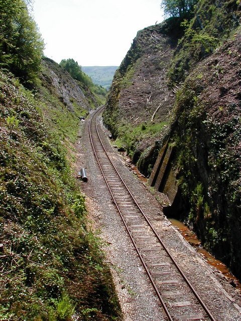
In civil engineering, a cut or cutting is where soil or rock from a relative rise along a route is removed. The term is also used in river management to speed a waterway's flow by short-cutting a meander. Cuts are typically used in road, rail, and canal construction to reduce the length and grade of a route. Cut and fill construction uses the spoils from cuts to fill in defiles to cost-effectively create relatively straight routes at steady grades. Cuts are used as alternatives to indirect routes, embankments, or viaducts. They also have the advantage of comparatively lower noise pollution than elevated or at-grade solutions. History The term ''cutting'' appears in the 19th century literature to designate rock cuts developed to moderate grades of railway lines. ''Railway Age's Comprehensive Railroad Dictionary'' defines a cut as "a passage cut for the roadway through an obstacle of rock or dirt." Creation Cuts can be created by multiple passes of a shovel, grader, ... [...More Info...] [...Related Items...] OR: [Wikipedia] [Google] [Baidu] |
 |
Bergen Hill
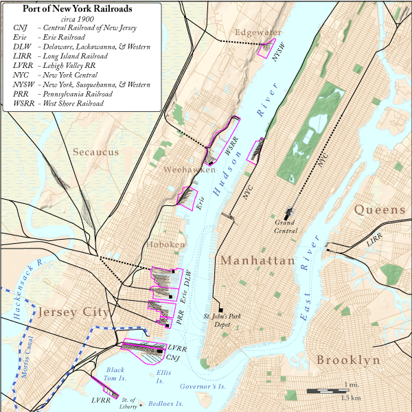
Bergen Hill refers to the lower Hudson Palisades in New Jersey, where they emerge on Bergen Neck, which in turn is the peninsula between the Hackensack and Hudson Rivers, and their bays. In Hudson County, it reaches a height of 260 feet. Rail Defining features of Bergen Hill include the 19th century and early 20th century railroad rights-of-way. Cuts and tunnels created to provide access to the terminals and ferries on the North River (Hudson River) and Upper New York Bay, and eventually under the river. From south to north they are: * The Central Railroad of New Jersey lines traveled on the CRRNJ Newark Bay Bridge across Newark Bay and through Bayonne and Greenville to its Communipaw Terminal. Portions are used by the Hudson Bergen Light Rail. * The Jersey City, Newark and Western Railway (later the Lehigh Valley Terminal Railway) freight line on the bridge over Newark Bay and across Pamrapo is now used by CSX Transportation as the National Docks Secondary to Por ... [...More Info...] [...Related Items...] OR: [Wikipedia] [Google] [Baidu] |