|
New Zealand State Highway 39
State Highway 39 (SH 39) is a New Zealand state highway that forms a western bypass of the city of Hamilton. Gazetted in 1999, it is a generally quicker route to get between Auckland and New Plymouth as well as connecting to the Waitomo Caves, just south of the SH 39 southern terminus. The southernmost 14 km section has a concurrency with , as this highway has existed for much longer (SH 31 continues west to Kawhia). Route SH 39 begins at on the Te Rapa section of the Waikato Expressway at Koura Drive, just north of the city of Hamilton. It veers south briefly before reaching a roundabout junction where it follows Te Kowhai Road westbound, eventually changing to Limmer Road. At the intersection of Horotiu Road SH 39 veers south (the northbound road formed the previous SH 39 route) until the intersection with at Whatawhata. It shares a brief concurrency, turning left into SH 23, then immediately right back onto SH 39 southbound. Following Kakaramea Road, the highway ... [...More Info...] [...Related Items...] OR: [Wikipedia] [Google] [Baidu] |
Te Rapa
Te Rapa is a mixed light industrial, large-scale retail and semi-rural suburb to the northwest of central Hamilton, New Zealand that is built on a flat area that was previously the bed of an ancient river, the forerunner to the present Waikato River. Stretching in a long, thin north‚Äďsouth axis, Te Rapa is home to many factories including Te Rapa Dairy Factory, one of the largest of its kind in the world. Te Rapa has freight and locomotive depots on the North Island Main Trunk railway. History Te Rapa and neighbouring Pukete were important sites for the kauri gum trade of the late 19th/early 20th centuries, being some of the southern-most locations where gum could be found. Demographics Te Rapa covers and had an estimated population of as of with a population density of people per km2. Te Rapa had a population of 294 at the 2018 New Zealand census, a decrease of 12 people (‚ąí3.9%) since the 2013 census, and a decrease of 33 people (‚ąí10.1%) since the 2006 cens ... [...More Info...] [...Related Items...] OR: [Wikipedia] [Google] [Baidu] |
Waikato District
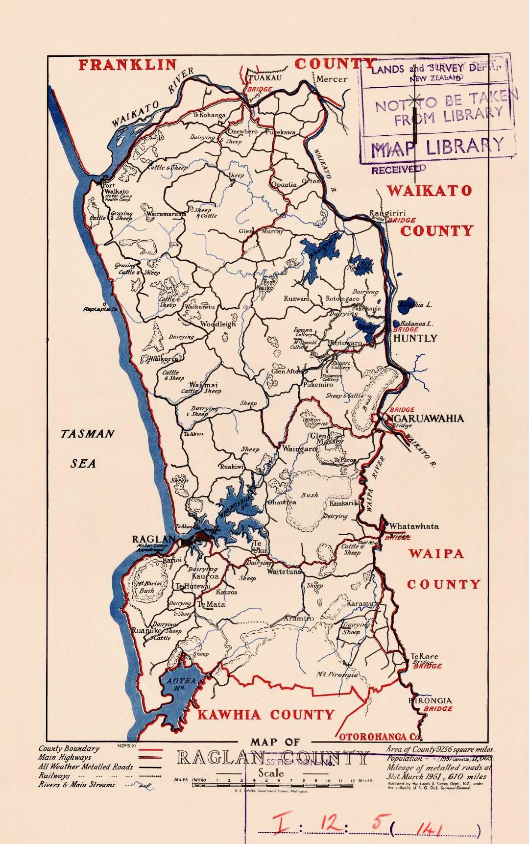
Waikato District is a territorial authority of New Zealand, in the northern part of Waikato region, North Island. Waikato District is administered by the Waikato District Council, with headquarters in NgńĀruawńĀhia. The district is centred to the north and west of the city of Hamilton, and takes in much of the northern Waikato Plains and also the Hakarimata Range. The north of the district contains swampy floodplain of the Waikato River and several small lakes, of which the largest is Lake Waikare. Other than NgńĀruawńĀhia, the main population centres are Huntly, Raglan, and Te Kauwhata. The main industries in the district are dairy farming, forestry, and coal mining. There is a major coal-fired power station at Huntly. Te Kauwhata is at the centre of a major wine region. Demographics At the 2006 census the district had a population of 43,959. Of these, 6834 lived in Huntly, 5106 in NgńĀruawńĀhia, 2637 in Raglan, and 1294 in Te Kauwhata. In 2010, the district acquired part o ... [...More Info...] [...Related Items...] OR: [Wikipedia] [Google] [Baidu] |
State Highways In New Zealand
State may refer to: Arts, entertainment, and media Literature * ''State Magazine'', a monthly magazine published by the U.S. Department of State * ''The State'' (newspaper), a daily newspaper in Columbia, South Carolina, United States * ''Our State'', a monthly magazine published in North Carolina and formerly called ''The State'' * The State (Larry Niven), a fictional future government in three novels by Larry Niven Music Groups and labels * States Records, an American record label * The State (band), Australian band previously known as the Cutters Albums * ''State'' (album), a 2013 album by Todd Rundgren * ''States'' (album), a 2013 album by the Paper Kites * ''States'', a 1991 album by Klinik * ''The State'' (album), a 1999 album by Nickelback Television * ''The State'' (American TV series), 1993 * ''The State'' (British TV series), 2017 Other * The State (comedy troupe), an American comedy troupe Law and politics * State (polity), a centralized political organizatio ... [...More Info...] [...Related Items...] OR: [Wikipedia] [Google] [Baidu] |
List Of New Zealand State Highways
This is a list of highways of the New Zealand state highway network and some touring routes. State highways are administered by the NZ Transport Agency, while all other roads are the responsibility of territorial authorities. Current North Island South Island Past The following state highways have been decommissioned. After revocation roads revert to their original names (e.g. Crown Range Road), are referred to as a route (e.g. Route 72), or have white shields. Unused numbers The following numbers have never been used: *North Island: SH 13, SH 19, SH 42, SH 55 *South Island: SH 9 (now in use by William), SH 64, SH 66, SH 68, SH 81 See also *List of roads and highways, for notable or famous roads worldwide References {{New Zealand State Highway navbox List State Highways A state highway, state road, or state route (and the equivalent provincial highway, provincial road, or provincial route) is usually a road that is either ''numbered'' or ''maintained ... [...More Info...] [...Related Items...] OR: [Wikipedia] [Google] [Baidu] |
Go Bus Transport
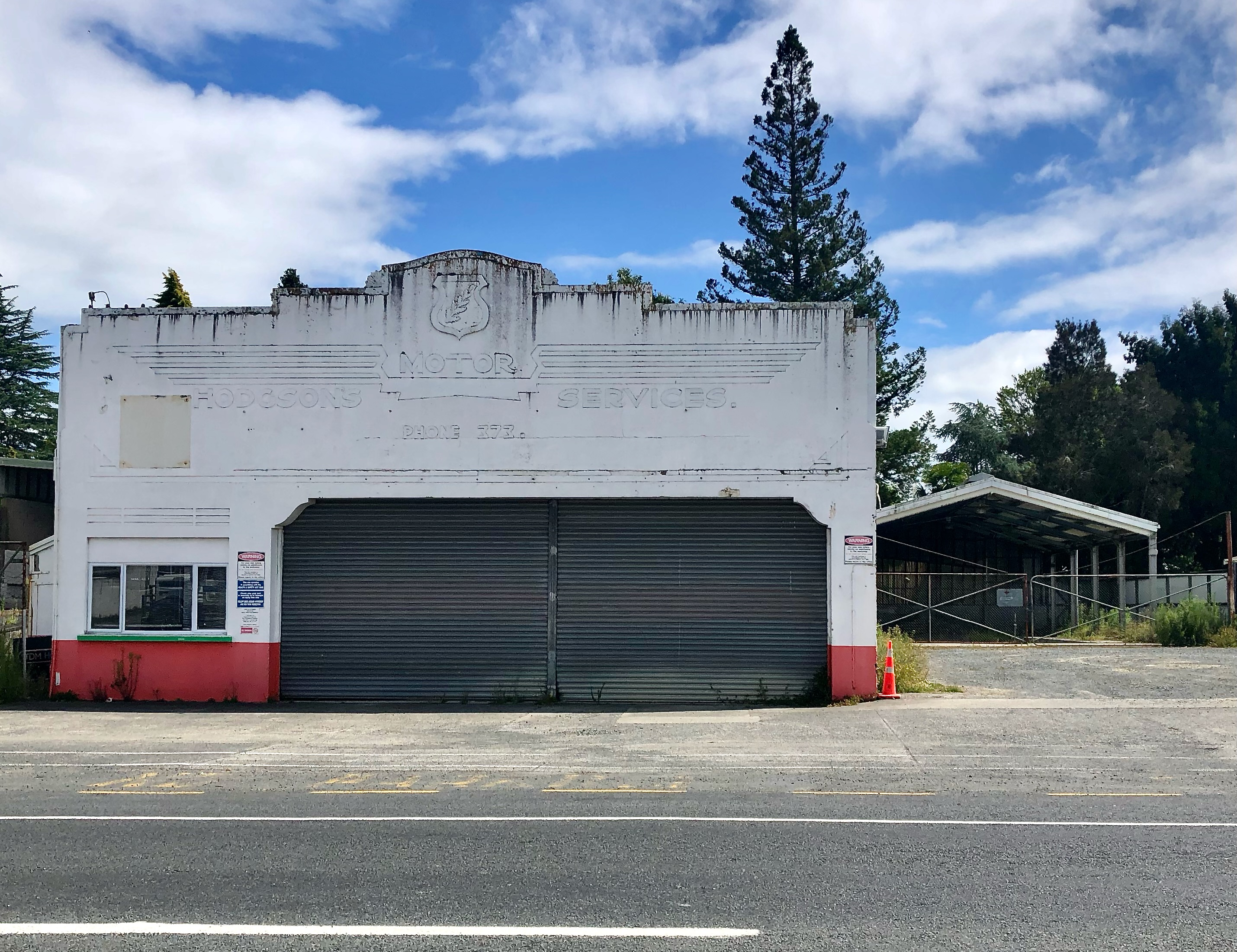
Go Bus Transport Ltd is a large bus company in New Zealand owned by Australian-based transport operator Kinetic Group. The company is based in Hamilton, New Zealand, and runs bus services in Hamilton, Napier, New Zealand#Buses, Hawke's Bay, Tauranga#Bus, Tauranga, Go Bus Christchurch, Christchurch, Public transport in New Zealand#Other areas, Gisborne, Public transport in Dunedin, Dunedin and Invercargill Passenger Transport, Invercargill. In March 2020, it was announced the company and its 1700 buses would be sold to Kinetic Group, who is also the operator of Auckland SkyBus (airport bus)#Services in New Zealand, SkyBus, subject to Overseas Investment Office approval. Approval was given in June and the acquisition was completed in August 2020. History In 2004, Go Bus was formed by the merger of C.J. Worth Ltd., trading as Blue Worth Coachlines and Hamilton City Buses (privatised in the 1990s), Simpsons and Hodgsons. Craig Worth was still commercial director in 2019. Original c ... [...More Info...] [...Related Items...] OR: [Wikipedia] [Google] [Baidu] |
Public Transport In Hamilton And Waikato
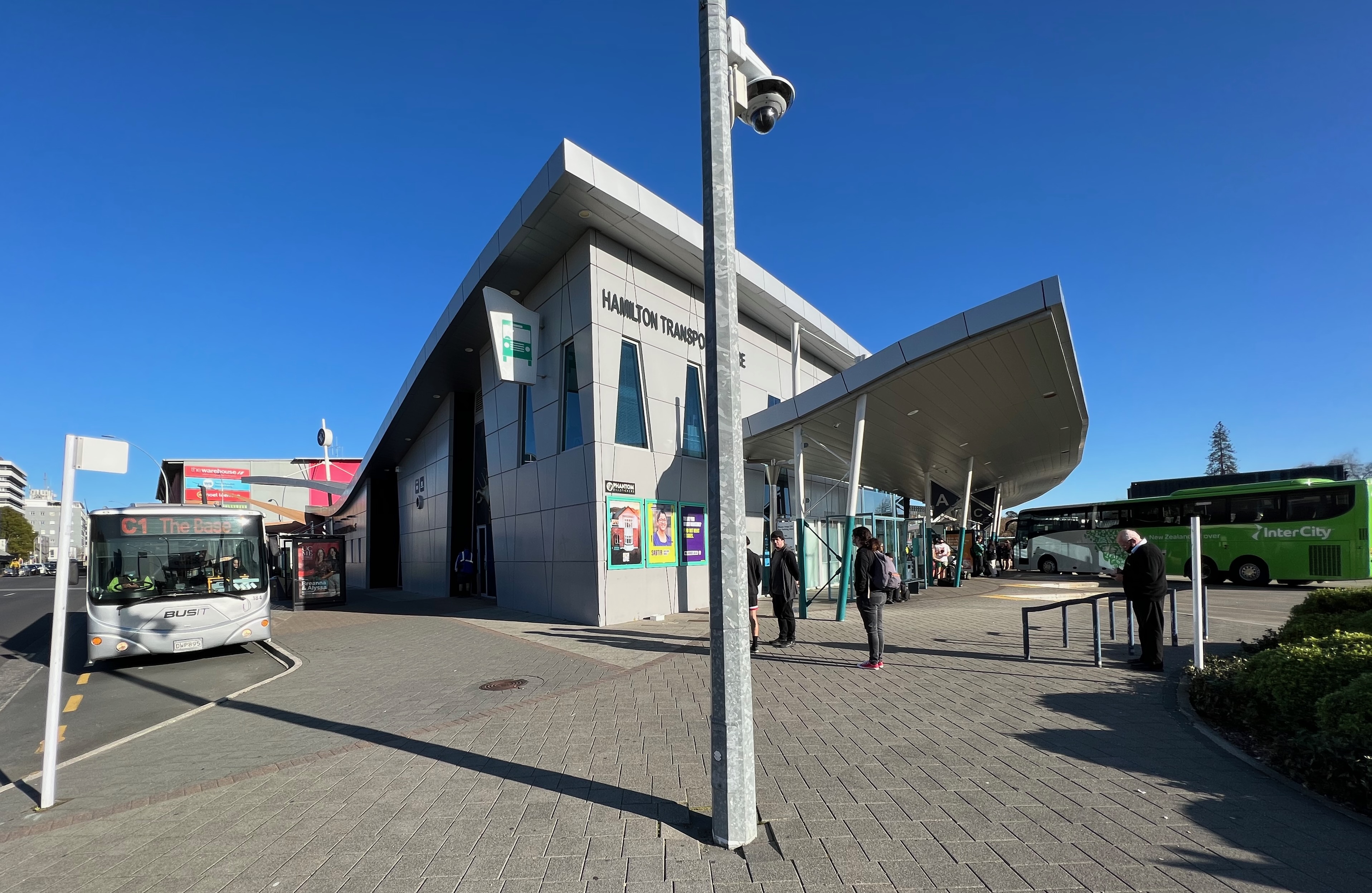
Public transport in Hamilton and the Waikato Region is poorly developed. Only 0.9% of trips were made by bus in 2013/14. This compares with 2.3% nationally, which itself is amongst the lowest modal shares in the world. A Mass Transit Plan aiming to increase public transport's share in Hamilton from 3 to 10% by running services at 10 minute intervals, was to be developed in 2019, but has yet to be funded by NZTA. Waikato, like all other regions, with the exception of Auckland and Wellington, saw falls in use of public transport from 2012. As the map shows, the coverage is sparse and, even of those services which operate daily, most have only 2 or 3 buses a day in each direction. Only Hamilton urban services and those to Huntly run hourly, or more frequently. About 40% of passengers travel on the two routes (Orbiter, Comet) which run at 15 minute intervals. From Monday 21 February 2022 the less frequent Hamilton buses were cut to hourly, or 2-hourly, due to driver shortages. Hamilto ... [...More Info...] [...Related Items...] OR: [Wikipedia] [Google] [Baidu] |
WaipńĀ River
The WaipńĀ River is in the Waikato region of the North Island of New Zealand. The headwaters are in the Rangitoto Range east of Te Kuiti. It flows north for , passing through ŇĆtorohanga and Pirongia, before flowing into the Waikato River at NgńĀruawńĀhia. It is the Waikato's largest tributary. The WaipńĀ's main tributary is the Puniu River. In the headwaters upstream of ŇĆtorohanga the river can be very clear during low flow conditions. This section of the river flows through rough farmland and patches of native bush. In this clearer part of the river there can be very good fly fishing for trout but access to the river may be limited without landowner permission. The WaipńĀ is prone to flooding in its lower reaches as flood flows can be over 100 times‚ÄĒ‚ÄĒthose of dry flows and the river can rise up to . In 2013 Maniapoto MńĀori Trust Board and the riparian local councils set up a joint management agreement for the river, following the passing of Nga Wai o Maniapoto ( ... [...More Info...] [...Related Items...] OR: [Wikipedia] [Google] [Baidu] |
Te Rore
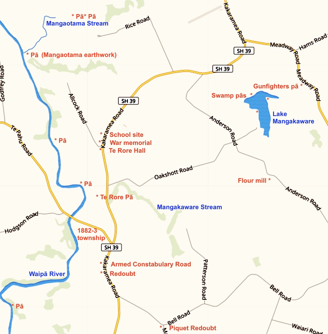
Te Rore was in the 1850s an important transhipment point on New Zealand's WaipńĀ River, between the Rangiaowhia#Crops, agriculture of the Waikato basin and its Auckland market. That was ended in 1864 by the Invasion of the Waikato, when Te Rore was, for a few months, part of the supply route to four Redoubt, redoubts set up nearby. It is now a rural community in the Waipa District, north of Pirongia and roughly the same distance south of NgńĀhinapŇćuri on New Zealand State Highway 39, State Highway 39. Early history Between 1450 and 1750 NgńĀti Puhiawe#Other hapŇę, NgńĀti Puhiawe built PńĀ#Swamp p%C4%81, swamp pńĀs of 2100, and a smaller pńĀ, around Lake Mangakaware. Many artefacts have been found in and around the lake, including beaters, pounders, paddles, fishing and eeling equipment, spears, weaving sticks, digging-sticks, spades, paddles, canoes, adze handles, weapons, rafters and palisades. The WaipńĀ River and its streams were lined with pńĀ sites, those at Te Rore bei ... [...More Info...] [...Related Items...] OR: [Wikipedia] [Google] [Baidu] |
Horotiu
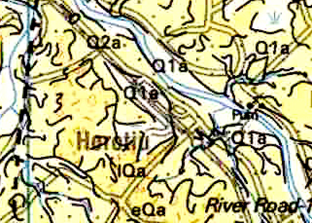
Horotiu is a small township on the west bank of the Waikato River in the Waikato District of New Zealand. It is on the Waikato Plains north of Hamilton, New Zealand, Hamilton and south of NgńĀruawńĀhia. From early in the 20th century it developed around a freezing works and other industries. The North Island Main Trunk railway runs through the town, as did State Highway 1 (New Zealand), State Highway 1 until opening of part of the Waikato Expressway in 2013. An hourly bus runs between Huntly, New Zealand, Huntly and Hamilton. Name The name, Horotiu, seems to have been used interchangeably with Waikato River, or Pukete. Its first use for the current township seems to occur in 1864, shortly after the invasion of the Waikato. Until then, Horotiu was the name of the upper Waikato river, where its current became faster and of Horotiu pńĀ, on its banks, near Cambridge, New Zealand, Cambridge. An 1858 map only shows the name as Horotiu Plains in the area near the pńĀ. The name, Ho ... [...More Info...] [...Related Items...] OR: [Wikipedia] [Google] [Baidu] |
List Of Statutes Of New Zealand (1912‚Äď28)
This article gives lists of New Zealand statute A statute is a formal written enactment of a legislative authority that governs the legal entities of a city, state, or country by way of consent. Typically, statutes command or prohibit something, or declare policy. Statutes are rules made by le ...s sorted by government. Chronological list of governments of New Zealand References External links New Zealand Legislation Parliamentary Counsel Office {{DEFAULTSORT:Statutes of New Zealand New Zealand law-related lists ... [...More Info...] [...Related Items...] OR: [Wikipedia] [Google] [Baidu] |
NgńĀruawńĀhia
NgńĀruawńĀhia () is a town in the Waikato region of the North Island of New Zealand. It is located north-west of Hamilton at the confluence of the Waikato and WaipńĀ Rivers, adjacent to the Hakarimata Range. NgńĀruawńĀhia is in the Hamilton Urban Area, the fourth largest urban area in New Zealand. The location was once considered as a potential capital of New Zealand. Demographics NgńĀaruawńĀhia covers and had an estimated population of as of with a population density of people per km2. NgńĀruawńĀhia had slightly smaller boundaries in the 2018 Census, covering . It had a population of 6,621, an increase of 1,257 people (23.4%) since the 2013 census, and an increase of 1,287 people (24.1%) since the 2006 census. There were 1,962 households, comprising 3,234 males and 3,384 females, giving a sex ratio of 0.96 males per female, with 1,914 people (28.9%) aged under 15 years, 1,434 (21.7%) aged 15 to 29, 2,661 (40.2%) aged 30 to 64, and 606 (9.2%) aged 65 or older. Ethniciti ... [...More Info...] [...Related Items...] OR: [Wikipedia] [Google] [Baidu] |
ŇĆtorohanga District
ŇĆtorohanga District is a territorial municipality in the King Country area and Waikato region of the North Island of New Zealand. It is a mostly rural area, with Otorohanga town being by far the biggest urban area, with a population nearing 3,000. The District was called Otorohanga County from 1971 to 1979. Geography and population ŇĆtorohanga District is located south of Hamilton, west of Rotorua, and northwest of Taupo. It stretches from Kawhia Harbour on the west coast inland to the Pureora Forest Park. Adjacent local government districts are (clockwise from the north) Waikato, Waipa, South Waikato, Taupo, and Waitomo. The district has a land area of . It is a mostly rural area, with significant areas of native forest. The district's population at was . The town of Otorohanga, located at about the centre of the district, is the largest town, with a population of . Other communities include Hauturu, Honikiwi, Kawhia, Maihiihi, Oparau, Otewa, Owhiro, Puketotara, Te Kaw ... [...More Info...] [...Related Items...] OR: [Wikipedia] [Google] [Baidu] |

