|
Neher Water System
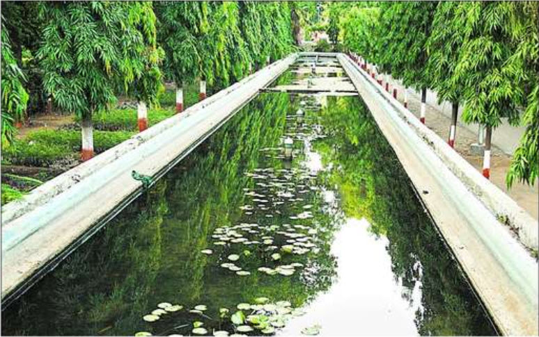
Neher water system provided clean water for the people of Aurangabad and its suburbs. It was created by Malik Ambar who founded the town under the name Khadki and was later expanded by Aurangzeb to facilitate the military activity that became prevalent under Mughal rule during the 17th century. History The first aqueduct in Aurangabad was designed in 1612 by Malik Ambar to address the shortage of water caused by the lack of reservoirs and natural water reserves in the area. Despite the surrounding landscape, which made it difficult to construct the aqueducts' supporting pillars, the construction went ahead. The reason for the construction of the aqueduct was the discovery of a subterranean water supply in the mountainous valleys north of Aurangabad. The consequent construction of the waterway provided a stable water supply for a population of around seven lakhs (around seven hundred thousand people), with the city of Aurangabad receiving enough fresh water to prevent the shor ... [...More Info...] [...Related Items...] OR: [Wikipedia] [Google] [Baidu] |
Aurangabad, Maharashtra
Aurangabad ( is a city in the Indian state of Maharashtra. It is the administrative headquarters of Aurangabad district, Maharashtra, Aurangabad district and is the largest city in the Marathwada region. Located on a hilly upland terrain in the Deccan Traps, Aurangabad is the fifth-most populous urban area in Maharashtra with a population of 1,175,116. The city is known as a major production center of cotton textile and artistic silk fabrics. Several prominent educational institutions, including Dr. Babasaheb Ambedkar Marathwada University, are located in the city. The city is also a popular tourism hub, with tourist destinations like the Ajanta Caves, Ajanta and Ellora Caves, Ellora caves lying on its outskirts, both of which have been designated as UNESCO World Heritage Sites since 1983. Other tourist attractions include the Aurangabad Caves, Daulatabad Fort, Devagiri Fort, Grishneshwar Temple, Jama Mosque, Aurangabad, Jama Mosque, Bibi Ka Maqbara, Himayat Bagh, Panchakki and S ... [...More Info...] [...Related Items...] OR: [Wikipedia] [Google] [Baidu] |
Gaumukh
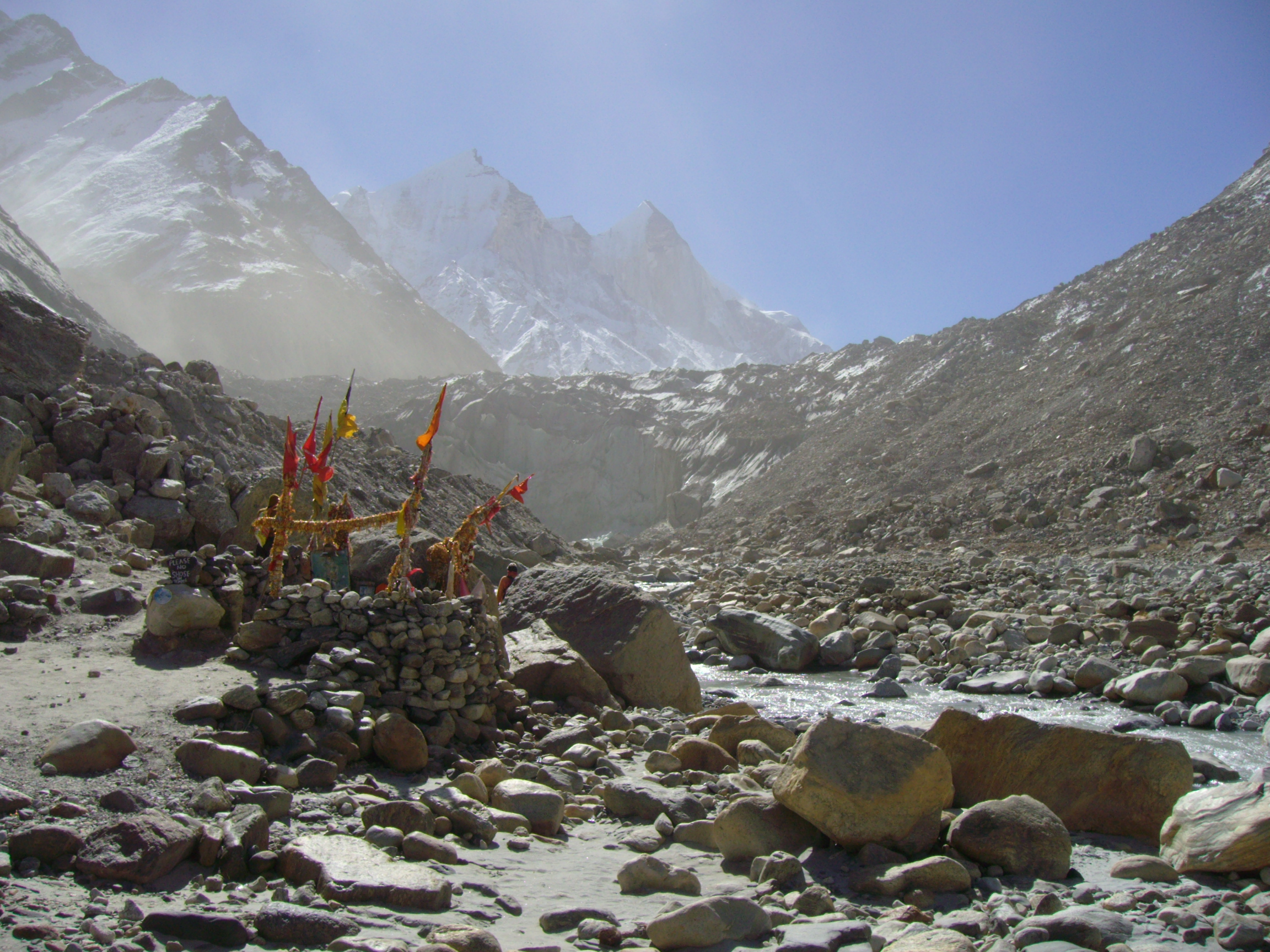
Gomukh, also known as "Gaumukh" or "Gomukhi" (Hindi: गौमुख or गौमुखी ; Assamese and Bengali: গোমুখ or গোমুখী), is the terminus or pout of the Gangotri Glacier and the source of the Bhagirathi River, one of the primary headstreams of the Ganga River. The word ''Gomukh/Gaumukh'' (''go/gau''=cow, ''mukh''= mouth) literally means "Mouth of a Cow." The place is situated at a height of 13,200 ft (4,023 m) in the Uttarkashi district in the state of Uttarakhand, India. It is one of the largest in the Himalayas with an estimated volume of over 27 cubic kilometers. It is a holy Hindu pilgrimage site, visited by many who visit Gangotri. It is around 20km away from Gangotri and can be reached by trekking. In 1972, Sir Seewoosagur Ramgoolam the then Prime Minister of Mauritius, brought the holy Ganga water from Gomukh and mixed it with the water of Grand Bassin in Mauritius and renamed it as Ganga Talao for the Mauritian Hindus. In ancient ti ... [...More Info...] [...Related Items...] OR: [Wikipedia] [Google] [Baidu] |
Islamic Architecture
Islamic architecture comprises the architectural styles of buildings associated with Islam. It encompasses both secular and religious styles from the early history of Islam to the present day. The Islamic world encompasses a wide geographic area historically ranging from western Africa and Europe to eastern Asia. Certain commonalities are shared by Islamic architectural styles across all these regions, but over time different regions developed their own styles according to local materials and techniques, local dynasties and patrons, different regional centers of artistic production, and sometimes different religious affiliations. Early Islamic architecture was influenced by Roman, Byzantine, Iranian, and Mesopotamian architecture and all other lands which the Early Muslim conquests conquered in the seventh and eighth centuries.: "As the Arabs did not have an architectural tradition suited to the needs of a great empire, they adopted the building methods of the defeated Sassan ... [...More Info...] [...Related Items...] OR: [Wikipedia] [Google] [Baidu] |
Indian Architectural History
Indian or Indians may refer to: Peoples South Asia * Indian people, people of Indian nationality, or people who have an Indian ancestor ** Non-resident Indian, a citizen of India who has temporarily emigrated to another country * South Asian ethnic groups, referring to people of the Indian subcontinent, as well as the greater South Asia region prior to the 1947 partition of India * Anglo-Indians, people with mixed Indian and British ancestry, or people of British descent born or living in the Indian subcontinent * East Indians, a Christian community in India Europe * British Indians, British people of Indian origin The Americas * Indo-Canadians, Canadian people of Indian origin * Indian Americans, American people of Indian origin * Indigenous peoples of the Americas, the pre-Columbian inhabitants of the Americas and their descendants ** Plains Indians, the common name for the Native Americans who lived on the Great Plains of North America ** Native Americans in the Uni ... [...More Info...] [...Related Items...] OR: [Wikipedia] [Google] [Baidu] |
Economy Of Aurangabad, Maharashtra
The city of Aurangabad was a major silk and cotton textile production centre. A fine blend of silk with locally grown cotton was developed as Himroo textile. Much of the silk industry has vanished over time, but some manufacturers have managed to keep the tradition alive. Paithani silk saris are also made in Aurangabad. The name of this cloth is derived from Paithan town. In 1889 a cotton-spinning and weaving mill was erected in Aurangabad city, which employed 700 people. With the opening of the Hyderabad-Godavari Valley Railways in the year 1900 several ginning factories were started. In the Jalna alone there were 9 cotton-ginning factories and 5 cotton-presses, besides two ginning factories at Aurangabad and Kannad, and one oil- press at Aurangabad. The total number of people employed in the cotton-presses and ginning factories in the year 1901 was 1,016. Until 1960, Aurangabad languished as a city, remaining industrially backward. In 1960, the region of Marathwada was m ... [...More Info...] [...Related Items...] OR: [Wikipedia] [Google] [Baidu] |
Himayat Bagh Aurangabad
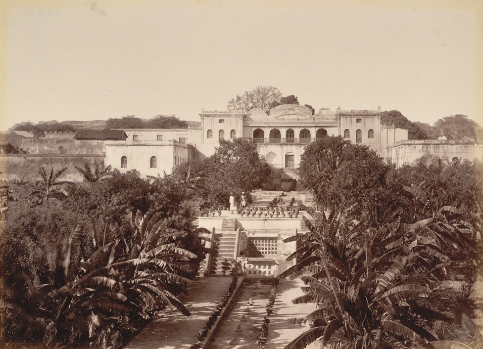
Himayat Bagh is a 17th-century garden that now houses the Fruit Research Station and Nursery, which is a part of the Vasantrao Naik Marathwada Krishi Vidyapeeth, Parbhani (Maharashtra). It is located near Delhi Gate in Rauza Bagh area of Aurangabad. It is a sprawling complex spread over , naturally green and in the olden days it was known as the Mughal Garden. Mughal era In Aurangzeb's time, Khizri Talao extended the whole length of the northern wall, (extending from present day Salim Ali Lake till Begumpura / Makbara) but the exhalation and dampness proved unhealthy and Aurangzeb ordered the portion immediately in front of his palace (Kila-e-Ark) to be filled in and converted into fields. This reclaimed portion was later developed into Mughal garden, (now known as Himayat Bagh) by one of the officials of Aurangzeb's court, with many fruit-bearing trees of different varieties for the royal court and its officials. Barra Darri Himayat Bagh also houses the Barra Darri which was ... [...More Info...] [...Related Items...] OR: [Wikipedia] [Google] [Baidu] |
Salim Ali Lake
Salim Ali Lake (Marathi - पक्षीमित्र सलीम आली सरोवर) is located near Delhi Gate, one of the many Gates in Aurangabad, opposite Himayat Bagh, Aurangabad. It is located in the northern part of the city. During the Mughal period, it was known as Khiziri Talab. It has been renamed after the great ornithologist, naturalist Salim Ali and also known as birdman of India. The office of Divisional Commissioner Aurangabad division is located near it, so is the collector's office of Aurangabad District. Mughal era In Aurangzeb's time, a large marsh or tank extended the whole length of the northern wall, (extending from present-day Salim Ali Lake till Begumpura / Makbara) but the exhalation and dampness proved unhealthy and Aurangzeb ordered the portion immediately in front of his palace (Kila-e-Ark) to be filled in and converted into fields. This reclaimed portion was later developed into Mughal garden, (now known as Himayat Bagh) by one of the ... [...More Info...] [...Related Items...] OR: [Wikipedia] [Google] [Baidu] |
Nizam
The Nizams were the rulers of Hyderabad from the 18th through the 20th century. Nizam of Hyderabad (Niẓām ul-Mulk, also known as Asaf Jah) was the title of the monarch of the Hyderabad State ( divided between the state of Telangana, Marathwada region of Maharashtra and Kalyana-Karnataka region of Karnataka). ''Nizam'', shortened from ''Nizam-ul-Mulk'', meaning ''Administrator of the Realm'', was the title inherited by Asaf Jah I. He was the former ''Naib'' (suzerain) of the Great Mughal in the Deccan, the premier courtier of Mughal India until 1724, the founding of an independent monarchy as the " Nizam (title) of Hyderabad". The Asaf Jahi dynasty was founded by Mir Qamar-ud-Din Siddiqi (Asaf Jah I), who served as a ''Naib'' of the Deccan sultanates under the Moghul Empire from 1713 to 1721. He intermittently ruled the region after Emperor Aurangzeb's death in 1707. In 1724 Mughal control weakened, and Asaf Jah became virtually independent of the Mughal Empire; Hyd ... [...More Info...] [...Related Items...] OR: [Wikipedia] [Google] [Baidu] |
Aurangabad Cantonment
Aurangabad Cantonment (Chawni), is a cantonment town in Aurangabad district in the state of Maharashtra, India. History The Aurangabad City was founded in 1610 by Malik Ambar, the Prime Minister of Murtuza Nizam Shah II, on the site of a village called Khadki. In 1653, Prince Aurangzeb son of Shahjahan, the Emperor of Delhi was appointed Viceroy of Deccan. Aurangzeb became emperor in 1658. From 1681 till his death in 1707, he was in the Deccan. Most of his time in the south was spent in Aurangabad. Along with Aurangzeb many RAJPUT Princes came from the north as his allies. Such princes were called ‘Rajas’. These Rajas settled around Aurangabad in small camps called 'Puras'. One of these was Rao Karansingh, the king of Bikaner (Rajasthan). He supported Aurangzeb in the Battle of Samugarh (1658) to annex the throne. Impressed by his act, Aurangzeb granted him three villages. He named them as Karanpura, Padampura & Kesrsingpura. After the decline of the Mughal Empire in the ... [...More Info...] [...Related Items...] OR: [Wikipedia] [Google] [Baidu] |
Dargah
A dargah ( fa, درگاه ''dargâh'' or ''dargah'', Turkish: ''dergâh'', Hindustani: ''dargah'' दरगाह درگاہ, bn, দরগাহ ''dorgah'') is a shrine or tomb built over the grave of a revered religious figure, often a Sufi saint or dervish. Sufis often visit the shrine for ziyarat, a term associated with religious visits and "pilgrimages". Dargahs are often associated with Sufi eating and meeting rooms and hostels, called ''khanqah'' or hospices. They usually include a mosque, meeting rooms, Islamic religious schools (madrassas), residences for a teacher or caretaker, hospitals, and other buildings for community purposes. The same structure, carrying the same social meanings and sites of the same kinds of ritual practices, is called ''maqam'' in the Arabic-speaking world. Dargah today is considered to be place where saints prayed and mediated (their spiritual residence). Shrine is modern day building which encompasses of actual dargah as well but n ... [...More Info...] [...Related Items...] OR: [Wikipedia] [Google] [Baidu] |
Begampura
Begampura is a neighbourhood in the Lahore District in Punjab, Pakistan. It is located near G.T road Lahore. The University of Engineering and Technology, Lahore is located in Begampura. There are a number of mosques and graveyards adjoining Begampura Road, including the early 18th-century Cypress Tomb Cypress Tomb, also known as Saruwala Maqbara (Urdu: ), is an early 18th century tomb located in Begumpura, Lahore, Pakistan Background This structure houses the tomb of Sharf-un-Nisa Begam, sister of Nawab Zakariya Khan, the governor of Lahore ... (also known as Saruwala Maqbara) and Begampura Mosque. References {{Neighbourhoods of Lahore Zones in Lahore Populated places in Lahore District ... [...More Info...] [...Related Items...] OR: [Wikipedia] [Google] [Baidu] |


.jpg)


