|
Navigation System
A navigation system is a computing system that aids in navigation. Navigation systems may be entirely on board the vehicle or vessel that the system is controlling (for example, on the ship's bridge) or located elsewhere, making use of radio or other signal transmission to control the vehicle or vessel. In some cases, a combination of these methods is used. Navigation systems may be capable of one or more of: * containing maps, which may be displayed in human-readable format via text or in a graphical format * determining a vehicle or vessel's location via sensors, maps, or information from external sources * providing suggested directions to a human in charge of a vehicle or vessel via text or speech * providing directions directly to an autonomous vehicle such as a robotic probe or guided missile * providing information on nearby vehicles or vessels, or other hazards or obstacles * providing information on traffic conditions and suggesting alternative directions * simultaneous l ... [...More Info...] [...Related Items...] OR: [Wikipedia] [Google] [Baidu] |
Guidance System
A guidance system is a virtual or physical device, or a group of devices implementing a controlling the movement of a ship, aircraft, missile, rocket, satellite, or any other moving object. Guidance is the process of calculating the changes in position, velocity, altitude, and/or rotation rates of a moving object required to follow a certain trajectory and/or altitude profile based on information about the object's state of motion. A guidance system is usually part of a Guidance, navigation and control system, whereas navigation refers to the systems necessary to calculate the current position and orientation based on sensor data like those from compasses, GPS receivers, Loran-C, star trackers, inertial measurement units, altimeters, etc. The output of the navigation system, the navigation solution, is an input for the guidance system, among others like the environmental conditions (wind, water, temperature, etc.) and the vehicle's characteristics (i.e. mass, control ... [...More Info...] [...Related Items...] OR: [Wikipedia] [Google] [Baidu] |
Computing
Computing is any goal-oriented activity requiring, benefiting from, or creating computing machinery. It includes the study and experimentation of algorithmic processes, and development of both hardware and software. Computing has scientific, engineering, mathematical, technological and social aspects. Major computing disciplines include computer engineering, computer science, cybersecurity, data science, information systems, information technology and software engineering. The term "computing" is also synonymous with counting and calculating. In earlier times, it was used in reference to the action performed by mechanical computing machines, and before that, to human computers. History The history of computing is longer than the history of computing hardware and includes the history of methods intended for pen and paper (or for chalk and slate) with or without the aid of tables. Computing is intimately tied to the representation of numbers, though mathematical ... [...More Info...] [...Related Items...] OR: [Wikipedia] [Google] [Baidu] |
Satellite Navigation System
A satellite or artificial satellite is an object intentionally placed into orbit in outer space. Except for passive satellites, most satellites have an electricity generation system for equipment on board, such as solar panels or radioisotope thermoelectric generators (RTGs). Most satellites also have a method of communication to ground stations, called transponders. Many satellites use a standardized bus to save cost and work, the most popular of which is small CubeSats. Similar satellites can work together as a group, forming constellations. Because of the high launch cost to space, satellites are designed to be as lightweight and robust as possible. Most communication satellites are radio relay stations in orbit and carry dozens of transponders, each with a bandwidth of tens of megahertz. Satellites are placed from the surface to orbit by launch vehicles, high enough to avoid orbital decay by the atmosphere. Satellites can then change or maintain the orbit by propulsi ... [...More Info...] [...Related Items...] OR: [Wikipedia] [Google] [Baidu] |
Guidance, Navigation And Control
Guidance, navigation and control (abbreviated GNC, GN&C, or G&C and within the context of NASA operations, often pronounced 'Gintsee' or (IPA) ʤɪnsiː) is a branch of engineering dealing with the design of systems to control the movement of vehicles, especially, automobiles, ships, aircraft, and spacecraft. In many cases these functions can be performed by trained humans. However, because of the speed of, for example, a rocket's dynamics, human reaction time is too slow to control this movement. Therefore, systems—now almost exclusively digital electronic—are used for such control. Even in cases where humans can perform these functions, it is often the case that GNC systems provide benefits such as alleviating operator work load, smoothing turbulence, fuel savings, etc. In addition, sophisticated applications of GNC enable automatic or remote control. * '' Guidance'' refers to the determination of the desired path of travel (the "trajectory") from the vehicle's curr ... [...More Info...] [...Related Items...] OR: [Wikipedia] [Google] [Baidu] |
Positioning System
A positioning system is a system for determining the position of an object in space. One of the most well-known and commonly used positioning systems is the Global Positioning System (GPS). Positioning system technologies exist ranging from worldwide coverage with meter accuracy to workspace coverage with sub-millimeter accuracy. Coverage Interplanetary systems Interplanetary-radio communication systems not only communicate with spacecraft, but they are also used to determine their position. Radar can track targets near the Earth, but spacecraft in deep space must have a working transponder on board to echo a radio signal back. Orientation information can be obtained using star trackers. Global systems Global navigation satellite systems (GNSS) allow specialized radio receivers to determine their 3-D space position, as well as time, with an accuracy of 2–20 metres or tens of nanoseconds. Currently deployed systems use microwave signals that can only be received reliabl ... [...More Info...] [...Related Items...] OR: [Wikipedia] [Google] [Baidu] |
X-ray Pulsar-based Navigation
X-ray pulsar-based navigation and timing (XNAV) or simply pulsar navigation is a navigation technique whereby the periodic X-ray signals emitted from X-ray pulsar, pulsars are used to determine the location of a vehicle, such as a spacecraft in deep space. A vehicle using XNAV would compare received X-ray signals with a database of known pulsar frequencies and locations. Similar to GPS, this comparison would allow the vehicle to calculate its position accurately (±5 km). The advantage of using X-ray signals over radio waves is that X-ray telescopes can be made smaller and lighter. Experimental demonstrations have been reported in 2018. Spacecraft navigation Studies The Advanced Concepts Team of ESA studied in 2003 the feasibility of x-ray pulsar navigation in collaboration with the Universitat Politecnica de Catalunya in Spain. After the study, the interest in the XNAV technology within the European Space Agency was consolidated leading, in 2012, to two different and more det ... [...More Info...] [...Related Items...] OR: [Wikipedia] [Google] [Baidu] |
Robotic Mapping
Robotic mapping is a discipline related to computer vision and cartography. The goal for an autonomous robot is to be able to construct (or use) a map (outdoor use) or floor plan (indoor use) and to localize itself and its recharging bases or beacons in it. Robotic mapping is that branch which deals with the study and application of ability to localize itself in a map / plan and sometimes to construct the map or floor plan by the autonomous robot. Evolutionarily shaped blind action may suffice to keep some animals alive. For some insects for example, the environment is not interpreted as a map, and they survive only with a triggered response. A slightly more elaborated navigation strategy dramatically enhances the capabilities of the robot. Cognitive maps enable planning capacities and use of current perceptions, memorized events, and expected consequences. Operation The robot has two sources of information: the idiothetic and the allothetic sources. When in motion, a ... [...More Info...] [...Related Items...] OR: [Wikipedia] [Google] [Baidu] |
Inertial Guidance System
An inertial navigation system (INS) is a navigation device that uses motion sensors ( accelerometers), rotation sensors (gyroscopes) and a computer to continuously calculate by dead reckoning the position, the orientation, and the velocity (direction and speed of movement) of a moving object without the need for external references. Often the inertial sensors are supplemented by a barometric altimeter and sometimes by magnetic sensors (magnetometers) and/or speed measuring devices. INSs are used on mobile robots and on vehicles such as ships, aircraft, submarines, guided missiles, and spacecraft. Other terms used to refer to inertial navigation systems or closely related devices include inertial guidance system, inertial instrument, inertial measurement unit (IMU) and many other variations. Older INS systems generally used an inertial platform as their mounting point to the vehicle and the terms are sometimes considered synonymous. Overview Inertial navigation is a self- ... [...More Info...] [...Related Items...] OR: [Wikipedia] [Google] [Baidu] |
Computer-assisted Surgery
Computer-assisted surgery (CAS) represents a surgical concept and set of methods, that use computer technology for surgical planning, and for guiding or performing surgical interventions. CAS is also known as computer-aided surgery, computer-assisted intervention, image-guided surgery, digital surgery and surgical navigation, but these are terms that are more or less synonymous with CAS. CAS has been a leading factor in the development of robotic surgery. General principles Creating a virtual image of the patient The most important component for CAS is the development of an accurate model of the patient. This can be conducted through a number of medical imaging technologies including CT, MRI, x-rays, ultrasound plus many more. For the generation of this model, the anatomical region to be operated has to be scanned and uploaded into the computer system. It is possible to employ a number of scanning methods, with the datasets combined through data fusion techniques. The ... [...More Info...] [...Related Items...] OR: [Wikipedia] [Google] [Baidu] |
Indian Regional Navigation Satellite System
The Indian Regional Navigation Satellite System (IRNSS), with an operational name of NavIC (acronym for 'Navigation with Indian Constellation; also, 'sailor' or 'navigator' in Indian languages), is an autonomous regional satellite navigation system that provides accurate real-time positioning and timing services. It covers India and a region extending around it, with plans for further extension. An extended service area lies between the primary service area and a rectangle area enclosed by the 30th parallel south to the 50th parallel north and the 30th meridian east to the 130th meridian east, beyond borders. The system currently consists of a constellation of eight satellites, with two additional satellites on ground as stand-by. The constellation is in orbit as of 2018. NavIC will provide two levels of service, the "standard positioning service", which will be open for civilian use, and a "restricted service" (an encrypted one) for authorised users (including the military) ... [...More Info...] [...Related Items...] OR: [Wikipedia] [Google] [Baidu] |
Galileo (satellite Navigation)
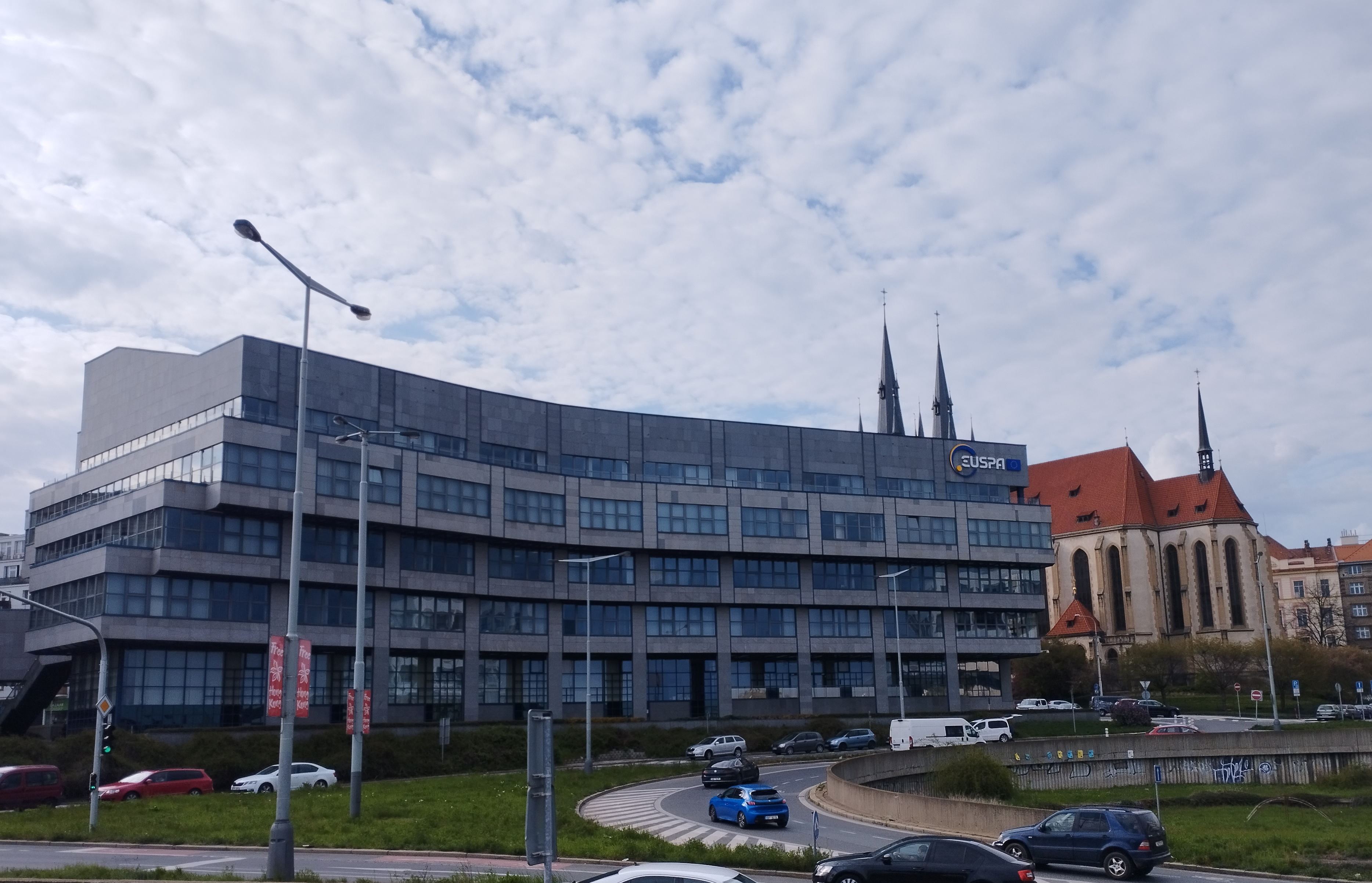
Galileo is a satellite navigation, global navigation satellite system (GNSS) that went live in 2016, created by the European Union through the European Space Agency (ESA), operated by the European Union Agency for the Space Programme (EUSPA), headquartered in Prague, Czech Republic, with two ground operations centres in Fucine Lake, Fucino, Italy, and Oberpfaffenhofen, Germany. The €10 billion project is named after the Italian astronomer Galileo Galilei. One of the aims of Galileo is to provide an independent high-precision positioning system so European political and military authorities do not have to rely on the US Global Positioning System, GPS, or the Russian GLONASS systems, which could be disabled or degraded by their operators at any time. The use of basic (lower-precision) Galileo services is free and open to everyone. A fully encrypted higher-precision service is available for free to government-authorized users. Galileo is intended to provide horizontal and verti ... [...More Info...] [...Related Items...] OR: [Wikipedia] [Google] [Baidu] |
GLONASS
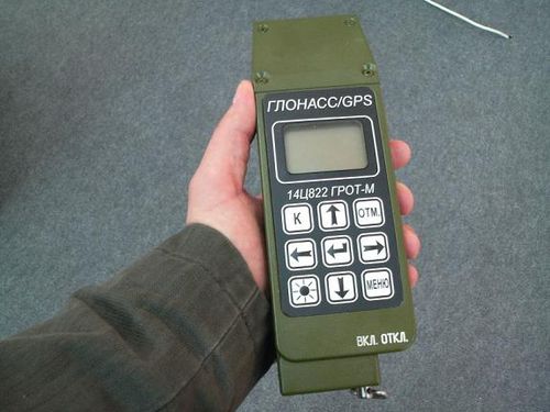
GLONASS (russian: ГЛОНАСС, label=none, ; rus, links=no, Глобальная навигационная спутниковая система, r=Global'naya Navigatsionnaya Sputnikovaya Sistema, t=Global Navigation Satellite System) is a Russian satellite navigation system operating as part of a radionavigation-satellite service. It provides an alternative to Global Positioning System (GPS) and is the second navigational system in operation with global coverage and of comparable precision. Satellite navigation devices supporting both GPS and GLONASS have more satellites available, meaning positions can be fixed more quickly and accurately, especially in built-up areas where buildings may obscure the view to some satellites. GLONASS supplementation of GPS systems also improves positioning in high latitudes (north or south). Development of GLONASS began in the Soviet Union in 1976. Beginning on 12 October 1982, numerous rocket launches added satellites to the system, u ... [...More Info...] [...Related Items...] OR: [Wikipedia] [Google] [Baidu] |


