|
Narraweena
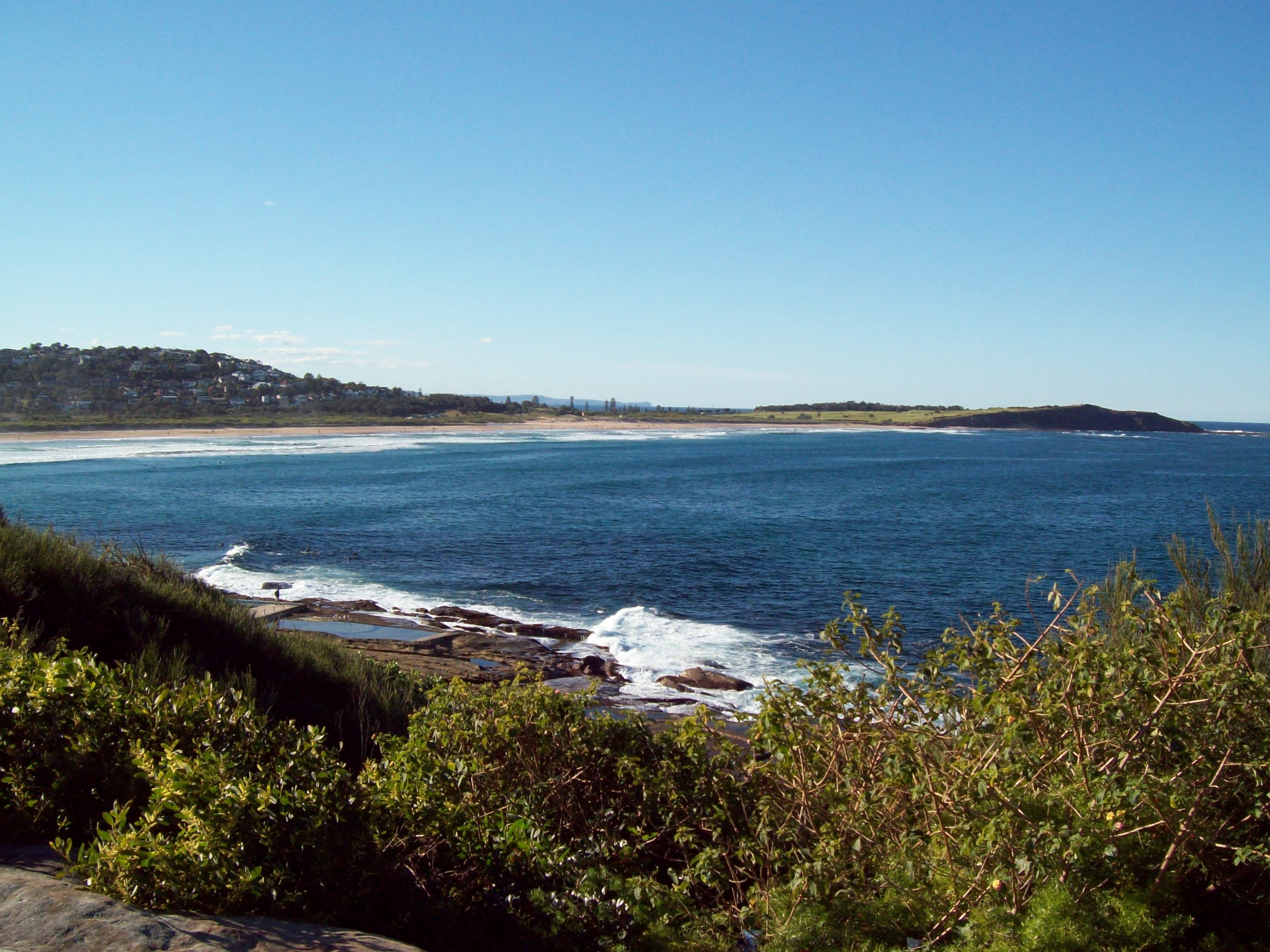
Narraweena is a suburb of northern Sydney, in the state of New South Wales, Australia. Narraweena is 18 kilometres north-east of the Sydney central business district, in the local government area of Northern Beaches Council and is part of the Northern Beaches region. Narraweena has two primary schools; Narraweena Public School and St John the Apostle Narraweena Catholic School. History Narraweena is an Aboriginal name meaning '' a quiet place in the hills''. The suburb developed after World War II, when the land was subdivided, Narraweena Post Office opening on 1 April 1953.''The Book of Sydney Suburbs'', Compiled by Frances Pollon, Angus & Robertson Publishers, 1990, Published in Australia Italian people from Pazzano since the 1980s have organised an annual Santo Salvatore's fiest Festa del Santissimo Salvatore a Pazzano ( scn, label=Central-Southern Calabrian, Calabrian, Festa dô Sarvaturi; "Feast of the Holiest Saviour") is a three-day Catholic festival celebra ... [...More Info...] [...Related Items...] OR: [Wikipedia] [Google] [Baidu] |
Dee Why, New South Wales
Dee Why is a coastal suburb of northern Sydney, in the state of New South Wales, Australia, 18 kilometres north-east of the Sydney central business district. It is the administrative centre of the local government area of Northern Beaches Council and, along with Brookvale, is considered to be the main centre of the Northern Beaches region. History Name The reasons for Dee Why's name remain unclear. The earliest reference to it is a pencil note in surveyor James Meehan's field book, "Wednesday, 27th Sept, 1815 Dy Beach - Marked a Honey Suckle Tree near the Beach". What it meant to him is not clear, but various claims have been put forward, including: *The letters DY were simply a marker that Meehan used to mark many other places on his map. *The name came from the local Aboriginal language that Meehan used to name many of the locations that he surveyed. *The suburb was named after Leibniz's notation for the derivative in differential calculus, ''dy''/''dx''. From ... [...More Info...] [...Related Items...] OR: [Wikipedia] [Google] [Baidu] |
Northern Beaches
The Northern Beaches is a region within Northern Sydney, in the state of New South Wales, Australia, near the Pacific coast. This area extends south to the entrance of Port Jackson (Sydney Harbour), west to Middle Harbour and north to the entrance of Broken Bay. The area was formerly inhabited by the Garigal or Caregal people in a region known as Guringai country. The Northern Beaches district is governed on a local level by the Northern Beaches Council, which was formed in May 2016 from Warringah Council (est. 1906), Manly Council (est. 1877), and Pittwater Council (est. 1992). History Early history The traditional Aboriginal inhabitants of the land now known as the Northern Beaches were the Garigal people of the Eora nation. Within a few years of European settlement, the Garigal had mostly disappeared from this area mainly due to an outbreak of smallpox in 1789. Much evidence of their habitation remains especially their rock etchings in Ku-ring-gai Chase National Park which ... [...More Info...] [...Related Items...] OR: [Wikipedia] [Google] [Baidu] |
Northern Beaches Council
The Northern Beaches Council is a local government area located in the Northern Beaches region of Sydney, in the state of New South Wales, Australia. The council was formed on 12 May 2016 after the amalgamation of Manly, Pittwater and Warringah Councils. The Council comprises an area of and as at the had an estimated population of 263,554, making it the fourth most populous local government area in New South Wales. The inaugural Mayor of the Northern Beaches Council is Cr. Michael Regan, of the Your Northern Beaches Independent Team, who was first elected on 26 September 2017. Suburbs and localities The following suburbs are located within Northern Beaches Council: The following localities are located within Northern Beaches Council: Demographics At the , there were people in the Northern Beaches local government area; of these 48.9 per cent were male and 51.1 per cent were female. Aboriginal and Torres Strait Islander people made up 0.6 per cent of the population; ... [...More Info...] [...Related Items...] OR: [Wikipedia] [Google] [Baidu] |
Santo Salvatore's Fiest
Festa del Santissimo Salvatore a Pazzano ( scn, label=Central-Southern Calabrian, Calabrian, Festa dô Sarvaturi; "Feast of the Holiest Saviour") is a three-day Catholic festival celebrated in Pazzano, Province of Reggio Calabria, Reggio Calabria, Italy, every first weekend after 5 August. It was originally the Byzantine celebration of the Transfiguration of Jesus, transfiguration of Christ, still observed today by both the Catholic and Orthodox churches on 6 August. It is divided in a civil and religious program. Starting nine days before the feast, Novena (Calabrian ''novina'') is celebrated, consisting of the adoration of the Saviour's statue and the recitation prayers for nine days. Novena is preceded by a litany. History The current wooden statue used in the celebration was created in 1797 by Serra San Bruno, Serrese sculptor Vincenzo Scrivo, discovered thanks to a restoration made in the 1980s. In 2006, another little restoration was made, and that year the feast began at ... [...More Info...] [...Related Items...] OR: [Wikipedia] [Google] [Baidu] |
Brookvale, New South Wales
Brookvale is a suburb of northern Sydney, in the state of New South Wales, Australia. Brookvale is 16 kilometres north-east of the Sydney central business district, in the local government area of Northern Beaches Council. It is part of the Northern Beaches region. History The first development in the area was in 1836 when 64 hectares of farmland was granted to William Frederick Parker. In this period further land was sold to the Malcolm, Burns and Miles families. In 1883, Sydney Alexander Malcolm built what became known as 'Brookvale House'. It eventually was sold in 1961 to the Hooker Investment Corporation paving the way for the construction of Warringah Mall, which is the largest shopping complex in the area. Brookvale had two post offices. Brookvale Post Office opened on 1 June 1888 and closed on 1 November 2013. The post office included a mail & parcel delivery & a collection service operated by Mailplus operates in that post office. Warringah Mall Post Office opened ... [...More Info...] [...Related Items...] OR: [Wikipedia] [Google] [Baidu] |
Suburbs Of Sydney
This is a complete listing of the suburbs and localities in the greater Sydney area in alphabetical order. Sydney has about 30 local government areas, each consisting of several suburbs. Suburbs in Australia are purely geographical, not political, divisions. See table below, : Suburbs of Sydney and : Local government areas in Sydney. Suburbs are listed here if they are inside the Sydney metro area, and are listed in the New South Wales Geographical Names Register as being suburbs. For this list, the boundaries of the Sydney metro area are defined as the Hawkesbury/Nepean River in the north/north west, and then the outer boundaries of the City of Penrith, Camden Council, the City of Campbelltown and Sutherland Shire. Some but not all Sydney localities are also listed, and localities are shown in italics to differentiate them from suburbs. Further localities may be added if they are on the Geographical Names Register, are inside the Sydney metro area, and are also listed in ... [...More Info...] [...Related Items...] OR: [Wikipedia] [Google] [Baidu] |
Beacon Hill, New South Wales
Beacon Hill is a suburb of northern Sydney, in the state of New South Wales, Australia 17 kilometres north-east of the Sydney central business district, in the local government area of Northern Beaches Council. It is part of the Northern Beaches region. History Beacon Hill was given the title when the Department of Lands built a trigonometric beacon there in 1881. Aboriginal culture Little is known of local aboriginal culture in the Beacon Hill area but other local areas towards the sea have a rich and diverse aboriginal background. There are some aboriginal carvings in rocks to the north of Red Hill. European settlement Daniel Egan, a member of the NSW Parliament, purchased two parcels of land on 5 October 1857. Most of the houses in the suburb were built in the boom days after World War II, in the 1950s and 1960s. Many of the streets in Beacon Hill are named after notable battles, military men or places where Australian troops served in World War II. These include ... [...More Info...] [...Related Items...] OR: [Wikipedia] [Google] [Baidu] |
Cromer, New South Wales
Cromer is a suburb of northern Sydney, in the state of New South Wales, Australia. Cromer is 20 kilometres north-east of the Sydney central business district, in the local government area of Northern Beaches Council and is part of the Northern Beaches region. Cromer is bordered to the north-east by Narrabeen Lagoon. History Cromer is named after the seaside town of Cromer, in Norfolk, England. The area had been known as Dee Why West but it was changed after Dee Why Golf Links was taken over by the Cromer Country Club in 1940. The club applied to have the area's name changed to Cromer and permission was granted to create the new suburb. Cromer Post Office opened on 1 September 1959 and closed in 1992. Education Cromer Public School (K-6) and Northern Beaches Secondary College Cromer Campus (7-12) are the two public schools in the suburb. The education status of people living in Cromer is Infants/Primary (7%), Secondary Education (6%), Technical or Further Education (4%), ... [...More Info...] [...Related Items...] OR: [Wikipedia] [Google] [Baidu] |
Division Of Warringah
The Division of Warringah is an Australian electoral division in the state of New South Wales. Geography Since 1984, federal electoral division boundaries in Australia have been determined at redistributions by a redistribution committee appointed by the Australian Electoral Commission. Redistributions occur for the boundaries of divisions in a particular state, and they occur every seven years, or sooner if a state's representation entitlement changes or when divisions of a state are malapportioned. History The division is named after the Warringah area of Sydney, which itself is named by an Aboriginal Australian word which translates into English as "rain", "waves" or "sea". The Division was proclaimed at the redistribution of 13 September 1922, and was first contested at the 1922 federal election. The word "Warrin ga" was recorded as the local name for Middle Harbour in 1832. Centred on Mosman and the Northern Beaches region of Sydney, it covers most of the land between ... [...More Info...] [...Related Items...] OR: [Wikipedia] [Google] [Baidu] |
Division Of Mackellar
The Division of Mackellar is an Australian electoral division in the state of New South Wales. History The division is named after Sir Charles Mackellar, a social reformer and surgeon who served in the Senate from October to November 1903, and his daughter Dorothea Mackellar, a 20th-century Australian poet. The division was proclaimed at the redistribution of 11 May 1949, and was first contested at the 1949 federal election. It was first held by Bill Wentworth, the first Minister for Aboriginal Affairs, and the great-grandson of politician and explorer William Wentworth, one of the first three Europeans to cross the Blue Mountains. Like most seats in northern Sydney, Mackellar was a safe seat for the Liberal Party of Australia for the majority of its history. Prior to 2022, for all but two months of its existence, the seat was held by Liberal MPs; Wentworth briefly sat as an independent for the last two months of his term. The territory covered by the electorate had been r ... [...More Info...] [...Related Items...] OR: [Wikipedia] [Google] [Baidu] |
Pazzano
Pazzano ( Calabrian: ) is a village and '' comune'' located in Locride's region in the province of Reggio Calabria (Calabria, southern Italy). History The first known mention of Pazzano dates to a 1094 document. The town was founded as a minerary center for the exploitation of iron (by pyrite and limonite) and molybdenum (the latter in caves of Monte Stella and Monte Consolino) deposits. During the period of the Kingdom of the Two Sicilies, its 25 mines made Pazzano the most important mining centre in all of southern Italy. The minerals were processed at Reali ferriere ed Officine di Mongiana in Mongiana. Pazzano became a '' comune ''in 1811. Minerary activities lasted until the 20th century. During the 1950s, the inhabitants began to emigrate to northern Italy, and Pazzano's population drastically reduced. At Sydney,(Australia), since the 1950s the emigrants of Pazzano created a little Community in Brookvale (nicknamed ''Pazzaniedu'') and at Narraweena, every year tak ... [...More Info...] [...Related Items...] OR: [Wikipedia] [Google] [Baidu] |
Oxford Falls, New South Wales
Oxford Falls is a suburb of northern Sydney, in the state of New South Wales, Australia 20 kilometres north-east of the Sydney central business district in the local government area of Northern Beaches Council. Oxford Falls is part of the Northern Beaches region and also considered to be part of the Forest District, colloquially known as ''The Forest''. History Alexander Bowen was granted here in 1878, which he named Bloodwood Gully. Oxford Falls was gazetted as the name of the suburb in 1902. Wakehurst Parkway is named after John de Vere Loder, 2nd Baron Wakehurst, the Governor of New South Wales (1937–1946).''The Book of Sydney Suburbs'', Compiled by Frances Pollen, Angus & Robertson Publishers, 1990, Published in Australia Oxford Falls Post Office opened on 2 January 1924 and closed in 1984. Landmarks The Oxford Falls are two waterfalls on Middle Creek, which flows north to meet Oxford Creek. Meandering Creek flows into Middle Creek. Wheeler Creek forms part of ... [...More Info...] [...Related Items...] OR: [Wikipedia] [Google] [Baidu] |


Manly_Municipal_Council.jpg)


