|
Narganá
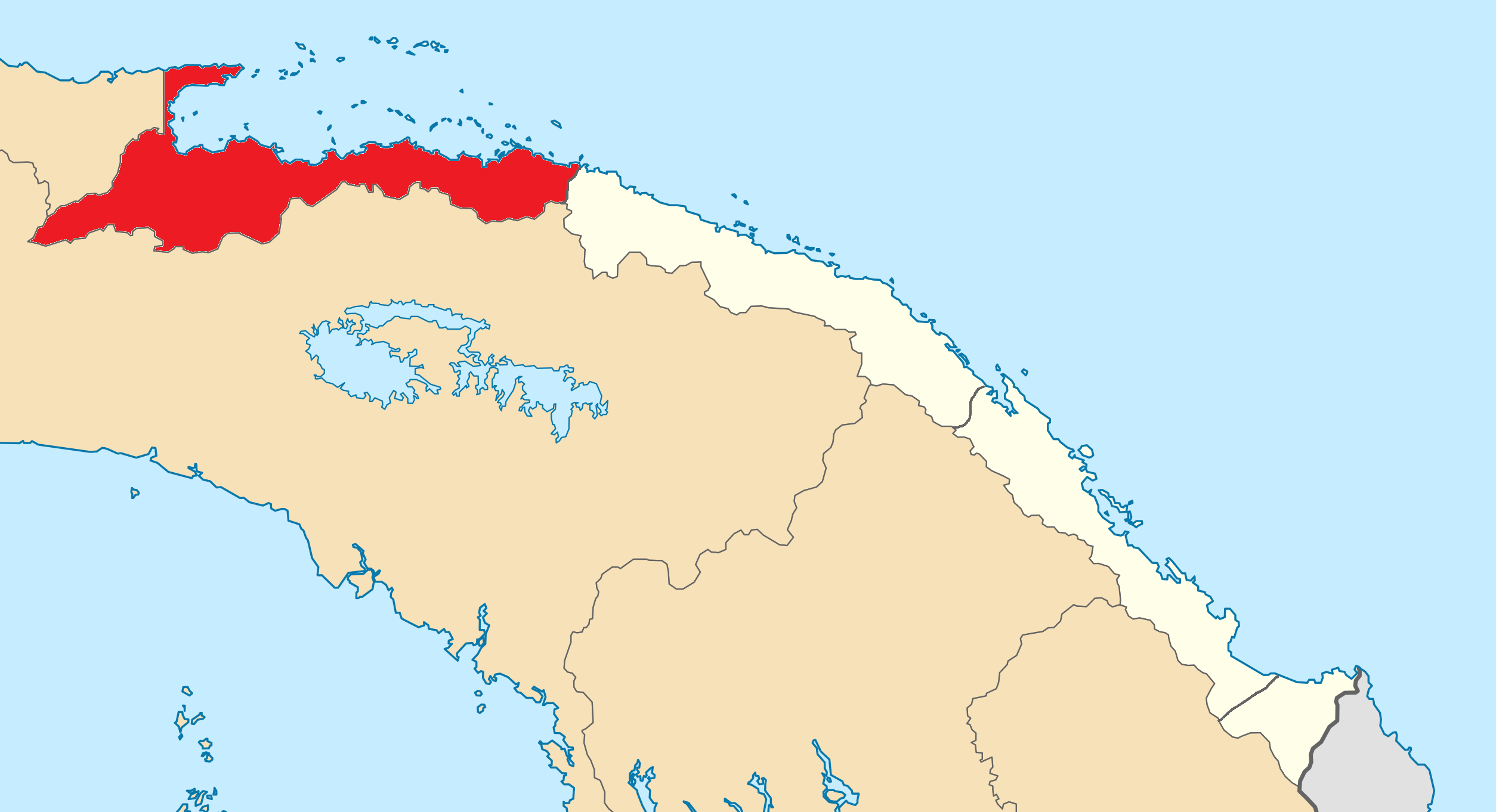
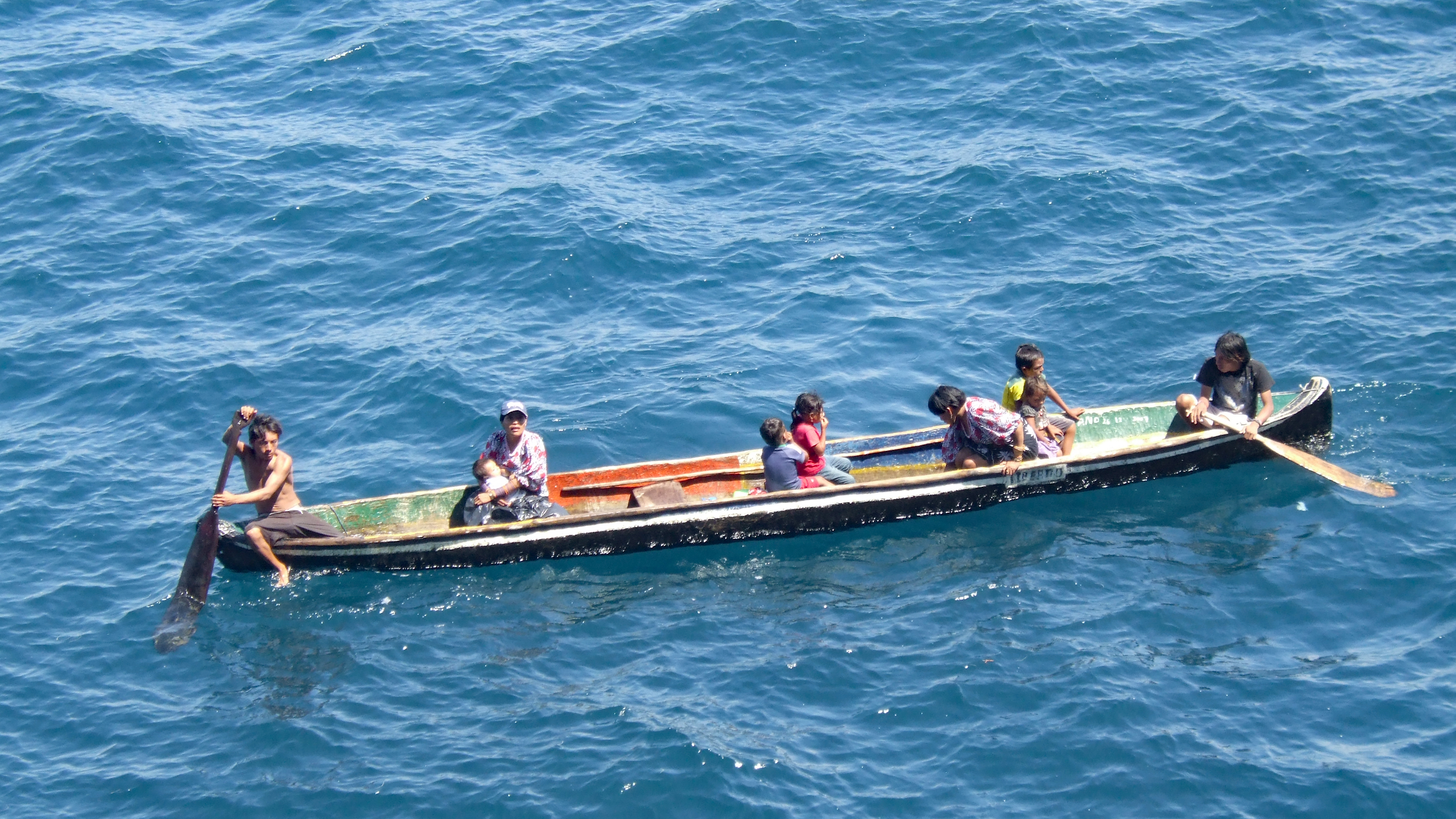
Narganá or Yandup in the Guna language is one of the islands belonging to the Guna Yala, an autonomous territory or comarca in Panama. The culture in Nargana is influenced heavily by Panama and most people there are bilingual speaking both Spanish and the Kuna language. The island has an area of 5.5 hectares and is completely overbuilt, and could be walked around in less than 10 minutes. There is a small hospital and school on the island. The nearest populated island, Corazón de Jesús, is connected to Nargana by a concrete bridge. Both islands are among the most westernized of the San Blas Islands The San Blas Islands of Panama is an archipelago comprising approximately 365 islands and cays, of which 49 are inhabited. They lie off the north coast of the Isthmus of Panama, east of the Panama Canal. A part of the ''comarca'' (district) Guna .... External linksVIDA website about Nargana Caribbean islands of Panama Guna Yala {{GunaYala-geo-stub ... [...More Info...] [...Related Items...] OR: [Wikipedia] [Google] [Baidu] |
Guna Yala
Guna Yala, formerly known as San Blas, is a ''comarca indígena'' (indigenous province) in northeast Panama. Guna Yala is home to the indigenous people known as the Gunas. Its capital is Gaigirgordub. It is bounded on the north by the Caribbean Sea, on the south by the Darién Province and Emberá-Wounaan, on the east by Colombia, and on the west by the province of Colón. Etymology Guna Yala in Kuna means "Land Guna" or "Guna Mountain". The area was formerly known as San Blas, and later as Kuna Yala, but the name was changed in October 2011 to "Guna Yala" when the Government of Panama recognized the claim of the people that "Guna" was a closer representation of the name. History The area was the site of the conquistador stronghold of Acla, where Vasco Núñez de Balboa was tried and beheaded. When the Spaniards arrived in the 1600s, the Kuna people were living here near the Gulf of Urabá, in what is considered Colombia today. However, contact with the Spaniards re ... [...More Info...] [...Related Items...] OR: [Wikipedia] [Google] [Baidu] |
Corazón De Jesús (island)
Corazón de Jesús (Spanish: ''Isla Corazón de Jesús'', Kuna ''Akuanasutupu'') is an island in Kuna Yala territory, Panama, with an area of 1.5 hectares and a population of 600. It is connected to larger Narganá due west of it by a concrete bridge, and completely overbuilt. Both islands are among the most westernized of the San Blas Islands The San Blas Islands of Panama is an archipelago comprising approximately 365 islands and cays, of which 49 are inhabited. They lie off the north coast of the Isthmus of Panama, east of the Panama Canal. A part of the ''comarca'' (district) Guna Y .... External links Satellite Image Caribbean islands of Panama {{GunaYala-geo-stub ... [...More Info...] [...Related Items...] OR: [Wikipedia] [Google] [Baidu] |
Location Of Nargana
In geography, location or place are used to denote a region (point, line, or area) on Earth's surface or elsewhere. The term ''location'' generally implies a higher degree of certainty than ''place'', the latter often indicating an entity with an ambiguous boundary, relying more on human or social attributes of place identity and sense of place than on geometry. Types Locality A locality, settlement, or populated place is likely to have a well-defined name but a boundary that is not well defined varies by context. London, for instance, has a legal boundary, but this is unlikely to completely match with general usage. An area within a town, such as Covent Garden in London, also almost always has some ambiguity as to its extent. In geography, location is considered to be more precise than "place". Relative location A relative location, or situation, is described as a displacement from another site. An example is "3 miles northwest of Seattle". Absolute location An absolute locatio ... [...More Info...] [...Related Items...] OR: [Wikipedia] [Google] [Baidu] |
Guna Language
The Kuna language (formerly Cuna, and in the language itself Guna), spoken by the Kuna people of Panama and Colombia, belongs to the Chibchan language family. History The Kuna were living in what is now Northern Colombia and the Darién Province of Panama at the time of the Spanish invasion, and only later began to move westward towards what is now Guna Yala due to a conflict with Spanish and other indigenous groups. Centuries before the conquest, the Kuna arrived in South America as part of a Chibchan migration moving east from Central America. At the time of the Spanish invasion, they were living in the region of Uraba and near the borders of what are now Antioquia and Caldas. Alonso de Ojeda and Vasco Núñez de Balboa explored the coast of Colombia in 1500 and 1501. They spent the most time in the Gulf of Urabá, where they made contact with the Kuna. In far-eastern Guna Yala, the community of New Caledonia is near the site where Scottish explorers tried, unsuccessful ... [...More Info...] [...Related Items...] OR: [Wikipedia] [Google] [Baidu] |
Panama
Panama ( , ; es, link=no, Panamá ), officially the Republic of Panama ( es, República de Panamá), is a transcontinental country spanning the southern part of North America and the northern part of South America. It is bordered by Costa Rica to the west, Colombia to the southeast, the Caribbean Sea to the north, and the Pacific Ocean to the south. Its capital and largest city is Panama City, whose metropolitan area is home to nearly half the country's million people. Panama was inhabited by indigenous tribes before Spanish colonists arrived in the 16th century. It broke away from Spain in 1821 and joined the Republic of Gran Colombia, a union of Nueva Granada, Ecuador, and Venezuela. After Gran Colombia dissolved in 1831, Panama and Nueva Granada eventually became the Republic of Colombia. With the backing of the United States, Panama seceded from Colombia in 1903, allowing the construction of the Panama Canal to be completed by the United States Army Corps of En ... [...More Info...] [...Related Items...] OR: [Wikipedia] [Google] [Baidu] |
Hectare
The hectare (; SI symbol: ha) is a non-SI metric unit of area equal to a square with 100-metre sides (1 hm2), or 10,000 m2, and is primarily used in the measurement of land. There are 100 hectares in one square kilometre. An acre is about and one hectare contains about . In 1795, when the metric system was introduced, the ''are'' was defined as 100 square metres, or one square decametre, and the hectare ("hecto-" + "are") was thus 100 ''ares'' or km2 (10,000 square metres). When the metric system was further rationalised in 1960, resulting in the International System of Units (), the ''are'' was not included as a recognised unit. The hectare, however, remains as a non-SI unit accepted for use with the SI and whose use is "expected to continue indefinitely". Though the dekare/decare daa (1,000 m2) and are (100 m2) are not officially "accepted for use", they are still used in some contexts. Description The hectare (), although not a unit of SI, i ... [...More Info...] [...Related Items...] OR: [Wikipedia] [Google] [Baidu] |
San Blas Islands
The San Blas Islands of Panama is an archipelago comprising approximately 365 islands and cays, of which 49 are inhabited. They lie off the north coast of the Isthmus of Panama, east of the Panama Canal. A part of the ''comarca'' (district) Guna Yala along the Caribbean coast of Panama is home to the Kuna people. San Blas and its surrounding area is a haven for ecotourism because of its pristine environs. The area is also popular for sailing, as it is known for its beauty and lack of hurricanes. Notable locations in the Archipelago are the main capital El Porvenir, the densely crowded island village of Carti Sugtupu, and the two keys, Cayos Limones, and Cayos Holandeses, both renowned for their clear waters. The islands could be rendered uninhabitable by sea level rise in the late 21st century. Tradition and legacy Before the arrival of Europeans, the Guna wore few clothes and decorated their bodies with colorful designs. When encouraged to wear clothes by the missionari ... [...More Info...] [...Related Items...] OR: [Wikipedia] [Google] [Baidu] |
Caribbean Islands Of Panama
The Caribbean (, ) ( es, El Caribe; french: la Caraïbe; ht, Karayib; nl, De Caraïben) is a region of the Americas that consists of the Caribbean Sea, its islands (some surrounded by the Caribbean Sea and some bordering both the Caribbean Sea and the North Atlantic Ocean) and the surrounding coasts. The region is southeast of the Gulf of Mexico and the North American mainland, east of Central America, and north of South America. Situated largely on the Caribbean Plate, the region has more than 700 islands, islets, reefs and cays (see the list of Caribbean islands). Island arcs delineate the eastern and northern edges of the Caribbean Sea: The Greater Antilles and the Lucayan Archipelago on the north and the Lesser Antilles and the on the south and east (which includes the Leeward Antilles). They form the West Indies with the nearby Lucayan Archipelago (the Bahamas and Turks and Caicos Islands), which are considered to be part of the Caribbean despite not bordering the Caribb ... [...More Info...] [...Related Items...] OR: [Wikipedia] [Google] [Baidu] |


