|
Naramata
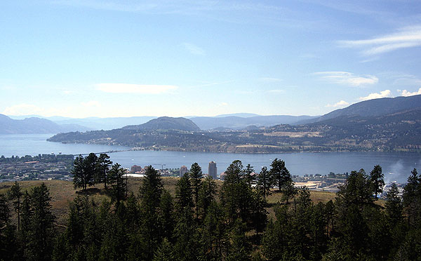
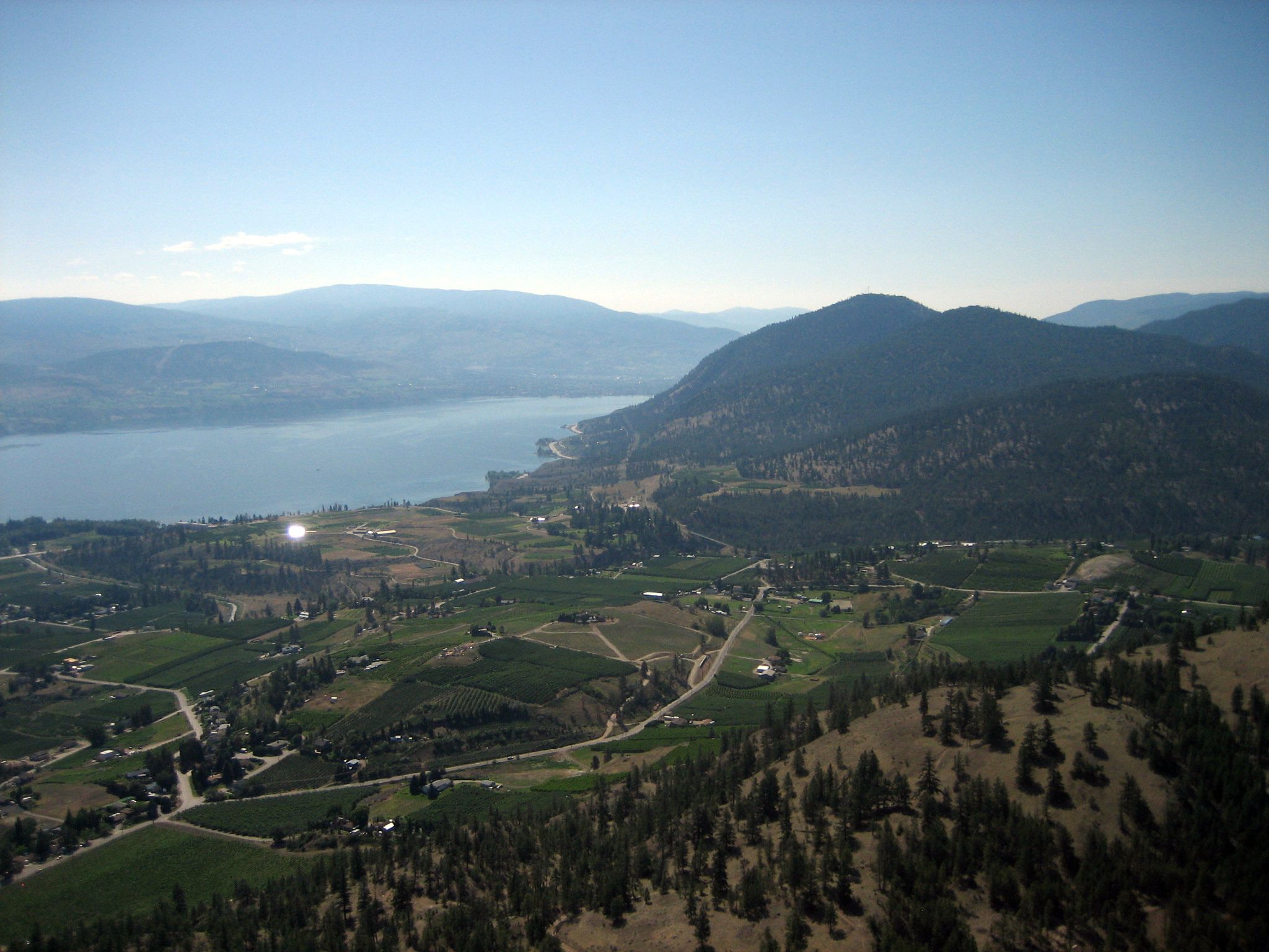
Naramata is an unincorporated community in the Okanagan region of south central British Columbia. On the eastern shore of southern Lake Okanagan, the locality is by road about north of Penticton. Name origin In November 1906, John Moore Robinson purchased land. Over the following nine months, the name changed from Nine Mile Point to East Summerland, to Brighton Beach, and finally to Naramata. Robinson claimed the name came in a séance, but more likely, he knew the value of a good story in promoting the sale of home sites and orchard lots. Alternative theories have suggested the name derives from a First Nations word or an Australian Aboriginal one, but supporting evidence is lacking. First Nations The Syilx name for the area is “Citxws Peqlqin," or "Eagle's House." The Naramata bench provided a seasonal camp site for elk hunting and food gathering. Early community Robinson advertised and sold parcels of land to people from other parts of Canada as well as the British Isles ... [...More Info...] [...Related Items...] OR: [Wikipedia] [Google] [Baidu] |
Lake Okanagan
Okanagan Lake ( oka, kɬúsx̌nítkw) is a lake in the Okanagan Valley of British Columbia, Canada. The lake is long, between wide, and has a surface area of 348 km2 (135 sq. mi.). Hydrography Okanagan Lake is called a fjord lake as it has been carved out by repeated glaciations. Although the lake contains numerous lacustrine terraces, it is not uncommon for the lake to be deep only offshore. Major inflows include Mission, Vernon, Trout, Penticton, Equesis, Kelowna, Peachland and Powers Creeks. The lake is drained by the Okanagan River, which exits the lake's south end via a canal through the city of Penticton to Skaha Lake, whence the river continues southwards into the rest of the South Okanagan and through Okanogan County, Washington to its confluence with the Columbia. The lake's maximum depth is near Grant Island (Nahun Weenox). There are three other islands: one known as Rattlesnake Island, much farther south by Squally Point. The other two are near Grant I ... [...More Info...] [...Related Items...] OR: [Wikipedia] [Google] [Baidu] |
Okanagan
The Okanagan ( ), also known as the Okanagan Valley and sometimes as the Okanagan Country, is a region in the Canadian province of British Columbia defined by the basin of Okanagan Lake and the Canadian portion of the Okanagan River. It is part of the Okanagan Country, extending into the United States as Okanogan County in north-central Washington. According to the 2016 Canadian census, the region's population is 362,258. The largest populated cities are Kelowna, Penticton, Vernon, and West Kelowna. The region is known for its sunny climate, dry landscapes and lakeshore communities and particular lifestyle. The economy is retirement and commercial-recreation based, with outdoor activities such as boating and watersports, skiing and hiking. Agriculture has been focused primarily on fruit orchards, with a recent shift in focus to vineyards and wine. The region stretches northwards via the Spallumcheen Valley to Sicamous in the Shuswap Country, and reaches south of the Canada–U ... [...More Info...] [...Related Items...] OR: [Wikipedia] [Google] [Baidu] |
Regional District Of Okanagan-Similkameen
The Regional District of Okanagan-Similkameen (RDOS) is in southern British Columbia, adjacent to the U.S. state of Washington. It is bounded by Fraser Valley Regional District to the west, Thompson-Nicola Regional District and Regional District of Central Okanagan The Regional District of Central Okanagan (RDCO) is a regional district in the Canadian province of British Columbia, representing the metropolitan area of Greater Kelowna, which comprises the City of Kelowna, City of West Kelowna and their ... to the north, Regional District of Kootenay Boundary to the east, and by Okanogan County, Washington to the south. At the Canada 2011 Census, 2011 census the population was 80,742. The district covers a land area of . The administrative offices are in the Penticton, City of Penticton. Population history * 2021: 90,178 (+8.6%) * 2016: 83,022 (+2.8%) * 2011: 80,742 (+1.6%) * 2006: 79,475 (+3.7%) * 2001: 76,635 (+0.9%) * 1996: 75,933 Municipalities RDOS comprises ... [...More Info...] [...Related Items...] OR: [Wikipedia] [Google] [Baidu] |
John Moore Robinson
John Moore Robinson, (born in Hustonville, Wellington County, Canada West in December 1855 – died February 23, 1934) was a pioneer, rancher, prospector, politician and orchardist who helped shape British Columbia's Okanagan Valley region through, among other things, the establishment of such communities as Naramata, Summerland, and Peachland. Biography Education and early career The son of William Robinson, an Irish-born merchant, and Maria Moore, he was educated in Hustonville, in Lockport, New York and in St. Catharines, Ontario. He taught school for four years in Ontario, and then, in 1879, he moved to Manitoba, where he taught in Woodlands for two more years. In 1882, Robinson married Eliza Lipsett. He was the editor and publisher of the ''Brandon Times'', the ''Portage la Prairie Tribune'' and the ''Portage la Prairie Review''. Robinson also served as clerk for Woodlands and for Portage la Prairie. He was later employed in the real estate business in Portage la Pr ... [...More Info...] [...Related Items...] OR: [Wikipedia] [Google] [Baidu] |
Penticton
Penticton ( ) is a city in the Okanagan Valley of the Southern Interior of British Columbia, Canada, situated between Okanagan and Skaha lakes. In the 2016 Canadian Census, its population was 33,761, while its census agglomeration The census geographic units of Canada are the census subdivisions defined and used by Canada's federal government statistics bureau Statistics Canada to conduct the country's quinquennial census. These areas exist solely for the purposes of stat ... population was 43,432. Name origin The name Penticton is derived from a word in the Okanagan language. It is conventionally translated as "a place to stay forever" but is actually a reference to the year-round flow of Okanagan Lake through Penticton where it enters Skaha Lake. Differing accounts of the meaning are given in the BC Geographical Names entry for the city: History The site of the city was first settled by the Syilx (Okanagan people), of the Interior Salish languages group,#Breese-Bi ... [...More Info...] [...Related Items...] OR: [Wikipedia] [Google] [Baidu] |
Designated Places In British Columbia
A designated place is a type of geographic unit used by Statistics Canada to disseminate census data. It is usually "a small community that does not meet the criteria used to define incorporated municipalities or Statistics Canada population centres (areas with a population of at least 1,000 and no fewer than 400 persons per square kilometre)." Provincial and territorial authorities collaborate with Statistics Canada in the creation of designated places so that data can be published for sub-areas within municipalities. Starting in 2016, Statistics Canada allowed the overlapping of designated places with population centres. In the 2021 Census of Population, British Columbia had 332 designated places, an increase from 326 in 2016. Designated place types in British Columbia include 55 Indian reserves, 13 island trusts, 5 Nisga'a villages, 5 retired population centres, and 254 unincorporated places. In 2021, the 332 designated places had a cumulative population of 258,060 and an ... [...More Info...] [...Related Items...] OR: [Wikipedia] [Google] [Baidu] |
Kettle Valley Railway
The Kettle Valley Railway was a subsidiary of the Canadian Pacific Railway (CPR) that operated across southern British Columbia, west of Midway running to Rock Creek, then north to Myra Canyon, down to Penticton over to Princeton, Coalmont, Brookmere, Coquihalla and finally Hope where it connected to the main CPR line. It opened in 1915 and was abandoned in portions beginning in 1961, with the surviving portion west of Penticton seeing their last trains in 1989. Much of the railway's original route has been converted to a multi-use recreational trail, known as the Kettle Valley Rail Trail, which carries the Trans-Canada Trail through this part of British Columbia. History The Kettle Valley Railway was built out of necessity to service the growing mining demands in the Southern Interior region of British Columbia. When the Canadian Pacific Railway (CPR) completed the transcontinental railway in 1885, the route cut through the Rocky Mountains at Kicking Horse and Rogers P ... [...More Info...] [...Related Items...] OR: [Wikipedia] [Google] [Baidu] |
Steamboats Of Lake Okanagan
A steamboat is a boat that is propelled primarily by steam power, typically driving propellers or paddlewheels. Steamboats sometimes use the prefix designation SS, S.S. or S/S (for 'Screw Steamer') or PS (for 'Paddle Steamer'); however, these designations are most often used for steamships. The term ''steamboat'' is used to refer to smaller, insular, steam-powered boats working on lakes and rivers, particularly riverboats. As using steam became more reliable, steam power became applied to larger, ocean-going vessels. Background Limitations of the Newcomen steam engine Early steamboat designs used Newcomen steam engines. These engines were large, heavy, and produced little power, which resulted in an unfavorable power-to-weight ratio. The Newcomen engine also produced a reciprocating or rocking motion because it was designed for pumping. The piston stroke was caused by a water jet in the steam-filled cylinder, which condensed the steam, creating a vacuum, which in turn caused ... [...More Info...] [...Related Items...] OR: [Wikipedia] [Google] [Baidu] |
Summerland, British Columbia
Summerland (2016 population 11,615) is a town on the west side of Okanagan Lake in the interior of British Columbia, Canada. The district is between Peachland to the north and Penticton to the south. The largest centre in the region is Kelowna, approximately to the north (via Highway 97), and Vancouver is approximately away to the west. The district is famous for "Bottleneck drive", a system of roads connecting various wineries. Electoral representatives The current Mayor is Toni Boot. The district's (2016 federal) Member of Parliament is Dan Albas of the Conservative Party of Canada. Its member of the Legislative Assembly of British Columbia is British Columbia Liberal Party member, Dan Ashton. History In 2006, the District of Summerland celebrated its centennial as an incorporated municipality in 1906, yet the history of settlement in the Summerland area extends beyond that time. Summerland's first inhabitants were the Syilx (Okanagan Salish), with the First Nations bound ... [...More Info...] [...Related Items...] OR: [Wikipedia] [Google] [Baidu] |
British Columbia
British Columbia (commonly abbreviated as BC) is the westernmost province of Canada, situated between the Pacific Ocean and the Rocky Mountains. It has a diverse geography, with rugged landscapes that include rocky coastlines, sandy beaches, forests, lakes, mountains, inland deserts and grassy plains, and borders the province of Alberta to the east and the Yukon and Northwest Territories to the north. With an estimated population of 5.3million as of 2022, it is Canada's third-most populous province. The capital of British Columbia is Victoria and its largest city is Vancouver. Vancouver is the third-largest metropolitan area in Canada; the 2021 census recorded 2.6million people in Metro Vancouver. The first known human inhabitants of the area settled in British Columbia at least 10,000 years ago. Such groups include the Coast Salish, Tsilhqotʼin, and Haida peoples, among many others. One of the earliest British settlements in the area was Fort Victoria, established ... [...More Info...] [...Related Items...] OR: [Wikipedia] [Google] [Baidu] |
Populated Places In The South Okanagan
Population typically refers to the number of people in a single area, whether it be a city or town, region, country, continent, or the world. Governments typically quantify the size of the resident population within their jurisdiction using a census, a process of collecting, analysing, compiling, and publishing data regarding a population. Perspectives of various disciplines Social sciences In sociology and population geography, population refers to a group of human beings with some predefined criterion in common, such as location, race, ethnicity, nationality, or religion. Demography is a social science which entails the statistical study of populations. Ecology In ecology, a population is a group of organisms of the same species who inhabit the same particular geographical area and are capable of interbreeding. The area of a sexual population is the area where inter-breeding is possible between any pair within the area and more probable than cross-breeding with ind ... [...More Info...] [...Related Items...] OR: [Wikipedia] [Google] [Baidu] |
Unincorporated Settlements In British Columbia
Unincorporated may refer to: * Unincorporated area, land not governed by a local municipality * Unincorporated entity, a type of organization * Unincorporated territories of the United States, territories under U.S. jurisdiction, to which Congress has determined that only select parts of the U.S. Constitution apply * Unincorporated association Unincorporated associations are one vehicle for people to cooperate towards a common goal. The range of possible unincorporated associations is nearly limitless, but typical examples are: :* An amateur football team who agree to hire a pitch onc ..., also known as voluntary association, groups organized to accomplish a purpose * ''Unincorporated'' (album), a 2001 album by Earl Harvin Trio {{disambig ... [...More Info...] [...Related Items...] OR: [Wikipedia] [Google] [Baidu] |

.jpg)


