|
Nansemond River
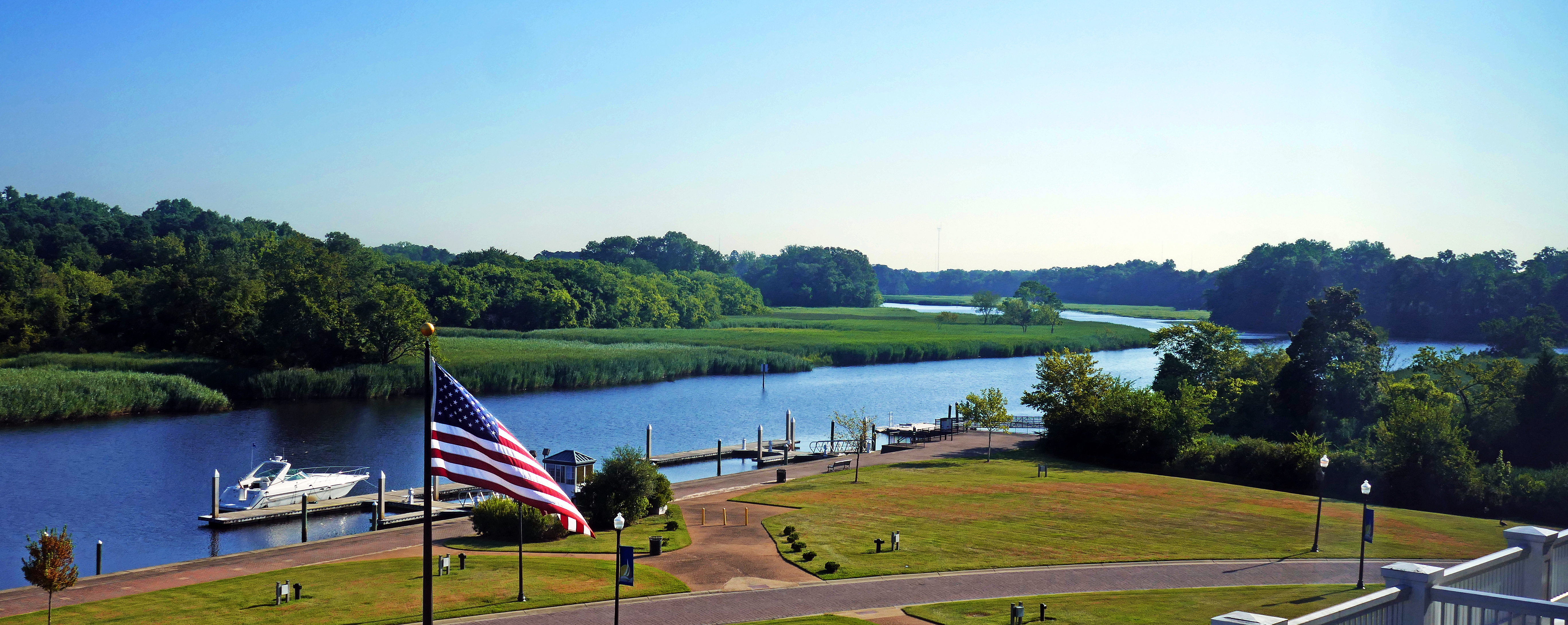
The Nansemond River is a U.S. Geological Survey. National Hydrography Dataset high-resolution flowline dataThe National Map accessed April 1, 2011 tributary of the James River in Virginia in the United States. Virginian colonists named the river for the Nansemond tribe of Native Americans, who had long inhabited the area. They continue as a federally recognized tribe in Virginia. The river begins at the outlet of Lake Meade north of downtown Suffolk, which had historically marked the northern boundary of the city. The Nansemond River Light once signaled the river's confluence with the James. The Nansemond River Bridge, once a toll bridge and part of U.S. Route 17, crosses the river near its mouth. Two other bridges cross the river, one from downtown Suffolk and one on Route 58. The Nansemond National Wildlife Refuge is located along the river. See also *List of rivers of Virginia This is a list of rivers in the U.S. state of Virginia. By drainage basin This list is arrang ... [...More Info...] [...Related Items...] OR: [Wikipedia] [Google] [Baidu] |
Nansemond National Wildlife Refuge
The Nansemond National Wildlife Refuge is a National Wildlife Refuge of the United States located along the Nansemond River in Suffolk, Virginia. It is managed by the United States Fish and Wildlife Service as a satellite of Great Dismal Swamp National Wildlife Refuge. In 1973 about of salt marsh were transferred to the Service by the United States Navy The United States Navy (USN) is the maritime service branch of the United States Armed Forces and one of the eight uniformed services of the United States. It is the largest and most powerful navy in the world, with the estimated tonnage ... to form the refuge. An additional were transferred in 1999. The refuge is not open to the public. External linksUS Fish & Wildlife Service: Nansemond National Wildlife Refuge National Wildlife Refuges in Virginia Protected areas of Suffolk, Virginia Protected areas established in 1973 1973 establishments in Virginia Wetlands of Virginia Landforms of Suffolk, Virginia ... [...More Info...] [...Related Items...] OR: [Wikipedia] [Google] [Baidu] |
James River (Virginia)
The James River is a river in the U.S. state of Virginia that begins in the Appalachian Mountains and flows U.S. Geological Survey. National Hydrography Dataset high-resolution flowline dataThe National Map , accessed April 1, 2011 to Chesapeake Bay. The river length extends to if one includes the Jackson River, the longer of its two source tributaries. It is the longest river in Virginia. Jamestown and Williamsburg, Virginia's first colonial capitals, and Richmond, Virginia's current capital, lie on the James River. History The Native Americans who populated the area east of the Fall Line in the late 16th and early 17th centuries called the James River the Powhatan River, named for the chief of the Powhatan Confederacy which extended over most of the Tidewater region of Virginia. The Jamestown colonists who arrived in 1607 named it "James" after King James I of England (), as they constructed the first permanent English settlement in the Americas at Jamestown along th ... [...More Info...] [...Related Items...] OR: [Wikipedia] [Google] [Baidu] |
Virginia
Virginia, officially the Commonwealth of Virginia, is a state in the Mid-Atlantic and Southeastern regions of the United States, between the Atlantic Coast and the Appalachian Mountains. The geography and climate of the Commonwealth are shaped by the Blue Ridge Mountains and the Chesapeake Bay, which provide habitat for much of its flora and fauna. The capital of the Commonwealth is Richmond; Virginia Beach is the most-populous city, and Fairfax County is the most-populous political subdivision. The Commonwealth's population was over 8.65million, with 36% of them living in the Baltimore–Washington metropolitan area. The area's history begins with several indigenous groups, including the Powhatan. In 1607, the London Company established the Colony of Virginia as the first permanent English colony in the New World. Virginia's state nickname, the Old Dominion, is a reference to this status. Slave labor and land acquired from displaced native tribes fueled the ... [...More Info...] [...Related Items...] OR: [Wikipedia] [Google] [Baidu] |
Colony Of Virginia
The Colony of Virginia, chartered in 1606 and settled in 1607, was the first enduring English colonial empire, English colony in North America, following failed attempts at settlement on Newfoundland (island), Newfoundland by Sir Humphrey GilbertGilbert (Saunders Family), Sir Humphrey" (history), ''Dictionary of Canadian Biography'' Online, University of Toronto, May 2, 2005 in 1583 and the colony of Roanoke (further south, in modern eastern North Carolina) by Sir Walter Raleigh in the late 1580s. The founder of the new colony was the Virginia Company, with the first two settlements in Jamestown, Virginia, Jamestown on the north bank of the James River and Popham Colony on the Kennebec River in modern-day Maine, both in 1607. The Popham colony quickly failed due to Starving Time, a famine, disease, and conflicts with local Native American tribes in the first two years. Jamestown occupied land belonging to the Powhatan Confederacy, and was also at the brink of failure before the arr ... [...More Info...] [...Related Items...] OR: [Wikipedia] [Google] [Baidu] |
Nansemond
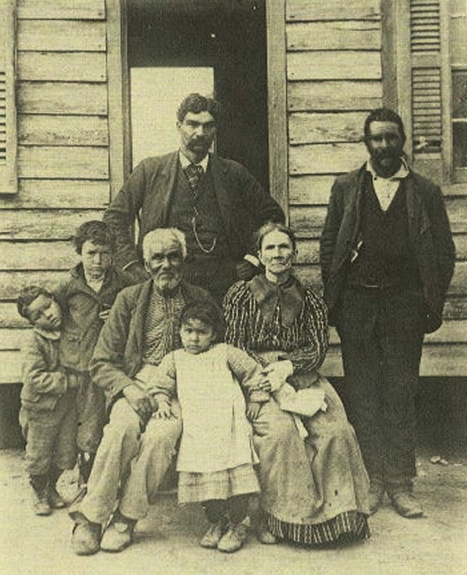
The Nansemond are the indigenous people of the Nansemond River, a 20-mile long tributary of the James River in Virginia. Nansemond people lived in settlements on both sides of the Nansemond River where they fished (with the name "Nansemond" meaning "fishing point" in Algonquian), harvested oysters, hunted, and farmed in fertile soil. Gradually pushed off their lands in the colonial and following periods, the Nansemond struggled to maintain their culture. They reorganized in the late 20th century and gained state recognition from Virginia in 1985. They gained federal recognition in 2018 after Congress passed a bill. Many members of the tribe still live on former ancestral lands in Suffolk, Chesapeake, and surrounding cities. Language The Nansemond language is believed to have been Algonquian, similar to that of many other Atlantic coastal tribes. But only six words have been preserved, which are not enough to identify it. The six words, which may have been corrupted in memory by ... [...More Info...] [...Related Items...] OR: [Wikipedia] [Google] [Baidu] |
Federally Recognized Tribe
This is a list of federally recognized tribes in the contiguous United States of America. There are also federally recognized Alaska Native tribes. , 574 Indian tribes were legally recognized by the Bureau of Indian Affairs (BIA) of the United States.Federal Acknowledgment of the Pamunkey Indian Tribe Of these, 231 are located in Alaska. Description  In the United States, the Indian tribe is a fundamental unit, and the constitution grants
|
Suffolk, Virginia
Suffolk is an independent city in the Commonwealth of Virginia, and as such has no county. As of the 2020 census, the population was 94,324. It is the 9th most populous city in Virginia and the largest city in Virginia by boundary land area as well as the 14th largest in the country. Suffolk is located in the Hampton Roads metropolitan area. This also includes the independent cities of Chesapeake, Hampton, Newport News, Norfolk, Portsmouth, and Virginia Beach, and smaller cities, counties, and towns of Hampton Roads. With miles of waterfront property on the Nansemond and James rivers, present-day Suffolk was formed in 1974 after consolidating with Nansemond County and the towns of Holland and Whaleyville. The current mayor (as of 2021) is Mike Duman. History Prior to colonization, the region was inhabited by the indigenous Nansemond people. The settlement of Suffolk was established in 1742 by Virginian colonists as a port town on the Nansemond River. It was originally na ... [...More Info...] [...Related Items...] OR: [Wikipedia] [Google] [Baidu] |
Nansemond River Light
The Nansemond River Light was a screwpile lighthouse located at the confluence of the Nansemond and James rivers in Virginia. History This light was erected in 1878 to mark the east side of the entrance to the Nansemond River. Some parts were recycled from the old Roanoke Marshes Light, which had been replaced the previous year. Little of note is recorded about this light, though in 1915 the keeper was cited for recovering a woman's wristwatch dropped overboard. The light was an early victim of automation in 1935, and in the late 1980s the whole structure was removed, leaving no trace of the light to be seen. Notes References *Nansemond River Light from the Chesapeake Chapter of the United States Lighthouse Society The United States Lighthouse Society is a non-profit organization dedicated to aiding in the restoration of American lighthouses and educating the public about their history. With four chapters, and more than a dozen affiliates, it is one of the ... * * {{auth ... [...More Info...] [...Related Items...] OR: [Wikipedia] [Google] [Baidu] |
Nansemond River Bridge
The Nansemond River Bridge, officially the Mills E. Godwin Bridge, is located in the independent city of Suffolk, Virginia and carries U.S. Route 17 across the Nansemond River. The current bridge, opened in 1982, was named in honor of former Virginia governor Mills E. Godwin Jr., a prominent member of the Chuckatuck community. The 1982 structure replaced an earlier one built in 1928 by the James River Bridge Corporation as part of a three-bridge system privately funded to be paid for through toll revenues. The others were the original James River Bridge and the Crittenden Bridge The Crittenden Bridge, also known as the Chuckatuck Creek Bridge, is officially named The Sidney B. Hazelwood Sr. Bridge after a prominent member of the community. This bridge is part of U.S. Route 17 and connects Suffolk, Virginia with Isle of ... (also known as the Chuckatuck Creek Bridge), each of which was also replaced with newer structures during the last quarter of the 20th century. Refe ... [...More Info...] [...Related Items...] OR: [Wikipedia] [Google] [Baidu] |
Nansemond National Wildlife Refuge
The Nansemond National Wildlife Refuge is a National Wildlife Refuge of the United States located along the Nansemond River in Suffolk, Virginia. It is managed by the United States Fish and Wildlife Service as a satellite of Great Dismal Swamp National Wildlife Refuge. In 1973 about of salt marsh were transferred to the Service by the United States Navy The United States Navy (USN) is the maritime service branch of the United States Armed Forces and one of the eight uniformed services of the United States. It is the largest and most powerful navy in the world, with the estimated tonnage ... to form the refuge. An additional were transferred in 1999. The refuge is not open to the public. External linksUS Fish & Wildlife Service: Nansemond National Wildlife Refuge National Wildlife Refuges in Virginia Protected areas of Suffolk, Virginia Protected areas established in 1973 1973 establishments in Virginia Wetlands of Virginia Landforms of Suffolk, Virginia ... [...More Info...] [...Related Items...] OR: [Wikipedia] [Google] [Baidu] |
List Of Rivers Of Virginia
This is a list of rivers in the U.S. state of Virginia. By drainage basin This list is arranged by drainage basin, with respective tributaries, arranged in the order of their confluence from mouth to source, indented under each larger stream's name. Atlantic Ocean north of Chesapeake Bay * Cockle Creek * Machipongo River Chesapeake Bay * Pocomoke River *Potomac River ** Hull Creek **Coan River **Yeocomico River ***Northwest Yeocomico River ***South Yeocomico River *** West Yeocomico River ** Lower Machodoc Creek ** Nomini Creek ** Popes Creek **Mattox Creek ** Rosier Creek **Upper Machodoc Creek **Potomac Creek *** Accokeek Creek ** Aquia Creek ** Chopawamsic Creek **Quantico Creek **Neabsco Creek **Occoquan River *** Bull Run ****Popes Head Creek ****Cub Run **** Little Bull Run *** Cedar Run *** Broad Run **** Kettle Run **Pohick Creek **Accotink Creek **Dogue Creek **Little Hunting Creek **Hunting Creek ***Cameron Run **** Holmes Run **Four Mile Run *** Lubber Run **Pimmit Run ... [...More Info...] [...Related Items...] OR: [Wikipedia] [Google] [Baidu] |
Tributaries Of The James River
A tributary, or affluent, is a stream or river that flows into a larger stream or main stem (or parent) river or a lake. A tributary does not flow directly into a sea or ocean. Tributaries and the main stem river drain the surrounding drainage basin of its surface water and groundwater, leading the water out into an ocean. The Irtysh is a chief tributary of the Ob river and is also the longest tributary river in the world with a length of . The Madeira River is the largest tributary river by volume in the world with an average discharge of . A confluence, where two or more bodies of water meet, usually refers to the joining of tributaries. The opposite to a tributary is a distributary, a river or stream that branches off from and flows away from the main stream. PhysicalGeography.net, Michael Pidwirny & S ... [...More Info...] [...Related Items...] OR: [Wikipedia] [Google] [Baidu] |


