|
Nancegollan
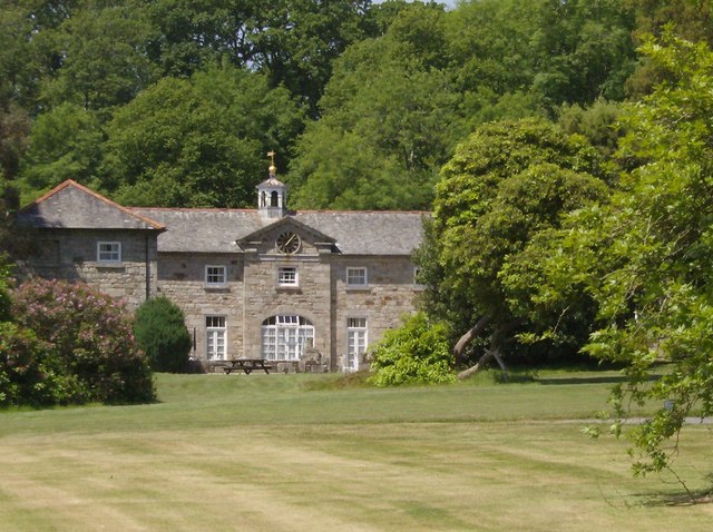
Nancegollan ( kw, Nansigolen) is a village in the civil parish of Crowan in west Cornwall, England. Nancegollan is on the B3303 road and south-east of Leedstown. The railway line from Helston to Hayle passed through the village (closed in 1964). Nancegollan station was the largest of the four stations on the branch. On Polcrebo Downs is the engine house of the Polcrebo Mine which was reopened in 1882 and still working in the 1890s; but is of very ancient origin. The name ''Nancegollan'' comes from the Cornish language words ''nans'', meaning 'valley', and ''igolen'', meaning 'whetstone'. History During World War 2 World War II or the Second World War, often abbreviated as WWII or WW2, was a world war that lasted from 1939 to 1945. It involved the vast majority of the world's countries—including all of the great powers—forming two opposing ... there was a single occurrence of bombs being dropped on Nancegollan. Late on the night of 22 August 1940 a mixtu ... [...More Info...] [...Related Items...] OR: [Wikipedia] [Google] [Baidu] |
Nancegollan Railway Station
Nancegollan railway station located in Nancegollan, Cornwall served an important agricultural district and was also the railhead for the fishing port of Porthleven. History The station opened on 9 May 1887 when the Helston Railway opened the line between and on the Great Western Railway mainline to . The line was operated by the Great Western Railway and absorbed by that company on 2 August 1898. Originally it had a single passenger platform on the upside and a goods loop without a platform; the connections were operated by a ground frame. In 1937 the facilities were considerably extended, with a full crossing facility for passenger trains and longer platforms on both lines, as well as a loop line behind the up platform and a large goods yard. In 1941 the station's goods sidings were further modified and extended in connection with airfield construction in the locality, and a new signal box with a lever frame that had been relocated from the Cornish Main Line at St Germ ... [...More Info...] [...Related Items...] OR: [Wikipedia] [Google] [Baidu] |
Helston Railway
The Helston Railway is a heritage railway in Cornwall which aims to rebuild and preserve as much as possible of the former GWR Helston Railway between Nancegollen and Water-Ma-Trout on the outskirts of Helston. It is operated by the Helston Railway Preservation Company using members of the Helston Railway Preservation Society. The Railway was a long railway branch line and is the southernmost branch line in the United Kingdom. It opened in 1887 and was absorbed by the Great Western Railway in 1898, continuing in existence as the Helston branch, and closing to passengers in 1962 and to goods in 1964.History of the Great Western Railway, vol II, MacDermot, E T, published by the Great Western Railway, London, 1932 It was built to open up the agricultural district of south-west Cornwall, joining Helston to the main line railway network at Gwinear Road, between Penzance and Truro. Its predominant business was agricultural, but in summer it carried holidaymakers, and its term ... [...More Info...] [...Related Items...] OR: [Wikipedia] [Google] [Baidu] |
Crowan
Crowan ( kw, Egloskrewen (village), Pluw Grewen (parish)) is a village and civil parish in Cornwall, United Kingdom. It is about three-and-a-half miles (6 km) south of Camborne.Ordnance Survey: Landranger map sheet 203 ''Land's End'' A former mining parish, all of the mines had shut by 1880. Geography Crowan had a population of 2,375 (2001) which had increased to 2,454 in the 2011 census. Crowan Churchtown is not the largest settlement: there are villages at Praze-an-Beeble, Nancegollan, Bolitho and Leedstown and a hamlet at Black Rock (on the B3280 road four miles (6.5 km) south of Camborne and five miles (8 km) north of Helston). The hamlets of Carzise, Clowance Wood, Drym, Fraddam, Gwinear Downs, Horsedowns, Nine Maidens Downs, Noonvares, Paul's Green, Releath, Townshend and Tremayne are also in the parish. The River Hayle rises near Crowan and flows through the village and the railway branch to Helston passed nearby. Notable buildings and antiquities ... [...More Info...] [...Related Items...] OR: [Wikipedia] [Google] [Baidu] |
Cornwall Council
Cornwall Council ( kw, Konsel Kernow) is the unitary authority for Cornwall in the United Kingdom, not including the Isles of Scilly, which has its own unitary council. The council, and its predecessor Cornwall County Council, has a tradition of large groups of independent councillors, having been controlled by independents in the 1970s and 1980s. Since the 2021 elections, it has been under the control of the Conservative Party. Cornwall Council provides a wide range of services to the approximately half a million people who live in Cornwall. In 2014 it had an annual budget of more than £1 billion and was the biggest employer in Cornwall with a staff of 12,429 salaried workers. It is responsible for services including: schools, social services, rubbish collection, roads, planning and more. History Establishment of the unitary authority On 5 December 2007, the Government confirmed that Cornwall was one of five councils that would move to unitary status. This was enacted by st ... [...More Info...] [...Related Items...] OR: [Wikipedia] [Google] [Baidu] |
Cornwall
Cornwall (; kw, Kernow ) is a historic county and ceremonial county in South West England. It is recognised as one of the Celtic nations, and is the homeland of the Cornish people. Cornwall is bordered to the north and west by the Atlantic Ocean, to the south by the English Channel, and to the east by the county of Devon, with the River Tamar forming the border between them. Cornwall forms the westernmost part of the South West Peninsula of the island of Great Britain. The southwesternmost point is Land's End and the southernmost Lizard Point. Cornwall has a population of and an area of . The county has been administered since 2009 by the unitary authority, Cornwall Council. The ceremonial county of Cornwall also includes the Isles of Scilly, which are administered separately. The administrative centre of Cornwall is Truro, its only city. Cornwall was formerly a Brythonic kingdom and subsequently a royal duchy. It is the cultural and ethnic origin of the Cornish dias ... [...More Info...] [...Related Items...] OR: [Wikipedia] [Google] [Baidu] |
Leedstown
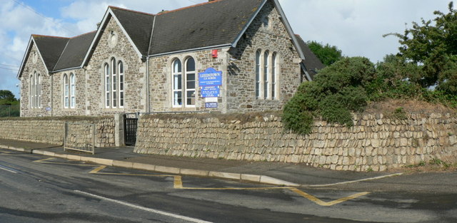
Leedstown is a village on the B3280 road between Helston and Hayle in the civil parish of Crowan (where the 2011 census population is included.), Cornwall, England. It lies north-west of Helston and south-east of Hayle at above sea level. It is located halfway between the north and south coasts. Leedstown got its name from the Duke of Leeds, who married the daughter of the St Aubyn family. The village has a primary school,a pub and a garage. The first school, described as ″a large boys school″ was funded by John St Aubyn in, or around 1813 and a girls school was built in the 1840s. A board school was opened June 1879. Designed by Mr W Carah of Crowan the school had two large classrooms. Today, the school is now known as Leedstown Community Primary School and is part of Kernow Learning Multi Academy Trust. Remains of the former Crenver and Wheal Abraham mines may be seen along the road to Crenver Grove. The former Godolphin Mine is in the woods near Godolphin Hall; coppe ... [...More Info...] [...Related Items...] OR: [Wikipedia] [Google] [Baidu] |
Helston
Helston ( kw, Hellys) is a town and civil parish in Cornwall, England, United Kingdom. It is situated at the northern end of the Lizard Peninsula approximately east of Penzance and south-west of Falmouth.Ordnance Survey: Landranger map sheet 203 ''Land's End'' Helston is the most southerly town on the island of Great Britain and is around farther south than Penzance. The population in 2011 was 11,700. The former stannary and cattle market town is best known for the annual Furry Dance (known locally as the Flora Dance), said to originate from the medieval period. However, the Hal-an-Tow is reputed to be of Celtic origin. The associated song and music, The Floral Dance, is known to have been written in 1911. In 2001, the town celebrated the 800th anniversary of the granting of its Charter. History The name comes from the Cornish 'hen lis' or 'old court' and 'ton' added later to denote a Saxon manor; the Domesday Book refers to Henliston (which survives as the name of ... [...More Info...] [...Related Items...] OR: [Wikipedia] [Google] [Baidu] |
Hayle
Hayle ( kw, Heyl, "estuary") is a port town and civil parish in west Cornwall, England. It is situated at the mouth of the Hayle River (which discharges into St Ives Bay) and is approximately seven miles (11 km) northeast of Penzance. Hayle parish was created in 1888 from part of the now defunct Phillack parish, with which it was later combined in 1935, and incorporated part of St Erth in 1937. The modern parish shares boundaries with St Ives to the west, St Erth to the south, Gwinear and Gwithian in the east, and is bounded to the north by the Celtic Sea. History Early history Although there is a long history of settlement in the Hayle Estuary area dating from the Bronze Age, the modern town of Hayle was built predominantly during the 18th century industrial revolution. Evidence of Iron Age settlement exists at the fort on the hill above Carnsew Pool where the Plantation now stands. It is thought that Hayle was an important centre for the neolithic tin industry ... [...More Info...] [...Related Items...] OR: [Wikipedia] [Google] [Baidu] |
Cornish Language
Cornish (Standard Written Form: or ) , is a Southwestern Brittonic language, Southwestern Brittonic language of the Celtic language family. It is a List of revived languages, revived language, having become Extinct language, extinct as a living community language in Cornwall at the Last speaker of the Cornish language, end of the 18th century. However, knowledge of Cornish, including speaking ability to a certain extent, continued to be passed on within families and by individuals, and Cornish language revival, a revival began in the early 20th century. The language has a growing number of second language speakers, and a very small number of families now raise children to speak revived Cornish as a first language. Cornish is currently recognised under the European Charter for Regional or Minority Languages, and the language is often described as an important part of Cornish identity, culture and heritage. Along with Welsh language, Welsh and Breton language, Breton, Cornish is ... [...More Info...] [...Related Items...] OR: [Wikipedia] [Google] [Baidu] |
World War 2
World War II or the Second World War, often abbreviated as WWII or WW2, was a world war that lasted from 1939 to 1945. It involved the vast majority of the world's countries—including all of the great powers—forming two opposing military alliances: the Allies and the Axis powers. World War II was a total war that directly involved more than 100 million personnel from more than 30 countries. The major participants in the war threw their entire economic, industrial, and scientific capabilities behind the war effort, blurring the distinction between civilian and military resources. Aircraft played a major role in the conflict, enabling the strategic bombing of population centres and deploying the only two nuclear weapons ever used in war. World War II was by far the deadliest conflict in human history; it resulted in 70 to 85 million fatalities, mostly among civilians. Tens of millions died due to genocides (including the Holocaust), starvation, massa ... [...More Info...] [...Related Items...] OR: [Wikipedia] [Google] [Baidu] |


