|
Nain, South Australia
Nain is a settlement west of Greenock in the northern Barossa Valley region of South Australia South Australia (commonly abbreviated as SA) is a state in the southern central part of Australia. It covers some of the most arid parts of the country. With a total land area of , it is the fourth-largest of Australia's states and territories .... It was first settled in the 1850s, mostly by German settlers moving from the Mount Barker area. The Nain "Zum Schmalen Wege" church operated from 1861 to 1893, and the present Nain church opened in 1856. Both have cemeteries. References Towns in South Australia {{SouthAustralia-geo-stub ... [...More Info...] [...Related Items...] OR: [Wikipedia] [Google] [Baidu] |
Greenock, South Australia
Greenock is a small town on the north-west edge of the Barossa Valley. Located 66 km from Adelaide on the Sturt Highway (A20), Greenock is characterised by tree-lined streets with shady peppercorn trees which offer welcome relief from the hot summers which are characteristic of the area. The town was named by James Smith, the secretary of George Fife Angas, after Greenock on the River Clyde in Scotland and is sometimes called ''Little Scotland in the Barossa Valley''. - Kapunda & Light Tourism (18 July 2008) The town is also located on the famous . Residents According to the 2016 Census the population of the Greenock census area was 1087 people. Of these 51.8% were male and Aboriginal and/o ...[...More Info...] [...Related Items...] OR: [Wikipedia] [Google] [Baidu] |
Electoral District Of Schubert
Schubert is a single-member electoral district for the South Australian House of Assembly covering an area of 2,017.8 km². It is named after Max Schubert, the winemaker of Penfolds Grange Hermitage. The Barossa Valley area was first represented by the seat of Barossa. The seat of Custance was abolished and recreated as Schubert in the 1994 redistribution and first contested at the 1997 election. Schubert currently covers the Barossa Valley area, the northern parts of the Adelaide Hills and much of the inner north and northwest plains bordering Adelaide. Areas covered include Eden Valley, Kangaroo Flat, Nuriootpa, Lyndoch Lyndoch is a town in Barossa Valley, located on the Barossa Valley Highway between Gawler and Tanunda, 58 km northeast of Adelaide. The town has an elevation of 175m and an average rainfall of 560.5mm. It is one of the oldest towns in Sou ..., Springton, Tanunda, Wasleys and Williamstown. Members for Schubert Election results No ... [...More Info...] [...Related Items...] OR: [Wikipedia] [Google] [Baidu] |
Division Of Barker
The Division of Barker is an Australian Electoral Division in the south-east of South Australia. The division was established on 2 October 1903, when South Australia's original single multi-member division was split into seven single-member divisions. It is named for Collet Barker, an early explorer of the region at the mouth of the Murray River. The 63,886 km² seat currently stretches from Morgan in the north to Port MacDonnell in the south, taking in the Murray Mallee, the Riverland, the Murraylands and most of the Barossa Valley, and includes the towns of Barmera, Berri, Bordertown, Coonawarra, Keith, Kingston SE, Loxton, Lucindale, Mannum, Millicent, Mount Gambier, Murray Bridge, Naracoorte, Penola, Renmark, Robe, Tailem Bend, Waikerie, and parts of Nuriootpa and Tanunda. Geography Since 1984, federal electoral division boundaries in Australia have been determined at redistributions by a redistribution committee appointed by the Australian Electoral Comm ... [...More Info...] [...Related Items...] OR: [Wikipedia] [Google] [Baidu] |
Fords, South Australia
Fords is a locality in the Mid North region of South Australia, southwest of Kapunda, South Australia. It is crossed by the Thiele Highway, and the former Morgan railway line The Morgan railway line or North-West Bend railway was a railway line on the South Australian Railways network. History The first section of the line opened from Gawler. It was built to service the copper mining at Kapunda, opened on 13 Augus .... The northern boundary of Fords is the Light River. Fords is named after an early landowner, John Ford. References {{authority control Towns in South Australia ... [...More Info...] [...Related Items...] OR: [Wikipedia] [Google] [Baidu] |
Daveyston, South Australia
Daveyston is a small town in the northern Barossa Valley region of South Australia. It is adjacent to the current Sturt Highway which previously ran through the middle of the town. The town is named after Benjamin Davey who had established a mill there before the town was established. There is a large stockfeed mill adjacent to the highway just west of the town, which is not the site of the original mill. History The town was founded in the ''Hundred of Nuriootpa, by Edward Hempel, circa 1856, and named after Thomas Davey (1796-1862) who, with his five sons, established mills at Penrice, Angaston, Eudunda, Salisbury and Adelaide.'' The towns first postmaster was Francis Norrie who opened a post office A post office is a public facility and a retailer that provides mail services, such as accepting letters and parcels, providing post office boxes, and selling postage stamps, packaging, and stationery. Post offices may offer additional serv ... in 1863 and it closed on 3 ... [...More Info...] [...Related Items...] OR: [Wikipedia] [Google] [Baidu] |
Freeling, South Australia
Freeling is a small town in South Australia, about 60 km north of Adelaide. It neighbours the Barossa Valley wine region. At the 2016 census, Freeling had a population of 2,214. Description Freeling is in the Light Regional Council, the state electoral district of Schubert and the federal Division of Barker. History The township of Freeling was surveyed in March 1860 by Robert Stephenson. It was named after Major-General Sir Arthur Henry Freeling, Surveyor-General of South Australia from 1849 to 1861. Freeling was a stopping place on the Gawler to Kapunda railway, which opened in 1860 but is no longer used. The Freeling Hotel was founded in 1863, the Railway Hotel in 1867 and the St Petri Lutheran Church (now a private home) in 1871. By 1866, Freeling's population numbered approximately 60. Local economy The main source of income for the town is its extensive farming land, where mainly cereal crops are grown. It is regarded as some of the best farming land in Austr ... [...More Info...] [...Related Items...] OR: [Wikipedia] [Google] [Baidu] |
List Of Cities And Towns In South Australia
A ''list'' is any set of items in a row. List or lists may also refer to: People * List (surname) Organizations * List College, an undergraduate division of the Jewish Theological Seminary of America * SC Germania List, German rugby union club Other uses * Angle of list, the leaning to either port or starboard of a ship * List (information), an ordered collection of pieces of information ** List (abstract data type), a method to organize data in computer science * List on Sylt, previously called List, the northernmost village in Germany, on the island of Sylt * ''List'', an alternative term for ''roll'' in flight dynamics * To ''list'' a building, etc., in the UK it means to designate it a listed building that may not be altered without permission * Lists (jousting), the barriers used to designate the tournament area where medieval knights jousted * ''The Book of Lists'', an American series of books with unusual lists See also * The List (other) * Listing (di ... [...More Info...] [...Related Items...] OR: [Wikipedia] [Google] [Baidu] |
Barossa Valley
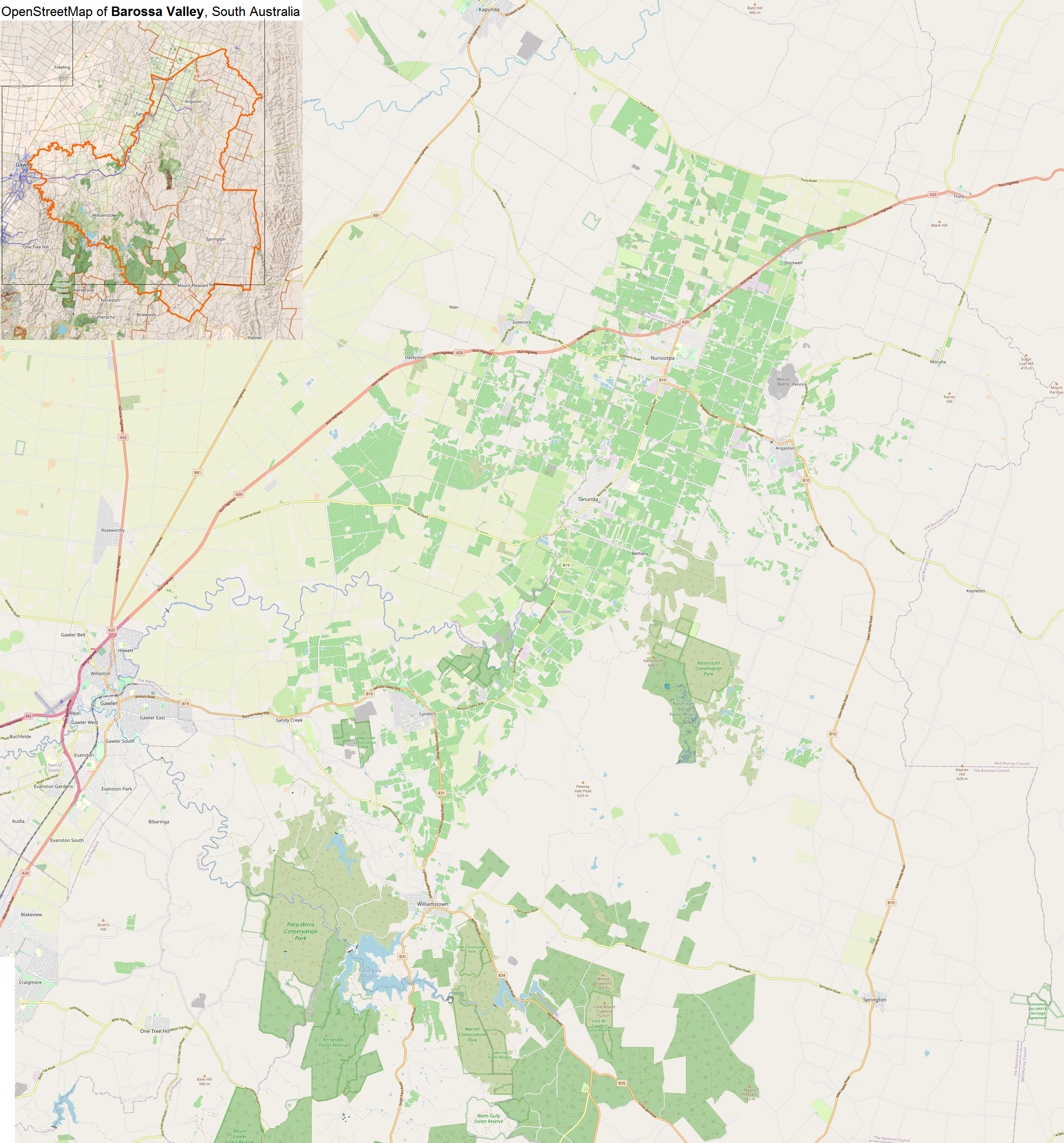
The Barossa Valley ( Barossa German: ''Barossa Tal'') is a valley in South Australia located northeast of Adelaide city centre. The valley is formed by the North Para River. It is notable as a major wine-producing region and tourist destination. The Barossa Valley Way is the main road through the valley, connecting the main towns on the valley floor of Nuriootpa, Tanunda, Rowland Flat and Lyndoch. The Barossa Trail walking and cycling path is long and also passes the main towns from near Gawler on the Adelaide Plains to Angaston to the east of the valley. History The traditional owners of the land including the Barossa Valley are the Peramangk people, who comprise a number of family groups. Evidence of their thousands of years of occupation can be seen all around the area, in the form of artefacts, scar trees and shelter paintings. The Barossa Valley derives its name from the Barossa Range, which was named by Colonel William Light in 1837. Light chose the name in ... [...More Info...] [...Related Items...] OR: [Wikipedia] [Google] [Baidu] |
South Australia
South Australia (commonly abbreviated as SA) is a state in the southern central part of Australia. It covers some of the most arid parts of the country. With a total land area of , it is the fourth-largest of Australia's states and territories by area, and second smallest state by population. It has a total of 1.8 million people. Its population is the second most highly centralised in Australia, after Western Australia, with more than 77 percent of South Australians living in the capital Adelaide, or its environs. Other population centres in the state are relatively small; Mount Gambier, the second-largest centre, has a population of 33,233. South Australia shares borders with all of the other mainland states, as well as the Northern Territory; it is bordered to the west by Western Australia, to the north by the Northern Territory, to the north-east by Queensland, to the east by New South Wales, to the south-east by Victoria, and to the south by the Great Australian Bight.M ... [...More Info...] [...Related Items...] OR: [Wikipedia] [Google] [Baidu] |
Mount Barker, South Australia
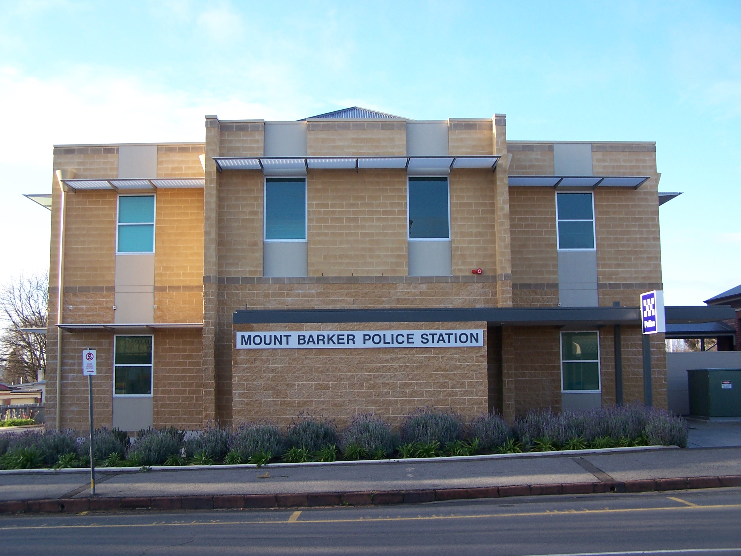
Mount Barker is a city in South Australia. Located approximately 33 kilometres (21 miles) from the Adelaide city centre, it is home to 16,629 residents. It is the seat of the District Council of Mount Barker, the largest town in the Adelaide Hills, as well as one of the fastest-growing areas in the state. Mount Barker lies at the base of a local eponymous peak called the Mount Barker summit. It is 50 kilometres from the Murray River. Mount Barker was traditionally a farming area; many of the lots just outside the town area are farming lots, although some of them have been replaced with new subdivisions in recent times. History Mount Barker, the mountain, was sighted by Captain Charles Sturt in 1830, although he thought he was looking at the previously discovered Mount Lofty. This sighting of Mount Barker was the first by a European. Captain Collet Barker corrected Sturt's error when he surveyed the area in 1831. Sturt named the mountain in honour of Captain Barker after he was ... [...More Info...] [...Related Items...] OR: [Wikipedia] [Google] [Baidu] |


