|
Nymagee
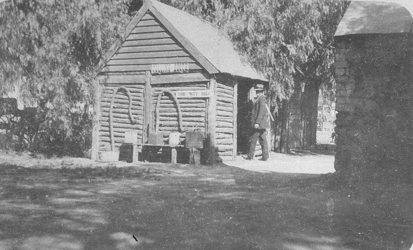
Nymagee is a small town in the north west of New South Wales, north west of Sydney, south west of Nyngan and south of Cobar. It is in the Shire of Cobar, The State Government area of Barwon and the Federal Government area of Parkes. At the 2016 census, Nymagee had a population of 101. An area, COP4, of around Nymagee has also been designated as an IBRA biogeographic subregion of the Cobar Peneplain biogeographic region. History Indigenous origins dit sourceThe Cobar area is part of the traditional territory of the Wongaibon people (within the Ngiyampaa language group associated with the arid plains and rocky hill country of the Central West area of NSW bordered by the Lachlan, Darling-Barwon and Bogan rivers). The name ‘Cobar’ is derived from a Ngiyampaa word – variously transcribed as kubbur, kuparr, gubarr or cuburra – for a water-hole and quarry where pigments of ochre, kaolin and blue and green copper minerals were mined for ceremonial use. 5] Other sources cla ... [...More Info...] [...Related Items...] OR: [Wikipedia] [Google] [Baidu] |
Cobar Shire
Cobar Shire is a local government area in the Orana region of New South Wales, Australia. The Shire is located in an outback area that is centred around the mining town of Cobar. The Shire is traversed by the Barrier Highway and the Kidman Way. With a total area of , about two-thirds the size of Tasmania, Cobar Shire is larger than Denmark and 99 other countries and self-governing territories, but its population is under 5000. Lilliane Brady was the Mayor of Cobar Shire for more than 20 years, before her death in 2021. At the time of her death, she was the longest-serving female mayor in New South Wales' history. The current Mayor of Cobar Shire Council is Cr. Peter Abbott, an independent politician. Villages and localities The shire also includes several small outback towns and localities; the twin villages of Euabalong and Euabalong West in the far south east of the shire, Mount Hope, Nymagee and Irymple. Demographics According to the Australian Bureau of Stati ... [...More Info...] [...Related Items...] OR: [Wikipedia] [Google] [Baidu] |
IBRA
The Interim Biogeographic Regionalisation for Australia (IBRA) is a biogeographic regionalisation of Australia developed by the Australian government's Department of Sustainability, Environment, Water, Population, and Communities. It was developed for use as a planning tool, for example for the establishment of a national reserve system. The first version of IBRA was developed in 1993–94 and published in 1995. Within the broadest scale, Australia is a major part of the Australasia biogeographic realm, as developed by the World Wide Fund for Nature. Based on this system, the world is also split into 14 terrestrial habitats, of which eight are shared by Australia. The Australian land mass is divided into 89 bioregions and 419 subregions. Each region is a land area made up of a group of interacting ecosystems that are repeated in similar form across the landscape. IBRA is updated periodically based on new data, mapping improvements, and review of the existing scheme. The most ... [...More Info...] [...Related Items...] OR: [Wikipedia] [Google] [Baidu] |
Cobar Peneplain
Cobar Peneplain, an interim Australian bioregion, is located in New South Wales,IBRA Version 6.1 data and comprises . The bioregion has the code COP. There are five subregions. See also *Geography of Australia
The geography of Australia encompasses a wide variety of biogeographic regions being the world's smallest continent, while comprising the territory of the sixth-largest country in the world. The population of Australia is concentrated along ...
References Further reading * Thackway ...[...More Info...] [...Related Items...] OR: [Wikipedia] [Google] [Baidu] |
Electoral District Of Barwon
Barwon is an electoral district of the Legislative Assembly in the Australian state of New South Wales. It is represented by Roy Butler a former the Shooters Fishers and Farmers Party MP, but now an Independent MP. Covering roughly 44% of the land mass of New South Wales, Barwon is by far the state's largest electoral district. It includes the local government areas of Bourke Shire, Brewarrina Shire, Narrabri Shire, Walgett Shire, Warrumbungle Shire, Coonamble Shire, Gilgandra Shire, Warren Shire, Bogan Shire, Lachlan Shire, Cobar Shire, Central Darling Shire, the City of Broken Hill as well as the large Unincorporated Far West Region surrounding Broken Hill. History Barwon was originally created in 1894, when it along with Moree, replaced Gwydir. In 1904, with the downsizing of the Legislative Assembly after Federation, Gwydir was recreated and Moree and Barwon were abolished. In 1927, with the breakup of the three-member Electoral district of Namoi, it was recreated. ... [...More Info...] [...Related Items...] OR: [Wikipedia] [Google] [Baidu] |
Division Of Parkes
The Division of Parkes is an Australian electoral division in the state of New South Wales. History The former Division of Parkes (1901–69) was located in suburban Sydney, and was not related to this division, except in name. The division is named after Sir Henry Parkes, seventh Premier of New South Wales and sometimes known as the 'Father of Federation'. The division was proclaimed at the redistribution of 11 October 1984, and was first contested at the 1984 federal election. The seat is currently a safe Nationals seat. It was substantially changed by the 2006 redistribution and is now considered by many observers as the successor to the abolished Division of Gwydir. As a result, the then member for Parkes, John Cobb, instead contested the Division of Calare. The current Member for Parkes, since the 2007 federal election, is Mark Coulton, a member of the National Party of Australia. According to the 2011 census, approximately 78 per cent of the population within the d ... [...More Info...] [...Related Items...] OR: [Wikipedia] [Google] [Baidu] |
New South Wales
) , nickname = , image_map = New South Wales in Australia.svg , map_caption = Location of New South Wales in AustraliaCoordinates: , subdivision_type = Country , subdivision_name = Australia , established_title = Before federation , established_date = Colony of New South Wales , established_title2 = Establishment , established_date2 = 26 January 1788 , established_title3 = Responsible government , established_date3 = 6 June 1856 , established_title4 = Federation , established_date4 = 1 January 1901 , named_for = Wales , demonym = , capital = Sydney , largest_city = capital , coordinates = , admin_center = 128 local government areas , admin_center_type = Administration , leader_title1 = Monarch , leader_name1 = Charles III , leader_title2 = Governor , leader_name2 = Margaret Beazley , leader_title3 = Premier , leader_name3 = Dominic Perrottet (Liberal) , national_representation = Parliament of Australia , national_representation_type1 = Senat ... [...More Info...] [...Related Items...] OR: [Wikipedia] [Google] [Baidu] |
Sydney
Sydney ( ) is the capital city of the state of New South Wales, and the most populous city in both Australia and Oceania. Located on Australia's east coast, the metropolis surrounds Sydney Harbour and extends about towards the Blue Mountains to the west, Hawkesbury to the north, the Royal National Park to the south and Macarthur to the south-west. Sydney is made up of 658 suburbs, spread across 33 local government areas. Residents of the city are known as "Sydneysiders". The 2021 census recorded the population of Greater Sydney as 5,231,150, meaning the city is home to approximately 66% of the state's population. Estimated resident population, 30 June 2017. Nicknames of the city include the 'Emerald City' and the 'Harbour City'. Aboriginal Australians have inhabited the Greater Sydney region for at least 30,000 years, and Aboriginal engravings and cultural sites are common throughout Greater Sydney. The traditional custodians of the land on which modern Sydney stands are ... [...More Info...] [...Related Items...] OR: [Wikipedia] [Google] [Baidu] |
Nyngan
Nyngan () is a town in the centre of New South Wales, Australia, in the Bogan Shire local government area within the Orana Region of central New South Wales. At the 2016 census, Nyngan had a population of 1,988 people. Nyngan is situated on the Bogan River between Narromine and Bourke, on the junction of the Mitchell Highway and Barrier Highway, south of Charleville and north-west of Sydney by road. The Barrier Highway starts at Nyngan, and runs west to Cobar and on through Wilcannia and Broken Hill into South Australia. Nyngan Airport is a small airport just north of the town centre. Nyngan also lies on the Main Western railway line of New South Wales but is no longer served by passenger trains. The line remains open to freight traffic. About south of the town, a cairn was erected in 1988 marking the centre of NSW. History The district was originally inhabited by the Wangaibon Peoples. Thomas Mitchell explored the Bogan River in 1835, camping on the future townsite. He r ... [...More Info...] [...Related Items...] OR: [Wikipedia] [Google] [Baidu] |
Cobar
Cobar is a town in central western New South Wales, Australia whose economy is based mainly upon base metals and gold mining. The town is by road northwest of the state capital, Sydney. It is at the crossroads of the Kidman Way and Barrier Highway. The town and the local government area, the Cobar Shire, are on the eastern edge of the outback. At the 2016 census, the town of Cobar had a population of 3,990. The Shire has a population of approximately 4,700 and an area of . Many sights of cultural interest can be found in and around Cobar. The town retains much of its colonial 19th-century architecture. The Towsers Huts, 3 km south of town but currently inaccessible to the public, are ruins of very simple colonial dwellings from around 1870. The ancient Aboriginal rock paintings at Mount Grenfell are some of the largest and most important in Australia. The new Cobar Sound Chapel was opened in April 2022. History Indigenous origins The Cobar area is part of the tradition ... [...More Info...] [...Related Items...] OR: [Wikipedia] [Google] [Baidu] |
2016 Australian Census
The 2016 Australian census was the 17th national population census held in Australia. The census was officially conducted with effect on Tuesday, 9 August 2016. The total population of the Commonwealth of Australia was counted as – an increase of 8.8 per cent or people over the . Norfolk Island joined the census for the first time in 2016, adding 1,748 to the population. The ABS annual report revealed that $24 million in additional expenses accrued due to the outage on the census website. Results from the 2016 census were available to the public on 11 April 2017, from the Australian Bureau of Statistics website, two months earlier than for any previous census. The second release of data occurred on 27 June 2017 and a third data release was from 17 October 2017. Australia's next census took place in 2021. Scope The Australian Bureau of Statistics (ABS) states the aim of the 2016 Australian census is "to count every person who spent Census night, 9 August 2016, in Au ... [...More Info...] [...Related Items...] OR: [Wikipedia] [Google] [Baidu] |
Chinese Australian
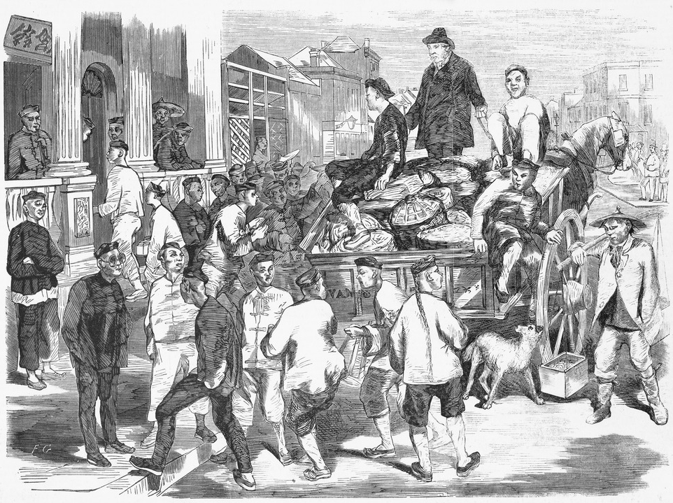
Chinese Australians () are Australians of Chinese ancestry. Chinese Australians are one of the largest groups within the global Chinese diaspora, and are the largest Asian Australian community. Per capita, Australia has more people of Chinese ancestry than any country outside Asia. As a whole, Australian residents identifying themselves as having Chinese ancestry made up 5.5% of Australia's population at the 2021 census. The very early history of Chinese Australians involved significant immigration from villages of the Pearl River Delta in South China, with most such immigrants speaking dialects within the Yue dialect group. The Gold rushes lured many Chinese to the Australian colonies in the 19th century. As with many overseas Chinese groups the world over, early Chinese immigrants to Australia established several Chinatowns in major cities, such as Sydney (Chinatown, Sydney), Melbourne (Chinatown, Melbourne), Brisbane (Chinatown, Brisbane) and Perth ( Chinatown, Perth). Aust ... [...More Info...] [...Related Items...] OR: [Wikipedia] [Google] [Baidu] |
Clancy Of The Overflow
"Clancy of the Overflow" is a poem by Banjo Paterson, first published in '' The Bulletin'', an Australian news magazine, on 21 December 1889. The poem is typical of Paterson, offering a romantic view of rural life, and is one of his best-known works. The poem is written in eight stanzas of four lines, lines one and three in a two-feet anapaest with a feminine internal rhyme, and lines two and four in trochaic octameter with masculine rhymes: AA–B–CC–B. History The poem is written from the point of view of a city-dweller who once met the title character, a shearer and drover, and now envies the imagined pleasures of Clancy's lifestyle, which he compares favourably to life in "the dusty, dirty city" and "the round eternal of the cashbook and the journal". And the bush hath friends to meet him, and their kindly voices greet him In the murmur of the breezes and the river on its bars, And he sees the vision splendid of the sunlit plains extended, And at night the wond'rous ... [...More Info...] [...Related Items...] OR: [Wikipedia] [Google] [Baidu] |
.jpg)


