|
Nykvåg
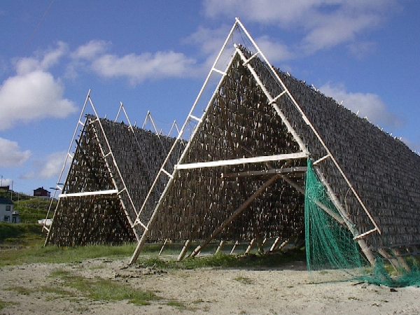
Nykvåg is a fishing village in Bø Municipality in Nordland county, Norway. It is one of the largest fishing villages on the west coast of the large island of Langøya in the Vesterålen archipelago An archipelago ( ), sometimes called an island group or island chain, is a chain, cluster, or collection of islands. An archipelago may be in an ocean, a sea, or a smaller body of water. Example archipelagos include the Aegean Islands (the o .... The village lies along the south side of Nykvåg bay and the neighboring village to the west is Vågen. The villages of Hovden and Malnes are located about northeast of Nykvåg. Nykvåg is also known for its rich bird life in the Nykvåg/Nykan Nature Reserve adjacent to the village. References Bø, Nordland Villages in Nordland Fishing communities in Norway Populated places of Arctic Norway {{Nordland-geo-stub ... [...More Info...] [...Related Items...] OR: [Wikipedia] [Google] [Baidu] |
Nykvåg/Nykan Nature Reserve
The Nykvåg/Nykan Nature Reserve () is located in Bø Municipality in Nordland county, Norway. The nature reserve lies between the villages of Sandvika and Nykvåg, south of the Nyke/Tussen and Frugga nature reserves. It covers an area of , of which is sea. The land area includes the west side of the island of Langøya and three larger islands (Fuglenyken, Måsnyken, and Spjøten) as well as several smaller islands. The area is protected to safeguard many important breeding sites for seabirds. The nature reserve was established on December 6, 2002. Norwegian County Road 916 passes by a bird cliff on the northeast edge of the reserve. It has been designated an Important Bird Area (IBA) by BirdLife International (BLI) because it supports breeding populations of great cormorants, Atlantic puffins and razorbill The razorbill (''Alca torda'') is a North Atlantic colonial seabird and the only extant member of the genus ''Alca (bird), Alca'' of the family Alcidae, the auks. It i ... [...More Info...] [...Related Items...] OR: [Wikipedia] [Google] [Baidu] |
Vågen, Nordland
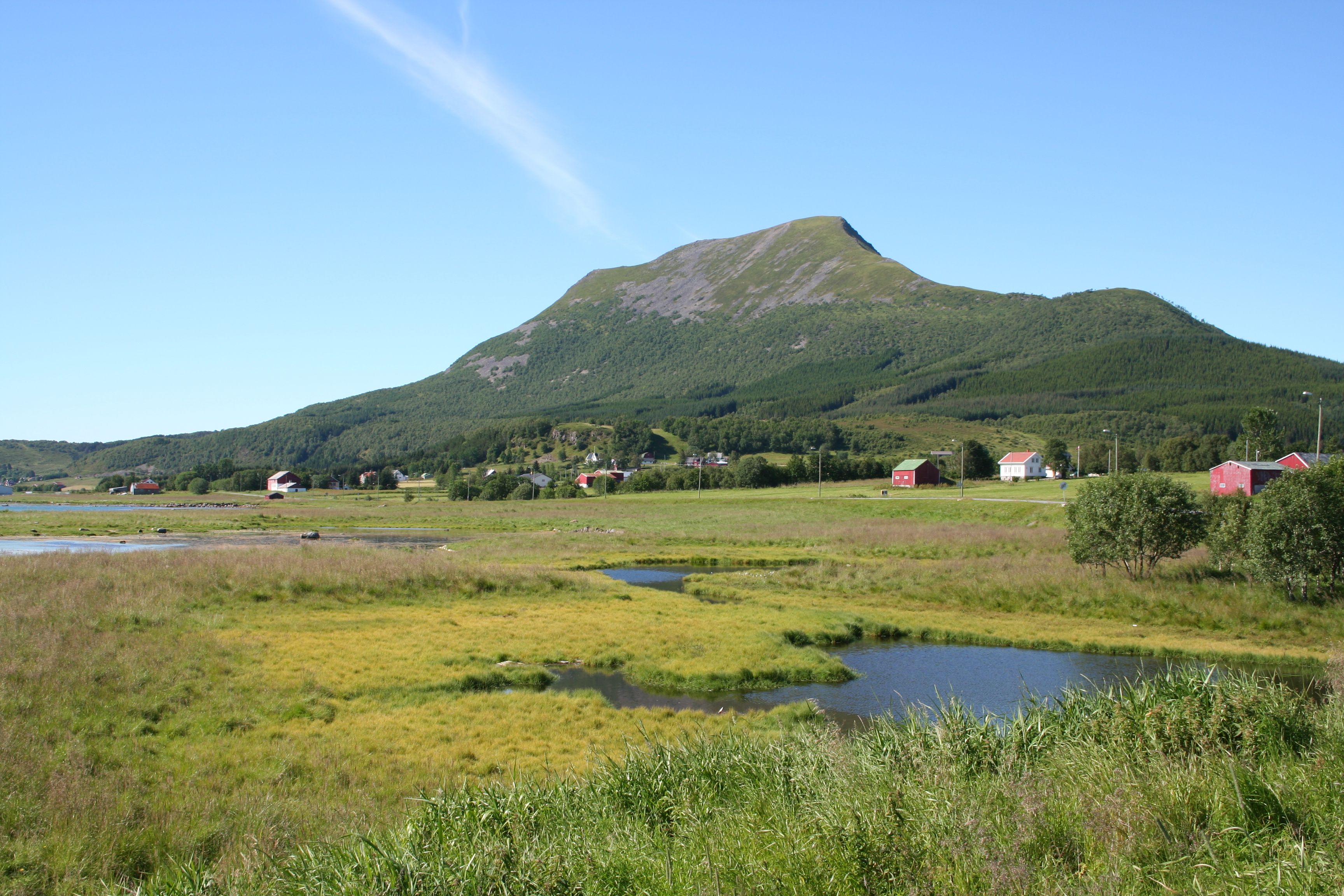
Vågen is a village in Bø Municipality in Nordland county, Norway. The village is located on the west side of the island of Langøya in the Vesterålen archipelago just west of the village of Nykvåg. Geography Vågen is connected to the neighboring village of Nykvåg by County Road 916, which branches off from County Road 915 in Nykvåg and runs east before circling around Nykvåg bay to the quay in Vågen. The hill Gårdsnyken () rises northwest of Vågen. The Nykvåg/Nykan Nature Reserve The Nykvåg/Nykan Nature Reserve () is located in Bø Municipality in Nordland county, Norway. The nature reserve lies between the villages of Sandvika and Nykvåg, south of the Nyke/Tussen and Frugga nature reserves. It covers an area of , of ..., encompassing the Nykan islands, lies east of Vågen. References {{DEFAULTSORT:Vaagen, Nordland Bø, Nordland Villages in Nordland ... [...More Info...] [...Related Items...] OR: [Wikipedia] [Google] [Baidu] |
Bø Municipality (Nordland)
Bø is a List of municipalities of Norway, municipality in Nordland Counties of Norway, county, Norway. It is part of the Vesterålen Districts of Norway, region. The administrative centre of the municipality is the village of Straume, Nordland, Straume which is where municipal administration, a grocery store, and a gasoline station are located. In addition to this, the urban area of Bø, Vesterålen, Bø (including Steine and Vinje), which is the largest urban area in the municipality and it has a grocery, liquor store, swimming pool, movie theater, Bø Church (Nordland), Bø Church, and additional service infrastructure. Other smaller villages include Gimstad, Fjærvoll, Straumsjøen, Skårvågen, Søberg, Malnes, Eidet, Bø, Eidet, Guvåg, Hovden, Nordland, Hovden, Klakksjorda, Nykvåg, Utskor, Ringstad, and Vågen, Nordland, Vågen. The municipality is the 289th largest by area out of the 357 municipalities in Norway. Bø is the 249th most populous municipality in Norway wi ... [...More Info...] [...Related Items...] OR: [Wikipedia] [Google] [Baidu] |
Malnes
Malnes is a small village in Bø Municipality in Nordland county, Norway. The village is located along the mouth of Malnesfjorden in the northwest part the island of Langøya. Malnes is now considered the southwestern part of the village of Hovden, but it was formerly a separate farming settlement. Geography The hill Malnesberget () rises south of Malnes. Norwegian County Road 915 connects Malnes to Hovden in the north and to the village of Nykvåg to the southwest. History Malnes Church was established at Malnes in the Middle Ages In the history of Europe, the Middle Ages or medieval period lasted approximately from the 5th to the late 15th centuries, similarly to the post-classical period of global history. It began with the fall of the Western Roman Empire and ..., and Malnes served as the clerical center of the former parish of Malnes in the Bø ecclesiastical district (''Bø herred''). In 1829, Malnes Church was moved from Malnes to the village of Eide ... [...More Info...] [...Related Items...] OR: [Wikipedia] [Google] [Baidu] |
Hovden, Nordland
Hovden is a fishing village in Bø Municipality (Nordland), Bø Municipality in Nordland county, Norway. The village is located at the northern tip of a peninsula on the island of Langøya, on the west side of the Malnesfjorden. The Atlantic Ocean, ocean lies to the north and west of the village. Norwegian County Road 915, The road that goes to Hovden ends at the village. The habitation of Hovden, on the outermost point on a peninsula of the third-largest island in Norway (Langøya) is because of the closeness to the rich fishing banks off of the Vesterålen archipelago. Fish processing and fishing are the main employment of dwellers in Hovden. Archaeological findings show that Hovden have been populated at least since 400 to 800 Common Era, CE. The village of Malnes lies to the south of Hovden. Malnes was the clerical center for the northern part of Bø Municipality (Nordland), Bø until 1829 when Malnes Church was moved from Malnes to the village of Eidet, Bø, Eidet. The nam ... [...More Info...] [...Related Items...] OR: [Wikipedia] [Google] [Baidu] |
Langøya
Langøya is the third largest island of Norway (outside of Svalbard), with an area of . The island is a part of the Vesterålen archipelago in Nordland county, Norway. The island includes Bø Municipality and Øksnes Municipality as well as parts of Sortland Municipality and Hadsel Municipality. Geography Langøya is mountainous, with mountains reaching above sea level, the highest is the tall Snykolla. There are also lowland near the coasts around the island, and in some valleys, some of it is bogs. The treeline is around above sea level on Langøya. The total population on the island is about 15,600 and the largest population center is the town of Sortland (population: 5,600) and the next largest population centre is the village of Myre. Langøya has been settled since the stone age. The larger island Hinnøya lies to the east (on the other side of the Sortlandssundet). The island of Andøya lies to the northeast. The small island of Skogsøya lies to the nort ... [...More Info...] [...Related Items...] OR: [Wikipedia] [Google] [Baidu] |
Norway
Norway, officially the Kingdom of Norway, is a Nordic countries, Nordic country located on the Scandinavian Peninsula in Northern Europe. The remote Arctic island of Jan Mayen and the archipelago of Svalbard also form part of the Kingdom of Norway. Bouvet Island, located in the Subantarctic, is a Dependencies of Norway, dependency, and not a part of the Kingdom; Norway also Territorial claims in Antarctica, claims the Antarctic territories of Peter I Island and Queen Maud Land. Norway has a population of 5.6 million. Its capital and largest city is Oslo. The country has a total area of . The country shares a long eastern border with Sweden, and is bordered by Finland and Russia to the northeast. Norway has an extensive coastline facing the Skagerrak strait, the North Atlantic Ocean, and the Barents Sea. The unified kingdom of Norway was established in 872 as a merger of Petty kingdoms of Norway, petty kingdoms and has existed continuously for years. From 1537 to 1814, Norway ... [...More Info...] [...Related Items...] OR: [Wikipedia] [Google] [Baidu] |
Fishing Village
A fishing village is a village, usually located near a fishing ground, with an economy based on catching fish and harvesting seafood. The continents and islands around the world have coastlines totalling around 356,000 kilometres (221,000 mi). From Neolithic times, these coastlines, as well as the shorelines of inland lakes and the banks of rivers, have been punctuated with fishing villages. Most surviving fishing villages are traditional. Characteristics Coastal fishing villages are often somewhat isolated, and sited around a small natural harbour which provides a safe haven for a village fleet of fishing boats. The village needs to provide a safe way of landing fish and securing boats when they are not in use. Fishing villages may operate from a beach, particularly around lakes. For example, around parts of Lake Malawi, each fishing village has its own beach. If a fisherman from outside the village lands fish on the beach, he gives some of the fish to the village headma ... [...More Info...] [...Related Items...] OR: [Wikipedia] [Google] [Baidu] |
Villages In Nordland
A village is a human settlement or community, larger than a hamlet but smaller than a town with a population typically ranging from a few hundred to a few thousand. Although villages are often located in rural areas, the term urban village is also applied to certain urban neighborhoods. Villages are normally permanent, with fixed dwellings; however, transient villages can occur. Further, the dwellings of a village are fairly close to one another, not scattered broadly over the landscape, as a dispersed settlement. In the past, villages were a usual form of community for societies that practice subsistence agriculture and also for some non-agricultural societies. In Great Britain, a hamlet earned the right to be called a village when it built a Church (building), church.Dr G ... [...More Info...] [...Related Items...] OR: [Wikipedia] [Google] [Baidu] |
Archipelago
An archipelago ( ), sometimes called an island group or island chain, is a chain, cluster, or collection of islands. An archipelago may be in an ocean, a sea, or a smaller body of water. Example archipelagos include the Aegean Islands (the origin of the term), the Canadian Arctic Archipelago, the Stockholm Archipelago, the Malay Archipelago (which includes the Indonesian and Philippine Archipelagos), the Lucayan (Bahamian) Archipelago, the Japanese archipelago, and the Hawaiian Archipelago. Etymology The word ''archipelago'' is derived from the Italian ''arcipelago'', used as a proper name for the Aegean Sea, itself perhaps a deformation of the Greek Αιγαίον Πέλαγος. Later, usage shifted to refer to the Aegean Islands (since the sea has a large number of islands). The erudite paretymology, deriving the word from Ancient Greek ἄρχι-(''arkhi-'', "chief") and πέλαγος (''pélagos'', "sea"), proposed by Buondelmonti, can still be found. Geograph ... [...More Info...] [...Related Items...] OR: [Wikipedia] [Google] [Baidu] |
Norwegian Mapping Authority
The Norwegian Mapping Authority (NMA) () is Norway's national mapping agency, dealing with land surveying, geodesy Geodesy or geodetics is the science of measuring and representing the Figure of the Earth, geometry, Gravity of Earth, gravity, and Earth's rotation, spatial orientation of the Earth in Relative change, temporally varying Three-dimensional spac ..., hydrographic surveying, cadastre and cartography. The current director is Johnny Welle. Its headquarters are in Hønefoss in Ringerike Municipality. It is a public agency under the Ministry of Local Government and Regional Development. NMA was founded in 1773. The Norwegian Mapping Authority participates in research and development and cooperates with Norwegian industry and other government agencies in areas such as export-oriented measures. Tasks The NMA carries out the following tasks: *Define frameworks, methodologies and specifications for the Norwegian Spatial Data Infrastructure *Administrator and drivin ... [...More Info...] [...Related Items...] OR: [Wikipedia] [Google] [Baidu] |


