|
Nuxalk People
The Nuxalk people (Nuxalk: ''Nuxalkmc''; pronounced )'','' also referred to as the Bella Coola, Bellacoola or Bilchula, are an Indigenous First Nation of the Pacific Northwest Coast, centred in the area in and around Bella Coola, British Columbia. Their language is also called Nuxalk. Their on-reserve tribal government is the Nuxalk Nation. Name and tribes/groups The name "Bella Coola", often used in academic writing, is not preferred by the Nuxalk; it is a derivation of the neighbouring Wakashan-speaking coastal Heiltsuk people's name for the Nuxalk as ''bəlxwəlá'' or ''bḷ́xʷlá'', meaning "stranger" (rendered plxwla in Nuxalk orthography). Within the Nuxalk language, "Nuxalkmc" is the term for the people, and "ItNuxalkmc" is the term for the language, and these terms are increasingly being used in English locally. The Nuxalk peoples, known today collectively as Nuxalkmc, are made up of lineages representing several ancestral villages within their territory. From Kimsq ... [...More Info...] [...Related Items...] OR: [Wikipedia] [Google] [Baidu] |
Eulichan Stink Box
The eulacheon ( (''Thaleichthys pacificus''), also spelled oolichan , ooligan , hooligan ), also called the candlefish, is a small Fish migration, anadromous species of smelt (fish), smelt that spawns in some of the major river systems along the Pacific coast of North America from northern California to Alaska. Etymology The name "candlefish" derives from it being so fatty during spawning, with up to 15% of the total body weight in fat, that if caught, dried, and strung on a wick, it can be burned as a candle. This is the name most often used by early explorers. The name ''eulacheon'' (occasionally seen as ooolichan, ooligan, oulachon, and uthlecan) is from the Chinookan languages, Chinookan language and the Chinook Jargon based on that language. One of several theories for the origin of the name of the state of Oregon is that it was a corruption from the term "Ooolichan Trail", the native trade route for ooolichan oil. The unrelated sablefish ''Anoplopoma fimbria'' is also call ... [...More Info...] [...Related Items...] OR: [Wikipedia] [Google] [Baidu] |
Kwatna Inlet
This is a list of Nuxalk villages. By 1953 there were only two bodies of Nuxalk left: The Kimsquit, on Dean Inlet; and the Bella Coola, at the mouth of Bella Coola River. Older writers speak of the Nuhalk (Nuxalk), which was the name of the Bella Coola Valley; Talyumc, whose village at the head of South Bentinck Arm (Ats'aaxlh) was abandoned about 1933; and the Noothlakamishb (Nuxalkmc) on North Bentinck Arm, reported by Tolmie, and by Dawson in 1884. Today Nuxalkmc live primarily in two villages, the village of Bella Coola, and the village of Snxlhh, also known as 4-mile, but continue to use their entire territory. Villages (as given by McIlwraith, cited by John Reed Swanton) Modern Nuxalk language orthography is in brackets, as is the meaning of the name. *Aimats (Aymats), north of Ahutskwakstl (Anutsqaaxlh) near the Peisela River (Piisla). *Aketi (Acati), on the south side of the Dean River (about 1 mile from the sea) *Anutlitlk, near the mouth of Dean River, still oc ... [...More Info...] [...Related Items...] OR: [Wikipedia] [Google] [Baidu] |
List Of Nuxalk Villages
This is a list of Nuxalk villages. By 1953 there were only two bodies of Nuxalk left: The Kimsquit, on Dean Inlet; and the Bella Coola, at the mouth of Bella Coola River. Older writers speak of the Nuhalk (Nuxalk), which was the name of the Bella Coola Valley; Talyumc, whose village at the head of South Bentinck Arm (Ats'aaxlh) was abandoned about 1933; and the Noothlakamishb (Nuxalkmc) on North Bentinck Arm, reported by Tolmie, and by Dawson in 1884. Today Nuxalkmc live primarily in two villages, the village of Bella Coola, and the village of Snxlhh, also known as 4-mile, but continue to use their entire territory. Villages (as given by McIlwraith, cited by John Reed Swanton) Modern Nuxalk language orthography is in brackets, as is the meaning of the name. *Aimats (Aymats), north of Ahutskwakstl (Anutsqaaxlh) near the Peisela River (Piisla). *Aketi (Acati), on the south side of the Dean River (about 1 mile from the sea) *Anutlitlk, near the mouth of Dean River, still oc ... [...More Info...] [...Related Items...] OR: [Wikipedia] [Google] [Baidu] |
Fort McLoughlin
Fort McLoughlin was a fur trading post established in 1833 by the Hudson's Bay Company (HBC) on Campbell Island in present-day British Columbia, Canada. At the time the Hudson's Bay Company performed quasi-governmental duties on behalf of the British Empire as well as undertaking trade for profit. The site is believed to have been at McLoughlin Bay on the northeast side of Campbell Island and is associated with the relocation of the Heiltsuk community of Bella Bella from its former location on islets near Denny Island. The McLoughlin name, which is that of John McLoughlin, regional head of company operations at that time, is also found in a lake and a creek entering that bay, and was conferred on these locations after the fort had closed. Background One of the primary reasons for the establishment of Fort McLoughlin, as well as Fort Simpson to the north, was to undermine the American dominance of the Maritime Fur Trade. By 1830 the higher prices paid for furs by American coas ... [...More Info...] [...Related Items...] OR: [Wikipedia] [Google] [Baidu] |
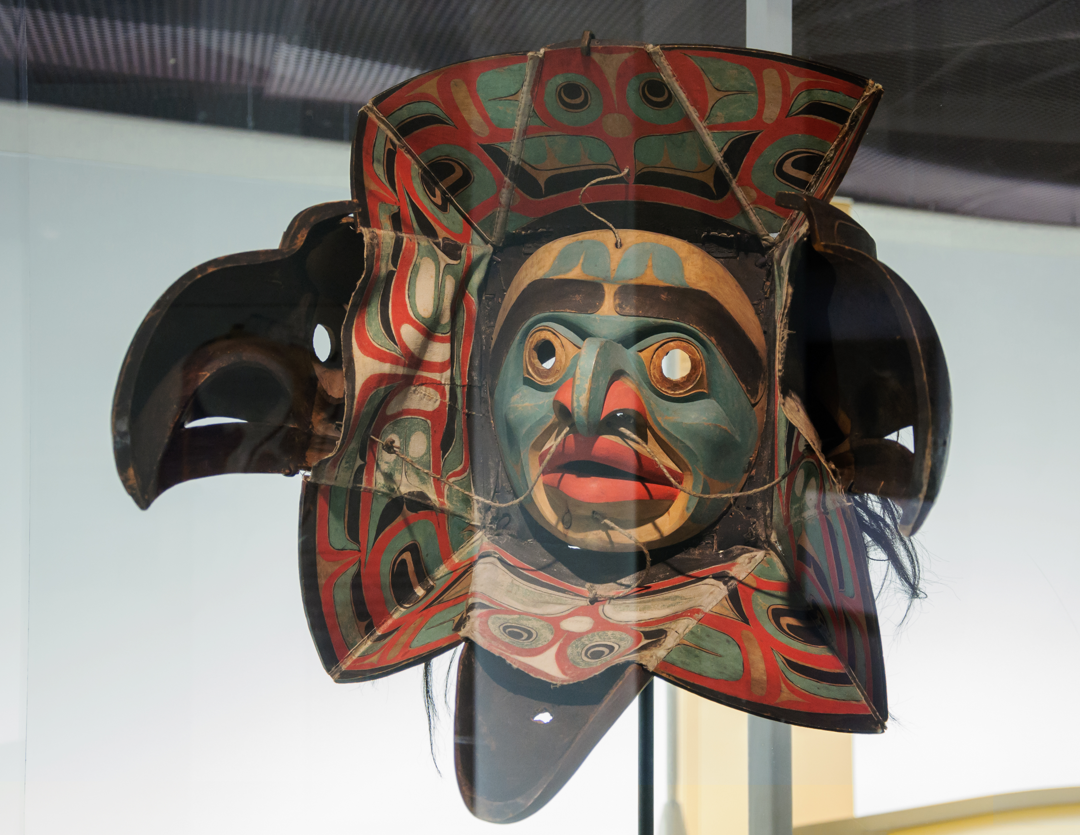
Nuxalk Transformation Mask 1
The Nuxalk people (Nuxalk: ''Nuxalkmc''; pronounced )'','' also referred to as the Bella Coola, Bellacoola or Bilchula, are an Indigenous First Nation of the Pacific Northwest Coast, centred in the area in and around Bella Coola, British Columbia. Their language is also called Nuxalk. Their on-reserve tribal government is the Nuxalk Nation. Name and tribes/groups The name "Bella Coola", often used in academic writing, is not preferred by the Nuxalk; it is a derivation of the neighbouring Wakashan-speaking coastal Heiltsuk people's name for the Nuxalk as ''bəlxwəlá'' or ''bḷ́xʷlá'', meaning "stranger" (rendered plxwla in Nuxalk orthography). Within the Nuxalk language, "Nuxalkmc" is the term for the people, and "ItNuxalkmc" is the term for the language, and these terms are increasingly being used in English locally. The Nuxalk peoples, known today collectively as Nuxalkmc, are made up of lineages representing several ancestral villages within their territory. From Kims ... [...More Info...] [...Related Items...] OR: [Wikipedia] [Google] [Baidu] |
1862 Pacific Northwest Smallpox Epidemic
Year 186 ( CLXXXVI) was a common year starting on Saturday (link will display the full calendar) of the Julian calendar. At the time, it was known as the Year of the Consulship of Aurelius and Glabrio (or, less frequently, year 939 '' Ab urbe condita''). The denomination 186 for this year has been used since the early medieval period, when the Anno Domini calendar era became the prevalent method in Europe for naming years. Events By place Roman Empire * Peasants in Gaul stage an anti-tax uprising under Maternus. * Roman governor Pertinax escapes an assassination attempt, by British usurpers. New Zealand * The Hatepe volcanic eruption extends Lake Taupō and makes skies red across the world. However, recent radiocarbon dating by R. Sparks has put the date at 233 AD ± 13 (95% confidence). Births * Ma Liang, Chinese official of the Shu Han state (d. 222) Deaths * April 21 – Apollonius the Apologist, Christian martyr * Bian Zhang, Chinese official an ... [...More Info...] [...Related Items...] OR: [Wikipedia] [Google] [Baidu] |
Heiltsuk People
The Heiltsuk or Haíɫzaqv , sometimes historically referred to as ''Bella Bella'', are an Indigenous people of the Central Coast region in British Columbia, centred on the island community of Bella Bella. The government of the Heiltsuk people is the Heiltsuk Nation, though the term is also used to describe the community. Its largest community is Bella Bella. They should not be confused with the Salish-speaking Nuxalk (Nuxalkmc) peoples ("People of Bella Coola Valley (Nuxalk)"), who were formerly usually called Bella Coola, an Anglicization of the Heiltsuk term Bíbḷxvḷá (singular: Bḷ́xvḷá, meaning: "stranger"). History Ancestors of the Heiltsuk (Haíɫzaqv) have been in the Central Coast region of British Columbia since at least 7190 BCE. The Heiltsuk (Haíɫzaqv) are the main descendants of Haíɫzaqvḷa(Heiltsuk)-speaking people and identify as being from one or more of five tribal groups: W̓úyalitx̌v (Wuyalitxv) (Seaward Tribe or Seaward Division; outsi ... [...More Info...] [...Related Items...] OR: [Wikipedia] [Google] [Baidu] |
Bella Coola Valley
The Bella Coola Valley is a relatively small but distinct region located in the Central Coast region of British Columbia, Canada, comprising the valley of the Bella Coola River and its tributaries. The region is served by BC Hwy 20, which runs from Williams Lake to the town of Bella Coola at the head of North Bentinck Arm, from where there is seasonal ferry service to Vancouver Island and Prince Rupert. The entire valley, and the regions surrounding North and South Bentinck Arm and Dean and Burke Channels, is the historical territory of the Nuxalk Nation, who claim sovereignty over it as unsurrendered to the Crown. The Bella Coola River, and so by default the Bella Coola Valley, forms the boundary between the Kitimat Ranges to the north and the Pacific Ranges to the south, which are two of the three major subdivisions of the Coast Mountains, the other being the Boundary Ranges along the border with Alaska. Communities * Bella Coola proper * Bella Coola Indian Reserve No. 1 *Nus ... [...More Info...] [...Related Items...] OR: [Wikipedia] [Google] [Baidu] |
Talchako River
The Talchako River is a river in the Bella Coola Valley of the Central Coast region of British Columbia, Canada. It meets the Atnarko River at the community of Stuie to form the Bella Coola River The Bella Coola River is a major river on the Pacific slope of the Coast Mountains in southern British Columbia. The town of Bella Coola is at its mouth on North Bentinck Arm. Bella Coola Indian Reserve No. 1 the location of the main community .... References Bella Coola Valley Pacific Ranges Rivers of the Pacific Ranges Range 3 Coast Land District {{BritishColumbiaCoast-river-stub ... [...More Info...] [...Related Items...] OR: [Wikipedia] [Google] [Baidu] |
Atnarko
Atnarko is a locality on the Atnarko River, at the south end of Tweedsmuir Provincial Park in the Bella Coola Valley region of British Columbia, Canada. The original name of the post office located here was Anaham, a name associated with the Tsilhqot'in people of the neighbouring Chilcotin Country region. Opened under that name in 1907, it was changed to Atnarko in 1913, with the post office itself closing in 1932. Location It is located southeast of the community of Stuie, which is at the base of the "Big Hill" where BC Hwy 20 descends from the Chilcotin Plateau The Chilcotin Plateau is part of the Fraser Plateau, a major subdivision of the Interior Plateau of British Columbia. The Chilcotin Plateau is physically near-identical with the region of the same name, i.e. "the Chilcotin", which lies between t ... into the Bella Coola Valley. The Hotnarko River joins the Atnarko River a few miles further upstream to the southeast. References Unincorporated settlements in ... [...More Info...] [...Related Items...] OR: [Wikipedia] [Google] [Baidu] |


.jpg)