|
Nuaman
Nuaman or Khallet an Nu'man ( ar, النعمان, meaning "Grace"), also written al-Numan/an-Nu'man, is a small village located just north of Beit Sahour in the Palestinian Governorate of Bethlehem. The Israeli government incorporated its territory within Jerusalem after the Israeli occupation of the West Bank in the 1967 Six-Day War. The village is regarded as neither part of the West Bank, nor part of Jerusalem. A United Nations report has described the villagers as "living in limbo." In terms of local government it is treated together with the neighbouring village Al-Khas, to the west, as one unit. Historical background Nuaman itself is a tiny hamlet, built on a single street, and composed of roughly 25 houses, 13 of which existed, as shown by aerial photos of the period, before 1967. Since 1994, together with Al Khas to the west, Nuaman has been governed by a village council of five members appointed by the Palestinian Authority. The hamlet's name is an eponym, taken from t ... [...More Info...] [...Related Items...] OR: [Wikipedia] [Google] [Baidu] |
Nu'man
Nu'man ( ar, نعمان ) or Nu'maan is an Arabic given name dating to pre-Islamic times, meaning ''blood'' or ''red''. Prevailingly, the Islamic given name is most commonly associated to the Arabic word meaning ''bliss''. It is also used with the definite article, , transliterated ''an-Nu'man'' or ''al-Nu'man''. Alternatives spellings include ''Noman'', ''Nouman'', ''Noumaan'', and ''Numan''.It may refer to: *seven of the Ghassanid Kings (327-ca. 600) *Al-Nu'man I ibn Imru' al-Qays (reigned ca. 390–418), king of the Lakhmids * Al-Nu'man II ibn al-Aswad (reigned 497–503), king of the Lakhmids *Al-Nu'man VI ibn al-Mundhir (active 581-583), king of the Ghassanids *Al-Nu'man III ibn al-Mundhir (active (582–ca. 602), king of the Lakhmids *Nouman ibn Muqarrin (died 641), one of the companions of Muhammad *Nuʿmān ibn Thābit ibn Zuṭā ibn Marzubān, known as Abū Ḥanīfa (699—767), founder of the Sunni Hanafi school of Islamic jurisprudence *Qadi al-Nu'man (died 974), Isma ... [...More Info...] [...Related Items...] OR: [Wikipedia] [Google] [Baidu] |
Israeli Occupation Of The West Bank
The Israeli occupation of the West Bank began on 7 June 1967, when Israeli forces captured and occupied the territory (including East Jerusalem), then occupied by Jordan, during the Six-Day War, and continues to the present day. The status of the West Bank as a militarily occupied territory has been affirmed by the International Court of Justice and, with the exception of East Jerusalem, by the Israeli Supreme Court. The official view of the Israeli government is that the laws of belligerent occupation do not apply to the territories, which it claims are "disputed", and it administers the West Bank, excepting East Jerusalem, under the Israeli Civil Administration, a branch of the Israeli Ministry of Defense. Considered to be a classic example of an "intractable" conflict, the length of Israel's occupation was already regarded as exceptional after two decades, and is now the longest in modern history. Israel has cited several reasons for retaining the West Bank within its am ... [...More Info...] [...Related Items...] OR: [Wikipedia] [Google] [Baidu] |
Arabic Script
The Arabic script is the writing system used for Arabic and several other languages of Asia and Africa. It is the second-most widely used writing system in the world by number of countries using it or a script directly derived from it, and the third-most by number of users (after the Latin and Chinese scripts). The script was first used to write texts in Arabic, most notably the Quran, the holy book of Islam. With the religion's spread, it came to be used as the primary script for many language families, leading to the addition of new letters and other symbols. Such languages still using it are: Persian (Farsi/Dari), Malay ( Jawi), Uyghur, Kurdish, Punjabi (Shahmukhi), Sindhi, Balti, Balochi, Pashto, Lurish, Urdu, Kashmiri, Rohingya, Somali and Mandinka, Mooré among others. Until the 16th century, it was also used for some Spanish texts, and—prior to the language reform in 1928—it was the writing system of Turkish. The script is written from right to left in a cu ... [...More Info...] [...Related Items...] OR: [Wikipedia] [Google] [Baidu] |
Ash-Shawawra
Ashawawra ( ar, الشواورة) is a Palestinian village located twelve kilometers southeast of Bethlehem. The village is in the Bethlehem Governorate central West Bank. History Modern era Since the Six-Day War in 1967, Ash-Shawawra has been under Israeli occupation. After the 1995 accords, 52.2% of Ash-Shawawra land is defined as Area A land, 6% is Area B, 14.6% is defined as Area C, while the remaining 27.2% is defined a nature reserves. According to the Palestinian Central Bureau of Statistics, the town had a population of over 3,737 in 2007.2007 PCBS Census Palestinian Central Bureau of Statistics
The Palestinian Ce ...
[...More Info...] [...Related Items...] OR: [Wikipedia] [Google] [Baidu] |
Abu Dis
Abu Dis or Abu Deis ( ar, أبو ديس) is a Palestinian village in the West Bank, in the Jerusalem Governorate of the State of Palestine, bordering Jerusalem. Since the 1995 Oslo II Accord, Abu Dis land has been mostly part of "Area B", under Israeli military control and Palestinian civic control. According to the Palestinian Central Bureau of Statistics (PCBS) census, Abu Dis had a population of 12,604 in 2016. History Abu Dis is situated on an ancient site, surrounded by deep valleys. Ruins have been found of ancient buildings, cisterns, grape presses and caves, one with a columbarium. Ceramics from Late Roman and Byzantine period has also been found. The French explorer Victor Guérin thought Abu Dis was identical with ancient Bahurim, but this identification is not accepted today. Ottoman era Abu Dis was one of the most populous villages in the Sanjak of Jerusalem during the 16th century, with a population of several hundred. Wheat and barley formed the bulk of cash ... [...More Info...] [...Related Items...] OR: [Wikipedia] [Google] [Baidu] |
Al-Quds University
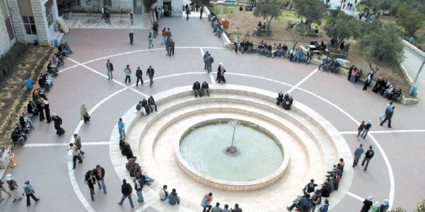
Al-Quds University ( ar, جامعة القدس) is a Palestinian university with campuses in Jerusalem, Abu Dis, al-Bireh, and Hebron. Overview The idea of establishing an institution of higher learning in the outskirts of Jerusalem was conceived early in 1957, when a board of trustees was formed in Kuwait. The board elected an executive committee entrusted with bringing the project into being. The committee entrusted Rouhi al-Khatib, the mayor of East Jerusalem, with the task of assisting the executive committee in its endeavors and to initiate construction work, which began in 1965. Nevertheless, a sizable section of the buildings on the campus was completed later and used as a primary and secondary school, servicing mostly Palestinian orphans. Its founding constituent colleges included the colleges of Science and Technology, Paramedical Sciences, Arts and Religious Studies. Its School of Medicine, associated with the city's Makassed Hospital, was the first college to b ... [...More Info...] [...Related Items...] OR: [Wikipedia] [Google] [Baidu] |
Sur Baher
Sur Baher ( ar, صور باهر, he, צור באהר), also ''Tsur Baher'', is a Palestinian neighborhood on the southeastern outskirts of East Jerusalem. It is located east of Ramat Rachel and northeast of Har Homa. In 2006, Sur Baher had a population of 15,000. History During a general survey of the southern part of Sur Baher, ancient stone cut olive presses, wine presses, cisterns and a limekiln were found. A cave, with remains dating to the Iron Age I (12-11th centuries B.C.E.) were excavated at Khirbat Za‛kuka, south of Sur Baher. A burial cave, dating to the end of the first century BCE and the first century CE have also been excavated. The cave contained remains of several ossuaries, in addition to arcosolia and benches. Pottery vessels that dated to the Late Roman and Byzantine periods were excavated from an ancient quarry at Sur Baher. One mile straight to the east of Sur Baher tombs from the Byzantine era have been found. They were probably connected with the ... [...More Info...] [...Related Items...] OR: [Wikipedia] [Google] [Baidu] |
Oslo Accords
The Oslo Accords are a pair of agreements between Israel and the Palestine Liberation Organization (PLO): the Oslo I Accord, signed in Washington, D.C., in 1993;''Declaration of Principles on Interim Self-Government Arrangements'' (DOP), 13 September 1993. From the Knesset website and the Oslo II Accord, signed in , in 1995. They marked the start of the Oslo process, a |
Palestinian Authority
The Palestinian National Authority (PA or PNA; ar, السلطة الوطنية الفلسطينية '), commonly known as the Palestinian Authority and officially the State of Palestine, Al Jazeera. Accessed 4 July 2021. is the -controlled government body that exercises partial civil control over West Bank areas "A" and "B" as a consequence of the 1993–1995 Oslo Accords. ... [...More Info...] [...Related Items...] OR: [Wikipedia] [Google] [Baidu] |
Ministry Of Interior (Israel)
The Ministry of Interior ( he, משרד הפנים, ''Misrad HaPnim''; ar, وزارة الداخلية) in the State of Israel is one of the government offices that is responsible for local government, citizenship and residency, identity cards, and student and entry visas. The current Minister is Ayelet Shaked. Responsibilities * Providing citizenship and permanent resident status. * Issuing of entry visas and staying visas in the country. * Inhabitants administration: personal registration ** Issuing of Israeli identity cards. ** Issuing of Israeli passports. ** Personal registrations such as birth, marriage etc. * Local government, city council A municipal council is the legislative body of a municipality or local government area. Depending on the location and classification of the municipality it may be known as a city council, town council, town board, community council, rural counc ...s and local councils supervision ** Appointing and dismissing Districts of Israel ... [...More Info...] [...Related Items...] OR: [Wikipedia] [Google] [Baidu] |
Israeli West Bank Barrier
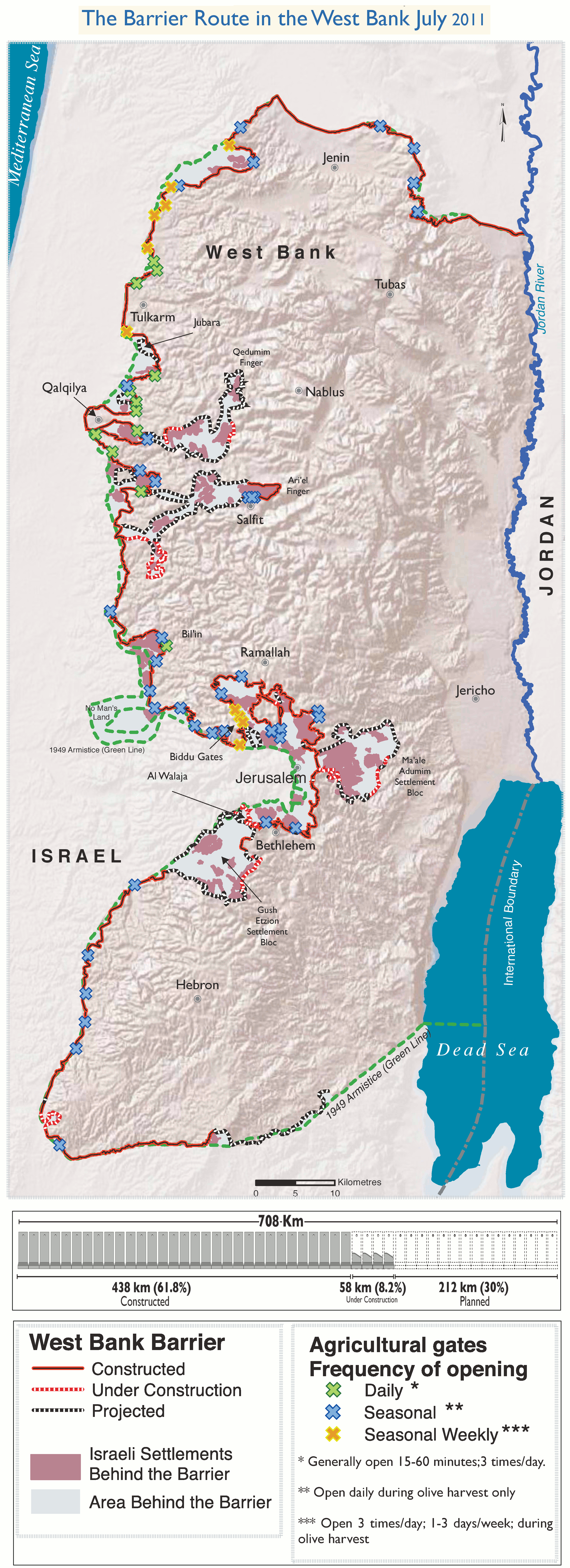
The Israeli West Bank barrier, comprising the West Bank Wall and the West Bank fence, is a separation barrier built by Israel along the Green Line and inside parts of the West Bank. It is a contentious element of the Israeli–Palestinian conflict: Israel describes the wall as a necessary security barrier against Palestinian terrorism, whereas Palestinians describe it as an element of racial segregation and a representation of Israeli apartheid. At a total length of upon completion, the route traced by the barrier is more than double the length of the Green Line, with 15% of its length running along the Green Line or inside Israel, and the remaining 85% running as much as inside the West Bank, effectively isolating about 9% of the land and approximately 25,000 Palestinians from the rest of the Palestinian territory. The barrier was built by Israel following a wave of Palestinian political violence and incidents of terrorism inside Israel during the Second Intifada, which ... [...More Info...] [...Related Items...] OR: [Wikipedia] [Google] [Baidu] |
Jerusalem Road 20
Jerusalem Road 20 is a combination of existing roads and new construction creating a continuous route between Jerusalem's Highway 50 (Begin Boulevard) and Pisgat Ze'ev via Beit Hanina. The number "20" is a designation used by the Jerusalem Municipality. Several segments of the road follow national road 4197. The cost of the project was NIS 180 million and was completed on 5 May 2013. Route The route begins at Highway 50 (Begin Boulevard) at the new Benzion Netanyahu Interchange just west of the Beit Hanina neighborhood of Jerusalem. From there the route traverses a bridge over the Atarot Stream. East of the bridge, the route connects to the existing Abdul Hamid Shomaan Street (Road 4197) 0.5 km before the intersection with the north-south Jerusalem Road 21. Originally a 2-lane road, Shoman Street has been upgraded as a 4 lane divided boulevard including new sidewalks and infrastructure. At the intersection with Taha Hussein and Al-Ma'mun Streets, where Shoman Stree ... [...More Info...] [...Related Items...] OR: [Wikipedia] [Google] [Baidu] |


