|
Noël Doiron
Noël Doiron (Port-Royal, 1684 – December 13, 1758) was a leader of the Acadians, renowned for his leadership during the Deportation of the Acadians. Doiron was deported on a vessel named the ''Duke William'' (1758). The ''Duke William'' sank, killing many passengers, in one of the worst marine disasters in Canadian history. The captain of the ''Duke William'', William Nichols, described Noel Doiron as the "father" to all the Acadians on Ile St. Jean (present-day Prince Edward Island) and the "head prisoner" on board the ship. Second only to Evangeline, the most well-known Acadian story of the Victorian era was that of Noel Doiron. For his "noble resignation" and self-sacrifice aboard the ''Duke William'', Doiron was celebrated in popular print throughout the 19th century in England and America. Doiron was commemorated in the naming of the village Noel, Nova Scotia, and the surrounding communities of Noel Shore, East Noel (also known as Densmore Mills), Noel Road and North ... [...More Info...] [...Related Items...] OR: [Wikipedia] [Google] [Baidu] |
Port-Royal (Acadia)
Port-Royal (1629–1710) was a settlement on the site of modern-day Annapolis Royal, Nova Scotia, part of the French colony of Acadia. The original French settlement of Port-Royal (Habitation de Port-Royal (1605-1613, about southwest) had earlier established farms in the area. In 1629, William Alexander (the younger) established a Scottish colony at the site and named it Charles Fort. Upon the handing back of Acadia to the French by the Treaty of Saint-Germain-en-Laye (1632) the settlement was occupied by the French and renamed Port-Royal. For most of the period until the Siege of Port Royal by the Kingdom of Great Britain in 1710, the village was the capital of Acadia. Port-Royal was the primary Acadian settlement until Acadians migrated out of the community to Pisiguit, Cobequid, Grand Pre, and Beaubassin (Isthmus of Chignecto) in the 1680s. Context The Habitation at Port-Royal was established on the other side of the river by Pierre Du Gua de Monts, with the able ass ... [...More Info...] [...Related Items...] OR: [Wikipedia] [Google] [Baidu] |
Benjamin Church (ranger)
Benjamin Church (c. 1639 – January 17, 1718) was New England military leader and captain of the first ranger force in America (1675).John Grenier. ''The First Way of War: American War Making on the Frontier.'' Cambridge University Press. 2005. p. 35 Church was commissioned by Josiah Winslow, the Governor of the Plymouth Colony, to form the first ranger company for King Philip's War. He later commanded the company to raid Acadia during King William's and Queen Anne's wars in the early 1700s, as French and English hostilities played out in North America. The two powers were competing for control in colonial territories. He was promoted to major and ended his service at the rank of colonel, as noted on his gravestone. Church designed his forces to emulate Indian practices of warfare. Toward this end, he worked to adopt Indian techniques of small, flexible forces that used the woods and ground for cover, rather than mounting frontal attacks in military formation. English col ... [...More Info...] [...Related Items...] OR: [Wikipedia] [Google] [Baidu] |
King George's War
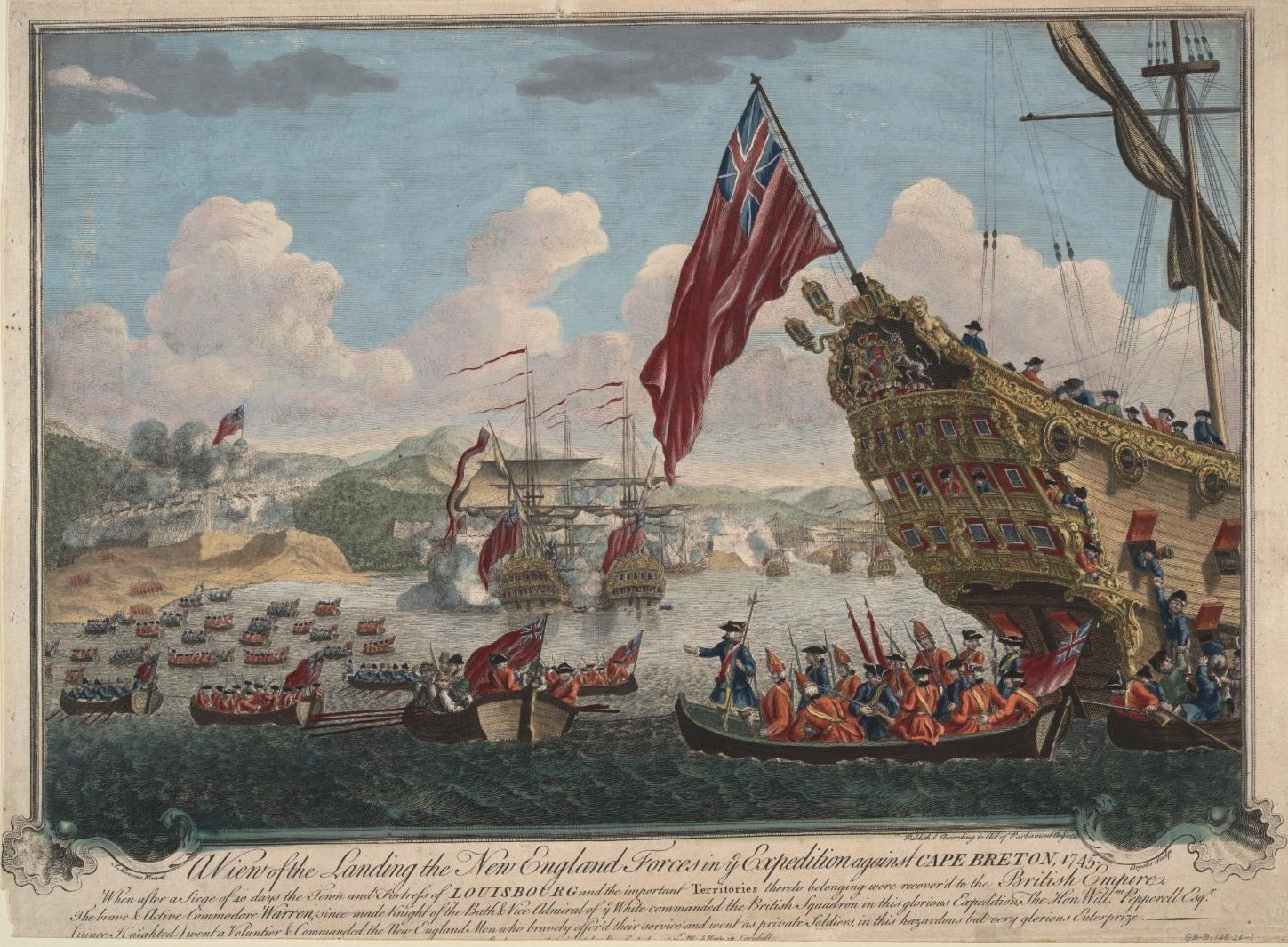
King George's War (1744–1748) is the name given to the military operations in North America that formed part of the War of the Austrian Succession (1740–1748). It was the third of the four French and Indian Wars. It took place primarily in the British provinces of New York, Massachusetts Bay (which included Maine as well as Massachusetts at the time), New Hampshire (which included Vermont at the time), and Nova Scotia. Its most significant action was an expedition organized by Massachusetts Governor William Shirley that besieged and ultimately captured the French fortress of Louisbourg, on Cape Breton Island in Nova Scotia, in 1745. In French, it is known as the ''Troisième Guerre Intercoloniale'' or Third Intercolonial War. The Treaty of Aix-la-Chapelle ended the war in 1748 and restored Louisbourg to France, but failed to resolve any outstanding territorial issues. Causes The War of Jenkins' Ear (named for a 1731 incident in which a Spanish commander sliced off the ea ... [...More Info...] [...Related Items...] OR: [Wikipedia] [Google] [Baidu] |
Fortress Of Louisbourg
The Fortress of Louisbourg (french: Forteresse de Louisbourg) is a National Historic Site and the location of a one-quarter partial reconstruction of an 18th-century French fortress at Louisbourg on Cape Breton Island, Nova Scotia. Its two sieges, especially that of 1758, were turning points in the Anglo-French struggle for what today is Canada. The original settlement was made in 1713, and initially called Havre à l'Anglois. Subsequently, the fishing port grew to become a major commercial port and a strongly defended fortress. The fortifications eventually surrounded the town. The walls were constructed mainly between 1720 and 1740. By the mid-1740s Louisbourg, named for Louis XIV of France, was one of the most extensive (and expensive) European fortifications constructed in North America. It was supported by two smaller garrisons on Île Royale located at present-day St. Peter's and Englishtown. The Fortress of Louisbourg suffered key weaknesses, since it was erected on ... [...More Info...] [...Related Items...] OR: [Wikipedia] [Google] [Baidu] |
Burntcoat Head, Nova Scotia
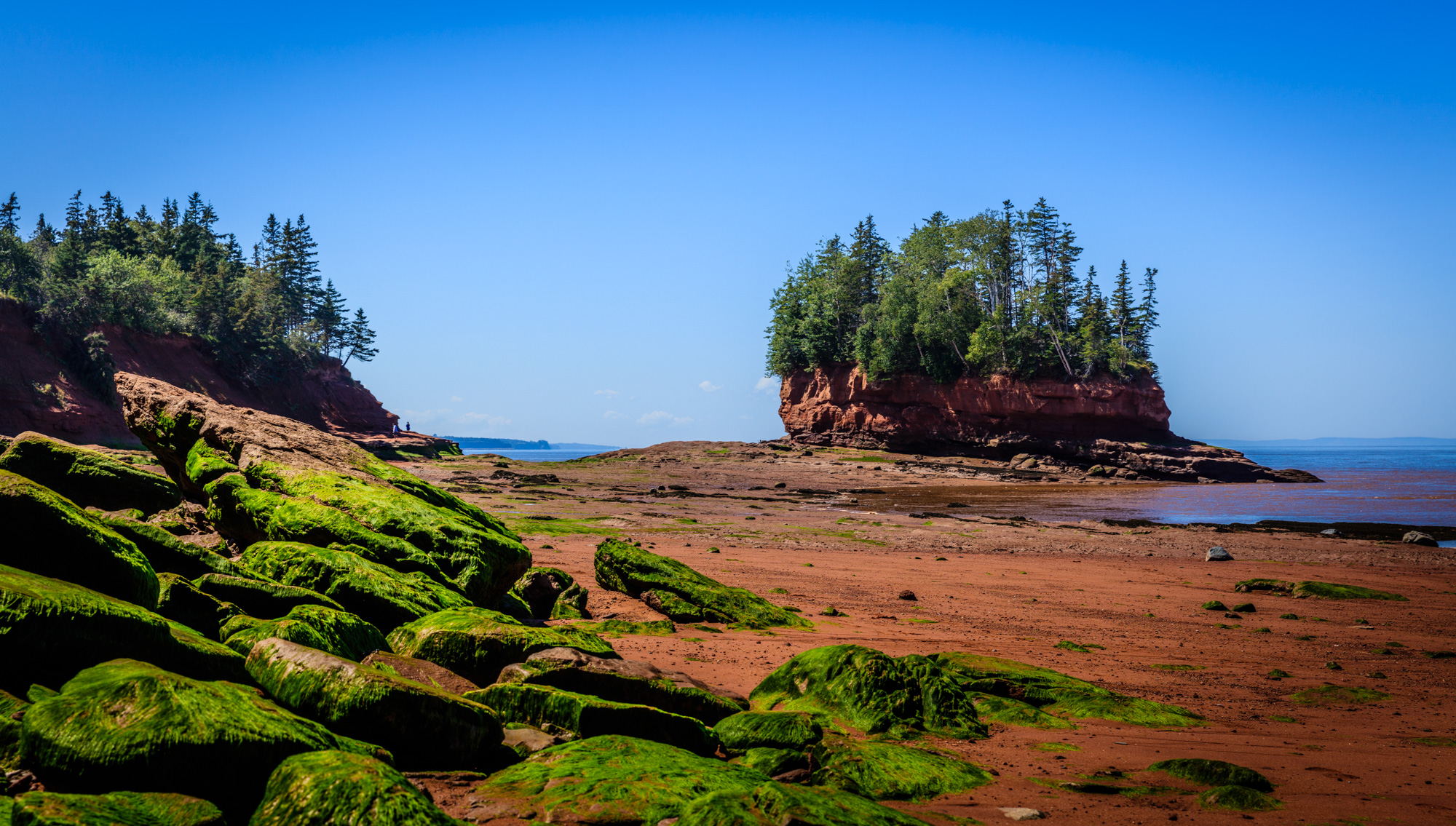
Burntcoat Head (improperly known as Burncoat) is an unincorporated rural Canadian community in Hants County, Nova Scotia. The area is known for having the largest tidal range (the greatest difference in height between high tide and low tide) of any location in the world. Etymology The origin of the name "Burntcoat" or "Burncoat", as the community is sometimes named, is unknown. The derivation of the spelling of the name is also unclear. Today the village on the ''west'' side of the Noel Bay is named Burntcoat, however, the Acadians named the village on the ''east'' side of the Noel Bay "Pointe Brull" (i.e., Burnt Point or Burnt Coast). Perhaps the Protestant settlers who came after the exodus of the Acadians from the community confused the names for the east and west side of the Noel Bay and thought the west side of the bay was "Pointe Brull". The Acadian name for ''west'' side of Noel Bay (i.e., present day Burntcoat) was "Pointe Cloche", indicating a chapel was likely locate ... [...More Info...] [...Related Items...] OR: [Wikipedia] [Google] [Baidu] |
Pierre Maisonnat Dit Baptiste
Pierre Maisonnat dit Baptiste (born in Bergerac, France 1663, died in Acadia after August 1714) was a French privateer famous for the success he had against New England merchant shipping and fishing interests during King William's War and Queen Anne's War. Baptiste's crew members were primarily Acadians. King William's War Battle of Port Royal (1690) During King William's War, Baptiste fought in the Battle of Port Royal (1690). On May 9, 1690 English forces under Sir William Phipps attacked the capital of Acadia of Port Royal with a fleet of seven vessels and 700 men. Baptiste was among only 85 men defending an unfinished fortification at Port Royal. After spending 12 days pillaging Port Royal, Phipps' troops pillaged the rest of Acadia, including Castine, La Hève, Chedabucto and the settlements at the head of the Bay of Fundy. Baptiste was taken prisoner along with other Acadians but shortly after escaped. Upon Baptiste's return to Acadia, Governor Joseph Robineau de Vil ... [...More Info...] [...Related Items...] OR: [Wikipedia] [Google] [Baidu] |
Fort Hill, Boston
Fort Hill is a 0.4 square mile neighborhood and historic district of Roxbury, in Boston, Massachusetts. The approximate boundaries of Fort Hill are Malcolm X Boulevard on the north, Washington Street on the southeast, and Columbus Avenue on the southwest. The geographic area comprising Fort Hill was strategically important during the American Revolutionary War and housed the patriot army defenses during the siege of Boston. Fort Hill is actually named after an earthwork fortification that the patriot army built upon the hill located at the center of the neighborhood. The hill is now the location of Highland Park, which is notable for a Victorian-era tower designed by Nathaniel Jeremiah Bradlee, and landscaping designed by Frederick Law Olmsted. Fort Hill developed rapidly as a residential neighborhood in the 19th century, especially after the extension of streetcar service from Boston. Fort Hill is served by the Massachusetts Bay Transportation Authority's Orange and Silver ... [...More Info...] [...Related Items...] OR: [Wikipedia] [Google] [Baidu] |
Castle Island (Massachusetts)
Castle Island is a peninsula in South Boston on the shore of Boston Harbor. In 1928, Castle Island was connected to the mainland by a narrow strip of land and is thus no longer an island. It has been the site of a fortification since 1634, and is currently a recreation site and the location of Fort Independence. History In 1632, a fortification was constructed on Fort Hill to defend the town. In 1634, Boston sought defenses farther out in the harbor, on one of the numerous islands which protected the port. In July 1634, the town decided to build a fortification on Castle Island. Deputy Governor Roger Ludlow and Captain John Mason of Dorchester supervised construction of the fort. After a structure was built on the northeast side of the island, the General Court resolved that the fort at Castle Island should be completed before any other fortification was begun. The fort was later known as Castle William and required incoming ships to recognize the fortification and would fi ... [...More Info...] [...Related Items...] OR: [Wikipedia] [Google] [Baidu] |
Beaubassin
Beaubassin was an important Acadian village and trading centre on the Isthmus of Chignecto in what is now Nova Scotia, Canada. The area was a significant place in the geopolitical struggle between the British and French empires. It was established in the 1670s on an upland close to an extensive area of saltwater marsh. Settlers reclaimed the land to engage in cattle ranching and trade. French colony The settlement had strong ties with Port Royal, and Jacques Bourgeois, a farmer, shipbuilder, and merchant at sold a part of his holdings there to settle in the Chignecto Basin, where he built a flour-mill and a saw-mill. Around the same time Michel Leneuf de la Vallière de Beaubassin set up a fur-trading post on the isthmus, while devoting part of his time to the fishing, farming, settlement, and soldiering. Following success in the latter activity, in 1676 governor Frontenac granted him 100 square leagues land which became the Beaubassin seigneury. He established himself on a ... [...More Info...] [...Related Items...] OR: [Wikipedia] [Google] [Baidu] |
Pisiguit
Pisiguit is the pre-expulsion-period Acadian region located along the banks of the Pisiquit River from its confluence with the Minas Basin of Acadia, which is now Nova Scotia, including the St. Croix River drainage area. Settlement in the region commenced simultaneous to the establishment of Grand-Pré. Many villages (Rivet, Foret, Babin, Landry, Thibodeau, Vincent, etc.) spread rapidly eastward along the river banks. These settlements became known as ''Pisiguit'' or (''Pisiquit'', ''Pigiguit'', ''Pisiquid'', ''Pisiguid''). The name is from the Mi'kmaq ''Pesaquid'', meaning "Junction of Waters". In 1714, there were 351 people (in 56 families) there.From Acadian-Cajun Genealogy & History: Exile Destination: Pisiguit Population By the mid-18th century, a memoire from 1748 noted that there were 2,700 people in Pisiguit compared to 2,400 in the Grand Pré and Canard area. But the area lost its population rather quickly. Pisiguit was the Acadian settlement closest to Halifax, ... [...More Info...] [...Related Items...] OR: [Wikipedia] [Google] [Baidu] |
Raid On Grand Pré
The Raid on Grand Pré was the major action of a raiding expedition conducted by the New England militia Colonel Benjamin Church (ranger), Benjamin Church against French Acadia in June 1704, during Queen Anne's War. The expedition was allegedly in retaliation for a Raid on Deerfield, French and Indian raid against the Province of Massachusetts Bay, Massachusetts frontier community of Deerfield, Massachusetts, Deerfield earlier that year. Departing Boston on 25 May 1704 with 500 provincial militia and some Indian allies, the expedition reached the Minas Basin on 24 June, after raiding smaller settlements at Penobscot Bay and Passamaquoddy Bay. Although he lost surprise due to the famously high tides of the Bay of Fundy, Church quickly gained control of Grand-Pré, Nova Scotia, Grand-Pré, and spent three days destroying the town and attempting to destroy the Levee, dikes and levees that protected its croplands. The croplands were flooded by salt water, but the local Acadians quic ... [...More Info...] [...Related Items...] OR: [Wikipedia] [Google] [Baidu] |


