|
Nové Mesto, Bratislava
Nové Mesto (meaning ''New Town'') is a borough of Bratislava, in the Bratislava III district. It is located north and north-east of the Old Town. The borough also borders Rača, Vajnory, Ružinov, Lamač and Záhorská Bystrica boroughs. History There was no compact settlement in the Middle Ages in the cadastral area of present-day borough, and for long it had countryside character. Three roads passed throughout the area: one from Bratislava to Modra, second to Vajnory and the third to Trnava and Nitra. The Little Carpathians part was almost untouched, with the exception of upper Mlynská dolina valley. The area started to have city-like character since the 18th century from two squares, which still have word "mýto" (meaning ''toll'') in their name: Račianske mýto and Trnavské mýto, although no tolls are collected today. The parts of the city name was ''Nádorváros'' in the 19th century. Some of the factories established in the 19th century include Stein brewery in 1 ... [...More Info...] [...Related Items...] OR: [Wikipedia] [Google] [Baidu] |
Bratislava III
Bratislava III is an okres (district) of Bratislava in the Bratislava Region of Slovakia. The district includes the boroughs of Nové Mesto, Rača and Vajnory. It has an area of 75 km² and 61,418 inhabitants. It is bordered by the Bratislava I, Bratislava II, Bratislava IV, Pezinok Pezinok (; hu, Bazin; german: Bösing; lat, Bazinium) is a town in southwestern Slovakia. It is roughly northeast of Bratislava and, as of December 2018, had a population of 23,002. Pezinok lies near the Little Carpathians and thrives mainly ... and Senec districts. Boroughs of Bratislava Districts of Slovakia {{Bratislava-geo-stub ... [...More Info...] [...Related Items...] OR: [Wikipedia] [Google] [Baidu] |
Račianske Mýto
Račianske mýto (literally '' Rača Toll'') is a major transport junction and intersection in Bratislava, the capital of Slovakia. It connects the city center with the suburb of Rača and also serves as a transport artery between Trnavské mýto and Old Town. Račianske mýto also contains an attached city park and several major public transport stops. It is located at the border of the Old Town and New Town districts, located at . Description In addition to the streets mentioned below, the intersection is crossed by tram lines north-south, trolleybus lines east-west, and bus routes in all directions. The northwestern side of the area includes a park and building complex, partially built on the site of two former cemeteries. Near the park's central fountain is a monument, erected in 2002 to commemorate this history. Nearby stands a statue entitled '' Hirošima'', a gift from sculptor Tibor Bártfay, at the former site of a Soviet statue of a militiaman dating to 1972''D ... [...More Info...] [...Related Items...] OR: [Wikipedia] [Google] [Baidu] |
Svätý Jur
Svätý Jur (; german: Sankt Georgen; he, Yergen; hu, Szentgyörgy; formerly ''Jur pri Bratislave'') is a small historical town northeast of Bratislava, located in the Bratislava Region. The city is situated on the slopes of Little Carpathians mountains and surrounded by typical terraced vineyards with more than 700 years of winemaking tradition. In 1990, the intact city center was declared a protected city reservation. Cadastrially, Svätý Jur includes also the natural reserve Šúr, established in 1952 to protect one of the last and largest remnants of a tall-stem swamp alder forest in Central Europe. Today, Svätý Jur has a population of over 5 thousand citizens. The town is well connected with a major road between Pezinok and Bratislava passing through and the Svätý Jur railway station situated on the main Košice - Bratislava railway line. The city is bordered by the Little Carpathian mountains to the west, Bratislava to the south, natural reserve Šúr to the east and ... [...More Info...] [...Related Items...] OR: [Wikipedia] [Google] [Baidu] |
Kamzík TV Tower
The Kamzík TV Tower is a tall television transmission tower in the Koliba area of Bratislava, the capital of Slovakia. The tower sits above sea level on the Kamzík hill, part of the Little Carpathians, overlooking much of the city. The tower lies within the territory of the Bratislava Forest Park. It was constructed in 1975, replacing a previous transmission tower. The tower was designed by architects Stanislav Májek, Jakub Tomašák, Juraj Kozák, Milan Jurica and Ján Privitzer. The tower has a public observation deck. In conditions of good visibility, Austria, Hungary and the Czech Republic are visible from the tower. Restaurant The VEŽA restaurant closed in May 2010 due to a lack of customers. The restaurant's chefs and staff moved to the West Restaurant at the Best Western West Hotel about down the tower approach road. In 2011, a new restaurant named Altitude opened with an updated interior, serving Mediterranean cuisine. The restaurant is divided into an obser ... [...More Info...] [...Related Items...] OR: [Wikipedia] [Google] [Baidu] |
Bratislava Forest Park
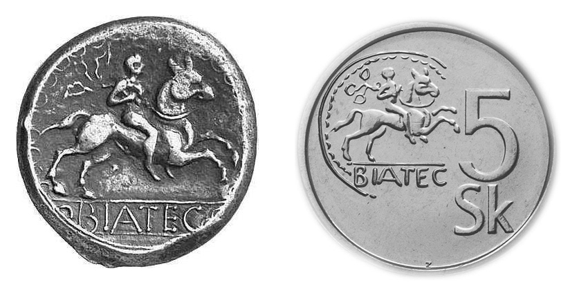
Bratislava (, also ; ; german: Preßburg/Pressburg ; hu, Pozsony) is the capital and largest city of Slovakia. Officially, the population of the city is about 475,000; however, it is estimated to be more than 660,000 — approximately 140% of the official figures. Bratislava is in southwestern Slovakia at the foot of the Little Carpathians, occupying both banks of the River Danube and the left bank of the River Morava. Bordering Austria and Hungary, it is the only national capital that borders two sovereign states. The city's history has been influenced by people of many nations and religions, including Austrians, Bulgarians, Croats, Czechs, Germans, Hungarians, Jews, Romani, Serbs and Slovaks. It was the coronation site and legislative center and capital of the Kingdom of Hungary from 1536 to 1783; eleven Hungarian kings and eight queens were crowned in St Martin's Cathedral. Most Hungarian parliament assemblies were held here from the 17th century until the Hungarian Refor ... [...More Info...] [...Related Items...] OR: [Wikipedia] [Google] [Baidu] |
Samsung Arena
The Ondrej Nepela Arena ( sk, Zimný Štadión Ondreja Nepelu) (also known as ''Orange Arena'' during the 2011 IIHF Championship, or as ''Slovnaft Arena'') is an indoor arena in Bratislava, Slovakia. It is primarily used for ice hockey and it was the home arena of the KHL's HC Slovan Bratislava. History It opened in 1940 and held 8,350 people until its full reconstruction started in 2009. The reconstructed arena opened in spring 2011 with one of the most advance game presentation, LED scoreboards and security systems ever built. It has increased capacity to 10,055 spectators. In the past Samsung arena was called ''ST Arena'' and ''T-Com Arena''. Reconstruction costs 87 million €. In the arena are also next two ice areas in the training halls. In addition to the arena, a new ''DoubleTree by Hilton'' hotel was built, which mainly serves for the accommodation of foreign athletes. The arena is named in honour of Ondrej Nepela, Slovak figure skater who competed for Czechoslov ... [...More Info...] [...Related Items...] OR: [Wikipedia] [Google] [Baidu] |
ŠK Slovan Bratislava
ŠK Slovan Bratislava (, "Bratislava Slav") is a football club based in Bratislava, Slovakia, that plays in the Slovak Super Liga. Founded as 1. ČsŠK Bratislava in 1919, the club changed its name to Slovan Bratislava in 1953. Slovan is the most successful team in Slovakia with the most titles in both league and cup in the country. Slovan Bratislava became the first and so far only club in Slovakia as well as former Czechoslovakia to win one of the European cup competitions, the Cup Winners' Cup when they defeated FC Barcelona in the final in Basel in 1969. The club also supplied seven players to the victorious UEFA Euro 1976 Czechoslovak team. History Historical names * 1. ČsŠK Bratislava (1919–39) * ŠK Bratislava (1939–48) * Sokol NV Bratislava (1948–53) * ÚNV Slovan Bratislava (1953–61) * Slovan CHZJD Bratislava (1961–90) * ŠK Slovan Bratislava (1990–present) Early years Slovan was founded on 1 April 1919 in the Panonia Café in Bratislava, as I.ČsŠK Br ... [...More Info...] [...Related Items...] OR: [Wikipedia] [Google] [Baidu] |
Tehelné Pole
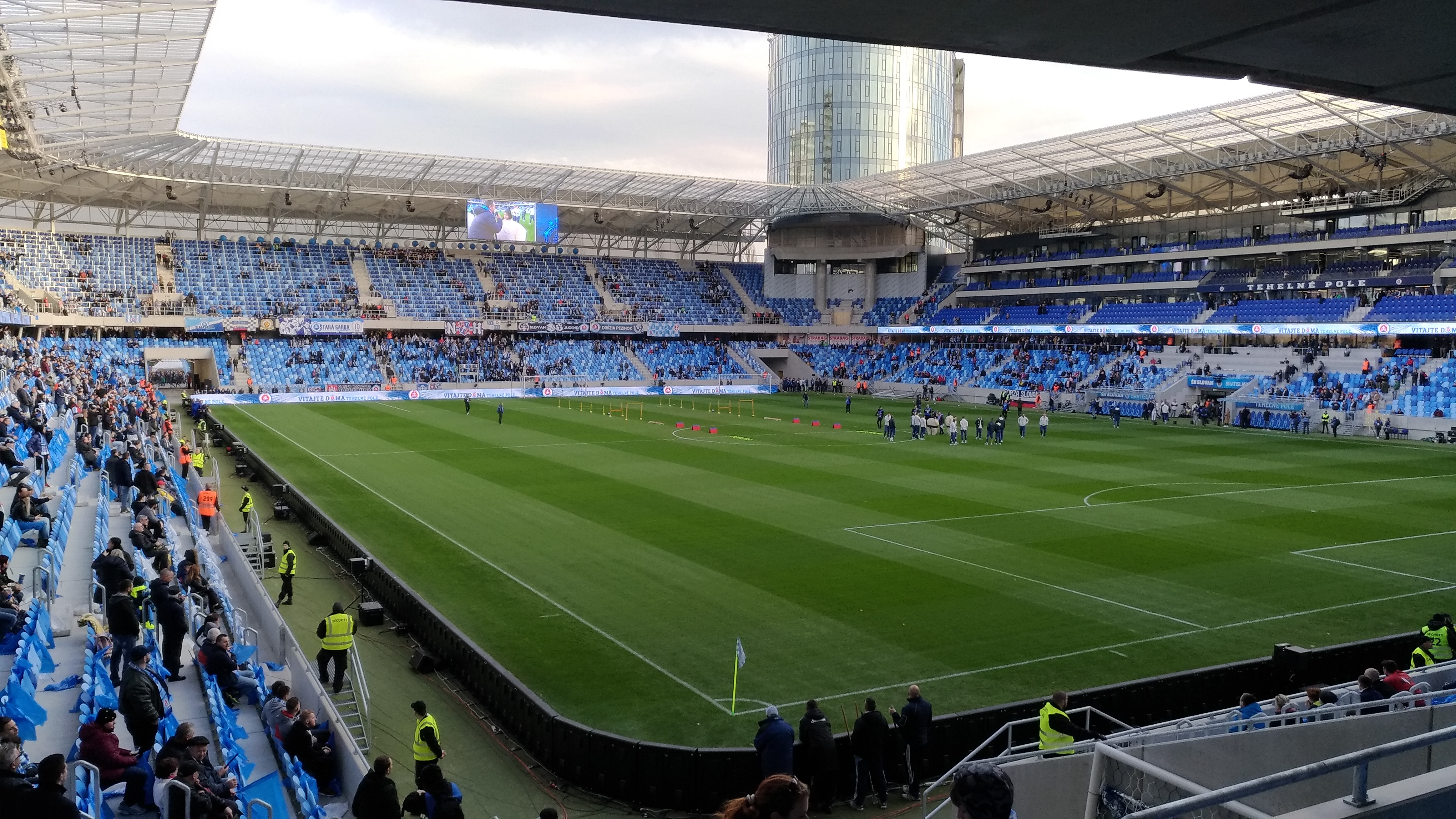
Tehelné pole or National football stadium ( sk, Národný futbalový štadión) is a multi-use stadium in Bratislava, Slovakia. It was completed in 2019 and is used for football (soccer), football matches, including the home matches of ŠK Slovan Bratislava and the Slovakia national football team. This project concerns mutual assistance between well-known Slovak entrepreneur Ivan Kmotrík as the owner of ŠK Slovan Bratislava and the Government of Slovakia. The stadium has a capacity of 22,500 spectators, and replaced the old Tehelné pole (1939), Tehelné pole stadium, which was demolished in summer 2013. Location Tehelné pole was a neighborhood in Bratislava, Slovakia, characterized by the presence of several sports facilities. Administratively, the neighborhood belongs to Nové Mesto, Bratislava, Nové Mesto borough, situated around 5 km north-east of the centre. The German and Hungarian names for this locality are ''Ziegelfeld'' and ''Téglamező''. Transport Tehelné ... [...More Info...] [...Related Items...] OR: [Wikipedia] [Google] [Baidu] |
Nazi Germany
Nazi Germany (lit. "National Socialist State"), ' (lit. "Nazi State") for short; also ' (lit. "National Socialist Germany") (officially known as the German Reich from 1933 until 1943, and the Greater German Reich from 1943 to 1945) was the German state between 1933 and 1945, when Adolf Hitler and the Nazi Party controlled the country, transforming it into a dictatorship. Under Hitler's rule, Germany quickly became a totalitarian state where nearly all aspects of life were controlled by the government. The Third Reich, meaning "Third Realm" or "Third Empire", alluded to the Nazi claim that Nazi Germany was the successor to the earlier Holy Roman Empire (800–1806) and German Empire (1871–1918). The Third Reich, which Hitler and the Nazis referred to as the Thousand-Year Reich, ended in May 1945 after just 12 years when the Allies defeated Germany, ending World War II in Europe. On 30 January 1933, Hitler was appointed chancellor of Germany, the head of gove ... [...More Info...] [...Related Items...] OR: [Wikipedia] [Google] [Baidu] |
Petržalka
Petržalka (; german: Engerau / Audorf; hu, Pozsonyligetfalu) is the largest borough of Bratislava, the capital of Slovakia. Situated on the right bank of the river Danube, the area shares a land border with Austria, and is home to around 100,000 people. Names and etymology The German name of the village ''Engerau'' (1654) derives from the ethnic name of Hungarians and comes from older placenames ''Mogorsciget'' ("Hungarian Island", 1225) and ''Ungerau'' ("Hungarian floodplain", 1509). The Hungarian name, ''Ligetfalva'', (later Pozsonyligetfalu, literally "parkland village") originates from the 1860s. After the foundation of Czechoslovakia, it was officially renamed to ''Petržalka'' (1920). The name refers to vegetables and herbs that were grown there (''petržlen'' means "parsley"). History Before the 18th century, the territory of present-day Petržalka consisted of several regularly flooded islands and was not suitable for larger permanent settlement. The deed of donation ... [...More Info...] [...Related Items...] OR: [Wikipedia] [Google] [Baidu] |
World War II
World War II or the Second World War, often abbreviated as WWII or WW2, was a world war that lasted from 1939 to 1945. It involved the vast majority of the world's countries—including all of the great powers—forming two opposing military alliances: the Allies and the Axis powers. World War II was a total war that directly involved more than 100 million personnel from more than 30 countries. The major participants in the war threw their entire economic, industrial, and scientific capabilities behind the war effort, blurring the distinction between civilian and military resources. Aircraft played a major role in the conflict, enabling the strategic bombing of population centres and deploying the only two nuclear weapons ever used in war. World War II was by far the deadliest conflict in human history; it resulted in 70 to 85 million fatalities, mostly among civilians. Tens of millions died due to genocides (including the Holocaust), starvation, ma ... [...More Info...] [...Related Items...] OR: [Wikipedia] [Google] [Baidu] |


